Ticker for September 20, 2016
MESONET TICKER ... MESONET TICKER ... MESONET TICKER ... MESONET TICKER ...
September 20, 2016 September 20, 2016 September 20, 2016 September 20, 2016
Do. Not. Want!
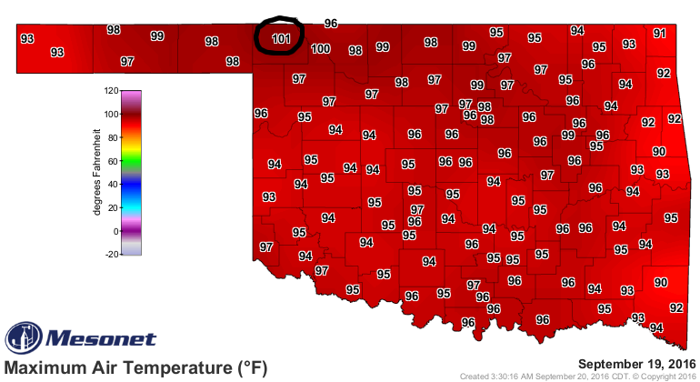
Yes, my prediction of Hooker capturing the top prize in yesterday's "they'll be
the ones to hit 100" failed miserably, although they did get close. I should
never have turned my back on my beloved Buffalo. Of course Freedom had to move
in on Buffalo's territory, what with their fancy schmancy salt plant and that
big hole in the ground, Alabaster Caverns. You'd think they would step aside
and let Buffalo bask in the glory which they should be afforded?
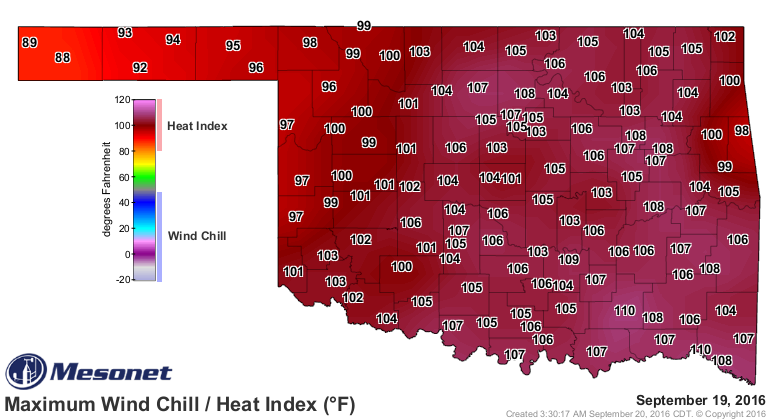
Now that was just on the actual air temperature scale...when you look at the
heat index map, Buffalo gets a lot less glamorous. Doesn't matter if it's later
into September or in July...when you combine a heat dome and recent heavy rains,
you're gonna get steamed and that's exactly what happened in Oklahoma yesterday
(and will happen again today!). In this case, Lane and Valliant take the prize
with a staggering 110 degrees! Indeed, these are things you do not want to see
ANYTIME during September, let alone well into its fourth week.
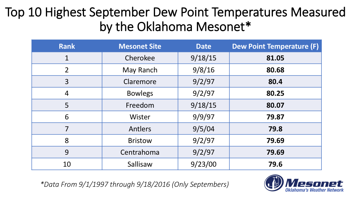
Like we mentioned, dewpoints were ridiculously high yesterday. Here's a little
tidbit from our Facebook and Twitter feeds yesterday about just how high:
So did you notice the humidity out there today and think - umm, is it
really September?! We did too! Leading the way was the Valliant Mesonet
site, which had a 78.9F dew point temperature today (yuck!). That ranks
as the 23rd highest September dew point temperature we've ever measured!
For fun here's a look back at the Top 10 highest dew point temperatures
we've measured during the month of September dating back to the mid
1990s. The higher the dew point temperature the more humid the air is.
And frankly, it don't look good today either ("doesn't" for non-Okies).
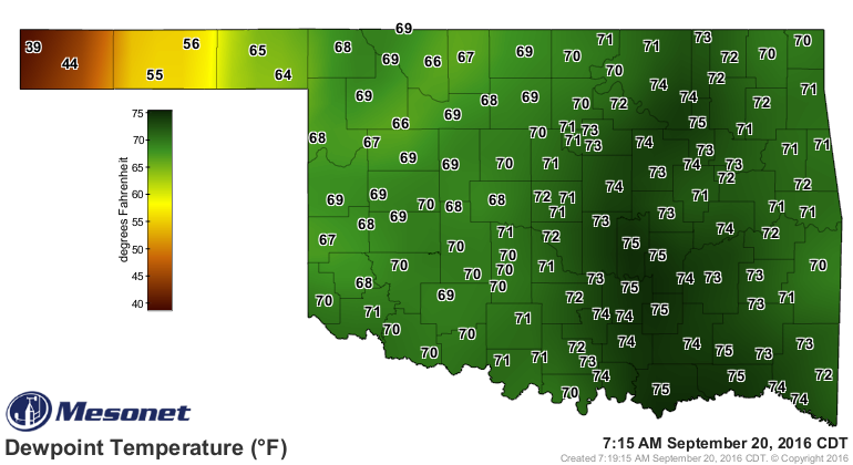
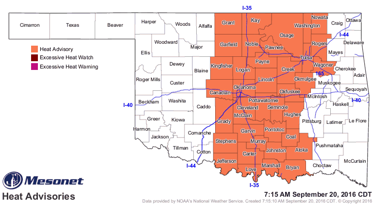
So with the heat dome still over us, we will remain in a heat advisory for the
I35 corridor eastward a ways.
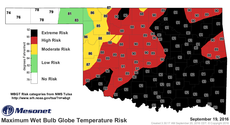
A very frightening pic of the Maximum Web Bulb Globe Risk Temperature which
rose into the "Extreme Risk" category over much of Oklahoma yesterday. This
indicator is much like the heat index, but it also takes into account the
impacts of sunlight exposure and wind speed.
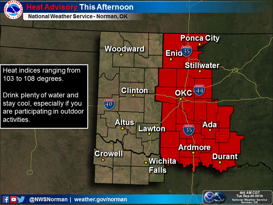
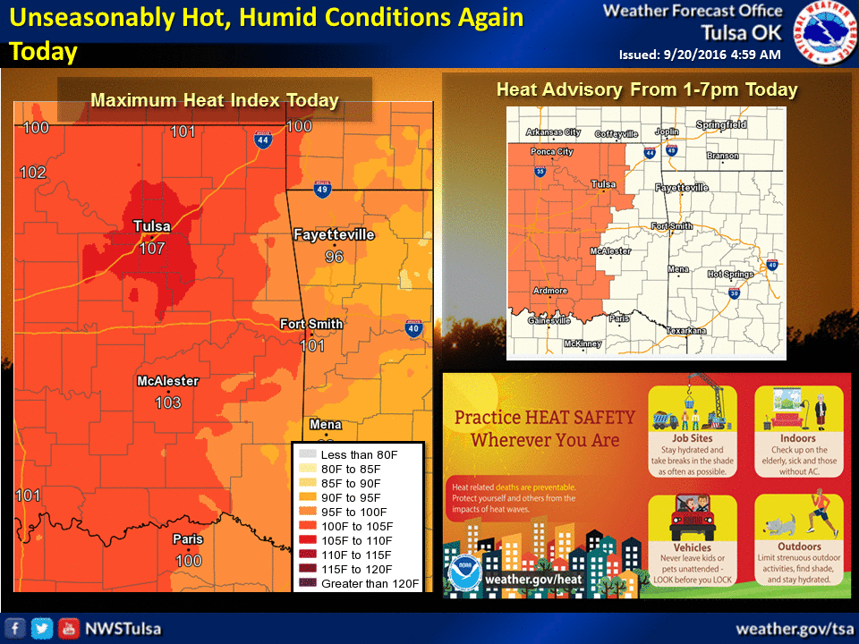
The local NWS offices weigh in on the topic.
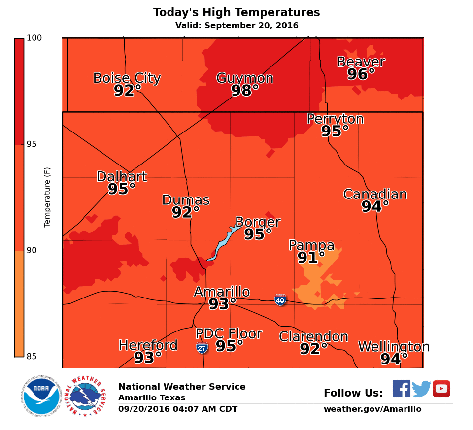
Our friends at the Amarillo NWS site paint a nice picture of our next chance of
rain (and cool down) coming up this weekend.
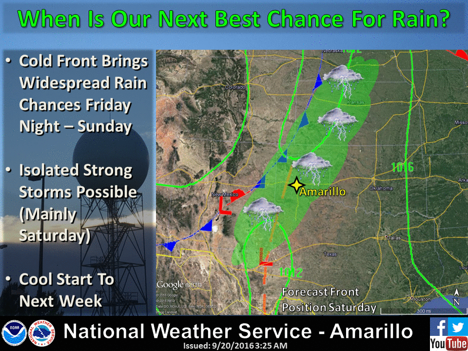
We should see a slow but steady decline in temps day by day until that front
arrives this weekend. Rain potential looks good as of now through the weekend,
especially across western Oklahoma, but that can change as we go through the
week.
Have we seen our last 100? Predict it...I dare ya!
Gary McManus
State Climatologist
Oklahoma Mesonet
Oklahoma Climatological Survey
(405) 325-2253
gmcmanus@mesonet.org
September 20 in Mesonet History
| Record | Value | Station | Year |
|---|---|---|---|
| Maximum Temperature | 107°F | FREE | 2024 |
| Minimum Temperature | 41°F | NOWA | 2003 |
| Maximum Rainfall | 5.83″ | MTHE | 2019 |
Mesonet records begin in 1994.
Search by Date
If you're a bit off, don't worry, because just like horseshoes, “almost” counts on the Ticker website!