Ticker for September 1, 2016
MESONET TICKER ... MESONET TICKER ... MESONET TICKER ... MESONET TICKER ...
September 1, 2016 September 1, 2016 September 1, 2016 September 1, 2016
August was...well, un-August like.
When you summarize weather by trade, you're often dealt lemons...in the form of
big changes on the last day of said summarized period (that also extends into the
next day). Same could be said for 7am Tuesday cutoff periods for drought
monitoring efforts. So even as it rains
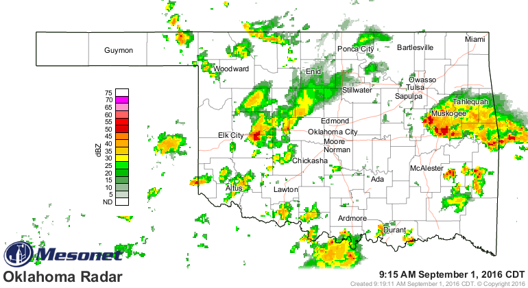
with more expected
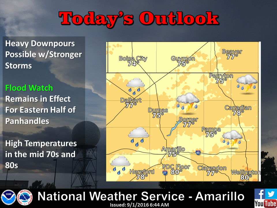
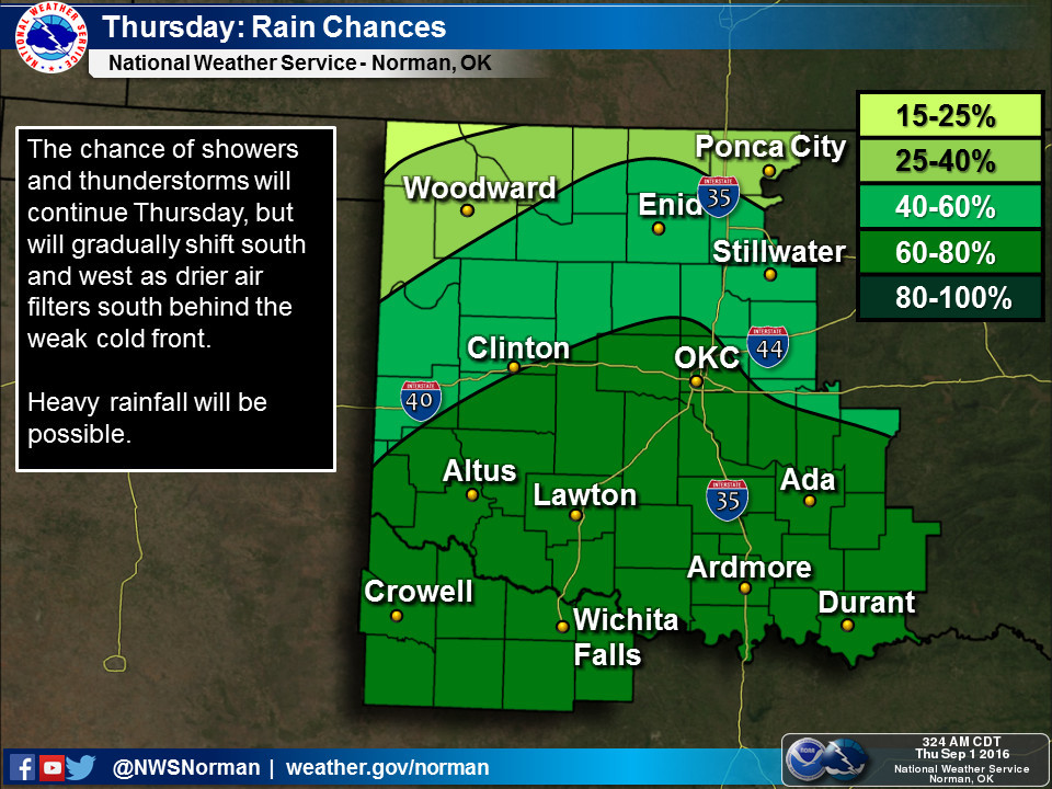
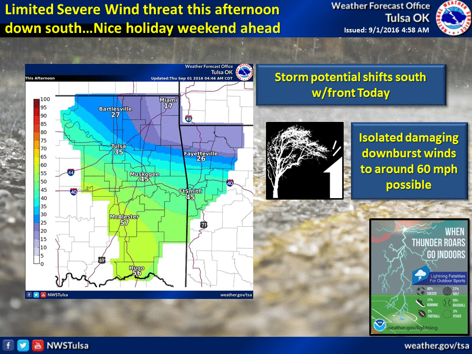
let's keep in mind that some changes are due for next week's report, and in some
cases, the rain is still greatly missed.
The month is dead. Long live the month!
----------------------------------------------------------------------------------
August Provides Fall Preview
Sept. 1, 2016
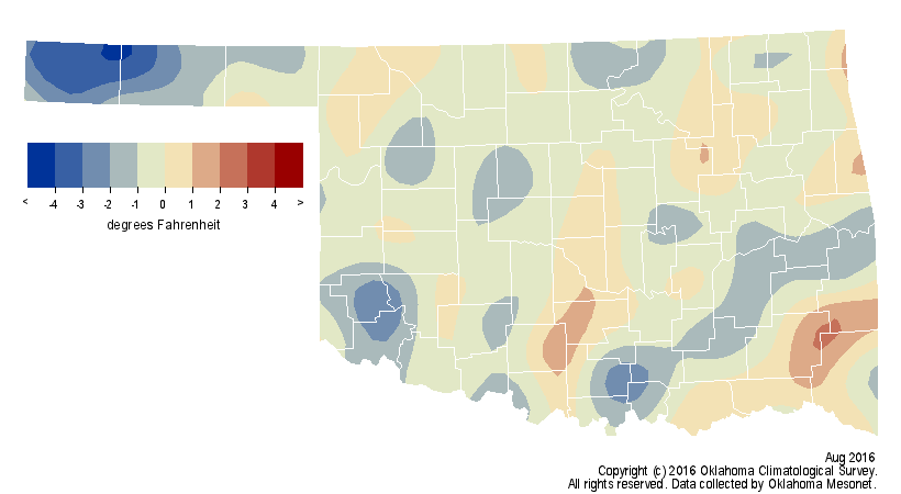
Autumn didn?t fully arrive during August, but it sure gave Oklahomans a nice
preview for a week during the middle of the month. It was enough of a sneak
peek to keep the month?s statewide average temperature at about a half-degree
below normal.
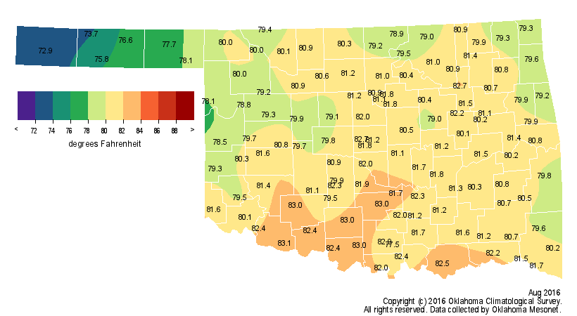
Unfortunately, the autumnal preview was flanked by some downright miserable
summer weather. Those summer bookends came with plenty of triple-digit
temperatures and even more triple-digit heat indexes. Grandfield led the state
with 106 degrees recorded on the third. Meanwhile, it was jacket weather at
Bristow with a low of 48 degrees on the 22nd. Oilton recorded a low of 49
degrees the previous day for the first 40s registered in the state since June
17. Broken Bow had the misfortune to claim not only the top heat index of the
month at 116 degrees on the 11th, but they also came in second with 114 degrees
a day later. The Mesonet reported 110 instances of heat index values of at least
110 degrees. The Panhandle was particularly fortunate to spend a significant
amount of time during August behind stalled cold fronts. While those fronts
often failed to progress too far southeast, they provided the Panhandle with
its 32nd coolest August to date at 1.3 degrees below normal. The end of August
also brought the climatological summer ? June 1 through August 31 ? to a close
and this year?s ended as the 31st warmest since records began in 1895 at 1.4
degrees above normal, signifying the very warm June and July this year. For the
January-August period, Oklahoma was again on the warm side at 1.7 degrees above
normal, the 11th warmest on record.
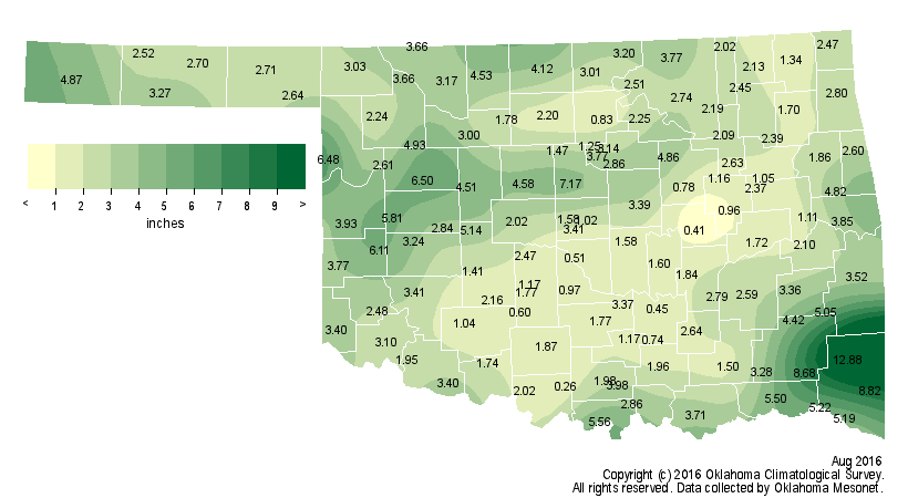
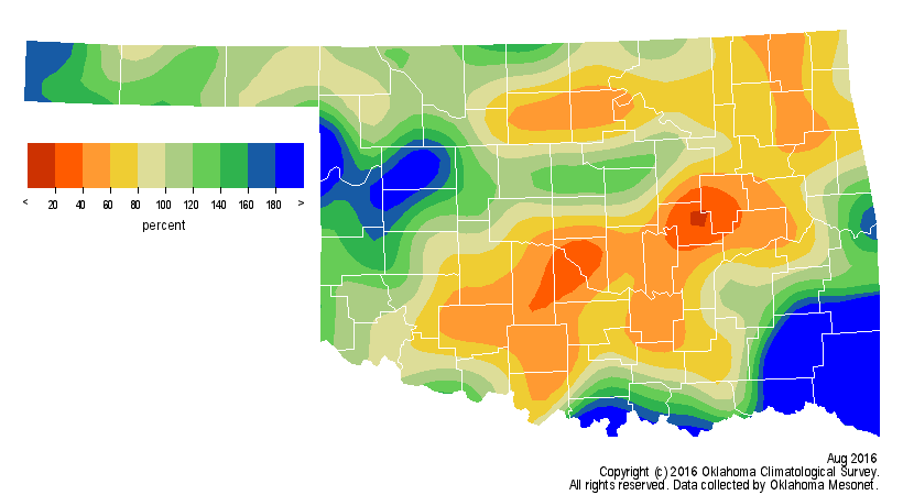
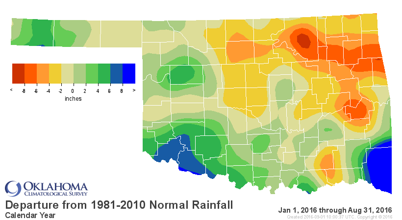
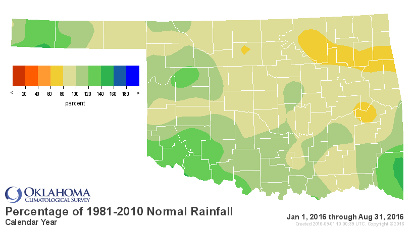
As is often the case, the rainfall pattern was not quite as simple. The stalled
fronts across the northwest provided frequent triggering mechanisms for showers
and storms. The Panhandle and west central Oklahoma saw their 26th and 19th
wettest Augusts on record, respectively. The far southeast was caught up in the
tropical moisture that produced the historic flooding in Louisiana and Texas.
The Mesonet gauges in McCurtain County recorded from 8-12 inches. That region?s
average of 5.99 inches was more than 3 inches above normal and ranked as their
12th wettest August. Outside of those areas, however, Mother Nature was a bit
stingier. From 1-2 inches was the norm, while several stations reported less
than an inch. Overall, the statewide average came out just a bit above normal
at 3.08 inches. Ringling had the Mesonet?s lowest total during August at 0.26
inches. Mt. Herman led all sites with 12.88 inches.
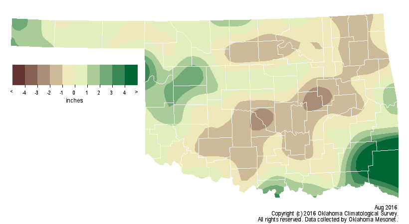
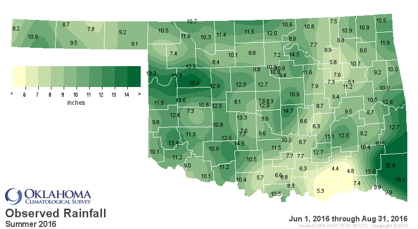
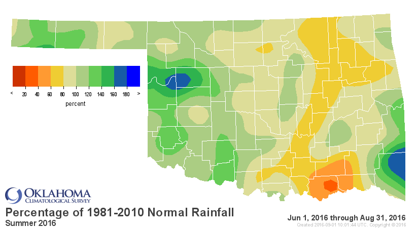
The summer was also near normal but again the disparity between regions was
quite stark. The northeast had the driest time at 3.4 inches below normal,
their 28th driest summer on record. West central Oklahoma fared the best at
more than 2 inches above normal to rank as their 17th wettest.

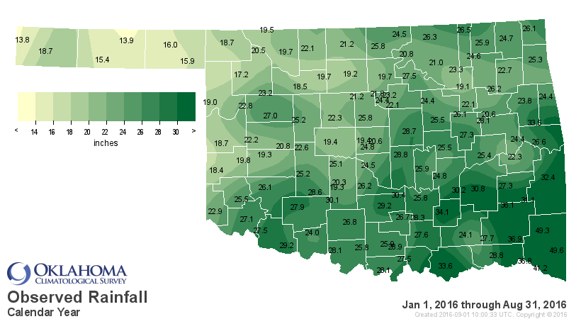
The January-August statewide average came in at 23.89 inches, about an inch
below normal.
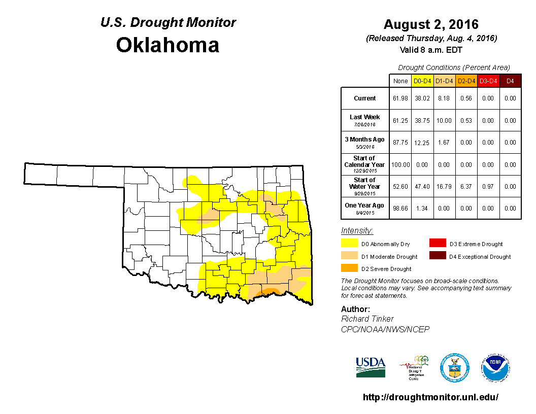
While the rains across southeastern and northwestern Oklahoma helped prevent
and eradicate drought, the dearth of moisture in other areas accelerated
drought formation and intensification. The U.S. Drought Monitor map at the
beginning of August showed eight percent of the state in at least moderate
drought, with an additional 30 percent in abnormally dry conditions ? a
precursor to drought formation.
By month?s end, those numbers had risen to 14 percent in at least moderate
drought to 34 percent in abnormally dry conditions.
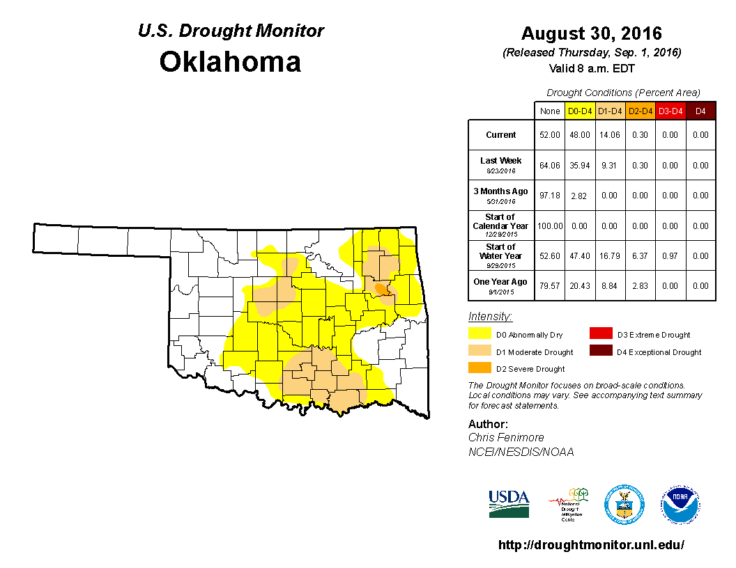
The moderate to severe drought in the far southeast had shifted west, also
intensifying across central and northeast Oklahoma. Heavy rains during the
month?s final two days could signal drought relief on September?s first Drought
Monitor report.
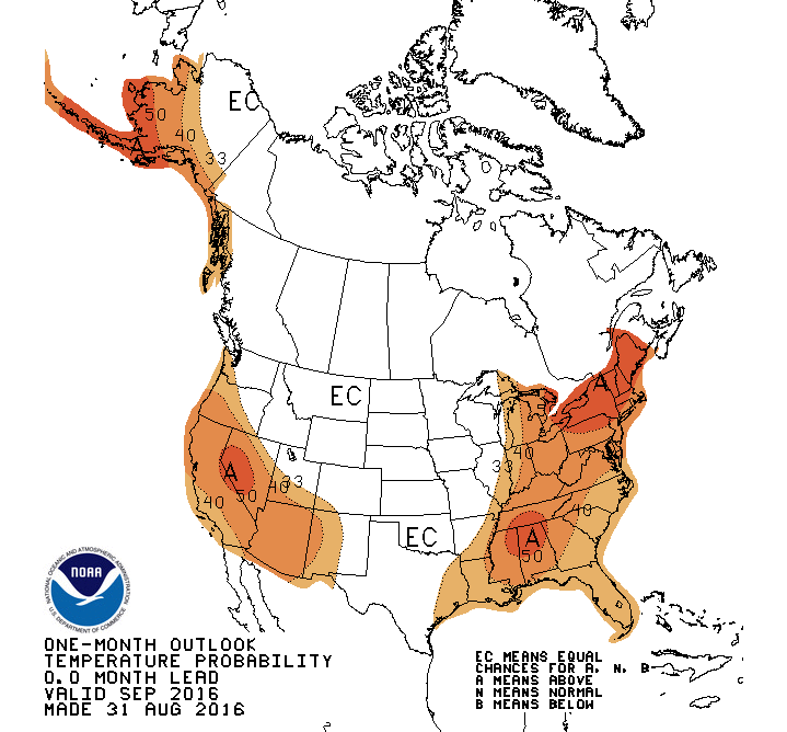
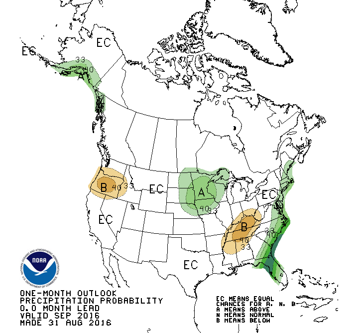
The Climate Prediction Center?s (CPC) temperature and precipitation outlooks
for September give equal chances for above-, below- and near-normal values.
That does not mean to imply that normal values are expected, rather that all
three classifications have equal odds of occurring.
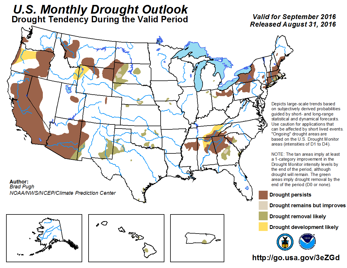
A wet looking first two weeks of September prompted CPC?s Drought Outlook to
show all the current drought areas in Oklahoma improving by the end of the
month.
Gary McManus
State Climatologist
Oklahoma Mesonet
Oklahoma Climatological Survey
(405) 325-2253
gmcmanus@mesonet.org
September 1 in Mesonet History
| Record | Value | Station | Year |
|---|---|---|---|
| Maximum Temperature | 110°F | WAUR | 2000 |
| Minimum Temperature | 49°F | GOOD | 2024 |
| Maximum Rainfall | 7.50″ | BYAR | 2020 |
Mesonet records begin in 1994.
Search by Date
If you're a bit off, don't worry, because just like horseshoes, “almost” counts on the Ticker website!