Ticker for August 15, 2016
MESONET TICKER ... MESONET TICKER ... MESONET TICKER ... MESONET TICKER ...
August 15, 2016 August 15, 2016 August 15, 2016 August 15, 2016
Louisiana takes it on the chin
Oh, I know what you're thinking. You're thinking "Gary, what happened to the rain
you promised us over the weekend?" And we've talked about this before, if you're
calling yourself "Gary" in your own head and your name's not Gary, then seek help.
But back to the subject, if you were expecting a good dose of rain this weekend
with our lovely cool front, you can thank (actually, commiserate or have sympathy
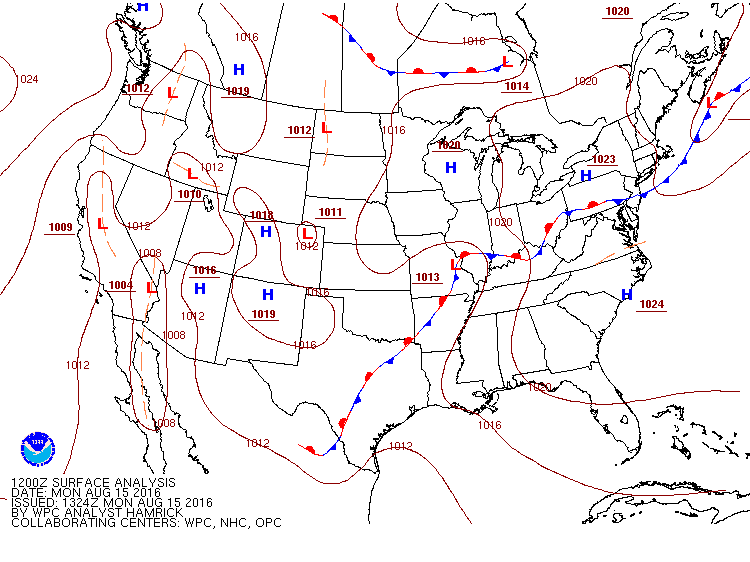
for) Louisiana and that large low pressure system that sat over the Gulf Coast
and rained and rained and rained. And then rained some more. With a lack of any
strong steering winds, it really had no impetus to move so it basically became
a stationary conduit for tropical moisture to flow up over that area. In some
cases, That meant more than 2 feet of rain in just a few days. Here's a
regional view of the radar (enhanced with gauge data) estimated rainfall in the
last 7 days.
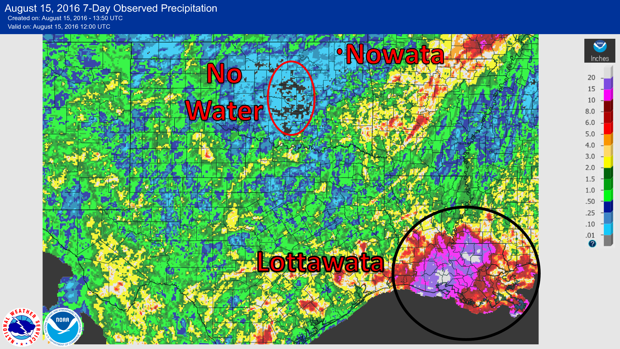
That low pressure system effectively shut off our moisture supply from the Gulf.
So quite a bit of the state got "NO WATER"...sprinkles at best. I had to throw
Nowata in there. I just had to. They received a meager 0.02 inches. Now as luck
would have it, some of that tropical moisture did escape the confines of the
Gulf's bane, that tropical low, and made it up across SE OK. Rainfall amounts
across the SE corner range from less than an inch up to nearly 5 inches.

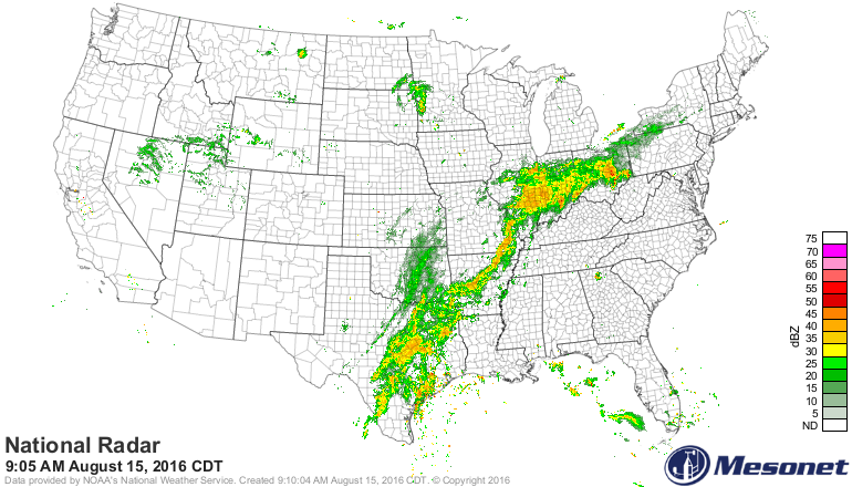
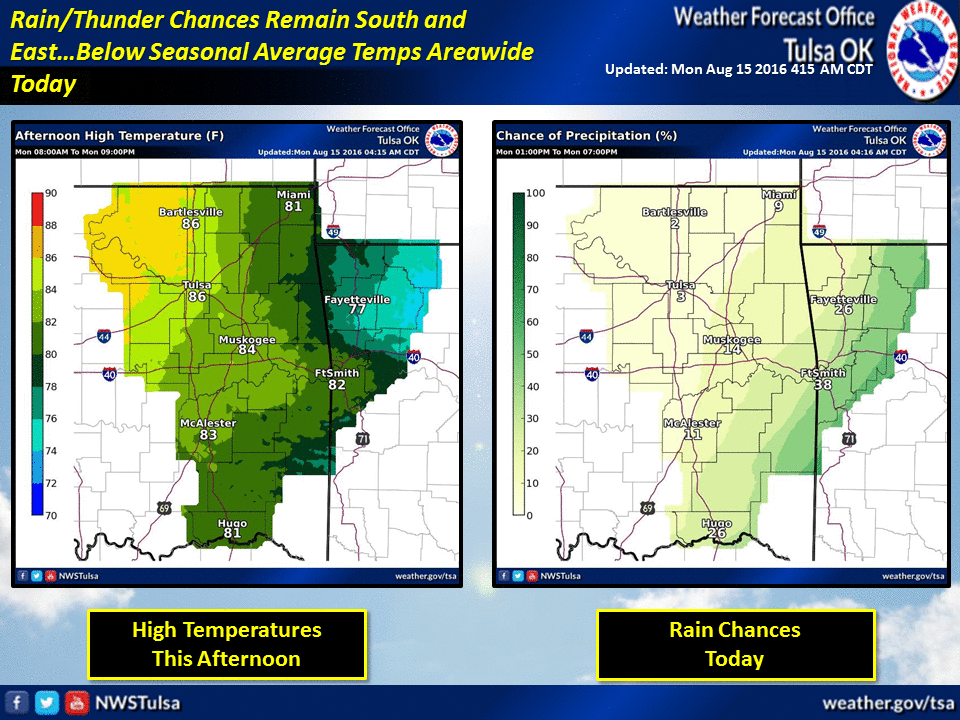
In fact, it's raining down there now as that low pressure system has lifted to
the north, which helped drag a trough of low pressure across our area. That's
why you're seeing the additional showers and storms across far SE OK, and the
lighter precip to the NW.
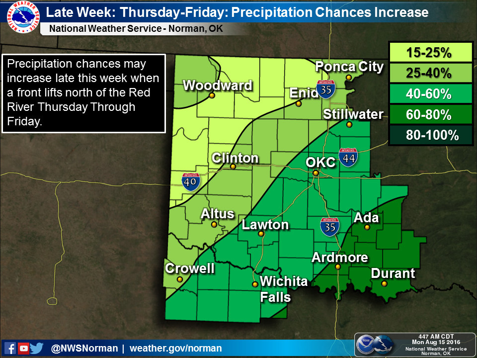
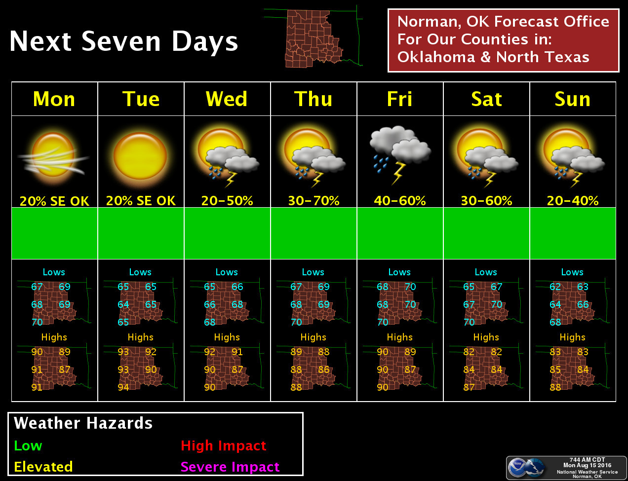
There will be additional rain chances coming up, especially this weekend as we
should see another significant-for-August cool front.

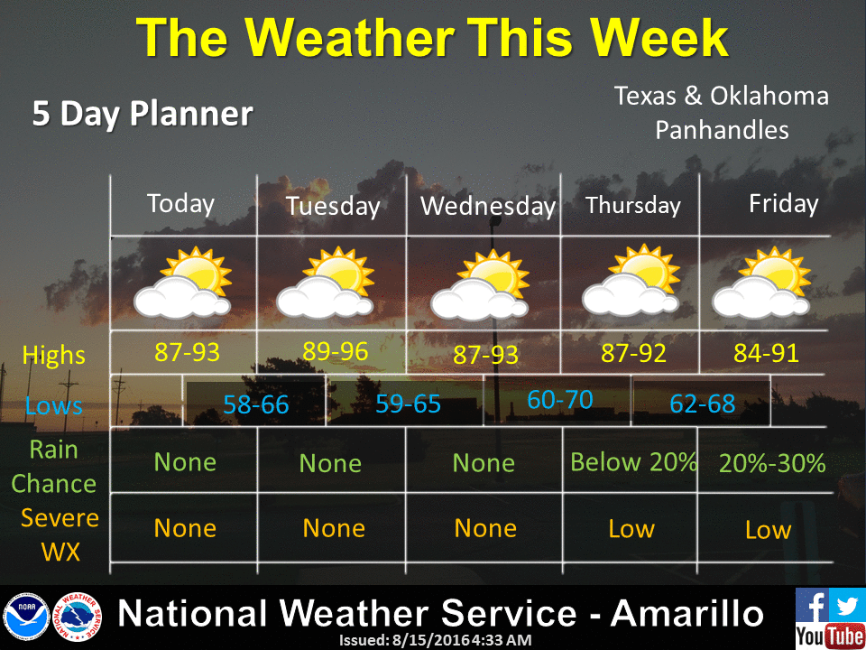
But how 'bout them temps, huh? A welcome break from the oppressive heat we've
been experiencing, and that should continue for at least another week or so.
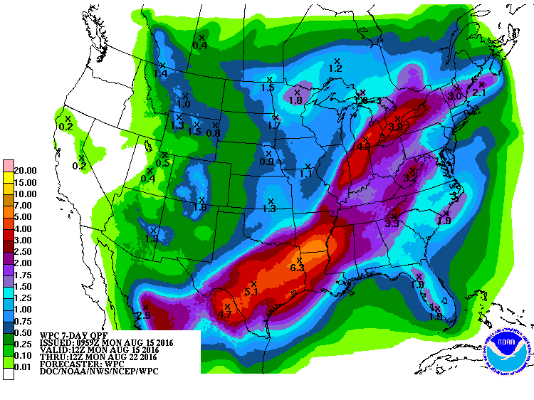
If you look at that 7day-rain-forecast, you can see Louisiana will be back in
the crosshairs throughout the week. We will gladly take some of that rain off
their hands. And roads. And fields. Etc.
Gary McManus
State Climatologist
Oklahoma Mesonet
Oklahoma Climatological Survey
(405) 325-2253
gmcmanus@mesonet.org
August 15 in Mesonet History
| Record | Value | Station | Year |
|---|---|---|---|
| Maximum Temperature | 107°F | GRA2 | 2024 |
| Minimum Temperature | 50°F | EVAX | 2016 |
| Maximum Rainfall | 4.96 inches | WIST | 2018 |
Mesonet records begin in 1994.
Search by Date
If you're a bit off, don't worry, because just like horseshoes, “almost” counts on the Ticker website!