Ticker for April 21, 2016
MESONET TICKER ... MESONET TICKER ... MESONET TICKER ... MESONET TICKER ...
April 21, 2016 April 21, 2016 April 21, 2016 April 21, 2016
Move over drought - severe weather takes the lead!

First off, this week's U.S. Drought Monitor is a bit of a bust BECAUSE of the
7am on Tuesday cutoff point for considering rainfall. So when we sorted things out
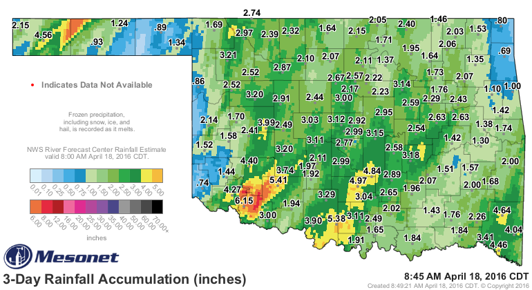
Monday-Wednesday, we were working with dated info. So instead of this (which is
quite significant rainfall in its own right)
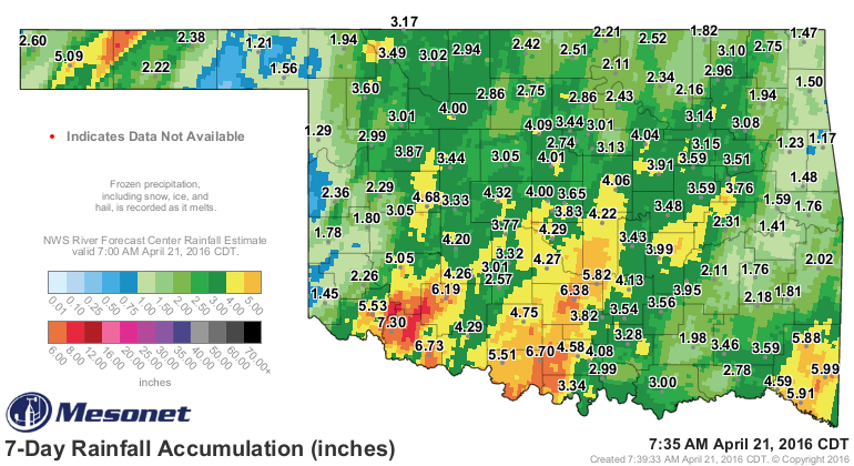
We have actually received this
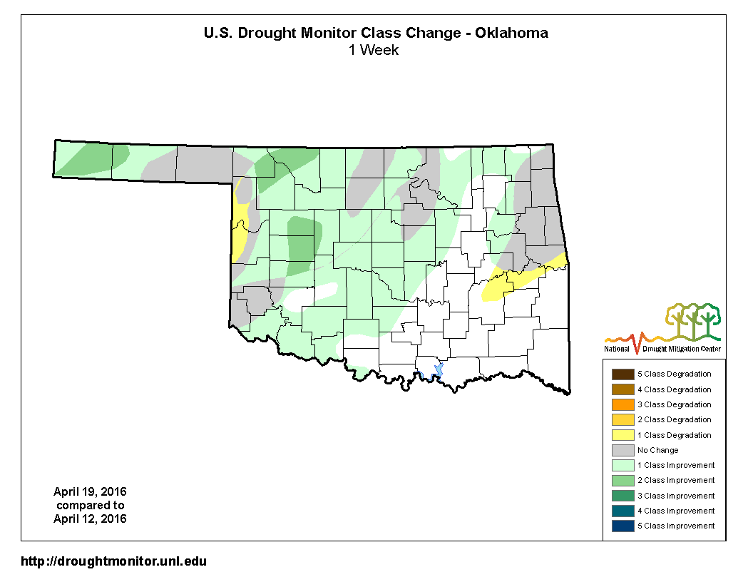
So when I show you this new DM map, please don't blow a gasket and start shooting
up oil cans! Here we go:

So we went from 32% of the state in drought to 10%...that seems about right. The
only increases were in western Roger Mills and Ellis counties, and also over
in east central Oklahoma. Tiny increases, but as you can see from the 1-week
change map, most of the area saw 1-2 class improvement.
However, given that even more rain fell over the last two days, I think we will
see more improvements next week (regardless of further rains). Speaking of
further rains, we will have several storm systems making their way through
the state over the next week to 10 days, bringing a chance of rain AND possibly
severe weather.
The risk starts on Sunday, but the real risk begins on Tuesday. The forecast
can and certainly will change a bit between now and Tuesday, but the chances
are enough that the local NWS offices are talking about it already (or
graphic-izing about it).
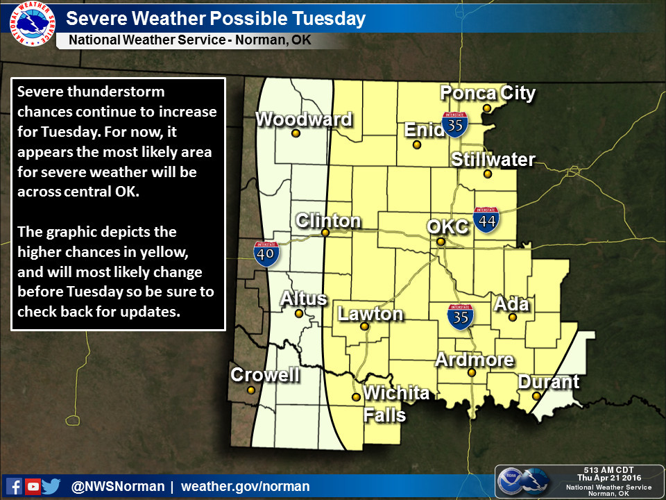
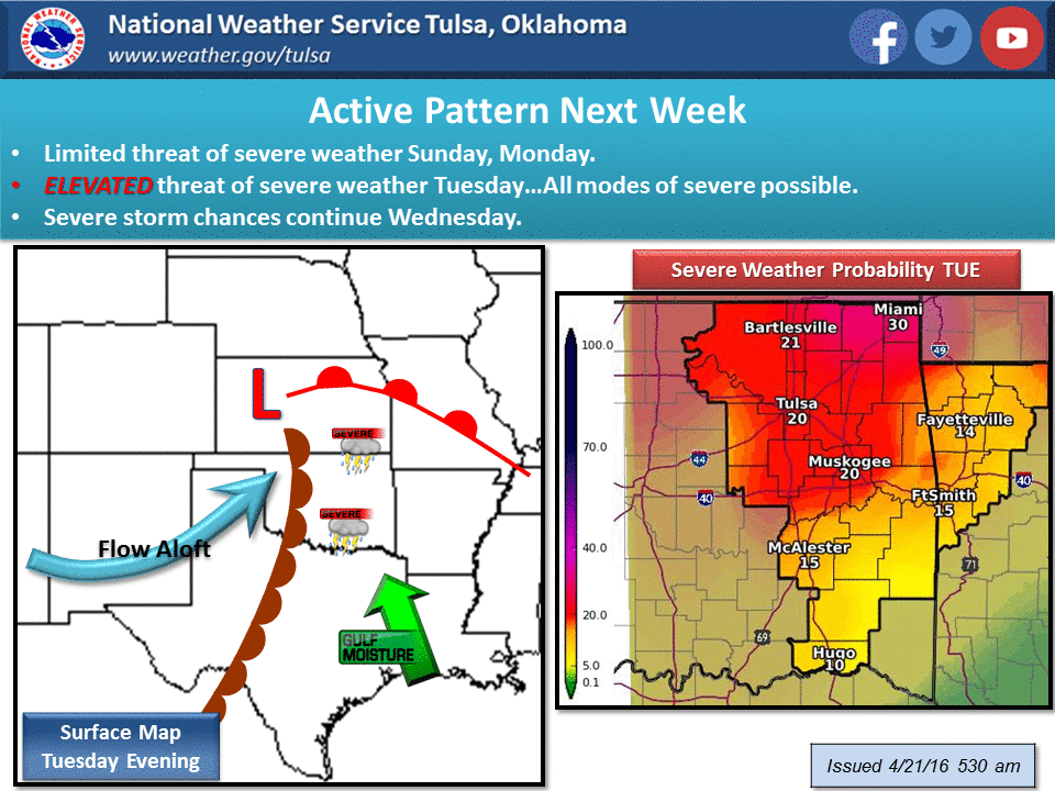
You can read what NWS Norman says about it right on the graphic, but here is
Tulsa's description:
"A period of quiet weather will continue through Saturday...however
this will change by Sunday as an upper wave slides across the
plains bringing the potential for thunderstorms with a limited risk
for severe weather. Another strong upper wave will take a track
across the plains on Tuesday...and this system will bring the greatest
potential for severe weather to the region...most likely during the
afternoon and evening hours. Details will continue to be refined but
it does appear a significant severe weather event may occur during
this time frame. Now is a good time to review safety plans as the
weather pattern will become rather active next week with multiple
opportunities for severe weather."
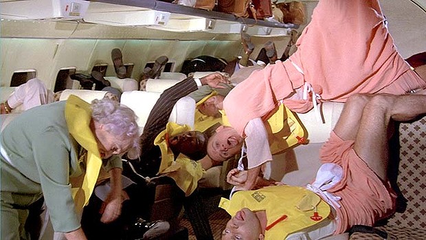
The best idea is to remain calm. No need to blow this out of proportion. It's
Oklahoma, we should expect this sort of...oh, who am I kidding...ASSUME CRASH
POSITIONS!!
In all seriousness however, this would be a good time to make your severe
weather preparations (it's spring, you should do that anyway), and stay weather
aware, especially as we approach early next week.
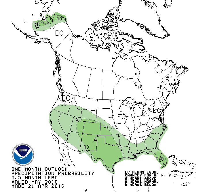
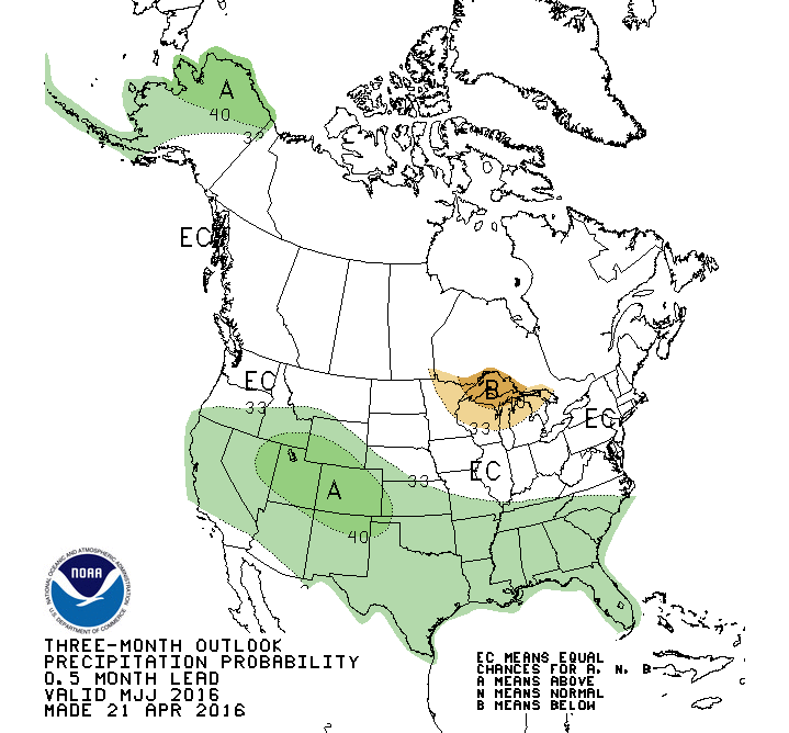
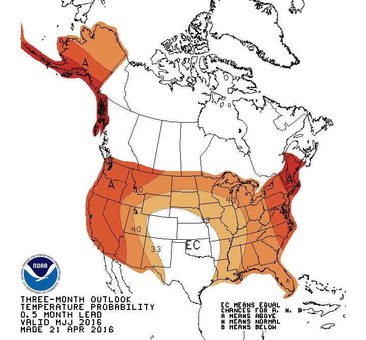
As we look towards the rest of spring into summer, CPC is still showing
increased odds for above normal precipitation for May and also May-July.
Hopefully not 2015-style, but the odds are tilted towards wetter than normal
weather nonetheless.
The temperature outlooks are rather unremarkable, but with more rain expected,
I guess cooler than normal conditions would not be a shock, although it's not
really showing up except across far western OK and the High Plains during May.
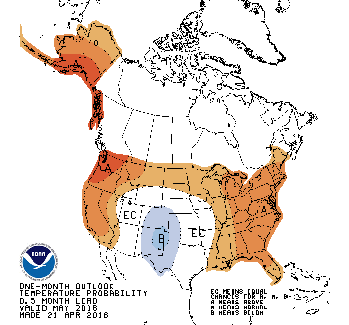
Again, don't mistake that white "EC" area for "we expect normal conditions."
That actually means equal odds of above-, below- or near-normal temperatures.
In other words, a punt.
Okay, finally, just a shout out to our weather forecasters and storm trackers
as we approach next week:
I just wanted to tell you good luck, and we're all counting on you.
Gary McManus
State Climatologist
Oklahoma Mesonet
Oklahoma Climatological Survey
(405) 325-2253
gmcmanus@mesonet.org
April 21 in Mesonet History
| Record | Value | Station | Year |
|---|---|---|---|
| Maximum Temperature | 98°F | HOLL | 2022 |
| Minimum Temperature | 22°F | KENT | 2021 |
| Maximum Rainfall | 4.95 inches | CHAN | 2017 |
Mesonet records begin in 1994.
Search by Date
If you're a bit off, don't worry, because just like horseshoes, “almost” counts on the Ticker website!