Ticker for March 31, 2016
MESONET TICKER ... MESONET TICKER ... MESONET TICKER ... MESONET TICKER ...
March 31, 2016 March 31, 2016 March 31, 2016 March 31, 2016
TORNADOES...WE GOT YOUR TORNADOES HERE!
Way too preliminary on the tornado reports and rest of the severe weather, but
Tulsa got pounded last night by several twister touchdowns. According to the
Tulsa World this morning, at least seven were injured in Tulsa, Mayes, Nowata
and Rogers counties. Several thousand were left without power as well. Other
storms dumped torrential rainfall, large hail and high winds from south central
Oklahoma up through the NE corner of the state. Here's a look at the PRELIMINARY
storm reports from SPC for yesterday.
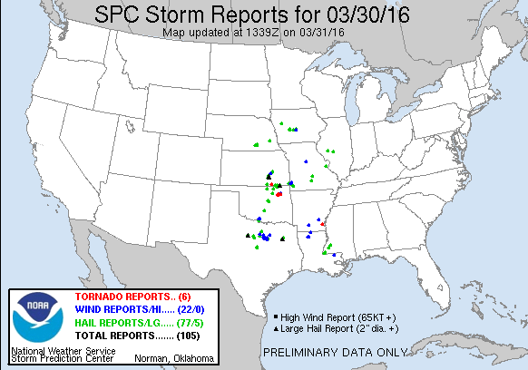
According to those storm reports, tornadoes touched down 4 miles north of Tulsa,
2 miles S of Owasso, 3 miles N of Catoosa, and 3 miles SE of Claremore. There
was at least one tornado warning for McCurtain County as well, but I have yet to
see a report of a tornado from that one. Doesn't mean one didn't touch down, of
course.
The Tulsa NWS office will be conducting storm surveys to determine how many
distinct twisters touched down, including other info like EF-ratings and straight
line wind damage paths. Until then, all info should be considered preliminary.
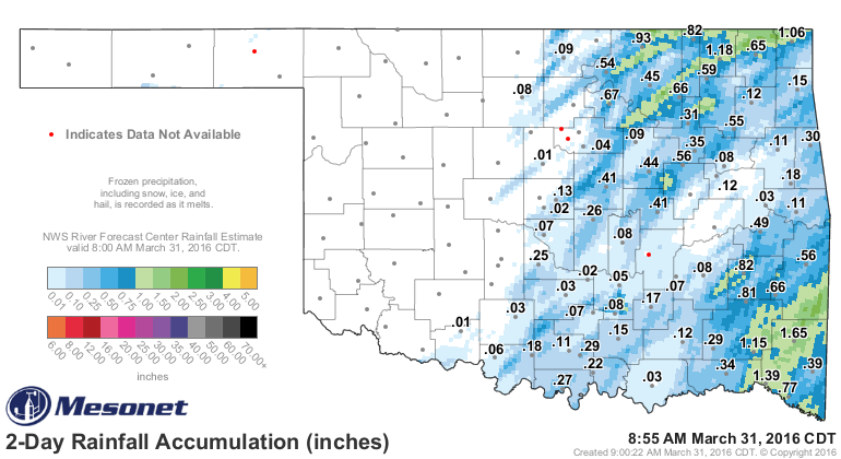
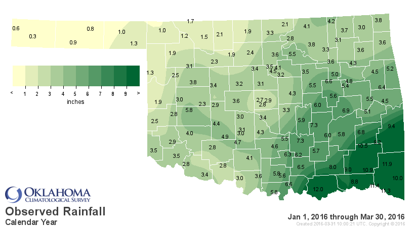
Now the rain that fell with the storms was badly needed in some parts, and it
was definitely hit and miss according to Mesonet totals. Over an inch fell in
narrow swaths, generally east of I35, although most amounts indicate a half-inch
or less owing to the speed of the storms. They just moved out too fast to dump
too much rain, and where too "lined out" to be more widespread.
That might help mitigate some new colors on the latest U.S. Drought Monitor map
released just this morning that shows a 5% increase in Moderate (D1) drought and
a 15% increase in abnormally dry (D0) conditions. Please remember once again that
the D0 designation is NOT a drought category, but a precursor to drought (or
in some cases, a drought that is fading).
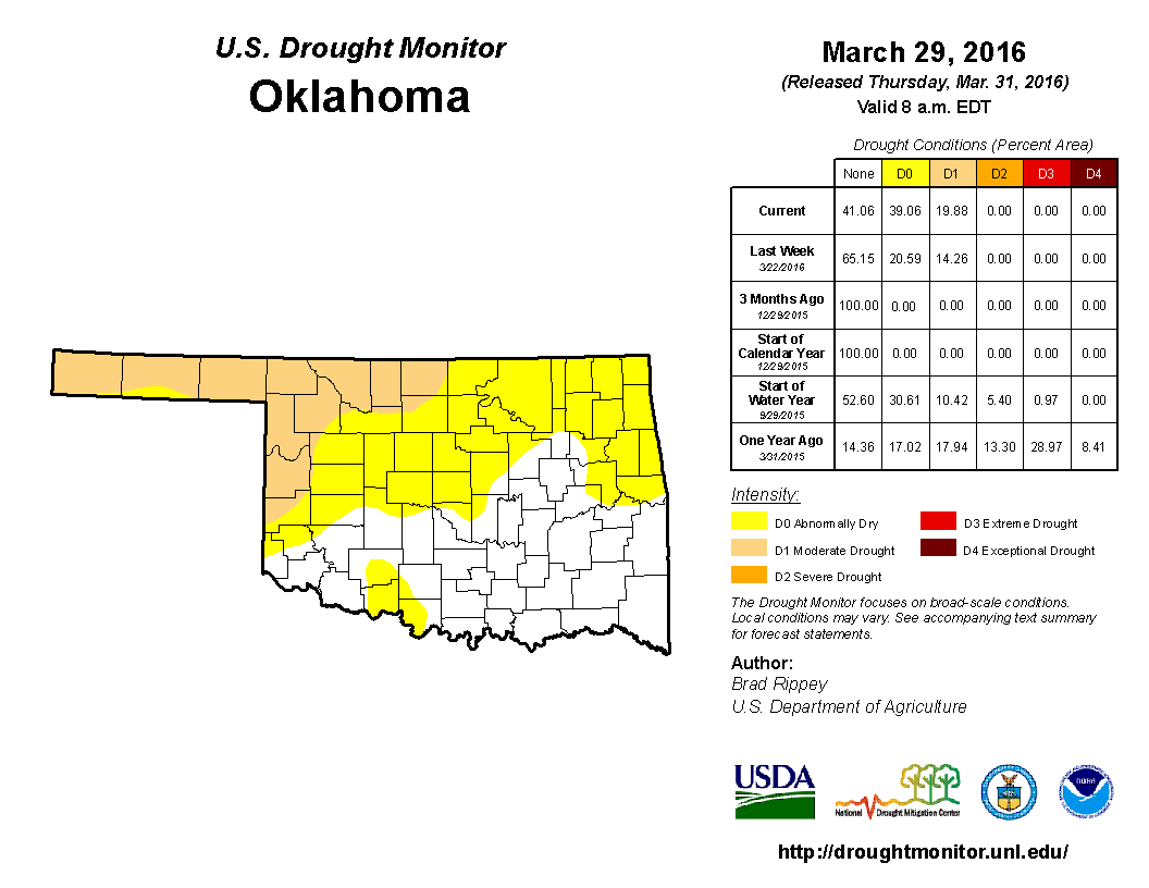
Not surprisingly, most of that D1 is contained in the NW quarter of the state
where the dearth of moisture since the beginning of the year is really starting
to add up.


And much of that area spent yet another day with high fire danger conditions,
conditions which exacerbate drought intensify. Wind gusts of 30-50 mph were
reported across that area of the state to go with relative humidity values
in the teens at best. That can really suck the moisture right out of the soil
and damage crops and vegetation.

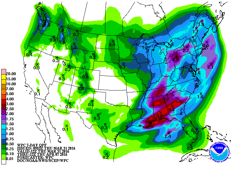
As for the near future, options for rain look bleak. The 7-day rain forecast
shows Oklahoma in a moisture donut hole.
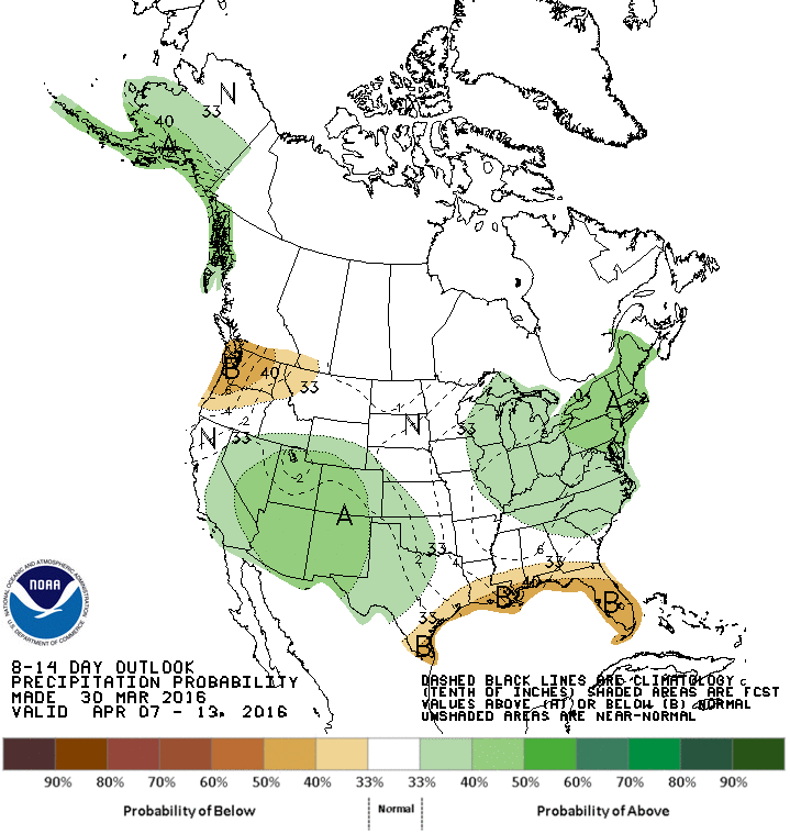
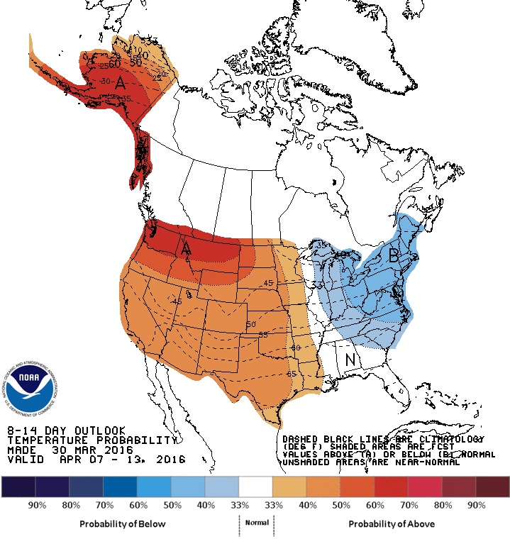
Maybe some help as we get into the second week of April where the CPC 8-14
day outlooks indicate increased odds of above normal precip, but also temps,
which won't help drought matters.
There are indications of a possible wet second half of April, which would do
wonders for the northern half and SW quarter of the state. But that forecast
coming to fruition is a wish at this point. Let's cross that bridge when
we come to it.
Gary McManus
State Climatologist
Oklahoma Mesonet
Oklahoma Climatological Survey
(405) 325-2253
gmcmanus@mesonet.org
March 31 in Mesonet History
| Record | Value | Station | Year |
|---|---|---|---|
| Maximum Temperature | 97°F | BUTL | 2010 |
| Minimum Temperature | 16°F | EVAX | 2019 |
| Maximum Rainfall | 5.36 inches | BOWL | 2015 |
Mesonet records begin in 1994.
Search by Date
If you're a bit off, don't worry, because just like horseshoes, “almost” counts on the Ticker website!