Ticker for October 15, 2015
MESONET TICKER ... MESONET TICKER ... MESONET TICKER ... MESONET TICKER ...
October 15, 2015 October 15, 2015 October 15, 2015 October 15, 2015
Look kids, Big Ben, Parliment, rain forecasts
It wasn't supposed to be this way. We were supposed to be laughing at 1957 as
we blew past it as the wettest year on record for Oklahoma. We were supposed
to be reveling in nice, cool weather as we watched the leaves start to change and
drop to the ground. Well they're changing color all right...to brown, and they're
dropping to the ground, dead, from lack of water. Today's release of the U.S.
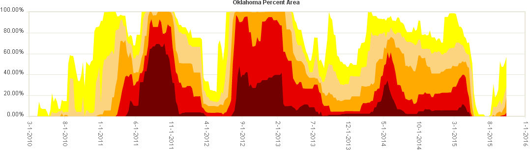
Drought Monitor shows the ugly truth. Nearly the entire southern 1/5th of the
state is now in severe drought.

More than 28% of the state now in drought, and increasing each week as we bake
in not only above normal temperatures, but temperatures 15-20+ degrees greater
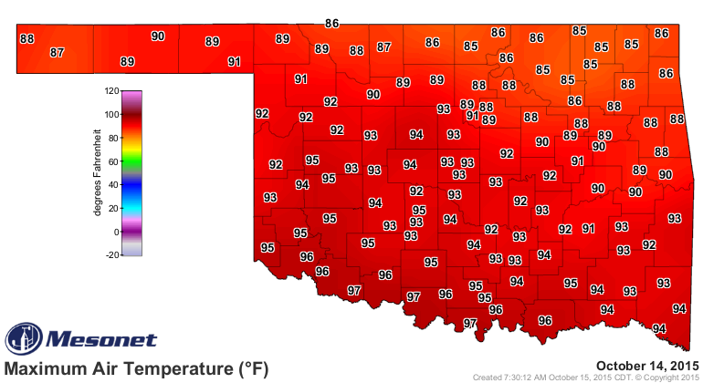
than normal. Record temperatures, like yesterday
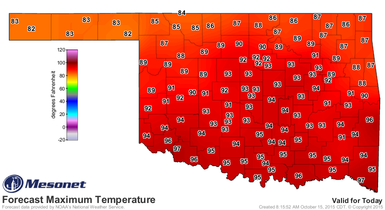
and again today
So we had a nice little 2-month break in our longer 2010-15 drought cycle, and
now you can see the increase as this flash drought turns into full-fledged
drought.
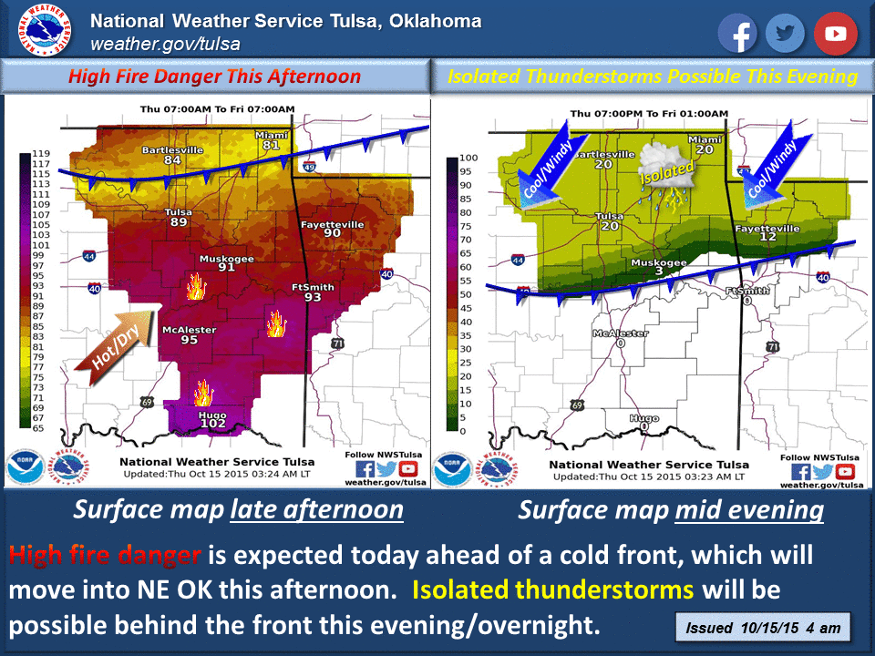
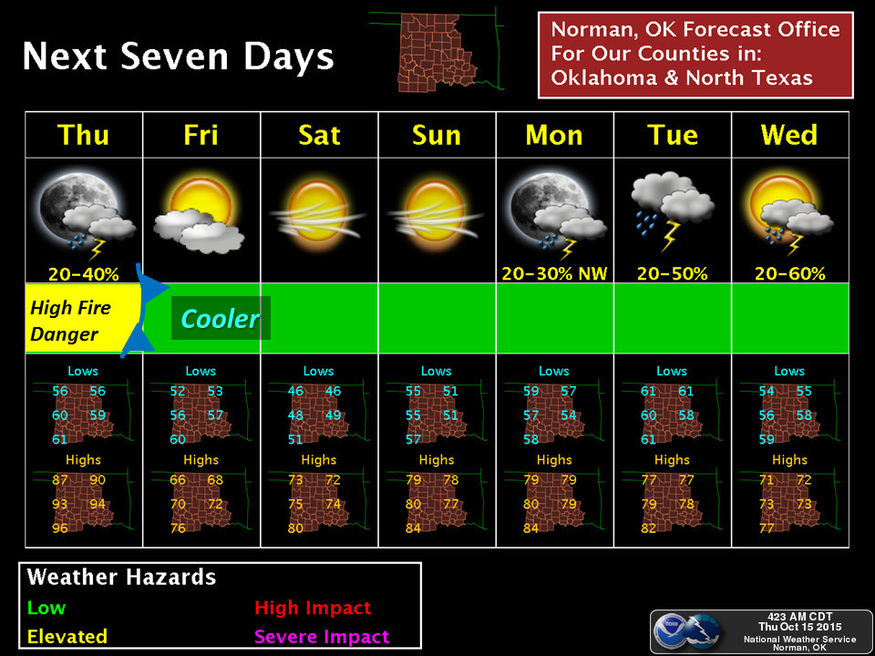
There is a front coming through tonight that will cool us down into actual fall
weather, with a big of a chance of rain, but not much.
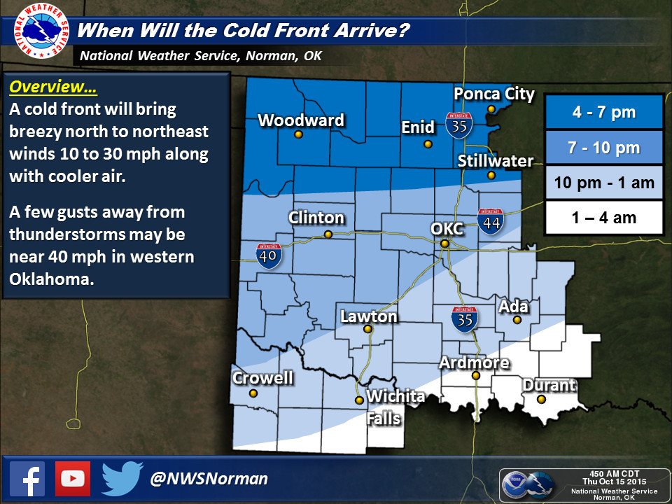
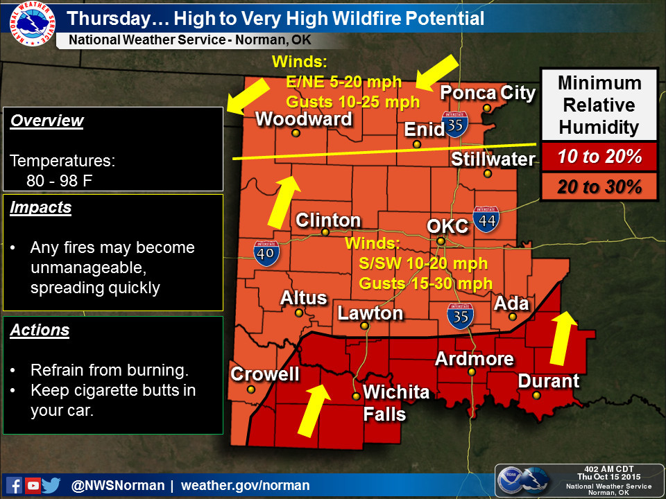
But high fire danger will prevail today as that front moves through and the
winds gust to more than 30 mph.
But we should actually stay in very pleasant weather for awhile...no more 90s
for awhile, at least, and another front and chance of rain next week, which
should add to the totals from tonight (if there are any).
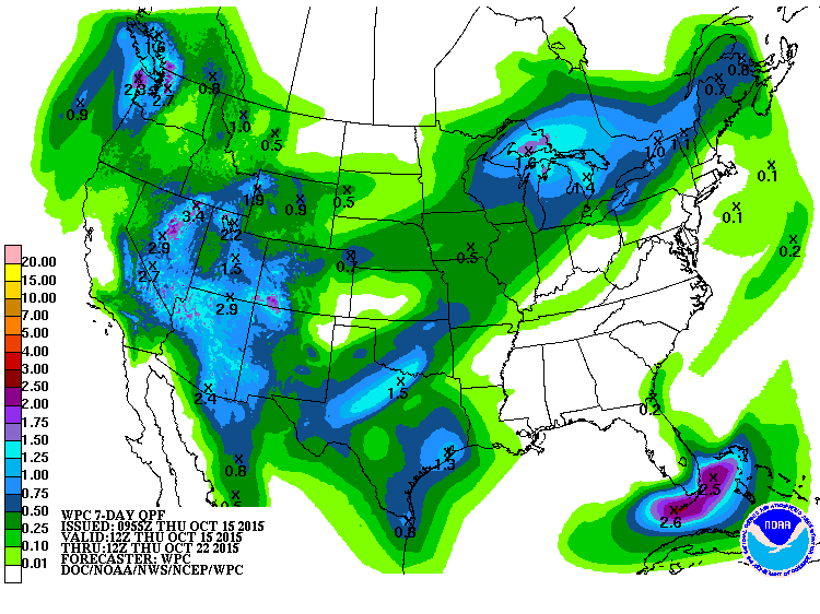
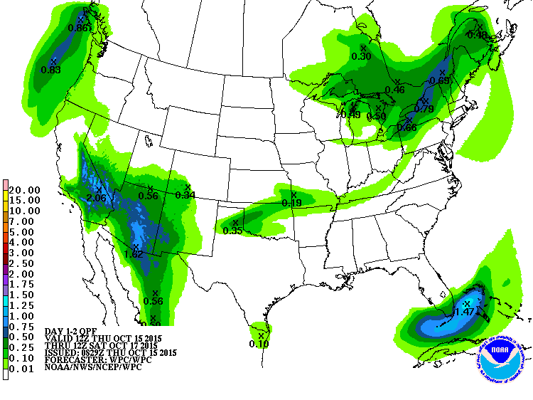
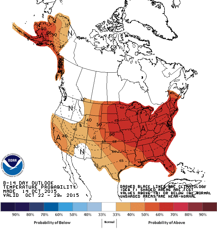
Farther into the future, we're seeing that front's rain chances on the medium
term outlooks from CPC.
But still no signs of any really cold air.
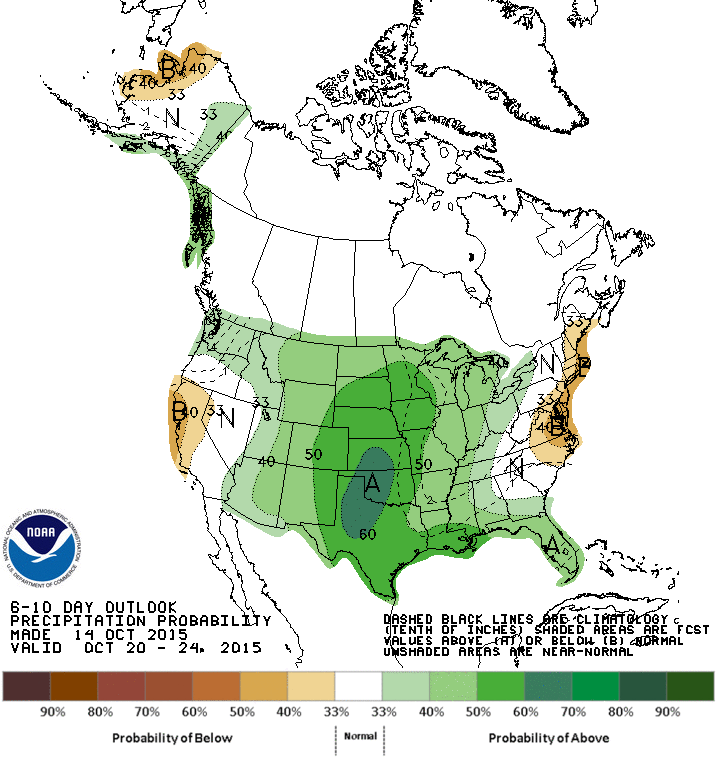
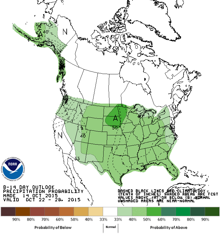
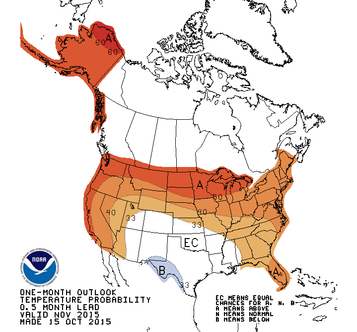
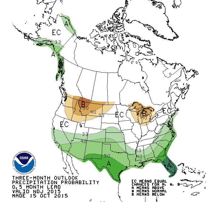
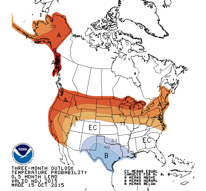
Now, for November and the November-January period, we see chances for drought
improvement and removal

Thanks to El Nino's influence, as seen on the November and November-January
outlooks from CPC. Now remember, these show probabilities of above- or below-
normal temperatures and precipitation, not expected amounts (e.g., darker shades
of green don't mean "really, REALLY wet" but "greater odds of above-normal
precip").
CPC November Outlooks

CPC November-January Outlooks
Unfortunately, for those of you that have been enjoying these sunny days and
pleasantly warm evenings, those will come to a close for awhile. Fear not,
since winter is not appearing on the horizon just yet.
But remember, the needs of the many outweigh the needs of the few.
Out-nerd that!
Gary McManus
State Climatologist
Oklahoma Mesonet
Oklahoma Climatological Survey
(405) 325-2253
gmcmanus@mesonet.org
October 15 in Mesonet History
| Record | Value | Station | Year |
|---|---|---|---|
| Maximum Temperature | 97°F | TIPT | 2015 |
| Minimum Temperature | 26°F | EVAX | 2018 |
| Maximum Rainfall | 5.41 inches | WALT | 2006 |
Mesonet records begin in 1994.
Search by Date
If you're a bit off, don't worry, because just like horseshoes, “almost” counts on the Ticker website!