Ticker for September 29, 2015
MESONET TICKER ... MESONET TICKER ... MESONET TICKER ... MESONET TICKER ...
September 29, 2015 September 29, 2015 September 29, 2015 September 29, 2015
But it's a dry heat, Sarge!

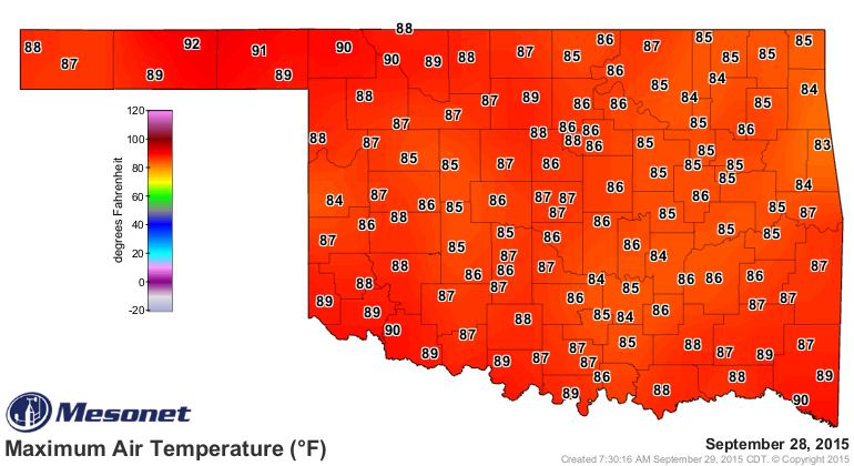
It's been hot, okay? Our one day of chili weather a couple of weeks ago turned
into a boon for the snow cone bidness, with temperatures soaring 10-15 degrees
above normal into the upper 80s and low 90s. Yesterday's high temperature map, as
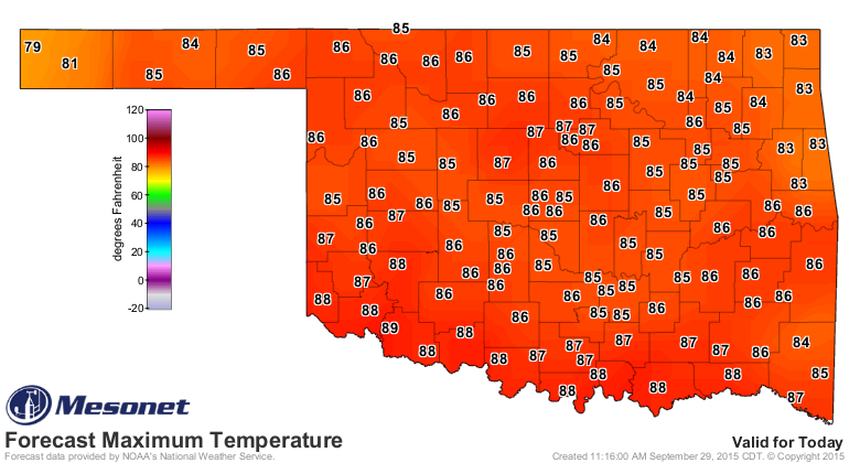
proof, and today's forecast highs.
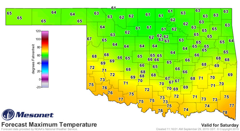
But never fear, for help is on the way. A tremendous burst of fall weather is
scheduled for this weekend, just in time to give last weekend's State Fair goers
heat rash in envy. Check out Saturday's forecast highs.
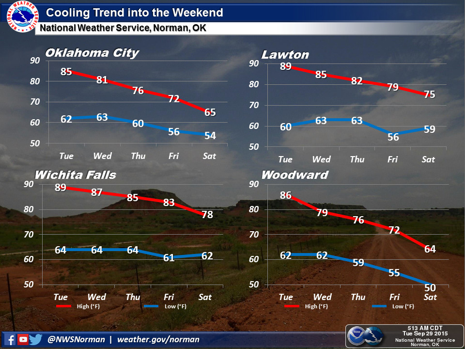
But we'll see the first signs of that front tomorrow before the main big blob of
cooler air oozes down across the region this weekend. I think the Norman NWS'
graphic of area temperatures through Saturday will give you the best idea of the
evolution of this thing.
And we'll also see chances for rain! Remember that stuff? It's water! And it
falls from the sky!
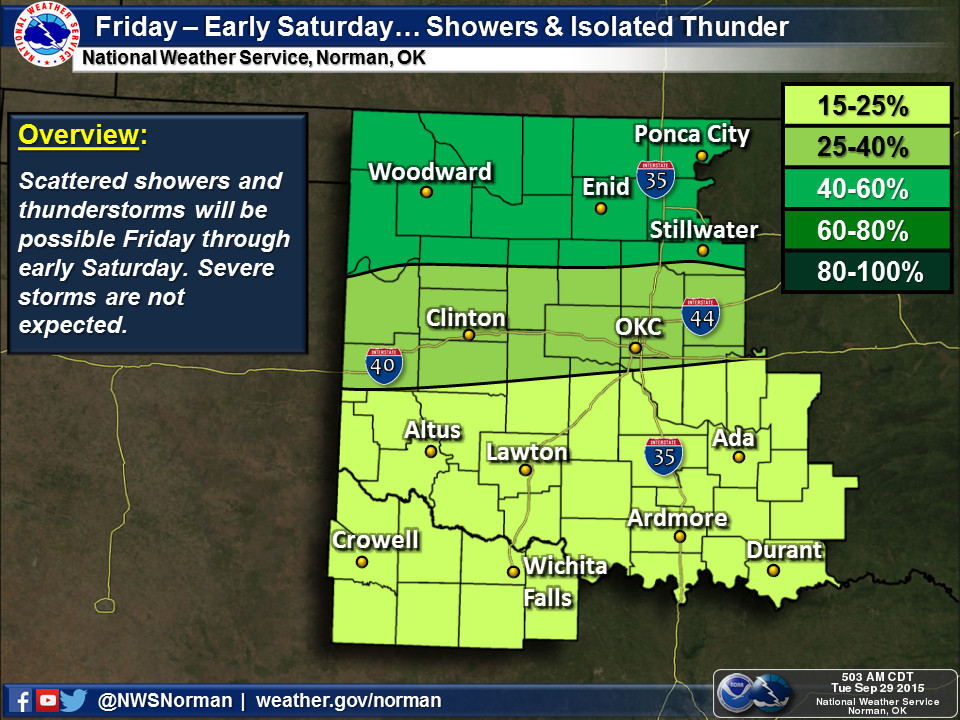
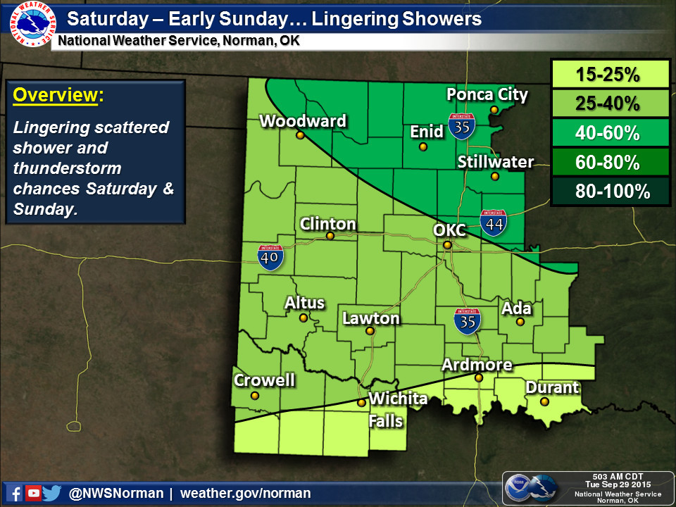
Amounts are not exactly earth shattering at this time, but they are earth
wetting.
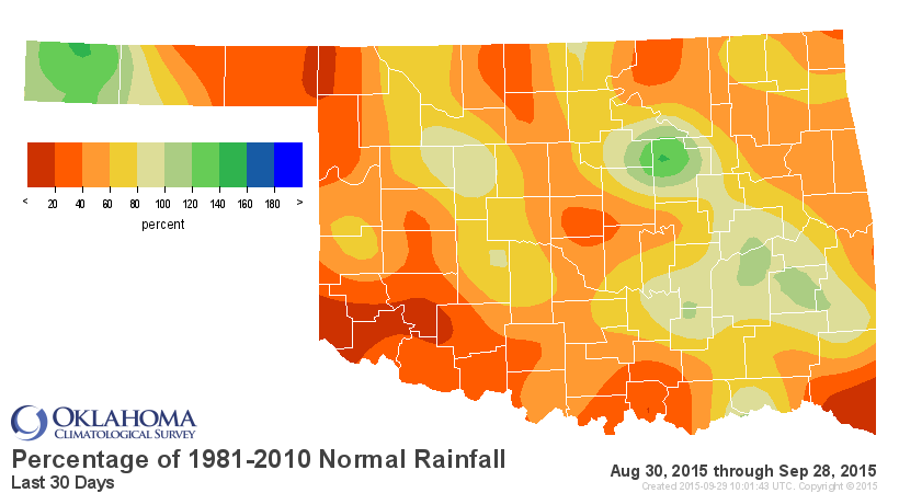
Let's face it. This is just ugly.

But so is this.
Gary McManus
State Climatologist
Oklahoma Mesonet
Oklahoma Climatological Survey
(405) 325-2253
gmcmanus@mesonet.org
September 29 in Mesonet History
| Record | Value | Station | Year |
|---|---|---|---|
| Maximum Temperature | 102°F | BURN | 2011 |
| Minimum Temperature | 31°F | KENT | 1999 |
| Maximum Rainfall | 4.93 inches | STIG | 2012 |
Mesonet records begin in 1994.
Search by Date
If you're a bit off, don't worry, because just like horseshoes, “almost” counts on the Ticker website!