Ticker for May 28, 2015
MESONET TICKER ... MESONET TICKER ... MESONET TICKER ... MESONET TICKER ...
May 28, 2015 May 28, 2015 May 28, 2015 May 28, 2015
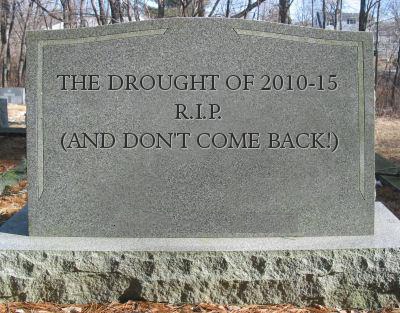
The Drought of 2010-15, R.I.P.
Even as the torrential rains rips across Oklahoma thanks to a squall line this
morning, that moisture tells us something that we knew in our hearts (and thanks
to our common sense) a couple of weeks ago...for all intents and purposes, the
drought that plagued the Southern Plains for the last 4.5 years is dead. Confirmed
by this week's gloriously wonderful U.S. Drought Monitor report.
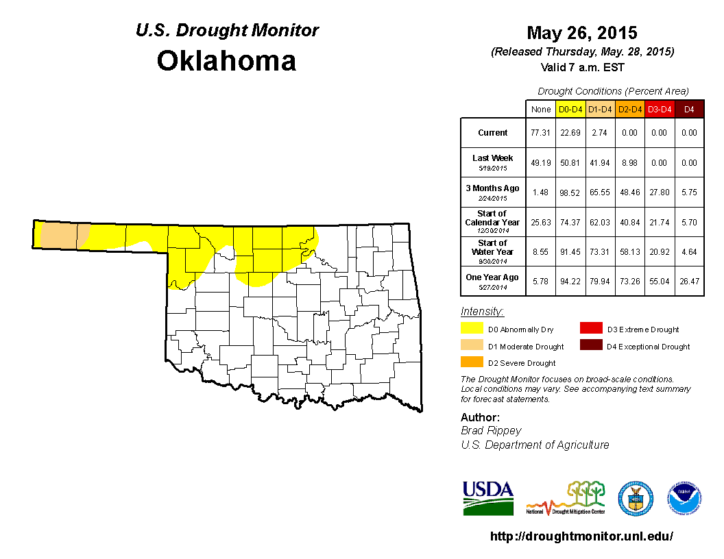
So only 2.7% of the state in drought (remember, the yellow "D0" areas signify
abnormally dry, which is not a drought category). We haven't seen a map with
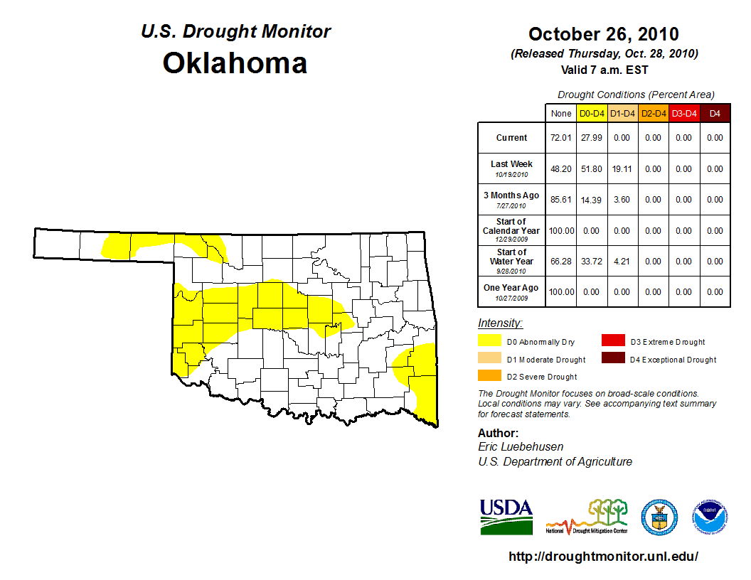
that low of a drought total since Oct. 26, 2010, when this whole mess was just
getting started (and all that yellow meant we were entering drought, as opposed
to our current yellow which signifies we are leaving drought).
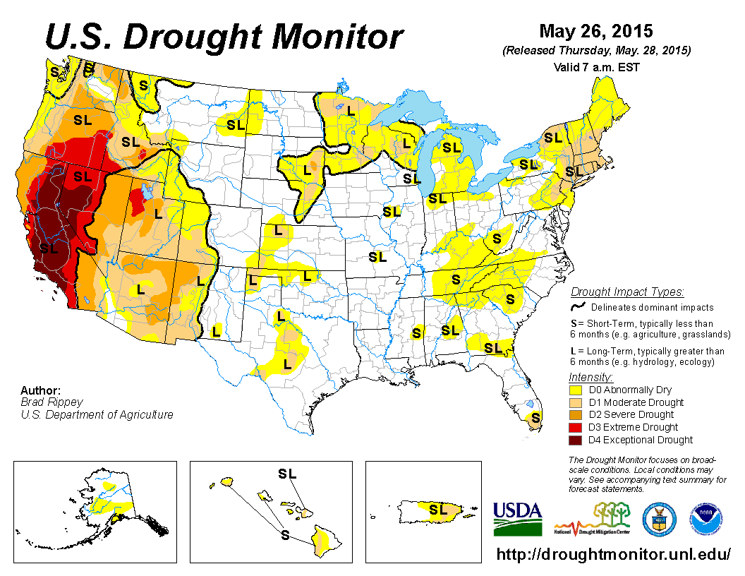
Now I called this the death of the Southern Plains drought. A quick look at the
broader picture illustrates that quite nicely, as most of the nasty colors from
across the region have disappeared as well. Just a few vestiges of drought
remain across areas surrounding the Oklahoma region.
I'm going to show you three periods of rainfall statistics for the state of
Oklahoma which illustrate drought, drought relief, and finally drought
eradication.
First up, the Mesonet rainfall for the start of the drought through the last
vestiges of the worst of the drought conditions...Oct. 1, 2010 through March 31,
2015. This could have gone through April 11, 2015, but I didn't want to split the
month up.
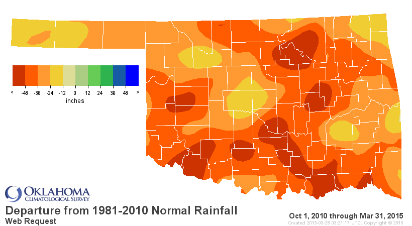
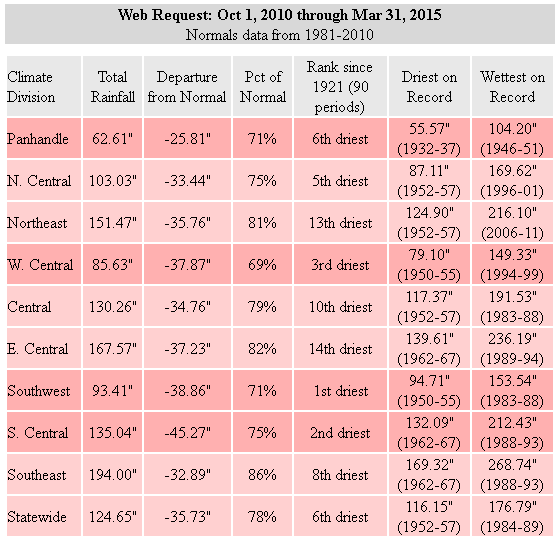
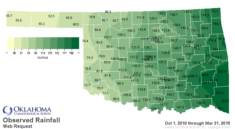
The Climate division statistics point towards deficits of 25-45 inches over that
span, but the second map shows you actual point-based departures of more than
50 inches.
Boom! There's your long-term drought in a nutshell. A few periods of relief
(sometimes significant) throughout that period, but always a return to drought,
and always significant drought across some part of western Oklahoma.
Now we come to the April-May period, one of the wettest two-month spans on
record for the state. April was the drought reliever...May was the drought
eradicator. Check out the maps and stats for the state since April 1 of this
year.
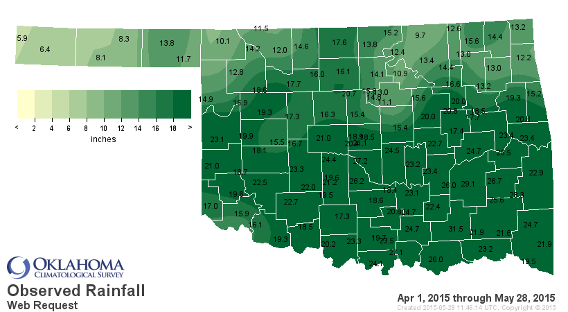
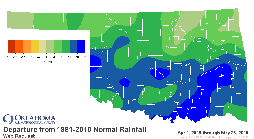
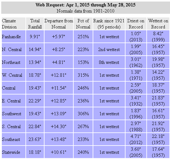
That's the drought's death rattle. There's a bit of give and take on that
ranking, however. The stats show it as the wettest April 1-May 28 on record,
but the final days of May 1957 pushed that year a bit above this year by month's
end to a statewide average of 18.58 inches. We'll see if we can top that with
more rains over the next 3 days (which are definitely in the forecast).
Speaking of May's rainfall, we continue to push that mark for wettest month on
record for the state higher and higher, currently sitting at 13.35", far
out-pacing the previous mark from October 1941 at 10.75".
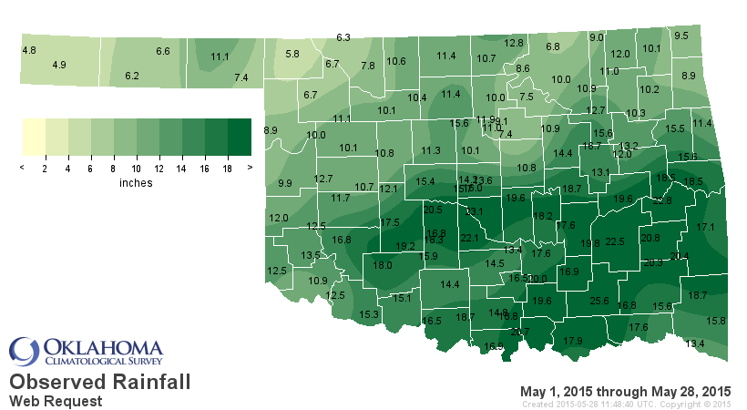
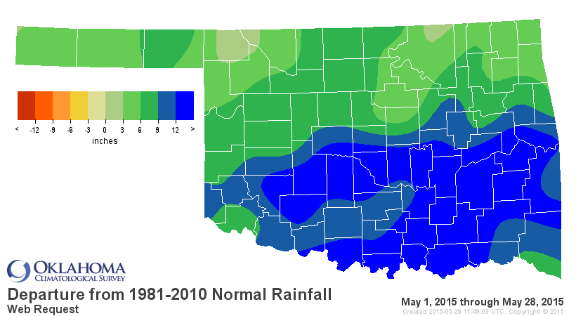
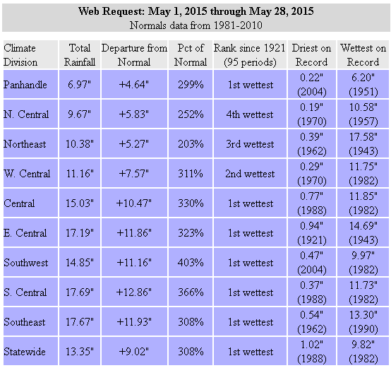
Here's the new tally board for the wettest months on record (dating back to
1895) for the state of Oklahoma.
May 2015: 13.35"
Oct 1941: 10.75"
May 1957: 10.54"
May 1982: 10.38"
May 1943: 9.66"
Jun 2007: 9.51"
May 1902: 9.14"
Jul 1950: 9.07"
OBLITERATION! And looking at the map of May totals thus far, lots of stations
have obviously destroyed their previous marks for wettest Mays or months on
record as well. Norman with 23.1 inches? The previous high for any month on
record for that city is 16.50" in October 1983 (Hurricane Tico remnants).
What's in store for the last days of May? Will we push that total even higher?
Uhhhhh, I'd say YES! In addition to the rain currently moving across the
state, we see more rain in the forecast through the weekend.
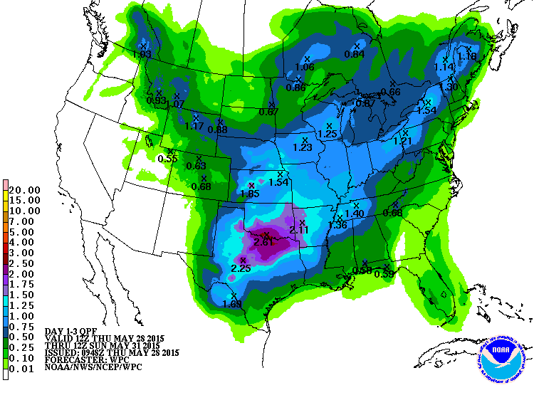
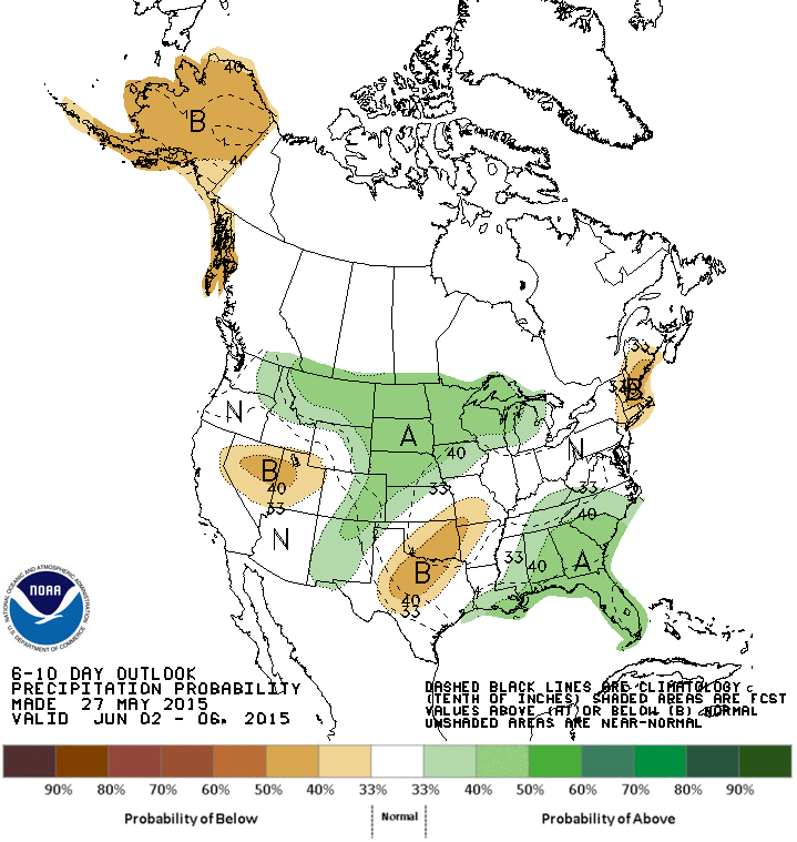
At last we see a bit of a lessening into next week, maybe give the mosquitoes
a chance to all hatch and drain us dry.
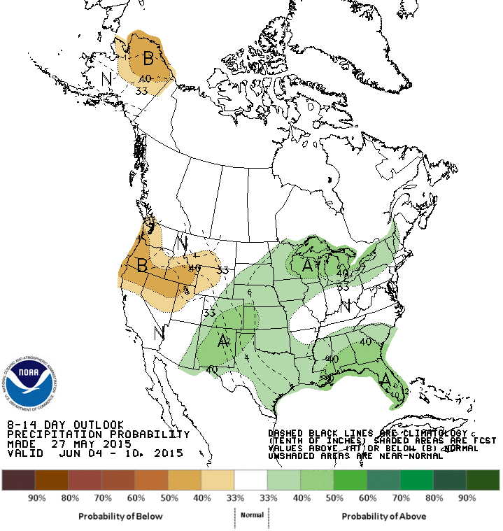
I wouldn't get too used to it, however. There may be more right around the
corner.
Gary McManus
State Climatologist
Oklahoma Mesonet
Oklahoma Climatological Survey
(405) 325-2253
gmcmanus@mesonet.org
May 28 in Mesonet History
| Record | Value | Station | Year |
|---|---|---|---|
| Maximum Temperature | 105°F | BEAV | 2022 |
| Minimum Temperature | 39°F | KENT | 2016 |
| Maximum Rainfall | 4.53 inches | MANG | 2023 |
Mesonet records begin in 1994.
Search by Date
If you're a bit off, don't worry, because just like horseshoes, “almost” counts on the Ticker website!