Ticker for May 6, 2015
MESONET TICKER ... MESONET TICKER ... MESONET TICKER ... MESONET TICKER ...
May 6, 2015 May 6, 2015 May 6, 2015 May 6, 2015
Had enough?
Not yet? When? How many questions in a row will I ask? Here are the rainfall
totals from last night. As you can tell, SW through NC OK got another drenching,
and there's more on the way. Heck, even the Panhandle got into the act again.
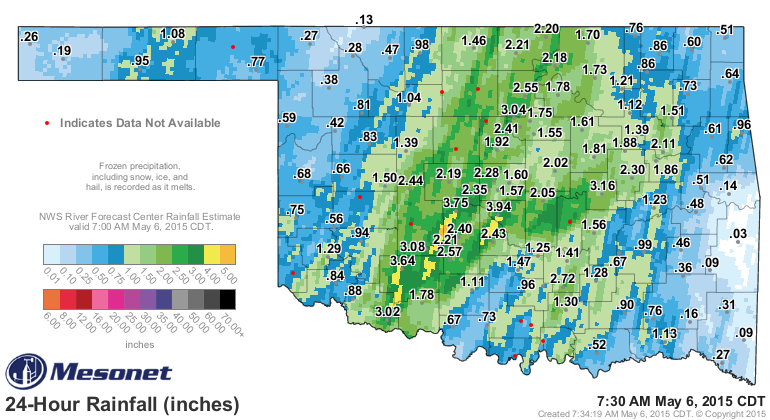
Flash flood warning were all the rage overnight as a lot of that rainfall fell
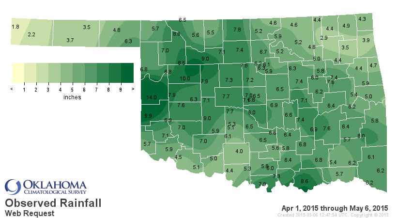
in a hurry with the training convection. Go back 30 days and you capture most of
the big rains. There are only a few stragglers left, like Stephens County down in
SC OK, and the far NE and NW corners of the state. I'm betting they get theirs
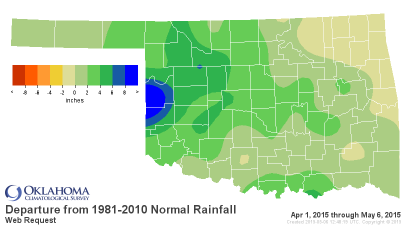
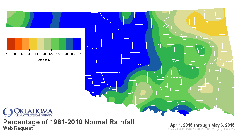
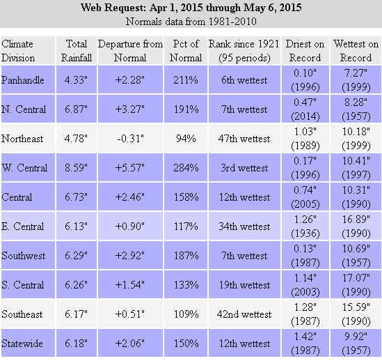
soon. Go back to the beginning of April and we see a statewide average of 6.18",
2.06" above normal and the 12th wettest such period since at least 1921. How's
that for drought relief?
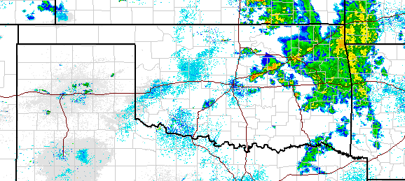
Oh, and it's still raining!
Oh, and we're expecting more rain the rest of the week (and the chances for
severe weather).
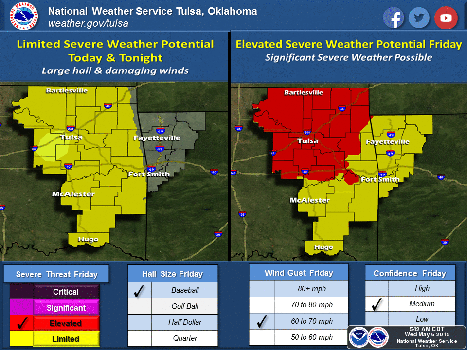
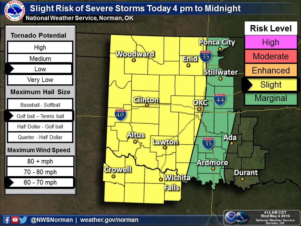
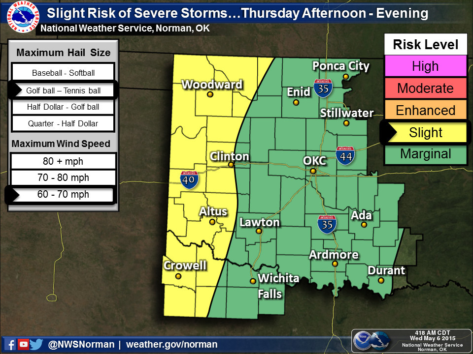
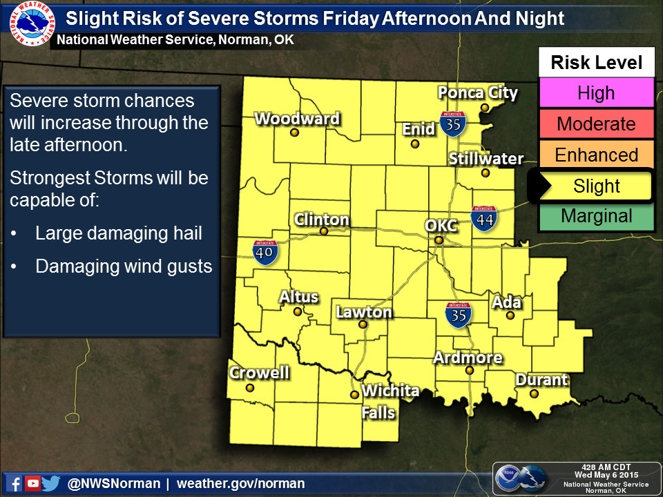
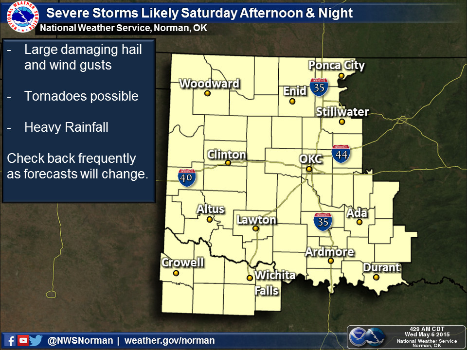
In addition to severe winds, large hail and the occasional tornado, expect
flash and/or river flooding to also be a possibility with all this nonsense
going on.
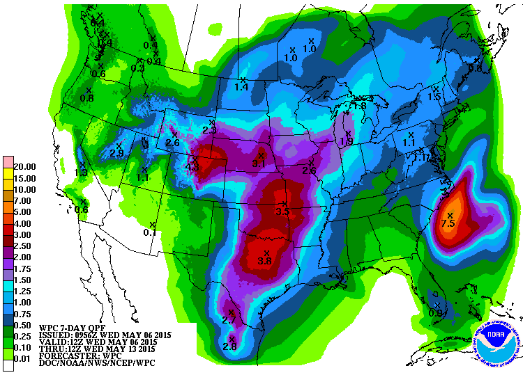
It's all about the conviction of the convection. If it feels strongly that YOU
need some exciting weather, well, prepare to get excited.
This is all a very rough overview. As per usual, remember that it's always
safest to be prepared now instead of later, and to keep advised of the changing
forecasts via your favorite NWS and media outlets.
Gary McManus
State Climatologist
Oklahoma Mesonet
Oklahoma Climatological Survey
(405) 325-2253
gmcmanus@mesonet.org
May 6 in Mesonet History
| Record | Value | Station | Year |
|---|---|---|---|
| Maximum Temperature | 105°F | CHER | 2014 |
| Minimum Temperature | 33°F | BOIS | 1999 |
| Maximum Rainfall | 5.02 inches | OKCE | 2015 |
Mesonet records begin in 1994.
Search by Date
If you're a bit off, don't worry, because just like horseshoes, “almost” counts on the Ticker website!