Ticker for April 27, 2015
MESONET TICKER ... MESONET TICKER ... MESONET TICKER ... MESONET TICKER ...
April 27, 2015 April 27, 2015 April 27, 2015 April 27, 2015
Rain Street

Of course, Gordon Gekko never lived along the Washita River out in Roger Mills
County either. That county, after 4.5 years of horrendous drought, now has water
running over the banks of the Washita, its farm ponds, and anywhere else it has to
go. This is what the Washita looked like last week, courtesy of the Roger Mills
Emergency Management office and the Arkansas-Red Basic River Forecast Center.
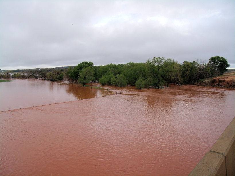
Now that in and of itself doesn't mean an end to drought in that area until we
can be certain that it has soaked into the deeper soils and also into the area
farm ponds. But I think we have enough evidence of the latter, and with all that
standing water, probably the former as well. So they are on their way. They're
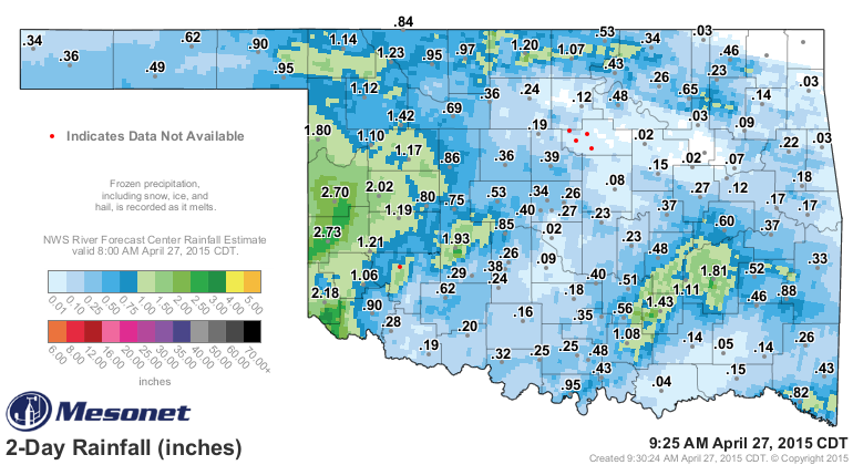
also dealing with more flooding today along that river with another 2-3 inches
having fallen since yesterday.
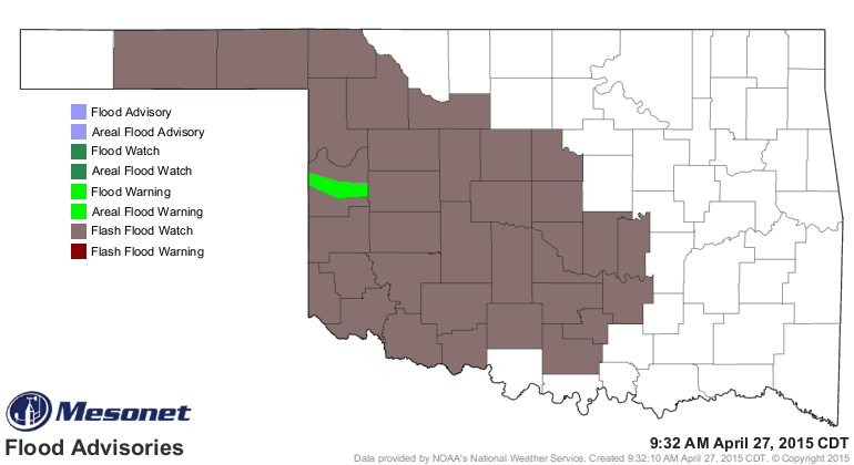
That has prompted a flood warning once again for Roger Mills County along the
Washita, and then much of the SW half of the state is under a flash flood watch
with what is expected to fall today through tomorrow.
Here are some particulars for the Washita River flooding near Cheyenne.
-------------------------------------------------------------------------------
* At 8:00 AM Monday the stage was 10.9 feet.
* Minor flooding is forecast.
* Flood stage is 13.5 feet.
* Forecast...The Washita River will rise above flood stage late
Monday morning and crest near 14.8 feet Monday evening.The Washita
River will fall below flood stage early Tuesday afternoon.
* Impact...At 15 feet...Flooding of agricultural lands along the
Washita River occurs in Roger Mills and western Custer counties
above the headwaters of Foss Lake. U.S. Highway 283 between
Cheyenne and Roll may be overtopped.
-------------------------------------------------------------------------------
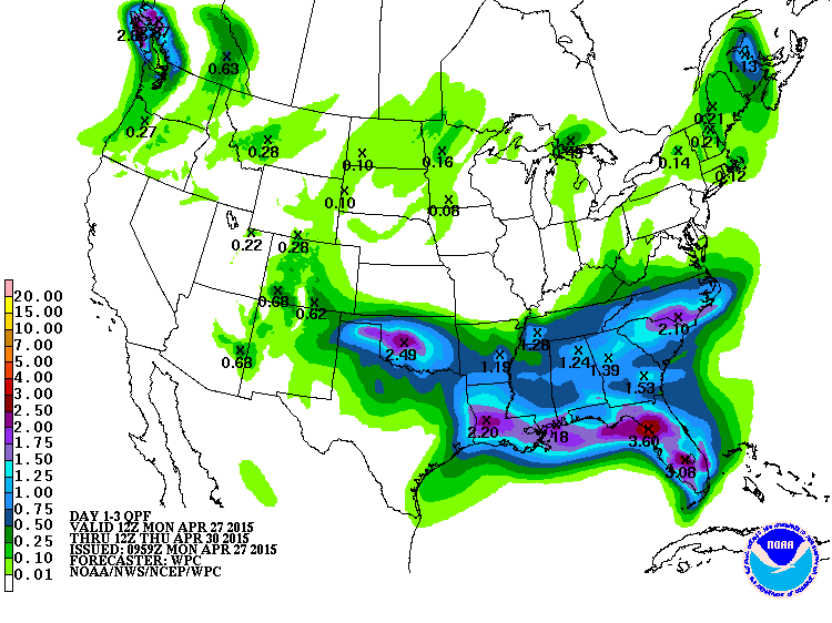
As for the forecast rainfall amounts, this is pretty much what it looks like for
the next couple of days. Keep in mind some of this forecast total has already
fallen this morning.
Take another look...now ain't that a wonderful sight?
https://content.mesonet.org/ticker/archive/20150427/southern-plains-radar.MOV
And remember...turn around, don't drown! A completely preventable death.
On the other side of the coin, let's remember that some places haven't been
quite as lucky with the rain, such as the far western Panhandle. This is what
a lot of the dryland (non-irrigated) wheat crop looks like out that way (thanks
for the Cimmaron County NRCS office for the visual evidence of drought).
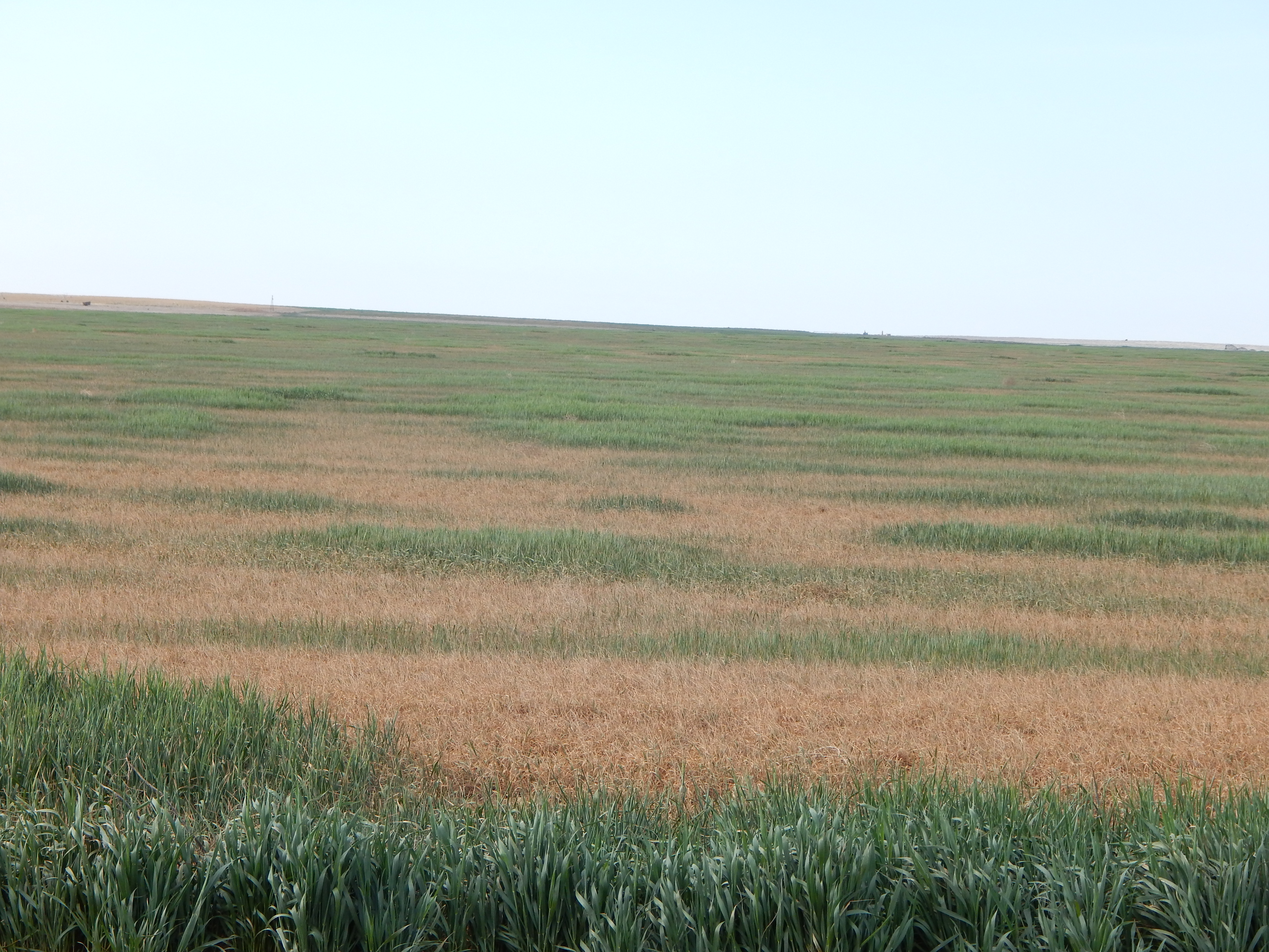
Here's hoping they get some more rain, although it's probably a bit too late
for a lot of that wheat. Can't hurt though, right?
Gary McManus
State Climatologist
Oklahoma Mesonet
Oklahoma Climatological Survey
(405) 325-2253
gmcmanus@mesonet.org
April 27 in Mesonet History
| Record | Value | Station | Year |
|---|---|---|---|
| Maximum Temperature | 96°F | GRA2 | 2012 |
| Minimum Temperature | 24°F | BOIS | 2008 |
| Maximum Rainfall | 5.85″ | BLAC | 2024 |
Mesonet records begin in 1994.
Search by Date
If you're a bit off, don't worry, because just like horseshoes, “almost” counts on the Ticker website!