Ticker for January 8, 2015
MESONET TICKER ... MESONET TICKER ... MESONET TICKER ... MESONET TICKER ...
January 8, 2015 January 8, 2015 January 8, 2015 January 8, 2015
Isn't it too cold to have a drought?
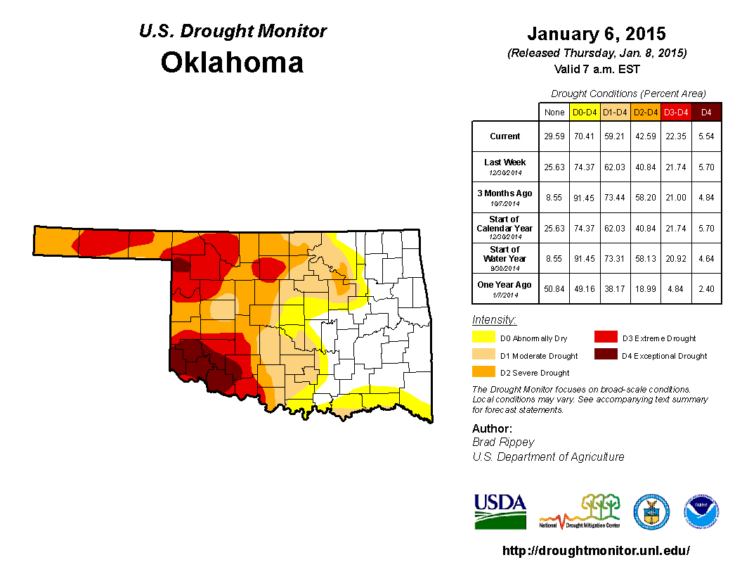
As it turns out, no. Drought is still the big LONG-TERM story in Oklahoma weather,
going on 4+ years now. The newest U.S. Drought Monitor map shows the same old
story, with significant drought plaguing the western half of the state and the
eastern half oscillating in and out of drought with more periodic beneficial
moisture.
A look at the last 30 days shows us the reasons why drought decreased across far
SE OK, but has gained a bit of ground across the western half.
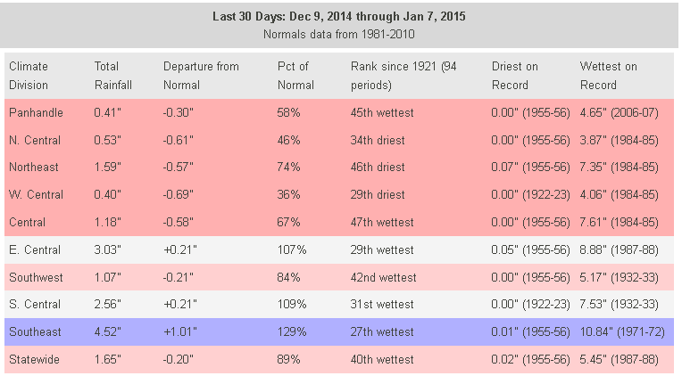
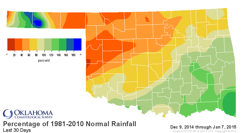
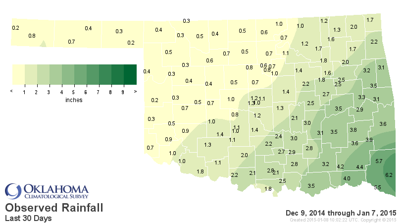
Some really odd mixtures in different regions of below normal precipitation but
being on the "wettest" side of the rankings. That is just and indication of this
being the driest time of the year and when its dry in Dec-Jan, it's REALLY dry.
Being 0.2 inches below normal statewide gets you the 40th wettest Dec. 9-Jan. 7
since at least 1921. Just an oddity of the statistics. But, it's drier than
normal if you look at the last 30 years, a more recent comparison value.
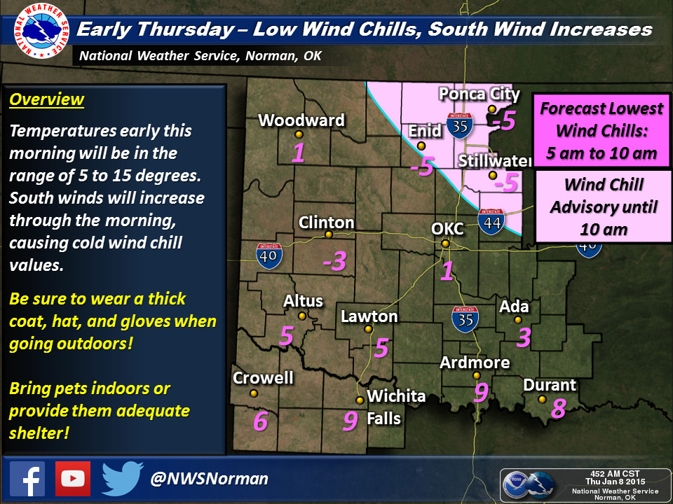
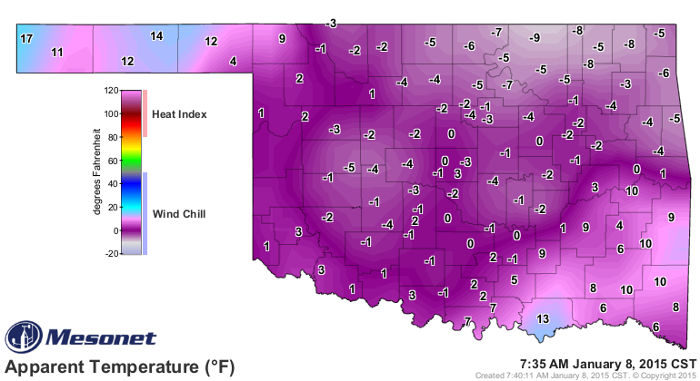
Now the big SHORT-TERM story is the cold. The air temperatures are even lower
than yesterday, but at least the winds have switched around to the south,
allowing them to begin to rise once again. Today's lows were downright frigid,
and the wind chills are even worse (same as yesterday).
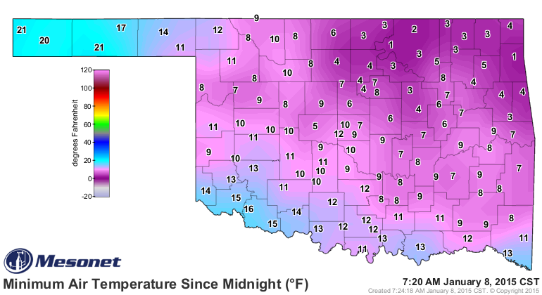
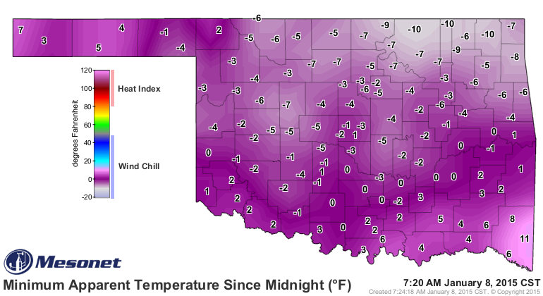
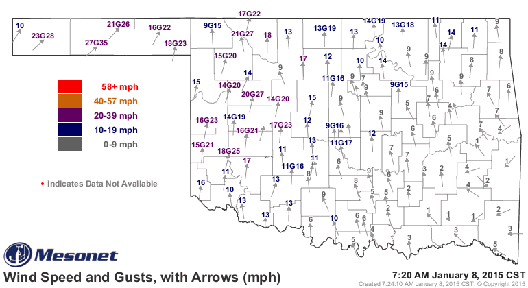
As I mentioned, here come the southerly winds (and they're howling!). That means
even though temperatures will be up, the windchills will keep it feeling like
the arctic circle today.
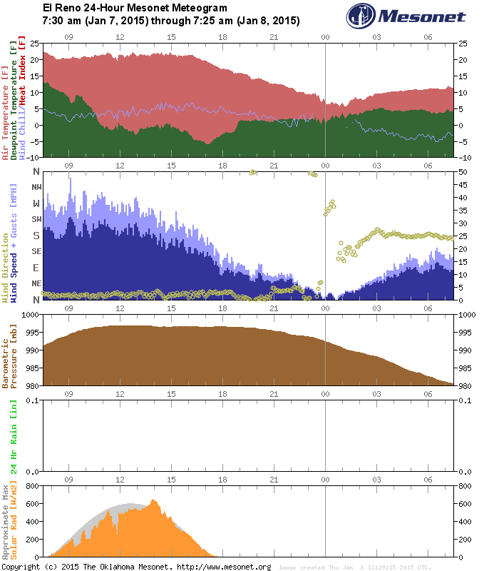
You can see the impact of those southerly winds. El Reno's meteogram, for
instance, shows the switchover to southerly winds right after midnight, and also
a slow-but-steady increase in temperatures. Unfortunately, the windchill has
been steadily decreasing over that same period.
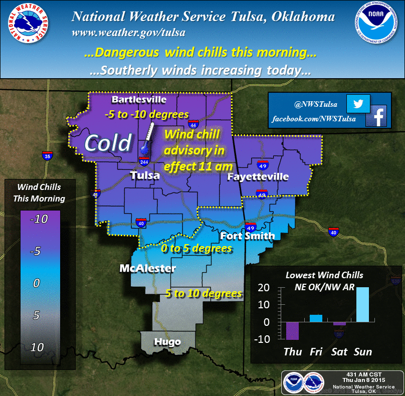
So for today, we stay with the dangerous wind chills, especially across NE OK
where those winds haven't switched over to the warming southerly direction just
yet.
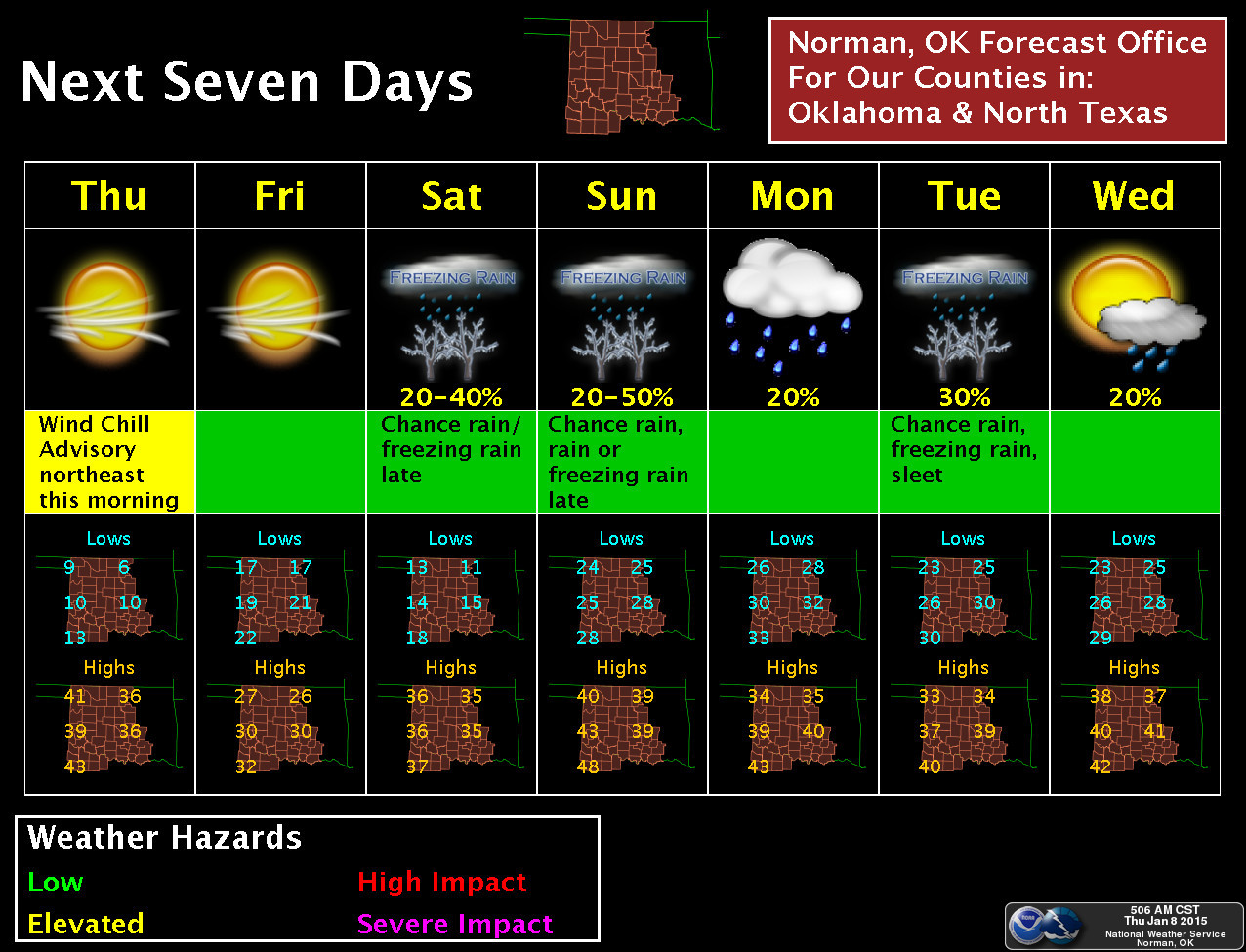
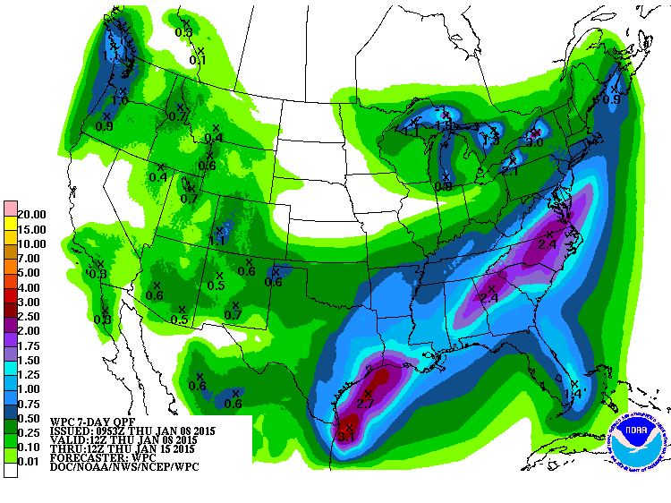
After that, we still see chances of precip of some type (rain, sleet, freezing
rain???) for the weekend and early next week. Amounts won't be massive, but a
good quarter-to-half inch across the state through the period is expected.
Now for some even better news, at least if it comes true. The CPC 8-14 day
temperature outlook shows warmer weather on the horizon.
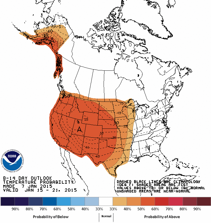
Granted, increased odds of above normal temperatures for mid-January doesn't
exactly scream "YAY, 70s!!!" but it sure beats this!
Gary McManus
State Climatologist
Oklahoma Mesonet
Oklahoma Climatological Survey
(405) 325-2253
gmcmanus@mesonet.org
January 8 in Mesonet History
| Record | Value | Station | Year |
|---|---|---|---|
| Maximum Temperature | 79°F | CAMA | 2002 |
| Minimum Temperature | -6°F | GOOD | 2010 |
| Maximum Rainfall | 1.43 inches | CLOU | 2024 |
Mesonet records begin in 1994.
Search by Date
If you're a bit off, don't worry, because just like horseshoes, “almost” counts on the Ticker website!