Ticker for March 20, 2014
MESONET TICKER ... MESONET TICKER ... MESONET TICKER ... MESONET TICKER ...
March 20, 2014 March 20, 2014 March 20, 2014 March 20, 2014
Drought improves and worsens ... where ya at??
Remember that day back in '06 (1900s, 2000s ... one of those centuries) when the
wind didn't blow 40 mph in Oklahoma? Yeah, me me either. Yesterday wasn't so bad,
at least as the day wore on, but things are expected to get out of control again
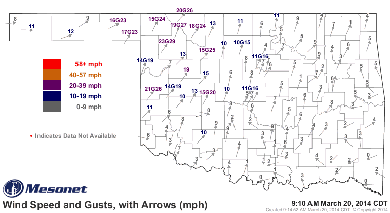
today with winds gusting in the 30-40 mph range. We're already seeing those types
of winds up in the NW on the Mesonet.
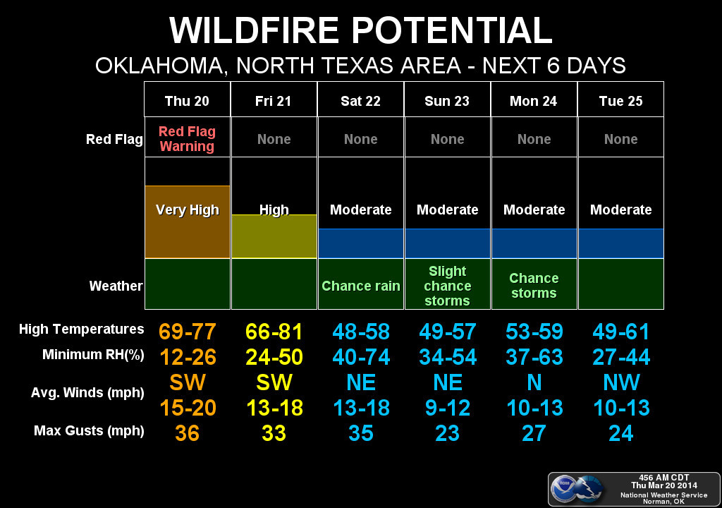
We know what that means for today, given the low humidity and moisture being
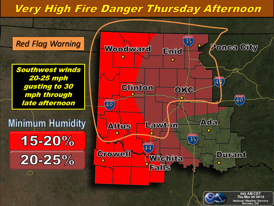
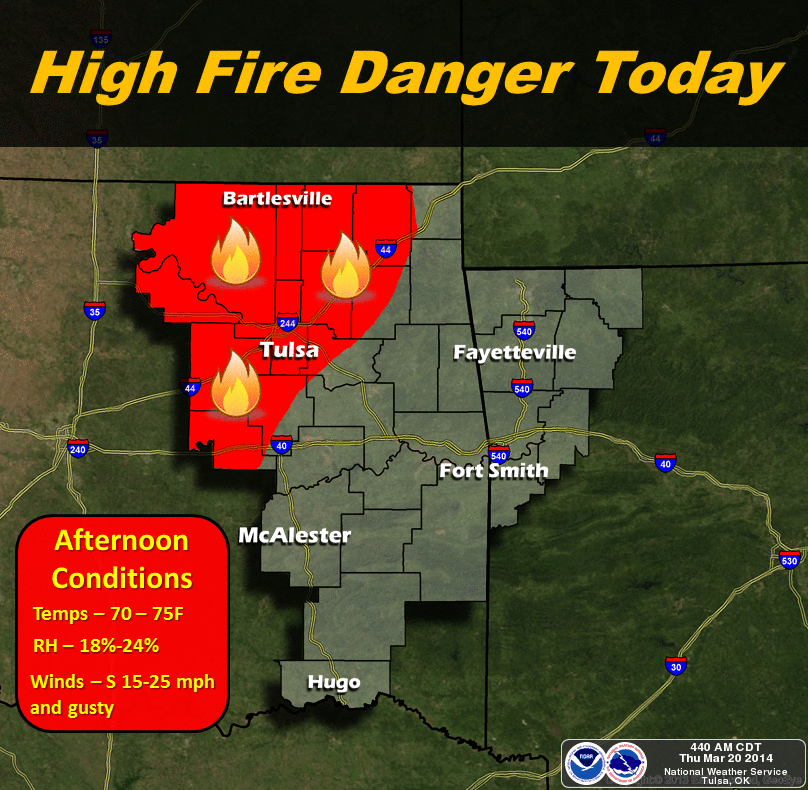
nothing more than wishful thinking ... wildfire danger. Sure enough, much of
the NW half of Oklahoma is in a Red Flag Fire Warning. Here are some not-so-pretty
pictures from our friends at the NWS describing today's situation.
The good news is after today, the fire danger swings into moderate mode for a few
days thanks to a cold front and a bit more moisture (not a big fan of the cool-
down myself ... I'd rather see warm weather and rain resulting in a green-up,
our best defense against future wildfire danger).
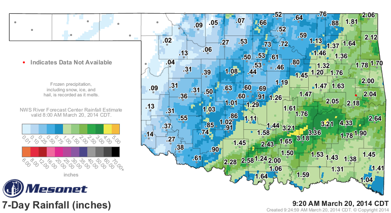
The rain we did get last weekend at least improved conditions across the SE
half of the state, generally, and gave even parts of NW OK a decent soaking.
It was enough to improve the advancing drought across the SE, and at least
forestall any intensification across north central and central Oklahoma.
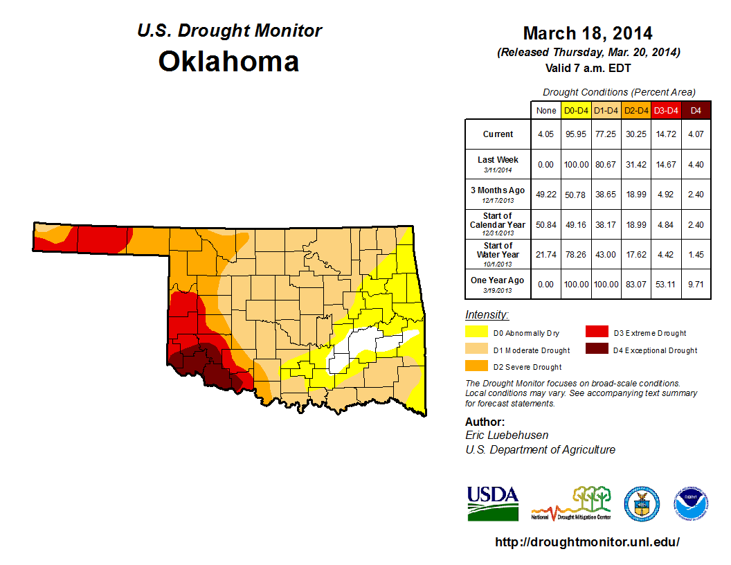
Our area with at least moderate (D1) drought dropped from 81% to 77%, which is
something of a victory, and our area in at least abnormally dry (D0) conditions
dropped to 96% from 100%. We might have expected more of an improvement, but
here's the problem. Remember all that wind and fire danger we've seen over the
last few weeks? Well, that's done its damage, especially when coupled with the
long-term precipitation deficits. Let's just look at how far down we are since
Oct. 1, 2013 (known as the "water year" in agricultural and climatological
circles).
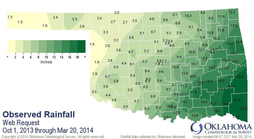
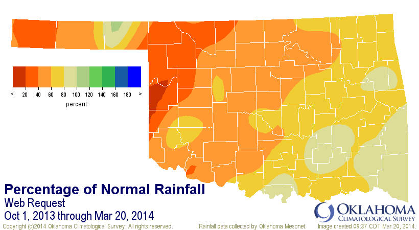
For OSU and OU fans alike, I'm afraid the oranges and reds on our maps today
mean bad things are happening.
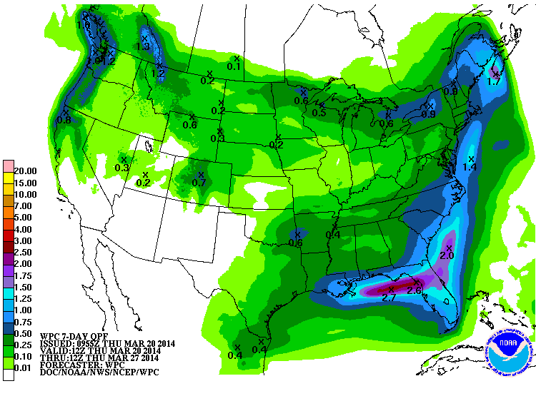
How about we look into the future? First off, the rainfall promised for this
weekend doesn't look like a drought-buster, or even denter, I'm afraid. The
SE, as per usual, looks to get the most.
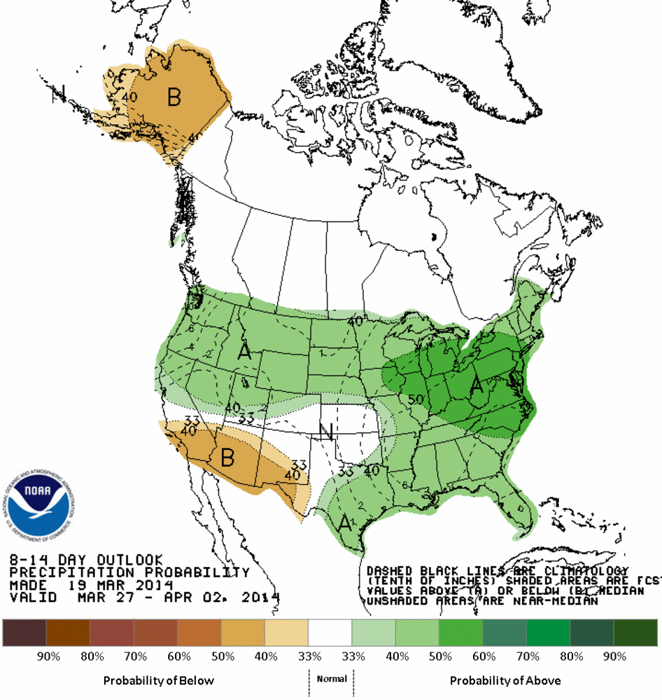
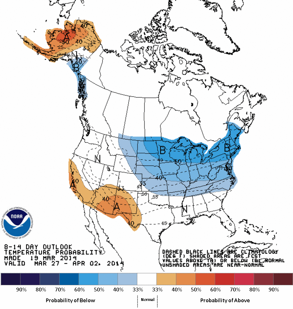
It doesn't look especially rainy as we go out to the last of March and first
part of April either, but neither does it look particularly dry. Just a bit on
the cool side.
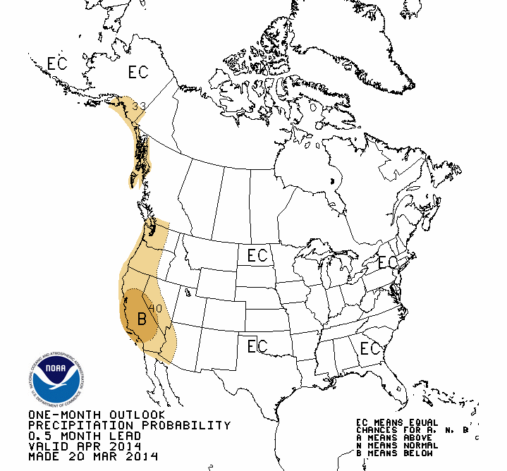
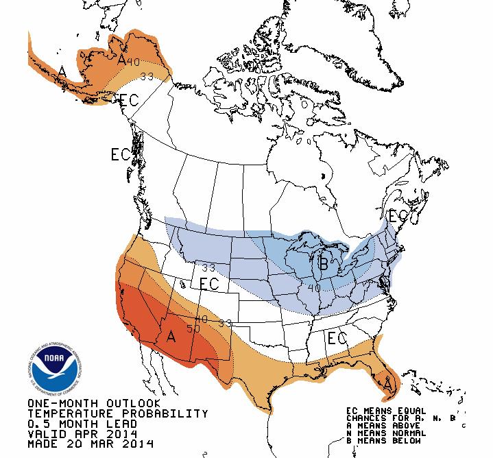
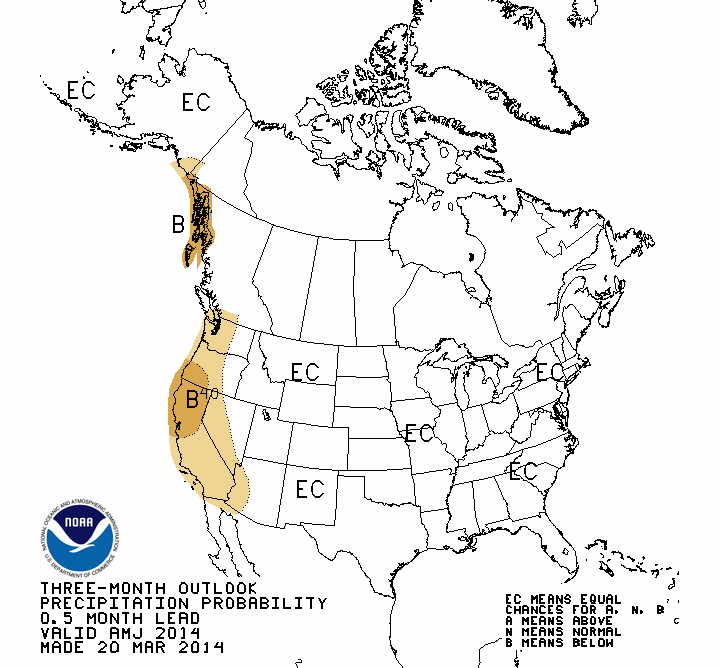
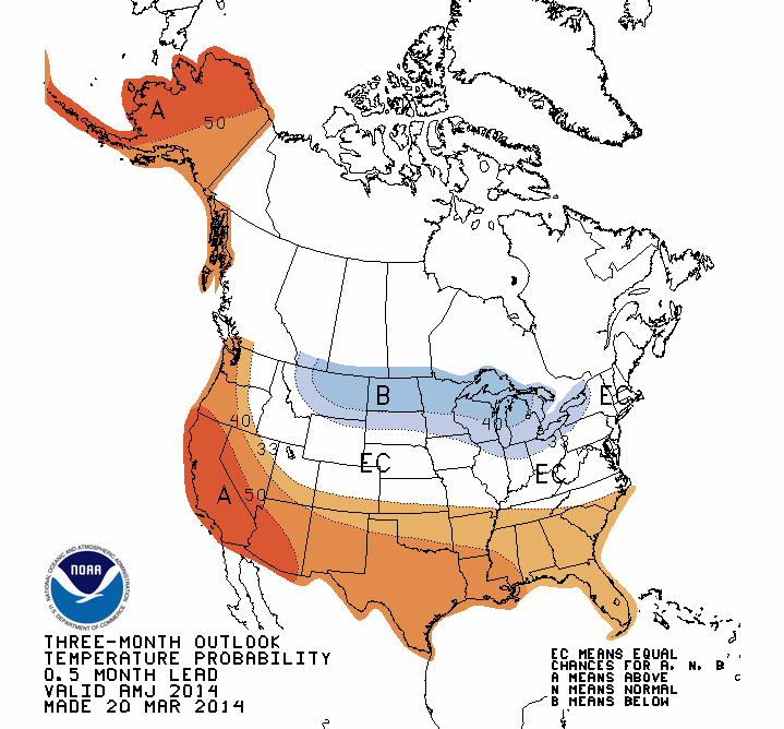
The CPC released it's April and April-June outlooks today, so we'll take a look
at those and see what they say. As it turns out, not a whole heckuva lot! The
only real signal we see from all those outlooks is increased odds of above
normal temperatures in the 3-month April-June period. All of the other outlooks
show us to be in "Equal Chances" (EC) for temperature and precipitation, meaning
the odds of seeing above-, below- and near-normal conditions for temps and
precip are all equal.
WARNING: EQUAL CHANCES DOES NOT MEAN INCREASED ODDS OF "NORMAL" CONDITIONS! It's
basically the forecasters admitting there are no models or large-scale climate
indicators pushing the outlooks one way or the other. Or the other (since there
are three choices).
April outlooks
April-June outlooks
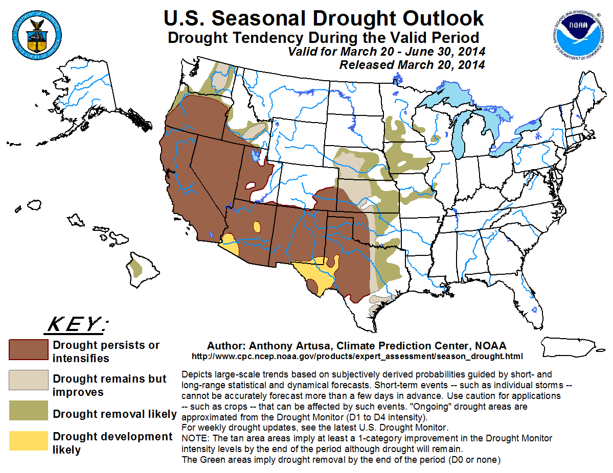
Not a lot of good news from CPC, although their U.S. Seasonal Drought Outlook
map for the March 20-June 30 period DOES show us some good things ... mainly,
the possibility of drought improvement and even drought removal across the
eastern two-thirds of the state. Unfortunately, they see drought persisting
or even intensifying for western Oklahoma (what else is new??).
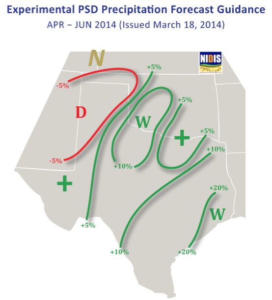
Wait a minute! Don't go selling your cattle or plowing up your wheat (if it's
even up yet) just yet. We have another source this week that might just give
us some good news. Dr. Klaus Wolter with NOAA's Cooperative Institute for
Research in Environmental Sciences (CIRES), who knows more about oceanic
influences on our weather than just about anybody else in the world, sees a
possible WET SPRING for much of the state. I'll show you his forecast first
just to whet your appetite.
As you may know, El Nino is forecast to possibly develop this summer and last
into next fall (and hopefully winter). Now El Nino historically doesn't really
have much of an impact here in our part of the world except for the cool season
(say, October-March or April). So this forecast is independent of the coming
El Nino, but based more on conditions on the Atlantic side.
One cautionary note from Dr. Wolter: "Being in drought adds an extra brake to
transitions back to 'normal', it is just hard to do without a major event
(certainly nothing on horizon anytime soon)."
In other words, a wet spring doesn't mean your drought is over. It can really
take a "major" event to snap you out of it. Also, should Dr. Wolter's forecast
come to fruition, much of the OK and TX panhandles are going to be very
depressed.
Final encouraging thoughts from Dr. Wolter: "... the incoming El Ni?o offers
you (OK) the best chance for a return to moisture in a long time (2009?!)."
We might just have to wait awhile. Should spring fail us, an El Nino cool season
in 2014-15 could be just what the doctor ordered.
Oh, did I forget to introduce you?
Doctor.
Doctor.
Doctor.
Doctor.
(You have to be a fan of bad 1980s comedies to get that one, I'm afraid)
Gary McManus
State Climatologist
Oklahoma Climatological Survey
(405) 325-2253
gmcmanus@mesonet.org
March 20 in Mesonet History
| Record | Value | Station | Year |
|---|---|---|---|
| Maximum Temperature | 98°F | BUTL | 2017 |
| Minimum Temperature | 8°F | KENT | 2016 |
| Maximum Rainfall | 5.14″ | FORA | 2007 |
Mesonet records begin in 1994.
Search by Date
If you're a bit off, don't worry, because just like horseshoes, “almost” counts on the Ticker website!