Ticker for November 16, 2012
MESONET TICKER ... MESONET TICKER ... MESONET TICKER ... MESONET TICKER ...
November 16, 2012 November 16, 2012 November 16, 2012 November 16, 2012
2012 to 1954 ... see ya later!
2012 might be starting to leave 1954 in the dust, and I say that literally with
the drought and winds we've had. But that fits with the release of Ken Burns'
documentary on the Dust Bowl this weekend on PBS. If you want some background
material on the Dust Bowl and how it impacted Oklahoma, we have an article on
that very subject in our Summer 2004 edition of our Seasonal Summary series. You
can check that out here:
http://climate.ok.gov/summaries/seasonal/Oklahoma_Climate_Summer_2004.pdf
Oklahoma's race to its warmest year on record is getting a big boost by November's
warmth. For some reason, I thought it has been a bit on the cold side, but I guess
my thermostat has been adjusted upward after the last couple of years. Going by
Mesonet numbers, the statewide average temperature through November thus far is
51.4 degrees (High temps: 69.8, Low temps: 39.2), about 3 degrees above normal.
The highs are 6.1 degrees above normal and the lows are right at normal. So
warm afternoons vs. cold mornings, the afternoons have been winning.
And remember, NCDC keeps the official numbers, but Mesonet numbers are generally
pretty close, and more than half of our Mesonet stations are included in the
official NCDC numbers along with all the COOP numbers. Numbers (just wanted to
say it one more time).
There doesn't appear to be a cold air outbreak showing up on the horizon right
now, but that could change pretty quickly. So we will remain in this warmer
than normal pattern for quite awhile. We can see the temperatures starting to
climb as we get close to Thanksgiving.
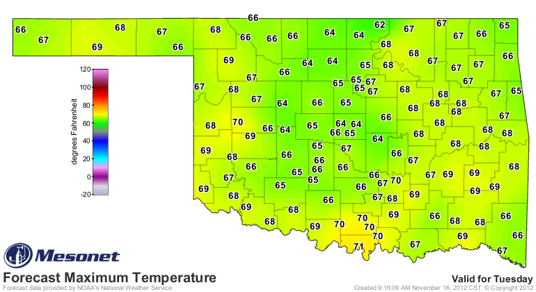
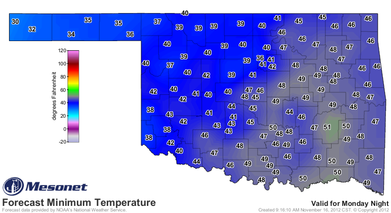
That doesn't look that impressively warm, but don't make the same mistake I keep
making. That's not an electrical socket! Oh wait, I'm getting my conversations
mixed up. Don't make the same mistake I keep making...we are approaching late
November when the normal highs dip into the 50s and the normal lows are in the
mid-30s.
A bit farther out, still looks like warm and dry for our area.
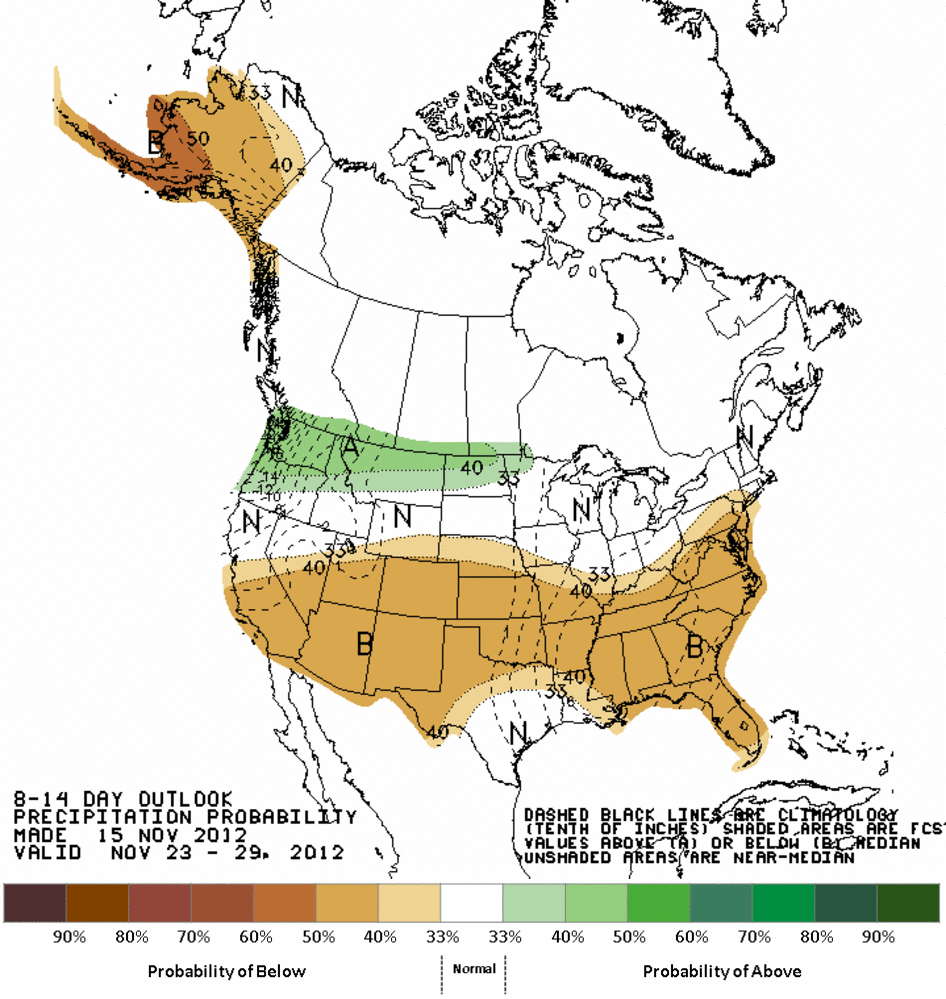
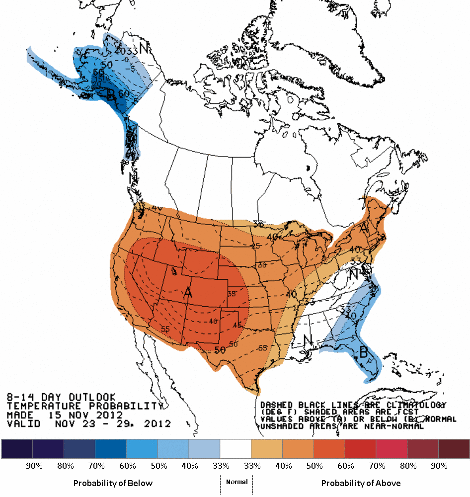
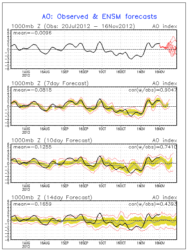
And no big dips showing up in the Arctic Oscillation (AO)for awhile (negative AO
can indicate the tendency for Arctic air to plunge into the U.S.).
So if we keep this up and stay close to our current average of 54.5 degrees,
it will be very close to becoming one of the top three warmest Oklahoma
Novembers on record (since they began in 1895). Tops is 1999's 56 degrees with
1965 a distant second at 54.5 degrees. 1909 and 1913 are up there as well at
54.4 and 54.3 degrees, respectively.
Remember also that 1954 (the current warmest year champion) and 2012 are
virtually tied through October, so a momentous November could give 2012 an
insurmountable lead. 1954's November came in at 50.9 degrees, so if 2012 beats
that by a good 4 degrees or so, that would give 2012 a few tenths of a degree
lead and the writing will be on the wall ...
FOR MASSIVE DECEMBER COLD AIR OUTBREAKS TO SPOIL EVERYTHING I JUST TALKED ABOUT!
That's okay. We're all about variety here on the Ticker.
Gary McManus
Associate State Climatologist
Oklahoma Climatological Survey
(405) 325-2253
gmcmanus@mesonet.org
November 16 in Mesonet History
| Record | Value | Station | Year |
|---|---|---|---|
| Maximum Temperature | 90°F | BUFF | 2016 |
| Minimum Temperature | 7°F | KENT | 1997 |
| Maximum Rainfall | 3.72 inches | PAWN | 1996 |
Mesonet records begin in 1994.
Search by Date
If you're a bit off, don't worry, because just like horseshoes, “almost” counts on the Ticker website!