Ticker for October 25, 2012
MESONET TICKER ... MESONET TICKER ... MESONET TICKER ... MESONET TICKER ...
October 25, 2012 October 25, 2012 October 25, 2012 October 25, 2012
Another dry front, drought monitor remains unchanged
Well, it's raining here in Norman as I type this and ... no, wait. It stopped. Oh
well. Here we go with yet another mostly dry frontal passage. Temperatures are
plummeting as the front passes, with 3-hour temperature drops of up to 30 degrees.

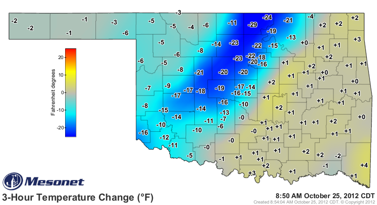
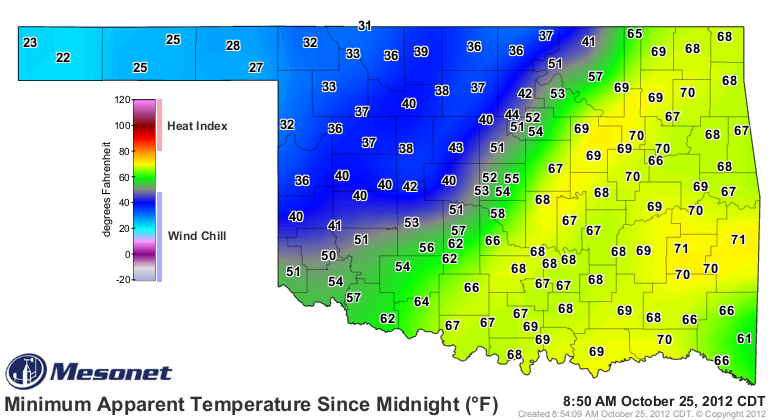
Winds are gusting to over 40 mph. Combine that with the dropping temps and you
get wind chills in the 30s (20s in the Panhandle).

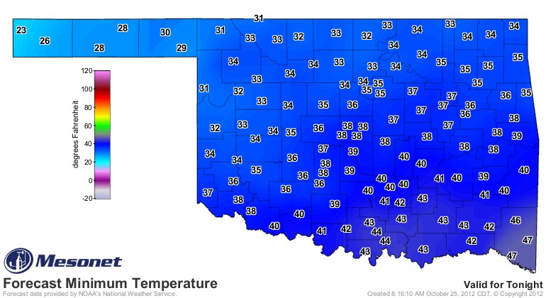
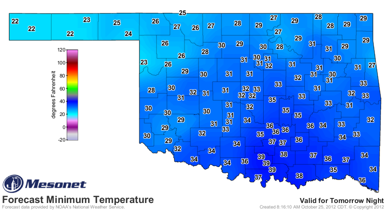
We will now begin a downward spiral of our morning low temperatures to below
freezing by Saturday morning over a large part of the state. Those low
temperatures are expected to hang around each morning through the weekend.

All of this makes little difference in the drought, although the cooler temps
will help slow evaporation from the topsoils and reservoirs. We didn't ask for
any changes this week, so the U.S. Drought Monitor picture remained the same ...
ugly.
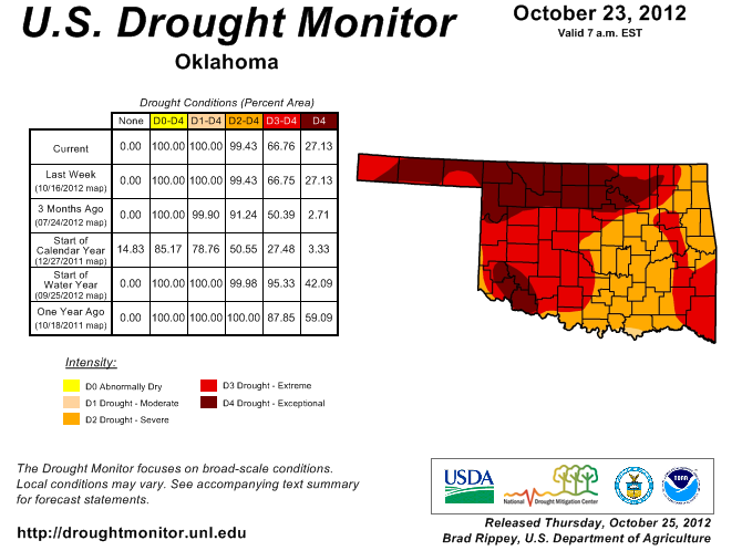
Over 27% of the state remains in exceptional drought, dominated by those hard-
hit areas in northern Oklahoma. Virtually the entire state remains in severe-
exceptional drought according to the Drought Monitor. A very similar picture
to last year at this time, although probably a tad better this year.
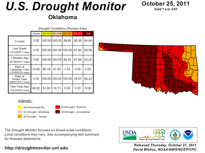
This is right around the time last year that our drought relief started full
blast, in defiance of a double-dip La Nina, with the state's 12th wettest
November-December period on record.
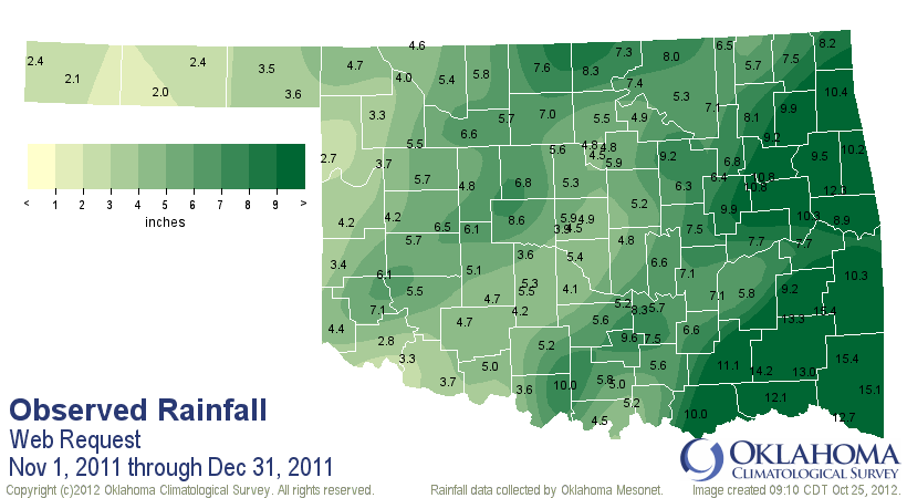
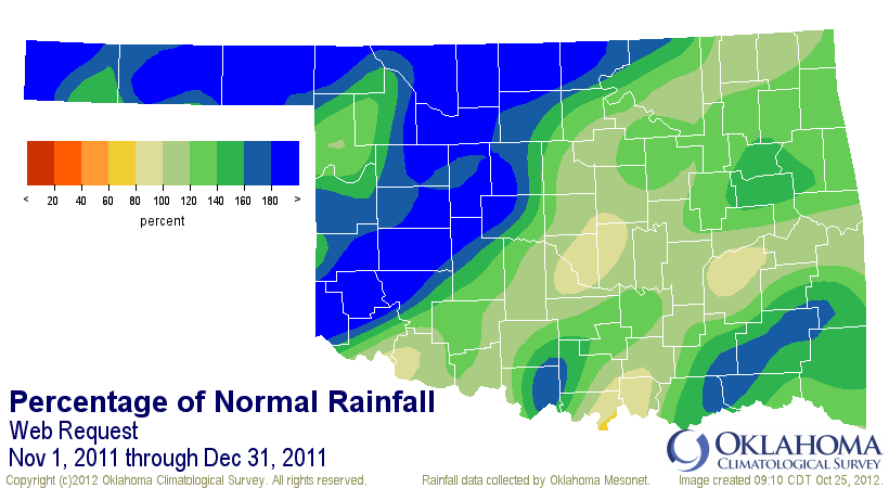
Unfortunately, that type of relief is not showing up on the horizon just yet.
In fact, the mid-range outlooks from the Climate Prediction Center still have
our area under the dreaded brown color, meaning increased odds of below normal
precipitation. And below-normal precipitation as we start getting into November
and beyond is not good. These take us out through the first week of November.
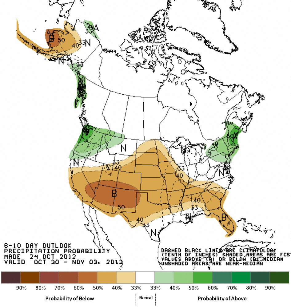
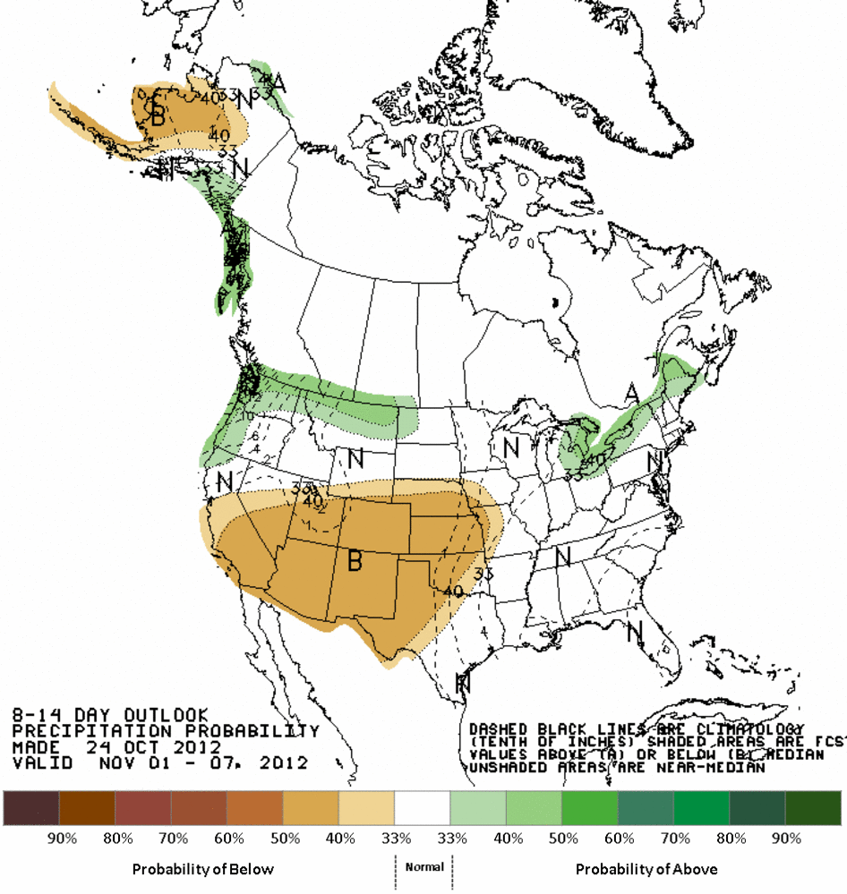
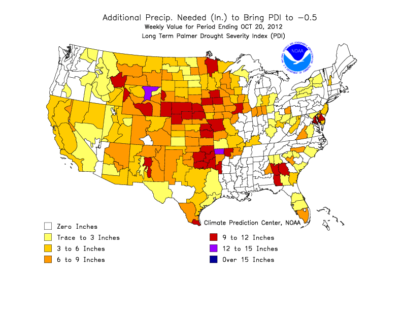
I'm not a huge fan of these graphics, but they are good just as a reminder of
how far we have to go to get back to some semblance of normal. It's nearly
impossible just to put a number up to get us back, since drought is much more
complicated than that, but you can see we need a good 6-12 inches in a hurry.
Looking at a time series of the Drought Monitor levels for Oklahoma from the
DM's inception in 2000 through the current date, you can see just how dominant
this 2-year drought cycle is. The only period that comes close is our mid-2005
through 2006 drought.
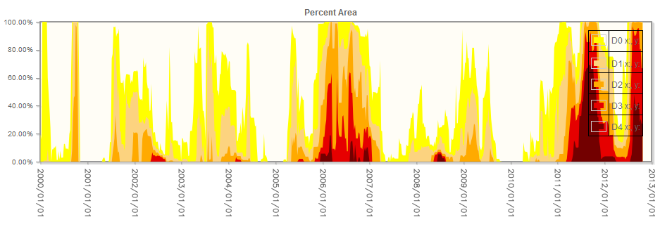
This current drought cycle continues to build its rep as one of the worst of
the last 50 years in Oklahoma. Like every other drought in Oklahoma history,
this too shall pass.
Gary McManus
Associate State Climatologist
Oklahoma Climatological Survey
(405) 325-2253
October 25 in Mesonet History
| Record | Value | Station | Year |
|---|---|---|---|
| Maximum Temperature | 93°F | MANG | 2014 |
| Minimum Temperature | 18°F | KENT | 2019 |
| Maximum Rainfall | 3.91 inches | MCAL | 2023 |
Mesonet records begin in 1994.
Search by Date
If you're a bit off, don't worry, because just like horseshoes, “almost” counts on the Ticker website!