Ticker for August 16, 2012
MESONET TICKER ... MESONET TICKER ... MESONET TICKER ... MESONET TICKER ...
August 16, 2012 August 16, 2012 August 16, 2012 August 16, 2012
More drought expansion with rain on the way!
Despite recent rains, exceptional drought (D4) continued to expand across
Oklahoma according to this morning's release of the latest U.S. Drought Monitor
report. The D4 area now extends into southwestern, south central, and
northeastern Oklahoma and covers 39% of the state. That's the greatest coverage
of exceptional drought on the U.S. Drought Monitor since November 1, 2011.
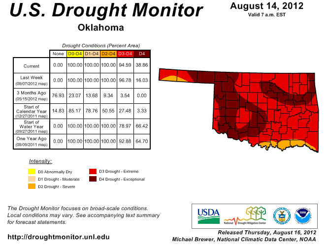
There was a slight reduction in extreme (D3) drought with a bit of improvement
due to some nice rains along the Red River in southern Oklahoma. However, 95%
of the state is still covered by extreme-to-exceptional drought.
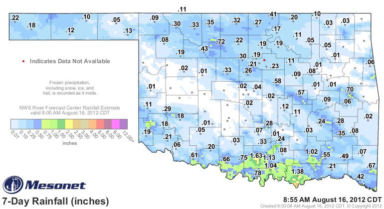
The rains of the last week, while certainly welcome, did little to impact drought
conditions outside of far southern Oklahoma. That moisture is quickly absorbed
into the upper layers of soil and then evaporated almost as quickly, or used
by stressed vegetation. This 7-day rainfall total map from the Oklahoma Mesonet
with radar-estimated totals shows that area in southern Oklahoma that received
nice rains of more than an inch, but also the spotty nature of the rain elsewhere.
Going farther back, the rainfall statistics from the Mesonet tell the story. Much
of the state has experienced one of its top-3 driest May 1-Aug. 16 periods dating
back to 1921.
-****-
May 1-Aug. 16 Mesonet Rainfall
Area Total Departure Pct Norm Rank since 1921
Panhandle 4.39" -5.70" 44% 2nd driest
N. Central 4.25" -9.08" 32% 1st driest
Northeast 6.19" -8.66" 42% 2nd driest
W. Central 4.45" -7.79" 36% 2nd driest
Central 5.94" -8.00" 43% 2nd driest
E. Central 6.62" -8.43" 44% 3rd driest
Southwest 6.52" -5.99" 52% 7th driest
S. Central 7.49" -6.20" 55% 9th driest
Southeast 9.13" -6.94" 57% 8th driest
Statewide 6.08" -7.45" 45% 2nd driest
-***-
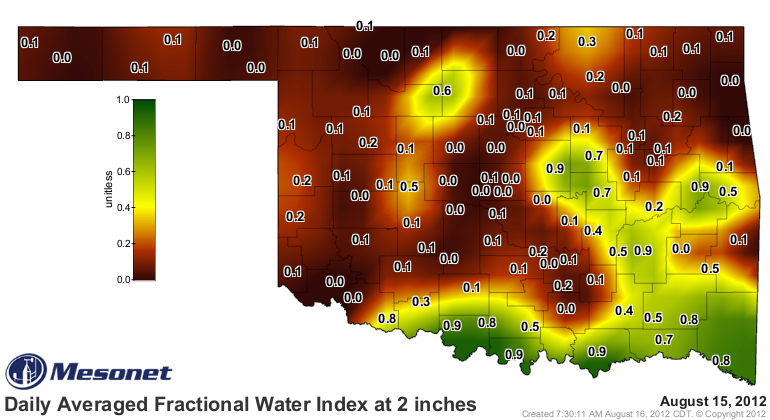
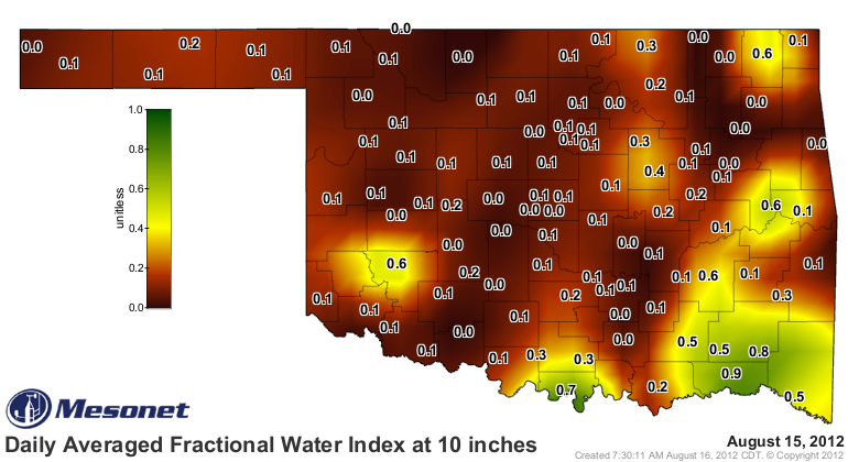
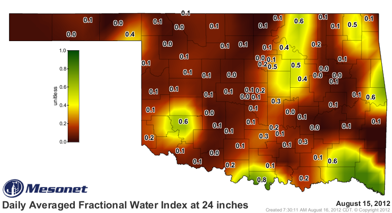
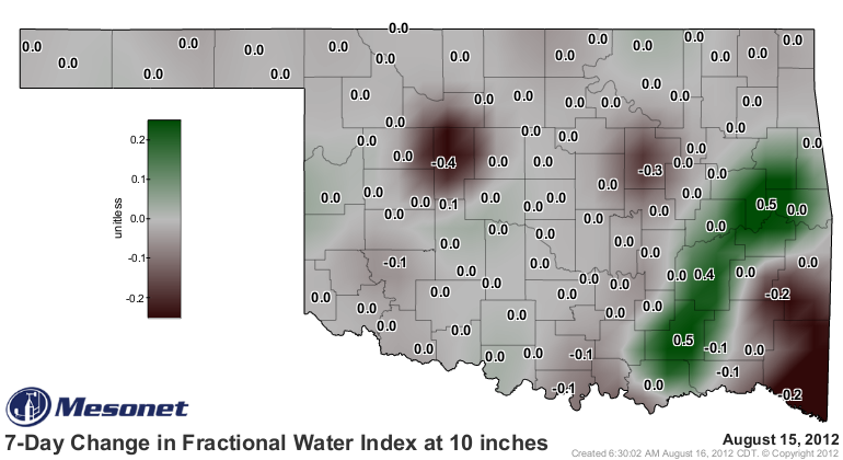
The impact of the recent rains on the topsoils is evident in the Mesonet soil
moisture map, but the maps from 10 and 24 inches indicate that little of that
moisture is making it to the lower levels.
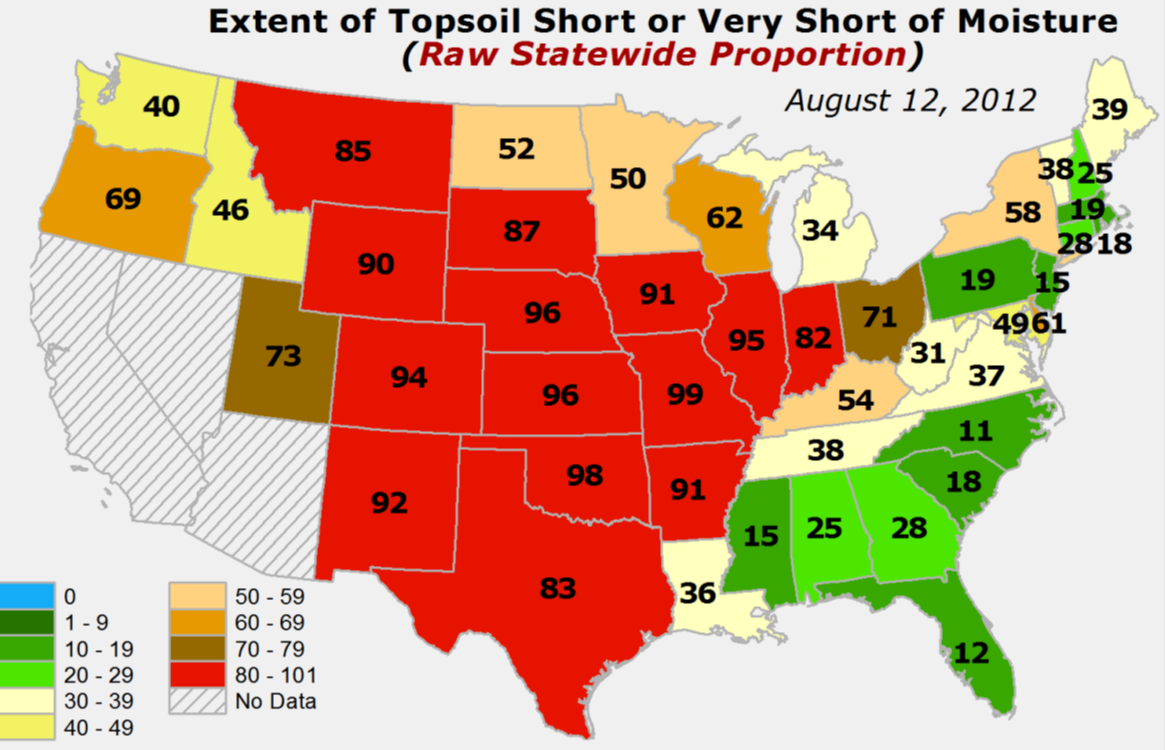
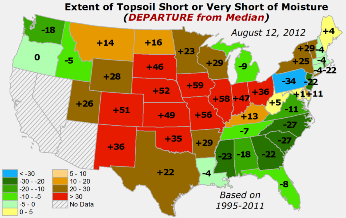
The latest soil moisture conditions as reported from the field by the USDA shows
the same types of conditions with 98% of the state's topsoils being rated as
short/very short. Soil moisture is often not in good shape in the middle of
August, but that 98% figure is still 35% above where it has been historically
(1995-2011) at this time of the year.
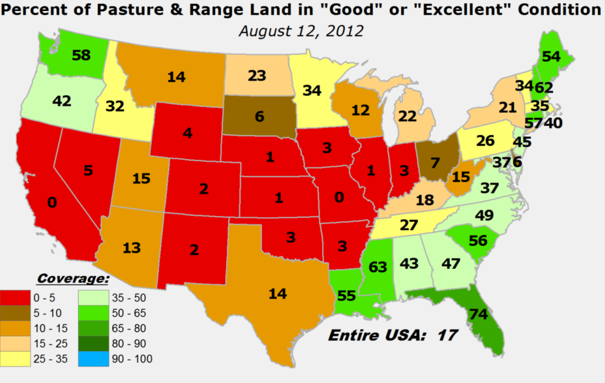
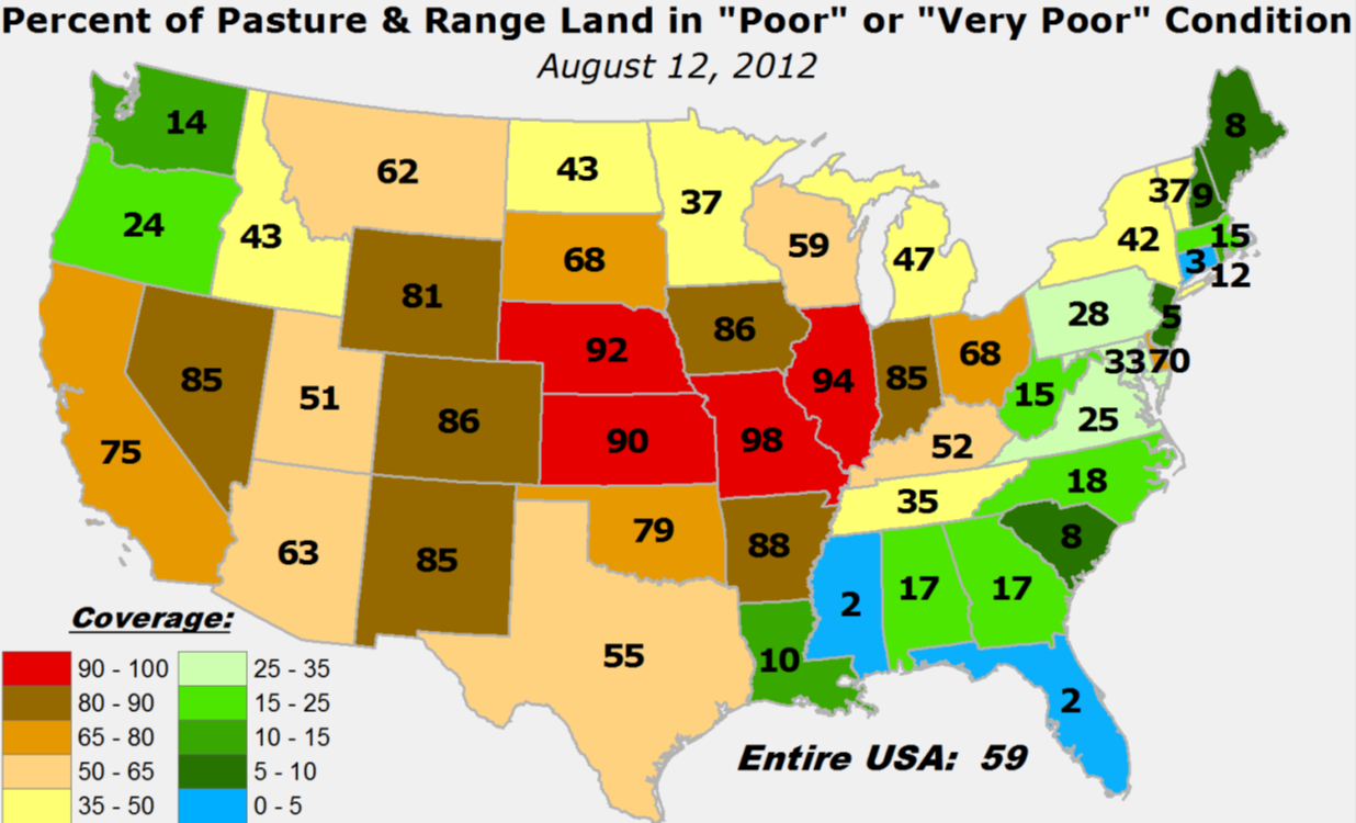
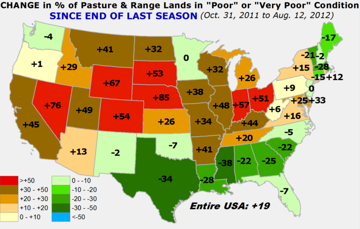
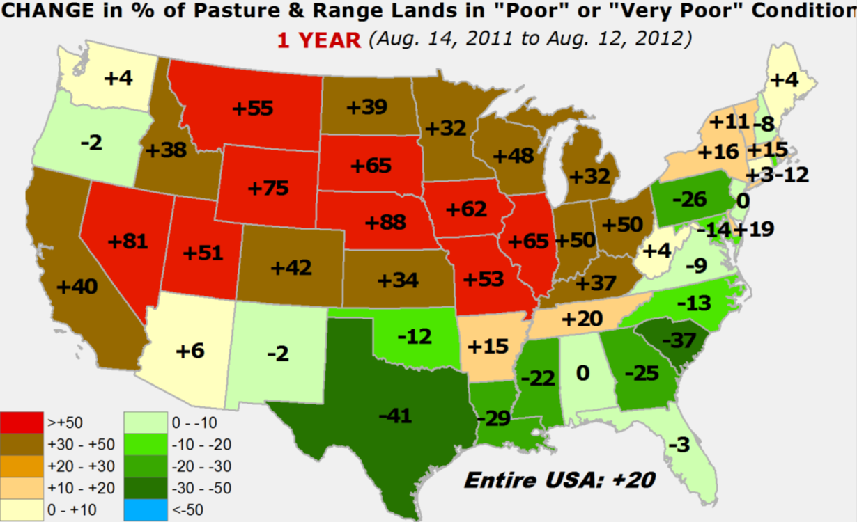
The lack of moisture and extreme heat have really taken a toll on the state's
pastures. Only 3% of the state's pastures and range land is now rated as
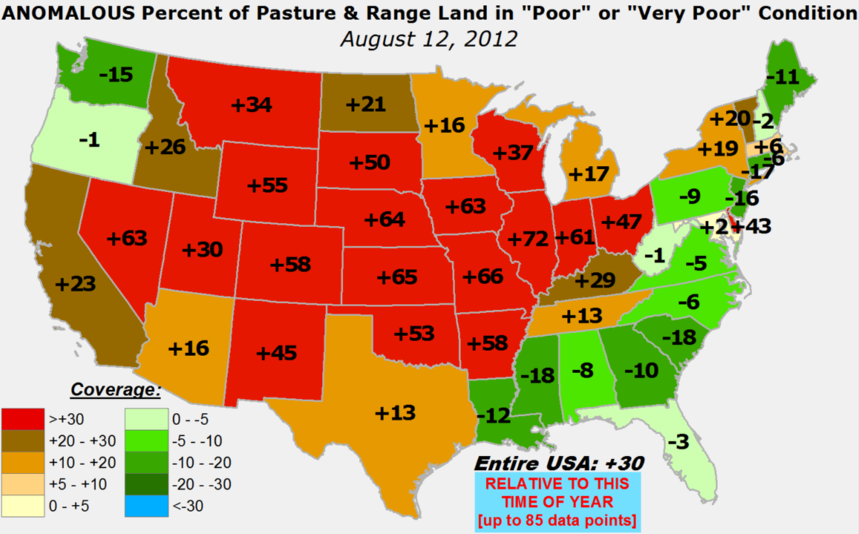
good/excellent, and 79% is now rated as poor/very poor. That obviously leaves
18% rated as "fair." Again, as with topsoil, pastures are often not in great shape
this time of the year. The current rating of 79% poor/very poor is 53% higher
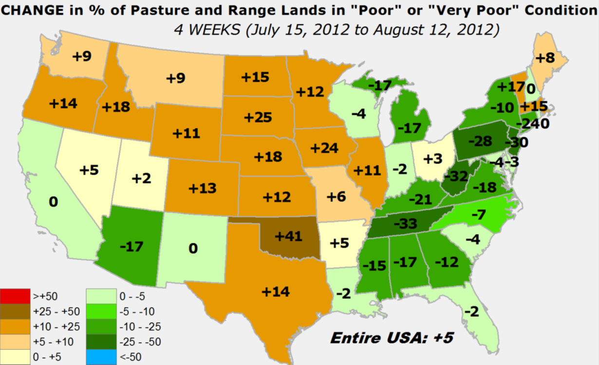
than normal for mid-August. The deterioration since mid-July is astounding with
a 41% increase in the poor/very poor category, an eye-opening indicator at the
flashy nature of this drought. As a testament to the impact of two straight years
of drought, conditions are now approaching where we were this time last year, and
during the drought's worst point in early October.
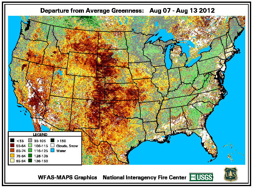
The stress on the state's vegetation is easily seen in this departure from
average greenness map.
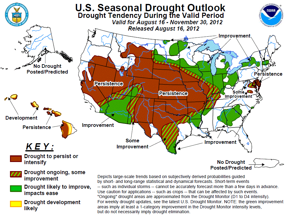
The U.S. Seasonal Drought Outlook released this morning is not too optimistic. It
indicates the possible persistence of drought through November for most of the
state. Improvements are expected in areas surrounding Oklahoma.
There is rain in the forecast, to go along with a cold front that will bring us
some unseasonably cool weather. That rain and milder temperatures will be just
what the doctor ordered to hopefully get some areas of the state decent relief.
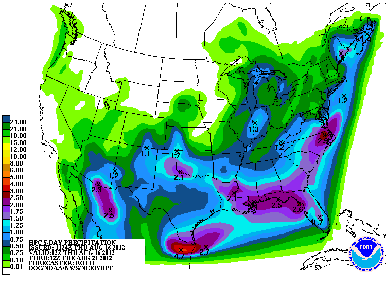
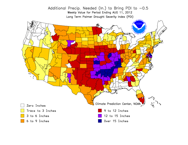
Rain chances are expected to peak tonight and again on Saturday. Keep in mind that
a lot of rain is needed to bring us out of drought, especially considering the
impacts are compounded by last year's drought as well. According to this estimate
by the CPC, from 9 inches to more than 15 inches will be needed to bring the
state completely out of drought.
We will be monitoring any sort of reduction in the impacts with this coming
moisture and future events to recommend changes in the Drought Monitor. One of
the key things to watch for is the hydrological response (i.e., getting the rain
from the ground to the reservoirs/stock ponds. In order for that to happen, that
moisture has to first soak into the soil, to a large degree. Many of the state's
lakes have taken a huge hit this summer. Lake Altus now stands at 20% of
capacity. It's continuous low state since last year has meant two years of little
to no discharge for irrigation of that area's cotton crop.
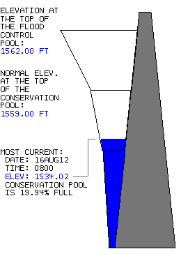
Here are some other lake conditions:
Waurika -- 61% Kaw Lake -- 99%
Fort Cobb -- 81% Oologah -- 90%
Eufaula -- 76% Skiatook -- 100%
Canton -- 45% Ft. Gibson -- 35%
Thunderbird -- 74% Tenkiller -- 77%
Ft. Supply -- 77% Broken Bow -- 76%
Keystone -- 85% Hugo -- 63%
The best to hope for in the next few days is for that front to stall out and dump
a lot of rain over some lucky folks. The cooler weather takes a lot of stress
off of that moisture once it falls. It will be quickly absorbed into the soils,
hopefully, and percolate down a bit. That will help green things up a bit more
and maybe ease our wildfire potential when any heat and low humidity returns.
Gary McManus
Associate State Climatologist
Oklahoma Climatological Survey
(405) 325-2253
gmcmanus@mesonet.org
August 16 in Mesonet History
| Record | Value | Station | Year |
|---|---|---|---|
| Maximum Temperature | 108°F | MANG | 2024 |
| Minimum Temperature | 53°F | BRIS | 2016 |
| Maximum Rainfall | 3.48″ | KENT | 2010 |
Mesonet records begin in 1994.
Search by Date
If you're a bit off, don't worry, because just like horseshoes, “almost” counts on the Ticker website!