Ticker for May 23, 2012
MESONET TICKER ... MESONET TICKER ... MESONET TICKER ... MESONET TICKER ...
May 23, 2012       May 23, 2012       May 23, 2012       May 23, 2012


(insert dessication sound here)

I tried to come up with a good sound to mimic that of the moisture being sucked
from the soils, but my attempts began to sound like a resort town in the Czech
Republic. Of course, you couldn't hear it over the wind, but I thought I'd try
anyway.

The conditions today and for the next few days are not pleasant unless you own
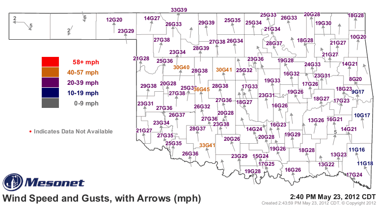
stock in ChapStick (Carmex investors are a whole different breed). Winds are
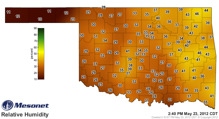
gusting from 35-45 mph over much of the state, relative humidity is in the
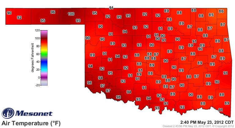
static electricity range, and temperatures are approaching (and besting) triple-
digits.


Statewide average temperatures for May 1-22 stack up this way:

-****-
Tmax          Tmin         Tavg
May 1-22 Avg.     82.4          58.0         70.2
May 1-22 Norm.    78.5          54.9         66.7
May 1-22 Dep.      3.9           3.1          3.5
-***-

There is no doubt now that we are going to finish with at least a top-15
warmest May and absolutely shatter the record for our warmest spring. Combine
that type of warmth with the sudden shutoff of the spigot by Mother Nature and
it's obvious we are going to have some catching up to do before the REAL
heat arrives.

There is still time. Watch for a pattern shift anytime now ...

Gary McManus
Associate State Climatologist
Oklahoma Climatological Survey
(405) 325-2253
gmcmanus@mesonet.org
May 23 in Mesonet History
| Record | Value | Station | Year |
|---|---|---|---|
| Maximum Temperature | 112°F | ALTU | 2000 |
| Minimum Temperature | 40°F | EVAX | 2017 |
| Maximum Rainfall | 9.67″ | VINI | 2011 |
Mesonet records begin in 1994.
Search by Date
If you're a bit off, don't worry, because just like horseshoes, “almost” counts on the Ticker website!