Ticker for December 22, 2011
MESONET TICKER ... MESONET TICKER ... MESONET TICKER ... MESONET TICKER ...
December 22, 2011  December 22, 2011  December 22, 2011  December 22, 2011


Drought reduction continues

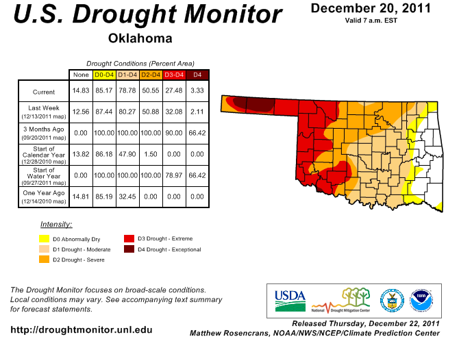
Oklahoma's continuing wet ways have helped the state reduce its drought
designation once again. The U.S. Drought Monitor map released this morning shows
about 27% of the state now in the two worst intensity categories (exceptional and
extreme), down about 5% from last week. Only 3% of that 27% is the worst drought
category of exceptional.


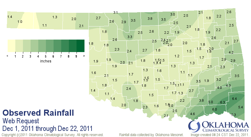
The statewide average precipitation total for December now stands at 2.33 inches
according to data from the Oklahoma Mesonet. That total will continue to increase
regardless of further precipitation as the snowpack currently covering most
of the Panhandle melts.


The normal total for the entire month is 2.04 inches. This follows the 12th
wettest November for the state since 1895. The two wetter-than-normal months,
along with a little bit of help from October, have reduced the state's drought
picture significantly since late September. At that time, 66% of the state was
painted with exceptional drought intensity.

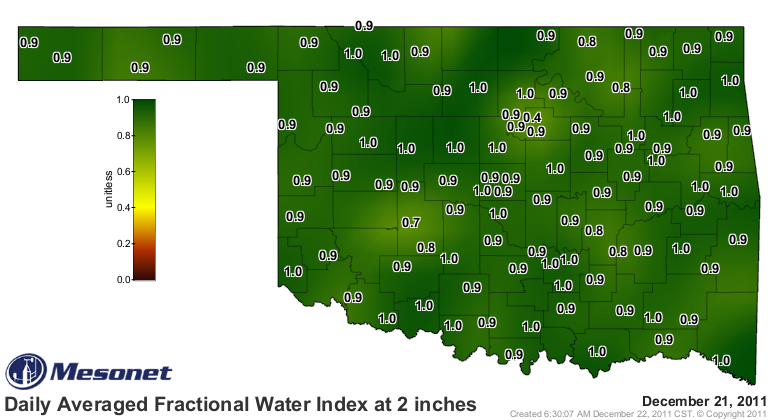
Topsoil moisture is in good shape across the entire state according to the
Mesonet's sensors at 2 inches.


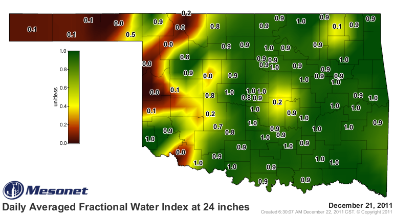
The dryness is still showing up in western Oklahoma and the Panhandle down to
24 inches, however.


Hopefully that moisture profile in the Panhandle will improve with further
melting of the snow. The lack of response to lakes in western Oklahoma remains
a concern as well. The reservoir at Ft. Supply is still at 68% capacity and
Canton Lake, a secondary water source for Oklahoma City, is at a miserable 28%
of capacity. Drought and water released to OKC have significantly drained that
lake's level over the last several months. Lake Altus, a primary irrigation
source for southwestern Oklahoma's cotton crop, is at 18% of capacity, signaling
a desperate need for further rains in that area.

Lakes in eastern Oklahoma have either filled or continued to fill. Lake Eufaula
is now at 90% of capacity. Lake Skiatook remains a bit low at 64% of capacity.

Oklahoma and the rest of the Southern Plains looks to be a bit drier over the
next week or two, a bit of a respite from the series of south-diving storms
we've seen over the last two months.

Gary McManus
Associate State Climatologist
Oklahoma Climatological Survey
(405) 325-2253
gmcmanus@mesonet.org
December 22 in Mesonet History
| Record | Value | Station | Year |
|---|---|---|---|
| Maximum Temperature | 81°F | SLAP | 2025 |
| Minimum Temperature | -9°F | VINI | 2000 |
| Maximum Rainfall | 2.34″ | BROK | 2017 |
Mesonet records begin in 1994.
Search by Date
If you're a bit off, don't worry, because just like horseshoes, “almost” counts on the Ticker website!