Ticker for November 17, 2011
MESONET TICKER ... MESONET TICKER ... MESONET TICKER ... MESONET TICKER ...
November 17, 2011 November 17, 2011 November 17, 2011 November 17, 2011
Kicking drought and taking names
I have just arrived back from a tour of the state over the last couple of weeks
talking drought and boy is my car tired. Four of them to be exact. Sorry, had to
do it.
I'm happy to report great news for parts of the state regarding the drought
situation. For the first time since late June, a significant portion of the
state is completely out of drought (D1-D4) according to the latest U.S. Drought
Monitor. Several counties in the northeast/east central part of the state
centered on Adair County are now labeled as D0 or "abnormally dry."
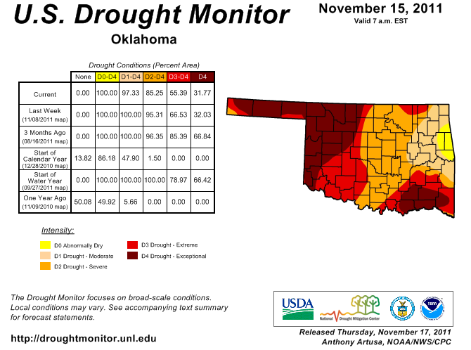
The D3 (extreme) drought area has also shrunk and now much of central Oklahoma
is categorized in severe drought. It may seem odd to cheer for severe drought,
but it's better than extreme or exceptional. Parts of the state are continue in
very bad shape, however. The western half of the state is still dominated by
dry conditions, as well as southeastern Oklahoma. I saw many shrunken or dry
stock ponds in both areas in my travels. The key to the improvement has been
the abundant rainfall we've had from south central through northeastern Oklahoma
since the beginning of October.
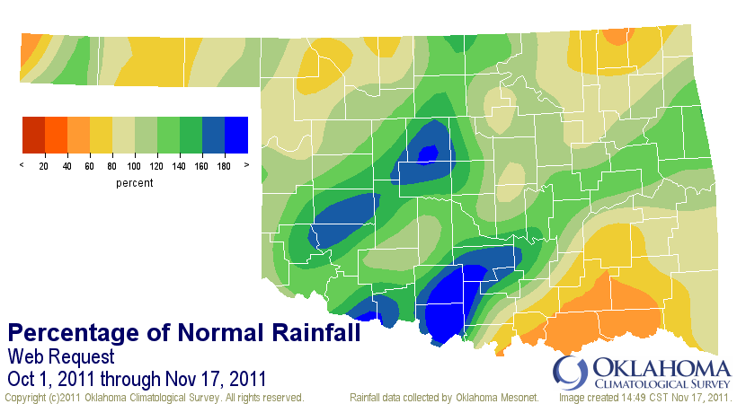
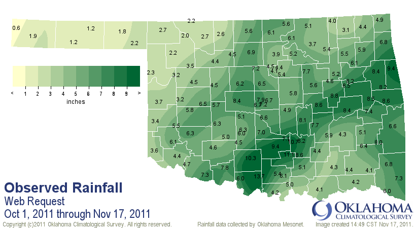
That has allowed soil moisture to recover quite well down to a depth of 2 feet
from southwestern through northeastern Oklahoma. With that column of soil
moistened, that was enough to ask for the reductions in the Drought Monitor.
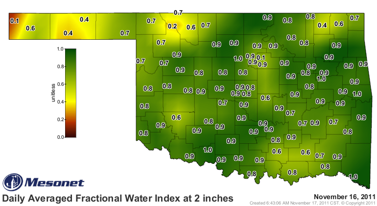
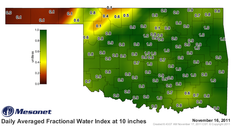
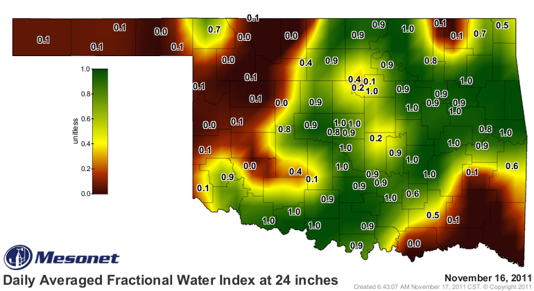
A good look at that soil moisture map at 24 inches tells the story of where we
are in the drought relief process. For most of the state, the top 10 inches of
the soil has had a nice drink. As you get down to 24 inches, however,
northwestern and southeastern Oklahoma are still significantly dry that deep.
A good soaking rainfall is promised for next week. Should that arrive as
expected, we could possibly see more of the state out of that extreme/exceptional
drought category and in pretty good shape for the winter. Unfortunately, as of
now it like looks western Oklahoma might be on the outside looking in as far as
the heavier amounts go, but every bit counts.
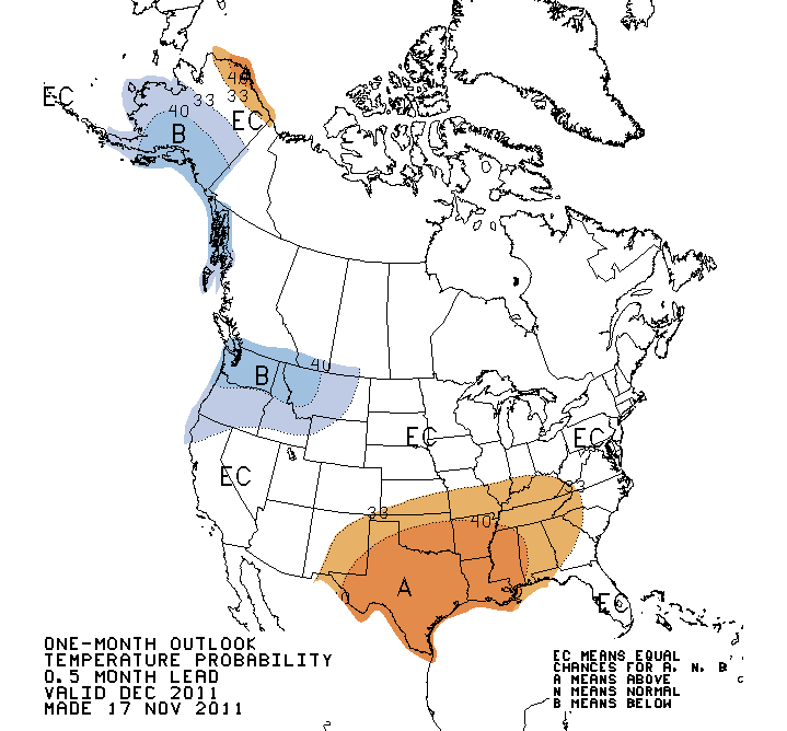
The Seasonal Drought Outlook from the NWS' Climate Prediction Center remains
in Scrooge mode as we approach the Holiday season with most of the state
remaining in the "persistence/intensification of drought" category.
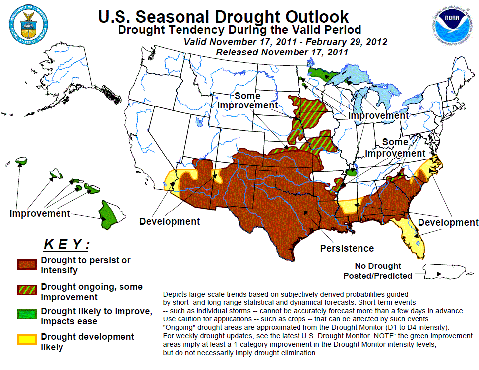
That is for the current period through February 29th. That outlook builds off
the latest seasonal outlooks that also reflect the presence of La Nina and its
tendency for bringing the southern tier of the U.S. drier/warmer weather through
the cool months.
December outlooks:
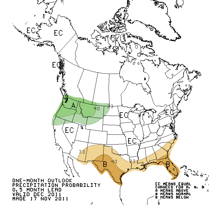
December-February outlooks:
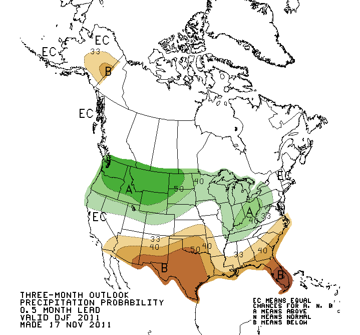
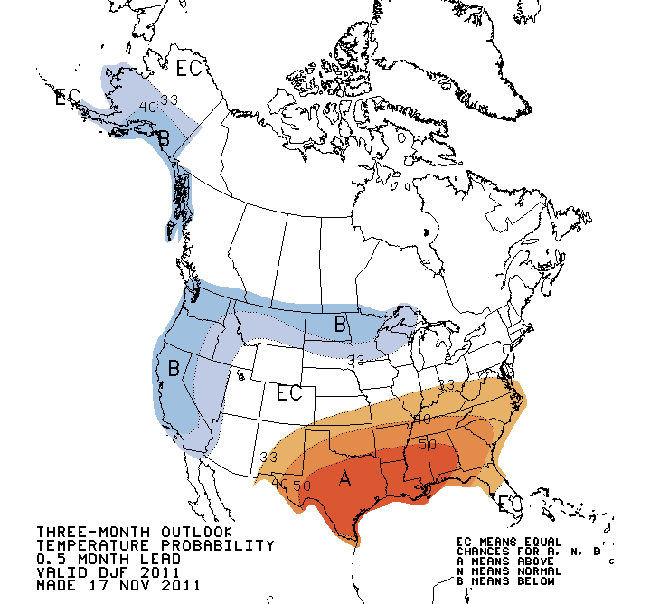
The key to remember on those outlooks is even if there is not much of an
increased chance for drier weather, as with the December outlook, we are
entering the driest three months of the year climatologically. That makes
persistence of drought OF SOME SEVERITY a bit more likely even without the
possible impacts of La Nina.
Also remember that not all La Ninas impact the U.S. the same way and those
impacts are usually stronger as you go farther south. Texas normally sees
bigger impacts than Oklahoma, but there are times we are dragged along kicking
and screaming like last winter.
Bring on the rain, and "Bah Humbug" to you, CPC!
Gary McManus
Associate State Climatologist
Oklahoma Climatological Survey
(405) 325-2253
gmcmanus@mesonet.org
November 17 in Mesonet History
| Record | Value | Station | Year |
|---|---|---|---|
| Maximum Temperature | 94°F | MANG | 2017 |
| Minimum Temperature | 3°F | KENT | 2014 |
| Maximum Rainfall | 3.71 inches | MIAM | 2015 |
Mesonet records begin in 1994.
Search by Date
If you're a bit off, don't worry, because just like horseshoes, “almost” counts on the Ticker website!