Ticker for November 2, 2011
MESONET TICKER ... MESONET TICKER ... MESONET TICKER ... MESONET TICKER ...
November 2, 2011   November 2, 2011   November 2, 2011   November 2, 2011


Frontpocalypse!

Hope you've been to Braum's to buy your milk and bread today (just previewing
that line for our first snow) because the most talked about cold front of this
week is currently barreling through the state. Oklahoma has one of the best
front trackers in the business with the Mesonet, of course.

Air temperature
http://www.mesonet.org/index.php/weather/map/air_temperature/air_temperature

Winds
http://www.mesonet.org/index.php/weather/map/wind_map/wind

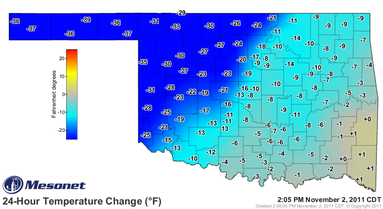
It's currently close to 40 degrees cooler in the Panhandle than it was yesterday
at this time.


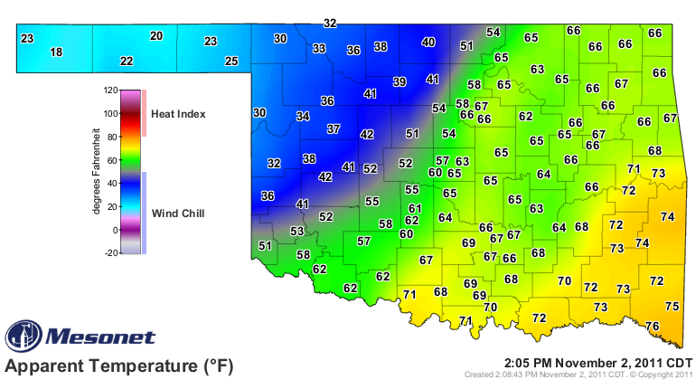
Some of that farther to the east is due to cloudiness, of course. The wind chills
are also dropping to BRRRR levels with 18 degrees showing up in the Panhandle.


Welcome to November. Another big piece of news a bit farther out is the rain
event expected for early next week. The NWS' Hydrometeorological Prediction
Center has some encouraging words concerning the possible moisture (sorry for
the shouting):

"THIS SYSTEM WILL BE WETTER WITH BETTER DYNAMICS ALOFT AND IS
ANTICIPATED TO SPREAD HEAVY RAINS TO ITS NORTHEAST FROM OKLAHOMA
AND NORTH TEXAS THROUGH THE MIDWEST TOWARDS THE GREAT LAKES...
EASING DROUGHT CONDITIONS ACROSS NORTHEAST TEXAS AND PORTIONS OF
OKLAHOMA.  THIS SYSTEM COULD CAUSE AN OUTBREAK OF STRONG/SEVERE
THUNDERSTORMS FROM THE SOUTHERN PLAINS INTO THE MID-MISSISSIPPI
VALLEY EARLY TO MID NEXT WEEK.  STAY TUNED."

Great news except for the severe outbreak, of course, but we need the rain
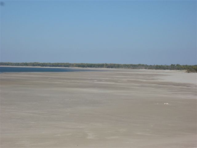
regardless. I received a picture from a relative concerned about the endangerment
of the Walleye Rodeo at Canton Lake due to dropping lake levels. Now it's still
half a year away, but when you see a lake drop to 27% of capacity, it will give
you pause. Here are a couple of the pictures.


We need to get Oklahoma's lakes and ponds a big drink before spring. Maybe
this coming event next week will be a start. So far we've seen little recharge
of the reservoirs because the soils are so thirsty.

By the way, I'd think you would want the lake levels to be low in a Walleye
Rodeo. Seems like your horse would drown.

Gary McManus
Associate State Climatologist
Oklahoma Climatological Survey
(405) 325-2253
gmcmanus@mesonet.org
November 2 in Mesonet History
| Record | Value | Station | Year |
|---|---|---|---|
| Maximum Temperature | 93°F | BURN | 2017 |
| Minimum Temperature | 15°F | KENT | 2004 |
| Maximum Rainfall | 4.12 inches | HOLL | 2024 |
Mesonet records begin in 1994.
Search by Date
If you're a bit off, don't worry, because just like horseshoes, “almost” counts on the Ticker website!