Ticker for May 17, 2011
MESONET TICKER ... MESONET TICKER ... MESONET TICKER ... MESONET TICKER ...
May 17, 2011 May 17, 2011 May 17, 2011 May 17, 2011
Drought, Tornadoes, Droughts and Tornadoes
The entire Ticker staff has been very busy today, trying to quantify drought
conditions for the U.S. Drought Monitor AND attempting to make the Kessel run
in less than 12 parsecs. Space travel? I'm so glad you brought it up, because we
have a couple of images from space that shed a new light on the drought in the
Southern Plains.
The latest Vegetation Health Index satellite analysis captures the damage drought
has done to the state's vegetation, especially in the southwestern quarter.
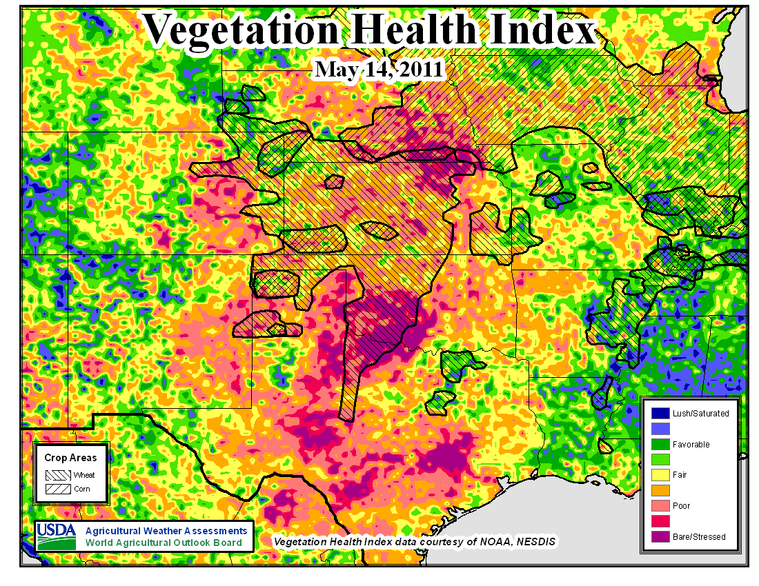
When a quarter of your state resembles bare ground from space in May, that can't
be a good thing. The change since last year at this time is quite remarkable.

Another by-product of a strong El Nino (2009-10) vs. strong La Nina (2010-11).
You can read more about Vegetation Health Index here:
http://www.star.nesdis.noaa.gov/smcd/emb/vci/VH/index.php
******************************************************************************
With possible severe weather (AND RAIN!) in the works for this week, it's a
good time to take a look back at the Oklahoma tornado count thus far in 2011.
The numbers have gone up just a bit. Preliminary data from the NWS now show
49 confirmed (work with me here)tornadoes for Oklahoma so far this year. Of
those 49, 48 occurred in April and none have touched down west of I-35. The
48 tornadoes in April breaks the record of 40 for that month from 1957.
Year April Jan-Apr Annual Total
2011 48 49 ???
1957 40 44 107
1991 24 41 73
1984 23 29 50
1995 22 24 79
1965 21 24 74
1956 20 23 49
1960 19 28 98
1999 19 26 145
1996 18 19 48
1964 17 17 53
1979 17 22 51
1993 17 23 64
2009 17 24 34
1968 16 16 55
An interesting tangent here as we go opposite over adjacent ... not only was
April 1957 the second wettest April on record in Oklahoma with a statewide
average of 8.18 inches:
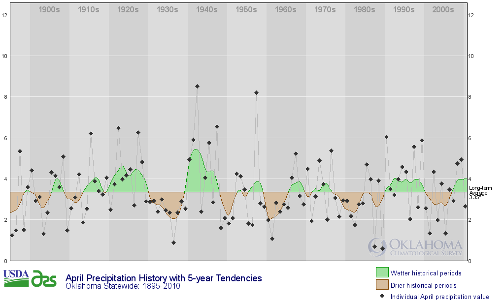
but 1957 was also the wettest year on record in Oklahoma at 48.21 inches.
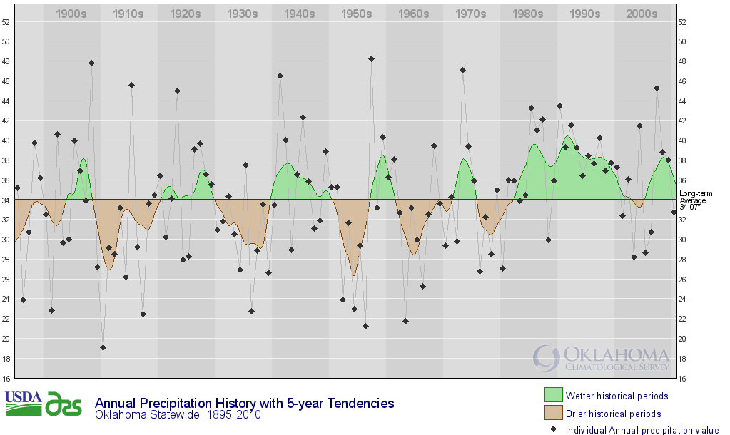
* 1957, wet statewide, lots of tornadoes statewide (ended up with 107, second
highest total on record)
* 2011, wet in the east (so far), dry in the west (so far), record number of
tornadoes in the east, none in the west (so far)
Anecdotal, my dear Watson.
******************************************************************************
A final bit of advice when talking drought and tornadoes ... nobody worries
about upsetting a Wookie. Let the Climatologist win.
Gary McManus
Associate State Climatologist
Oklahoma Climatological Survey
(405) 325-2253
gmcmanus@mesonet.org
May 17 in Mesonet History
| Record | Value | Station | Year |
|---|---|---|---|
| Maximum Temperature | 101°F | HOLL | 2022 |
| Minimum Temperature | 37°F | CAMA | 2009 |
| Maximum Rainfall | 3.66 inches | PORT | 2002 |
Mesonet records begin in 1994.
Search by Date
If you're a bit off, don't worry, because just like horseshoes, “almost” counts on the Ticker website!