Ticker for January 21, 2011
MESONET TICKER ... MESONET TICKER ... MESONET TICKER ... MESONET TICKER ...
January 21, 2011 January 21, 2011 January 21, 2011 January 21, 2011
Drought Continues to Persist, Worsen in Oklahoma
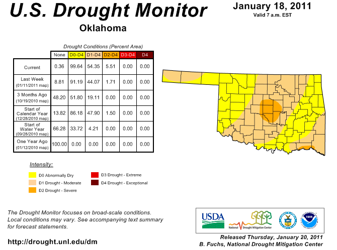
Despite moisture from recent wintry weather, drought conditions continue to
persist and intensify across Oklahoma. The latest U.S. Drought Monitor report
released on January 20 indicates severe drought is now present in central
Oklahoma, centered on Oklahoma City and surrounding areas. Moderate drought
extends through much of the central one-third of the state through the
southwest, with other moderate drought areas in the Panhandle and far
southeastern Oklahoma.
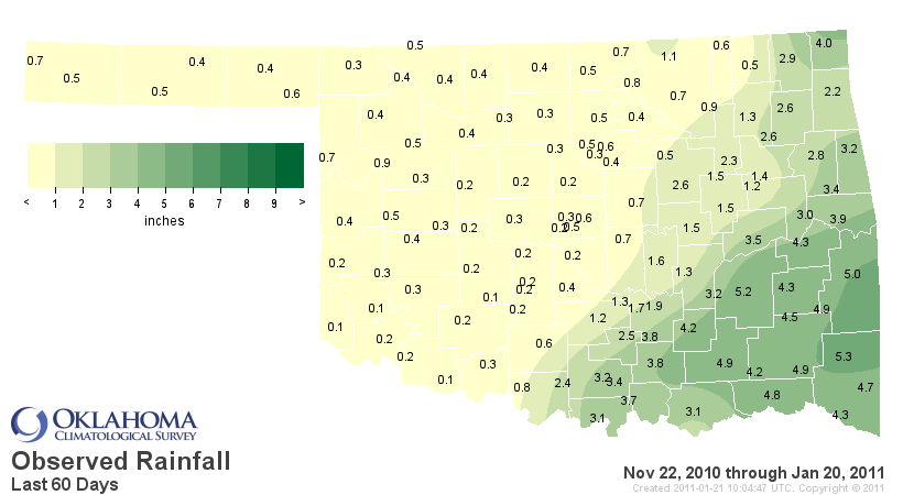
Data from the Oklahoma Mesonet, Oklahoma?s weather network, paint a bleak
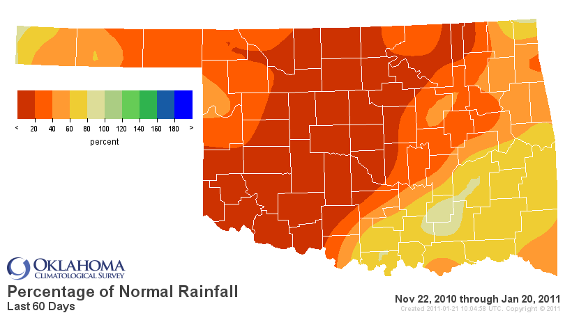
picture of the state?s drought situation. The average statewide precipitation
total for the last 60 days is a meager 1.49 inches, more than 2 inches below
normal and the 9th driest such period since 1921. Central Oklahoma?s statistics
are even more telling with an average total of 0.55 inches, more than 3 inches
below normal. That deficit ranks the last 60 days in central Oklahoma as the
third driest. Extended out to 90 days, central Oklahoma?s deficit rises to
nearly 5 inches and ranks that period as the fourth driest since 1921.
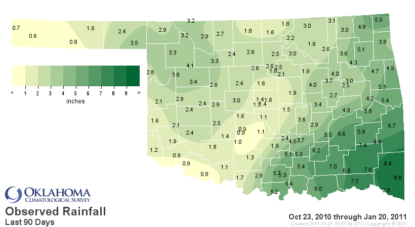
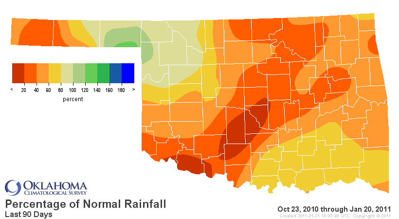
While some relief has occurred in southeastern and northern areas in January,
the entire state remains exceedingly dry. The southeastern two-thirds of the
state have a deficit of 4-to-10 inches since late September. The Mesonet
station in Norman has recorded 2.5 inches of rain during that period with only
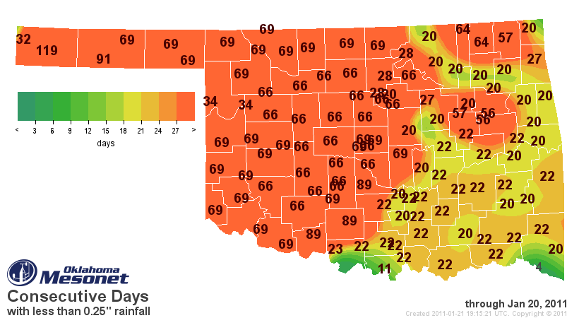
2.2 inches recorded at Shawnee. It has now been between 70-90 days since
southwestern and central Oklahoma has seen a day with more than a quarter-inch
of rainfall. That number expands to 120 days in the far western Panhandle.
Shrinking stock ponds and reservoirs are the most visible impacts seen above
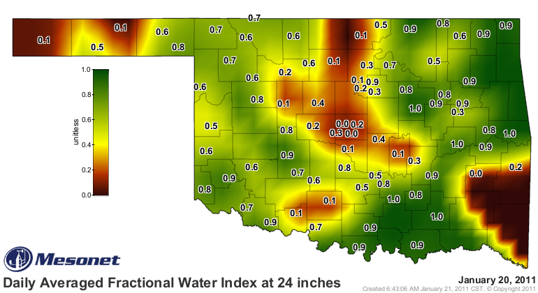
ground, but the soil is also beginning to reflect the drought. The Mesonet?s
soil moisture sensors in central Oklahoma show bone-dry conditions down to a
depth of at least 2 feet.
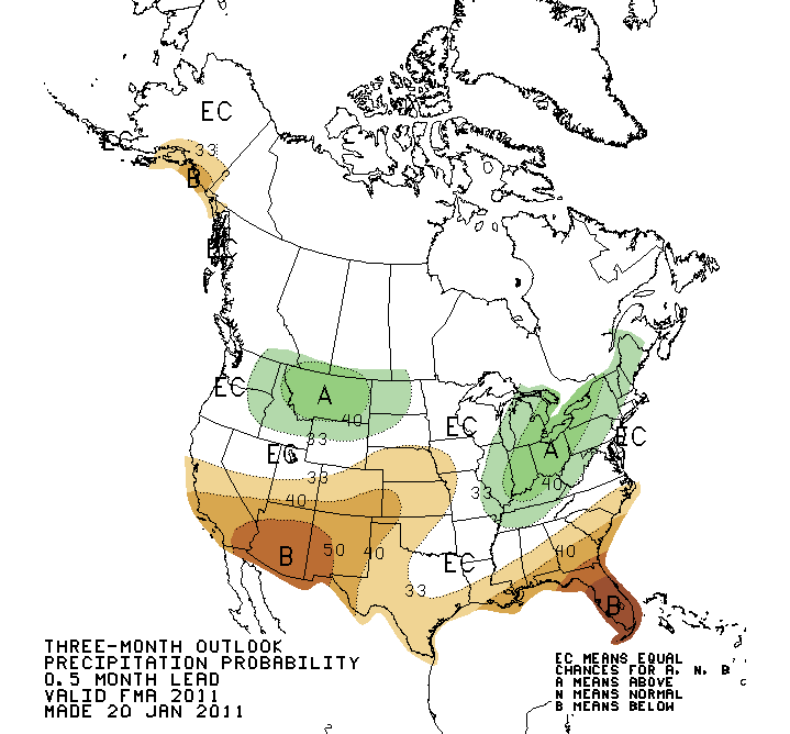
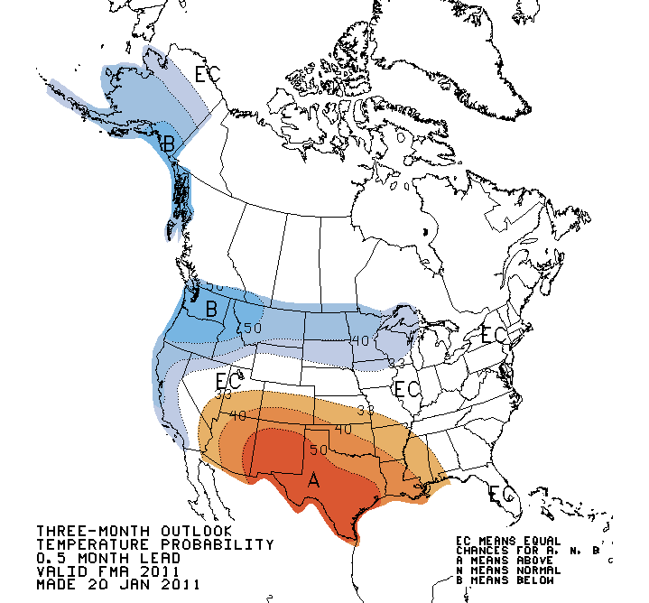
The prospects for relief over much of the state are not great according to
scientists at the National Weather Service?s Climate Prediction Center, thanks
in large part to the continuing moderate-to-strong La Nina occurring in the
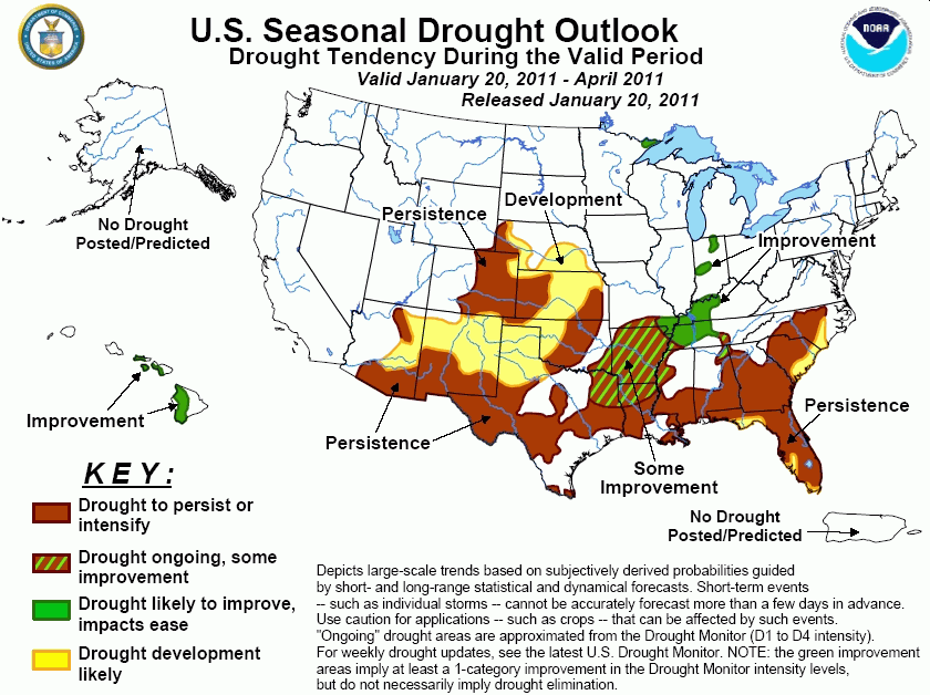
equatorial Pacific Ocean. Their latest drought outlook has the drought
persisting, with possible further development, through April in the northwestern
two-thirds of the state. Some improvement is possible in the southeast, however.
In addition, they expect an increased chance of above normal temperatures
through the entire state during that period as well, especially in western
Oklahoma.
This La Nina event is expected to last through spring, but scientists are
seeing some indications it might begin to wane over the next several months.
Drought extending into the spring months would have significant impacts on
Oklahoma?s agricultural producers, especially the Oklahoma wheat crop. Wildfire
conditions could also be amplified by continued dryness.
For more information on Oklahoma?s current drought situation, please visit the
Oklahoma Climatological Survey?s drought monitoring website:
http://climate.mesonet.org/rainfall_update.html
and the Oklahoma Mesonet:
http://www.mesonet.org
Gary McManus
Associate State Climatologist
Oklahoma Climatological Survey
(405) 325-2253
gmcmanus@mesonet.org
January 21 in Mesonet History
| Record | Value | Station | Year |
|---|---|---|---|
| Maximum Temperature | 78°F | WOOD | 2005 |
| Minimum Temperature | -17°F | BEAV | 2025 |
| Maximum Rainfall | 3.48 inches | CLOU | 2018 |
Mesonet records begin in 1994.
Search by Date
If you're a bit off, don't worry, because just like horseshoes, “almost” counts on the Ticker website!