Ticker for October 5, 2010
MESONET TICKER ... MESONET TICKER ... MESONET TICKER ... MESONET TICKER ...
October 5, 2010    October 5, 2010    October 5, 2010    October 5, 2010


********

Note to Ticker readers:

As you read the press release below, I just wanted to add a bit of additional
information about the forecasted strength of the current La Ni?a. As noted by
the experts at the Southeast Climate Consortium at Florida State University:

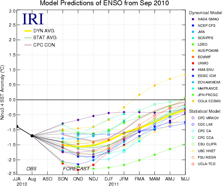
"Centers around the world that run El Ni?o/La Ni?a prediction models are
in overwhelming consensus in predicting a strengthening and long-lasting
La Ni?a. In fact, chances are good that the current La Ni?a will develop
into one of the stronger events in the last 60 years."

Much like last year's very strong El Ni?o, a very strong La Ni?a no doubt
stands a greater chance to affect our weather patterns than a less intense
episode.

*******

La Ni?a Could Bring Mild, Dry Winter to Oklahoma

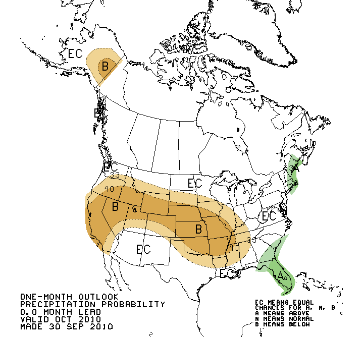
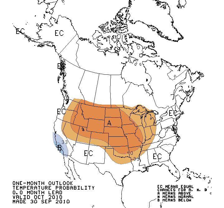
October has gotten off to a cool start in Oklahoma, including a few low
temperatures that fell below freezing the last several days. Despite the cool
beginning, however, the National Weather Service?s Climate Prediction Center (CPC)
sees an increased chance for warmer- and drier-than-normal weather in Oklahoma
during October. Looking farther out, the CPC indicates similar conditions could
persist through the winter months, meaning a milder but possibly drier winter for
Oklahoma. The culprit behind this possible disruption of Oklahoma?s weather is
none other than El Ni?o?s counterpart, La Ni?a.


La Ni?a occurs when sea surface temperatures in the equatorial Pacific become
cooler than normal. Much like El Ni?o, this cooling of sea surface temperatures
can influence weather around the globe, including that of the United States.
Impacts from La Ni?a include the tendency for a warmer and drier cool season in
the southern United States, along with cooler and wetter conditions in the
Midwest and Pacific Northwest. The current La Ni?a is expected to continue
strengthening and remain in place throughout the 2010-11 winter season.


La Ni?a?s impacts on Oklahoma?s economy can be significant. A warmer and drier
cool season can have adverse effects on Oklahoma?s agricultural industry. With
the planting of next year?s wheat crop underway, moisture becomes a key
ingredient for establishing that crop and developing it through to maturity.
That wheat can also be used to provide forage during the winter months for
cattle producers. Unfortunately, Oklahoma?s key wheat-producing areas are
beginning to see dry conditions spread due to below normal rainfall over the
last couple of months. Rainfall deficits due to La Ni?a?s influence would come
at an inopportune time. Another negative impact of warmer and drier conditions
is a possible increase in wildfires, which the state saw during the dry winter
of 2005-06.

Not all La Ni?a impacts are necessarily negative. Cooler weather in the
northern parts of the country can boost Oklahoma?s natural gas industry, and
therefore its economy, by increasing demand and keeping prices higher. The
state reaped that benefit last winter during a particularly cold and stormy
winter in the eastern half of the country. Oklahoma residents, on the other
hand, could see cheaper heating bills.

A warmer and drier winter does not necessarily translate into a season free of
ice and snow. Significant individual ice and snow events can still occur within
longer dry periods. For example, severe ice storms struck Oklahoma during the
La Ni?a winters of December 2000 and 2007.

It is important to remember that each La Ni?a episode can develop differently
and be influenced by other climate factors. However, increased confidence is
present in long-range outlooks when La Ni?a or El Ni?o conditions are present,
especially during the winter months.

Gary McManus
Associate State Climatologist
Oklahoma Climatological Survey
(405) 325-2253
gmcmanus@mesonet.org
October 5 in Mesonet History
| Record | Value | Station | Year |
|---|---|---|---|
| Maximum Temperature | 96°F | HOOK | 2018 |
| Minimum Temperature | 31°F | KENT | 2016 |
| Maximum Rainfall | 5.92 inches | PRYO | 1998 |
Mesonet records begin in 1994.
Search by Date
If you're a bit off, don't worry, because just like horseshoes, “almost” counts on the Ticker website!