Ticker for August 13, 2010
MESONET TICKER ... MESONET TICKER ... MESONET TICKER ... MESONET TICKER ...
August 13, 2010 August 13, 2010 August 13, 2010 August 13, 2010
Okay, who messed with this thermostat?
Looks like the fine folks from the NWS have dialed up some relief for next week.
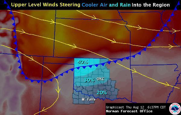
I don't know about you (no, seriously, what is the deal with you??), but I'm
ready for a nice northerly breeze and some rainfall. Mother Nature has certainly
lulled us into complacency with these August doldrums. It's been almost a month
with no weather disasters. So with a reprieve from the extreme heat in sight,
it's best to remember the need to remain vigilant for the next couple of days
for signs of heat exhaustion and heat stroke in our vulnerable populations. Seven
deaths have been attributed to the heat wave, and the effects from that heat
accumulate with each passing day.
To quote Dalton from "Road House": "It'll get worse before it gets better." (oh
sure, *I'M* the only one that can't flip past it on TNT!)
The heat has been significant. For August thus far, the statewide average
temperature according to the Oklahoma Mesonet is 86.3 degrees, 4.2 degrees
above normal. The average high temperature across the state for August 1-12
has been 99.5 degrees, which is 4.7 degrees above the normal high. Lows have
not been much better at 73.1 degrees, 3.7 degrees above normal. Not record-
breaking heat by any means, but significantly hot nonetheless.
It has been dry as well. I've been tempted to insist on further drought
expansion with the U.S. Drought Monitor, but I keep telling myself "It's August,
stupid!" This is very close to what is called a "flash drought", however.
Normally drought develops over longer time periods, but if you combine severe
rainfall deficits with abnormally high temperatures, it can impact vegetation
enough to cause rapid onset of drought. Hence the term "flash drought."
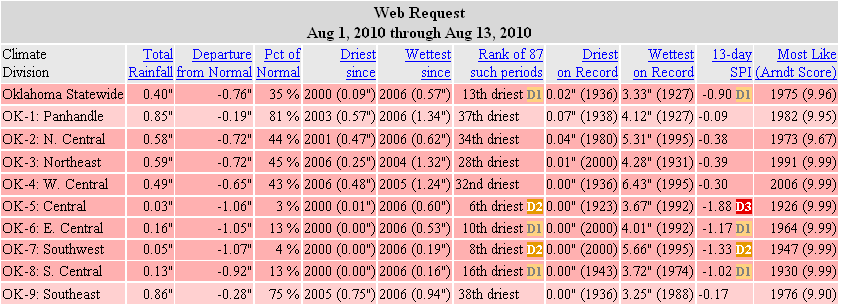
You can see the rainfall deficits for yourself with the climate division
averages and the percent of normal map from the Oklahoma Mesonet.
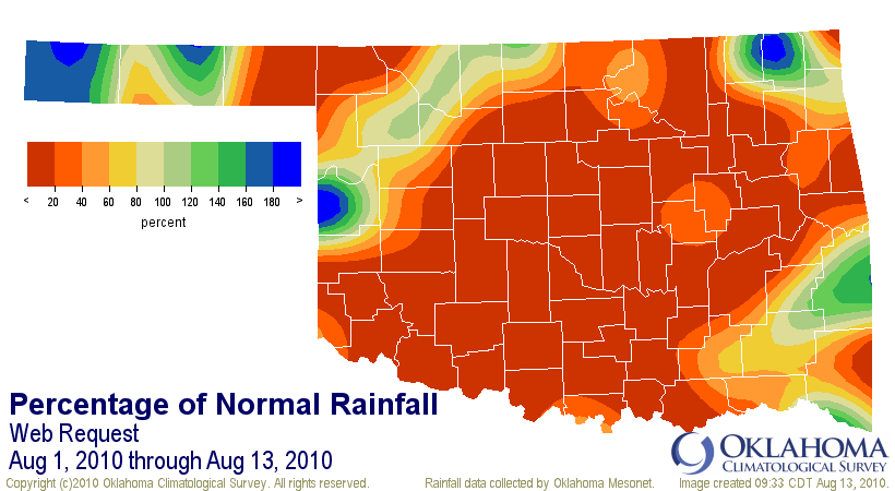
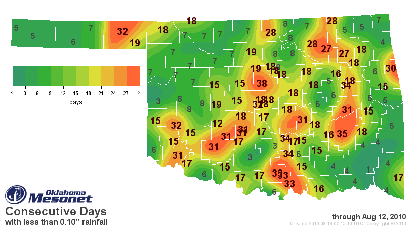
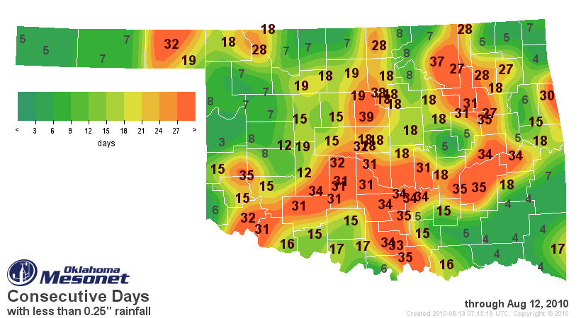
Of the 120 Mesonet stations, 45 have not received a drop of rain since August 1.
The consecutive days count with less than 0.10 inches and 0.25 inches of rain
continues to increase for many of those stations.
Sunshine has been in abundance, as indicated by the Mesonet's percent of
possible solar radiation map.
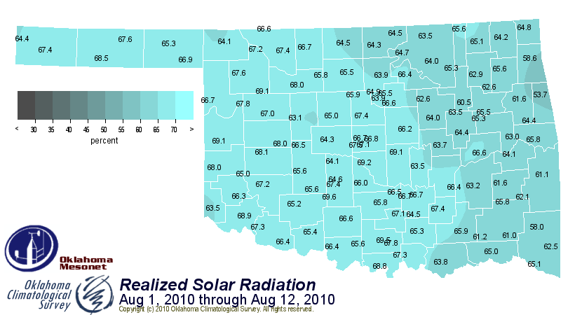
In fact, for the August 1-12 period, the statewide average percentage is tops
in Mesonet history (1994-2010):
Year % of possible sunshine
2010 65.4
2000 65.2
2007 64.2
2009 62.6
2006 61.1
2001 60.6
2002 60.4
1994 59.9
1999 58.7
2005 58.4
1995 57.3
2004 57.3
2003 56.7
1996 55.6
2008 53.6
1998 51.7
1997 48.5
August 2000 is not good company to keep, since it was the #1-driest and #6-
warmest August on record.
So let's hope that front that comes through is a doozy. We don't want to be
quoting "Road House" (come on, TNT, nearly every other night!) again when
it gets here: "I thought you'd be bigger."
Gary McManus
Associate State Climatologist
Oklahoma Climatological Survey
(405) 325-2253
gmcmanus@mesonet.org
August 13 in Mesonet History
| Record | Value | Station | Year |
|---|---|---|---|
| Maximum Temperature | 110°F | GRA2 | 2023 |
| Minimum Temperature | 48°F | MIAM | 2004 |
| Maximum Rainfall | 5.89 inches | SALL | 2017 |
Mesonet records begin in 1994.
Search by Date
If you're a bit off, don't worry, because just like horseshoes, “almost” counts on the Ticker website!