Ticker for April 7, 2010
MESONET TICKER ... MESONET TICKER ... MESONET TICKER ... MESONET TICKER ...
April 7, 2010 April 7, 2010 April 7, 2010 April 7, 2010
The Ugly Truth
Mother Nature pulled the rug out from under our spring/early-summer weather,
and nothing exemplifies that more than the following two figures ... the high
temperature map from yesterday and the 24-hr temperature change map from today:
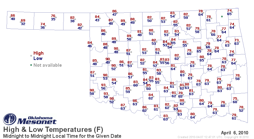

So when you have 24-hour temperature drops of more than 30-40 degrees from the
80s and 90s, you have to hope it is during July or August. Of course, today
would have been considered a nice day through parts of February and March. But
after the previous week's worth of spring-tease, it's just pouring salt in
bitter winter wounds.
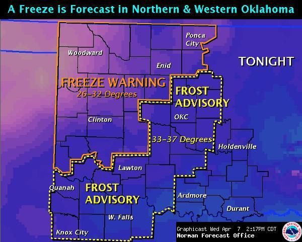
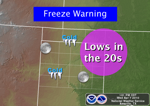
To make matters worse, we have freeze and frost warnings in effect for much of
western and central Oklahoma tonight:
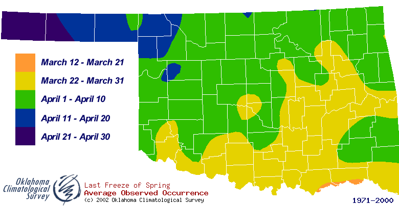
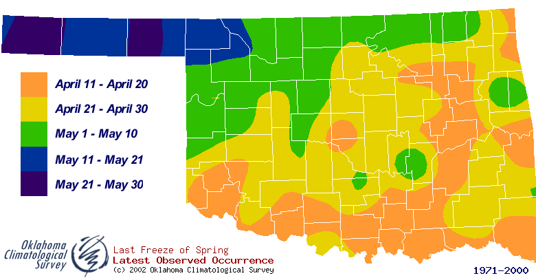
Now a freeze this late is nothing extraordinary, as we can see from our average
date of last freeze map (based on 1971-2000 data):
And before I complain too loudly, I should remember how bad it could be:
Temperature drops like this are the epitome of our transitions months here in
Oklahoma, so we'll just wait a few days for the nice weather to return. Just
be sure and remember to bring in your tender plants, animals and climatologists
(those last two are redundant) tonight and everything should be fine.
Gary McManus
Associate State Climatologist
Oklahoma Climatological Survey
(405) 325-2253
April 7 in Mesonet History
| Record | Value | Station | Year |
|---|---|---|---|
| Maximum Temperature | 96°F | HOLL | 2015 |
| Minimum Temperature | 16°F | CAMA | 2009 |
| Maximum Rainfall | 6.03 inches | ANTL | 2002 |
Mesonet records begin in 1994.
Search by Date
If you're a bit off, don't worry, because just like horseshoes, “almost” counts on the Ticker website!