Ticker for March 1, 2010
MESONET TICKER ... MESONET TICKER ... MESONET TICKER ... MESONET TICKER ...
March 1, 2010 March 1, 2010 March 1, 2010 March 1, 2010
February/Winter Numbers Are In
Drum rolllllllllllll ... it's now official, February was cold and wet. I know, I
know, you just can't beat analysis like that, right? Preliminary numbers from
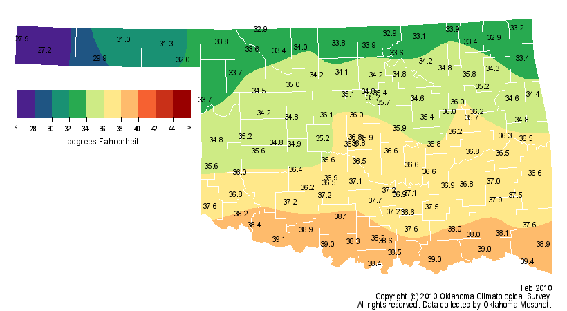
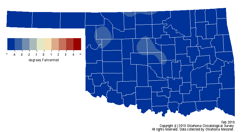
the Oklahoma Mesonet indicate that the average statewide temperature was 35.4
degrees, 6.3 degrees below normal and the 14th coolest February since 1895. The
precipitation total is a bit more tricky since the frozen precipitation we saw
at the end of January partially registered on the February totals as it melted.
However, Mother Nature doesn't care as much about those arbitrary endpoints as
we do, so look to the winter totals for a more accurate total. With that being
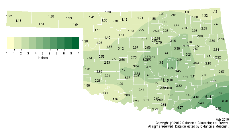
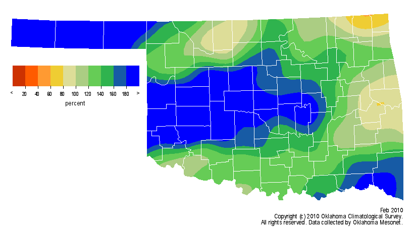
said, the statewide average precipitation total was 2.61 inches, 0.85 inches
above normal to rank as the 19th wettest February on record.
Temperature Graphics
Precipitation Graphics
The lowest temperature recorded by the Mesonet during February was 7 degrees at
Hooker on the 23rd. The highest temperature was 66 degrees at Butler on the
18th. Idabel led the way with 6.62 inches of precipitation and Alva brought up
the rear with 0.91 inches.
Oklahoma City finished the month with an average temperature of 36.6 degrees,
5.7 degrees below normal. The precipitation total stood at 2.47 inches, 0.91
inches above normal. Oklahoma City measured 1.5 inches of snow during February.
The highest temperature of the month was 62 degrees on the 18th and the lowest
was 20 degrees on the ninth.
*Winter*
The climatological winter (December-February) numbers show that Oklahoma
experienced its 7th coolest and 40th wettest winter on record. The statewide
average temperature was 34.7 degrees, 4.1 degrees below normal. The statewide
average precipitation total was 5.53 inches, 0.30 inches above normal.
All was not equal when it came to precipitation, however. Northern Oklahoma
didn't share in the moist bounty that southern Oklahoma received. North central
Oklahoma had a deficit of 1.28 inches and an average total of 2.17 inches, the
32nd driest winter on record for that area. Southwestern Oklahoma had a
surplus of 1.76 inches and an average total of 7.76 inches, the 17th wettest
such period on record in that section of the state.
Winter Temperature Graphics
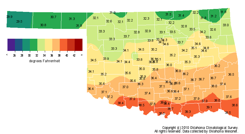
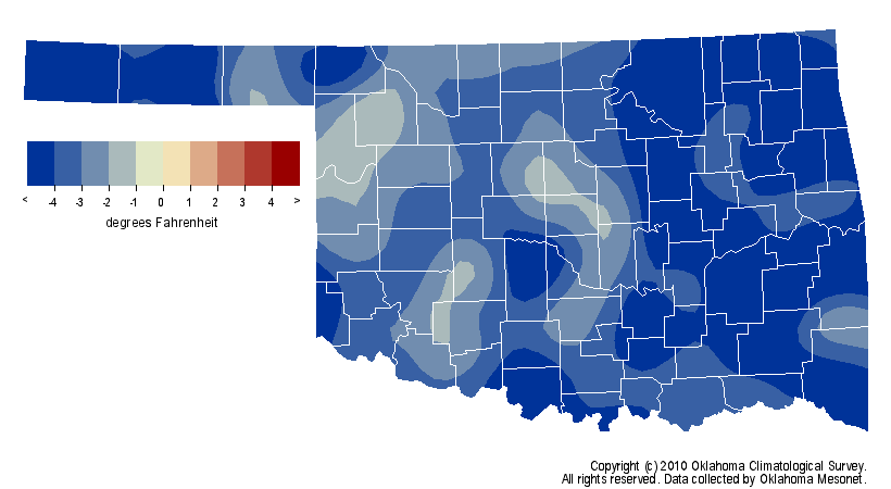
Winter Precipitation Graphics
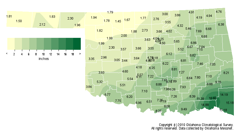
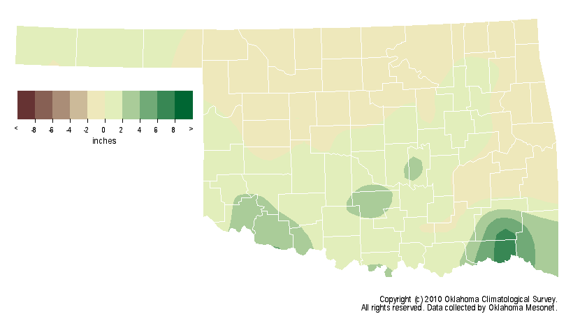
71, We Hardly Knew Ya
The high temperature in Oklahoma City this winter was 70 degrees on December
13. That marks the third time since statehood (1907 for those of you that
failed Mr. Pierce's Oklahoma History class!) that Oklahoma City failed to
register a high of at least 71 degrees during winter. The other years failing
to reach 71 degrees were 1985, 1968 and 1949. Two other also saw 70 degrees
being the winter high temperature ... 1979 and 1941.
Final Analysis:
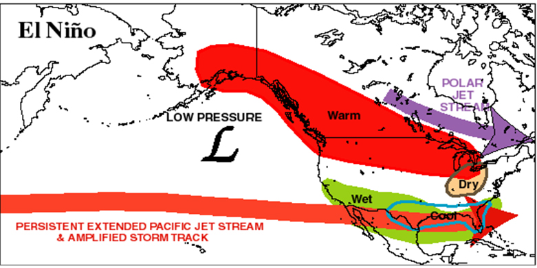
A cool and wet February/winter period is not really that surprising during a
strong El Nino event, especially with interference from the Arctic
Oscillation and North Atlantic Oscillation thrown in. All we had to do was look
at the El Nino normal impacts graphic from the Climate Prediction Center:
This winter did have its share of frozen precipitation, and we're probably not
out of the woods there either. But to keep things in perspective, the whopper
ice storm we had in January was only one in a series we've had since 2000 ...
nine for those counting, adding up to about $2 billion in damages and about
1.5 million utility customers without power. And those occurred in a variety
of climate regimes, including a predominance of warmer winters. And the
Christmas Eve blizzard was not even the most intense blizzard to hit the state
during 2009. That prize goes to the late-March event that broke the state's
24-hour snowfall record (26 inches at Freedom and Woodward).
So in the end, this cool and wet winter was momentous because ... it was the
latest cool and wet winter, and surely not our last. If you're like me,
however (sorry, you can get help for that), the fewer of these types of winters
we have, the better!
Gary McManus
Associate State Climatologist
Oklahoma Climatological Survey
(405) 325-2253
March 1 in Mesonet History
| Record | Value | Station | Year |
|---|---|---|---|
| Maximum Temperature | 95°F | NEWP | 2006 |
| Minimum Temperature | 7°F | GOOD | 2001 |
| Maximum Rainfall | 1.86″ | HUGO | 1997 |
Mesonet records begin in 1994.
Search by Date
If you're a bit off, don't worry, because just like horseshoes, “almost” counts on the Ticker website!