Ticker for September 12, 2008
MESONET TICKER ... MESONET TICKER ... MESONET TICKER ... MESONET TICKER ...
September 12, 2008 September 12, 2008 September 12, 2008 September 12, 2008
Extreme Weather; Extreme Rainfall
Some randomly-scattered information related to this weekend's
weather "stories":
LOWELL:
As the Texas Gulf Coast braces for Ike's arrival, we have some rainfall
issues of our own in Oklahoma. Tropical (Pacific) moisture has painted
a stripe of heavy rains across parts of Oklahoma for the last two days.
Unfortunately, it pretty much painted the stripe in the same place for
the whole time.
Here's a map of some of the two-day rain totals:
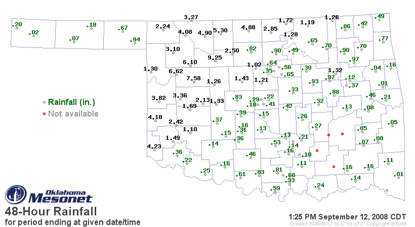
The 9.25" figure at Fairview is staggering, but heavy rains have fallen
all along and west of (roughly) U.S. 281. The heavy rains are causing
some problems locally.
This week's rains have left their mark on the Haywood graphs for
north-central and west-central Oklahoma:
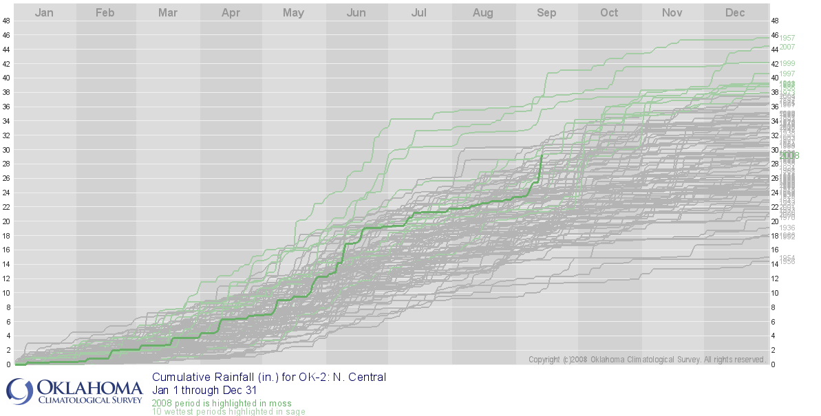
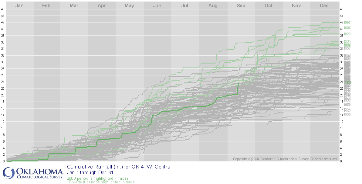
On each graph, you can see that the 2008 running total has vaulted from
"middle of the pack" to among the wettest years-to-date on record.
IKE:
The remnants of Ike are forecast to dump several inches of rain on
parts of eastern Oklahoma. This additional rain will help northeastern
Oklahoma build upon its "lead" for 2008 rainfall. The Haywood graph
for northeast Oklahoma shows that this year (dark green line) still
paces ahead of all other years since 1921:
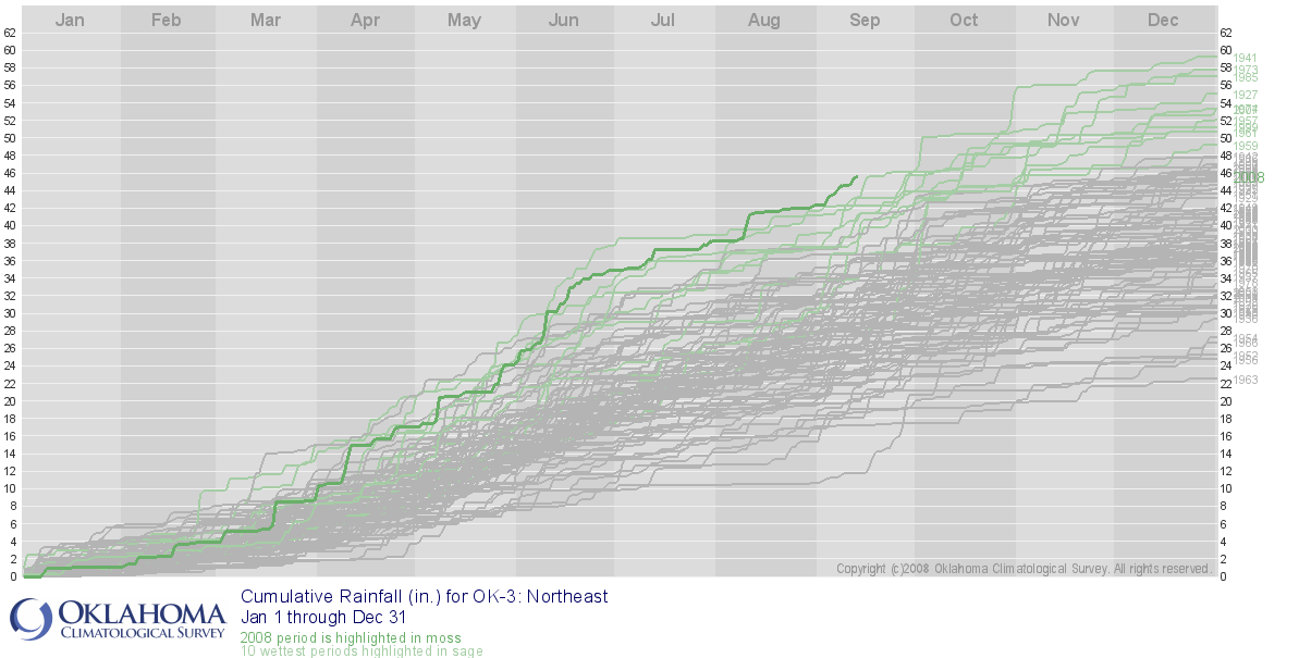
The additional rainfall will surely bump the running total up even more.
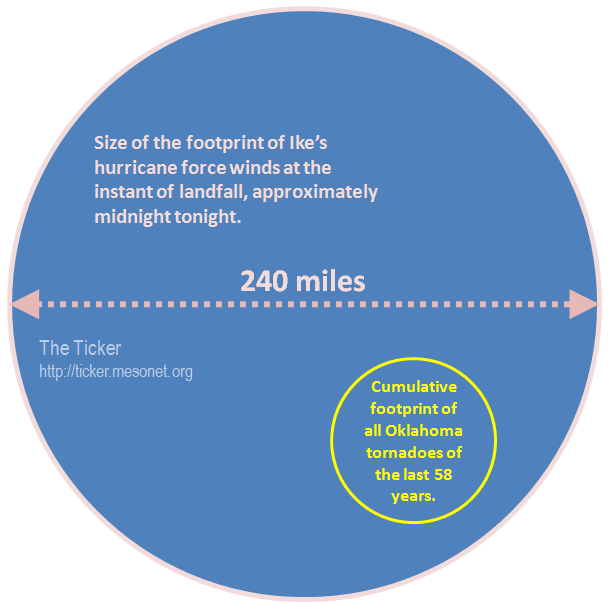
Finally, some perspective on just how big Ike is:
September 12 in Mesonet History
| Record | Value | Station | Year |
|---|---|---|---|
| Maximum Temperature | 105°F | ALTU | 2011 |
| Minimum Temperature | 40°F | BOIS | 2014 |
| Maximum Rainfall | 9.13 inches | FAIR | 2008 |
Mesonet records begin in 1994.
Search by Date
If you're a bit off, don't worry, because just like horseshoes, “almost” counts on the Ticker website!