Ticker for April 14, 2008
MESONET TICKER ... MESONET TICKER ... MESONET TICKER ... MESONET TICKER ...
April 14, 2008     April 14, 2008     April 14, 2008     April 14, 2008


It's Hard to Restrain and it's Totally Cool

A freeze is a danger of a different kind; it touches and it teases as
we stumble toward the daybreak. The Oklahoma Mesonet has some early
returns on this morning's low temps:


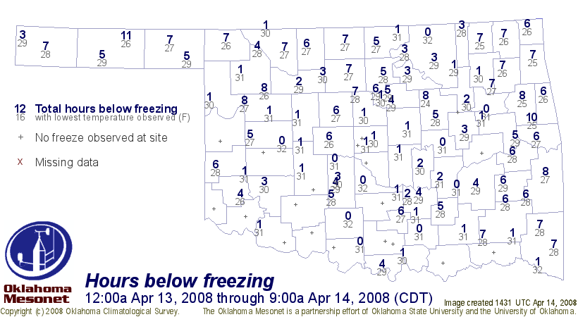
The first map represents the number of hours spent at or below 32.0F
since midnight Sunday morning. The gray number is the lowest
temperature that was observed during that period.

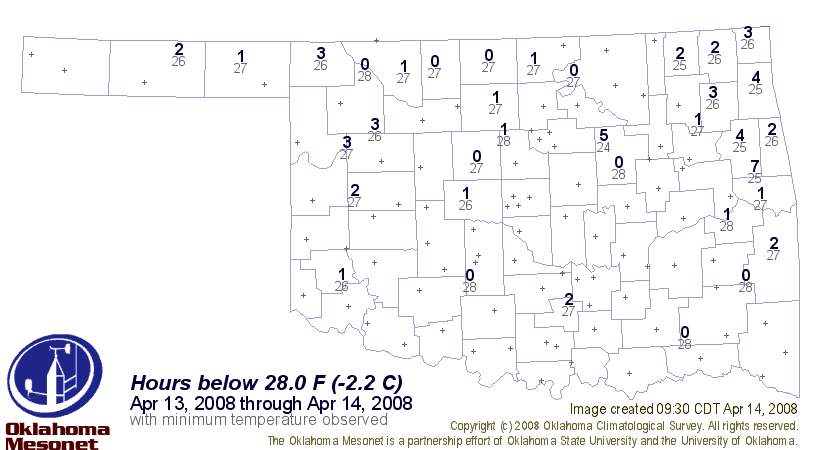
The second map gives the number of hours below 28.0F during the time
period. The upper twenties are important temps for the winter wheat
crop during this stage of growth.

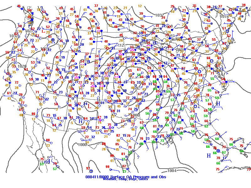
This cold outbreak was related to the extremely windy days we saw this
week. Strong winds are the couriers of change (they don't call them
"winds of change" for nothing). The system brought moisture, then
precip, then cool, then cold ... it was deep and strong and tightly
wound:


(surface map from last Thursday afternoon ... courtesy of SPC)

The northerly winds on the backside brought several days of nearly
unrestrained cooling influence.
April 14 in Mesonet History
| Record | Value | Station | Year |
|---|---|---|---|
| Maximum Temperature | 97°F | HOOK | 2003 |
| Minimum Temperature | 16°F | EVAX | 2022 |
| Maximum Rainfall | 3.12″ | GUTH | 2012 |
Mesonet records begin in 1994.
Search by Date
If you're a bit off, don't worry, because just like horseshoes, “almost” counts on the Ticker website!