Ticker for August 4, 2006
MESONET TICKER ... MESONET TICKER ... MESONET TICKER ... MESONET TICKER ...
August 4, 2006     August 4, 2006     August 4, 2006     August 4, 2006


Summer Weather, Like Politics, is Strongly Local

A pair of maps illustrate the profound propensity for proximity to
propel weather observations.

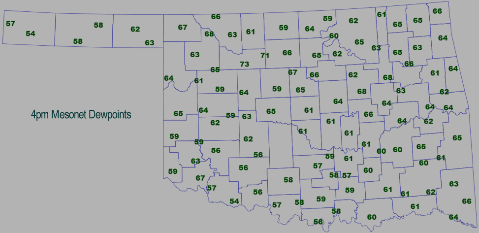
First, an afternoon dewpoint map from the Oklahoma Mesonet:


It's pretty sticky across Oklahoma, with dewpoints mainly in the 60s.
However, notice the 70s observations near Fairview in near-northwest
Oklahoma. Why are they 10 degrees higher than the average of their
neighbors?

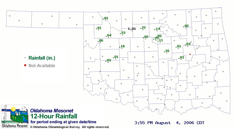
Well, much of the answer lies in a map that shows rainfall since
sunrise:


And indeed, most of the rainfall in the area fell around sunrise. Heavy
August rains, followed by intense August sun, dictated that many of the
water molecules that fell as liquid returned to the near-surface
atmosphere at water vapor, raising the humidity.

This process is amplified in summer, when large-scale systems generally
vanish, and the atmosphere is even more sensitive to local conditions.
August 4 in Mesonet History
| Record | Value | Station | Year |
|---|---|---|---|
| Maximum Temperature | 112°F | KIN2 | 2012 |
| Minimum Temperature | 54°F | NOWA | 2020 |
| Maximum Rainfall | 2.29 inches | JAYX | 1998 |
Mesonet records begin in 1994.
Search by Date
If you're a bit off, don't worry, because just like horseshoes, “almost” counts on the Ticker website!