Ticker for April 24, 2006
MESONET TICKER ... MESONET TICKER ... MESONET TICKER ... MESONET TICKER ...
April 24, 2006 April 24, 2006 April 24, 2006 April 24, 2006
New OCS Drought Update Online
Today's storminess notwithstanding, it's been a dry month. Here's the
latest drought update from OCS's Climate Information Group:
https://content.mesonet.org/ticker/archive/20060424/OKdrought.2006424.pdf
The punchline:
" ... the state is undergoing drought on multiple timescales. It has
now taken on two faces: a short-term event (scale of months) that
is worst in the state's northern half, and a historically-severe
long-term drought (seasons to years) in the east. Northeast
Oklahoma is at the intersection of both timescales."
If It Weren't For Bad Luck ...
You know you're in the grips of drought when even the thunderstorms
deliver hot, dry gusty weather! Sounds weird, but that's what happened
in north-central Oklahoma after sunset last night, causing temps to
peak in the mid 90s ... for a second time.
Here's how it went down:
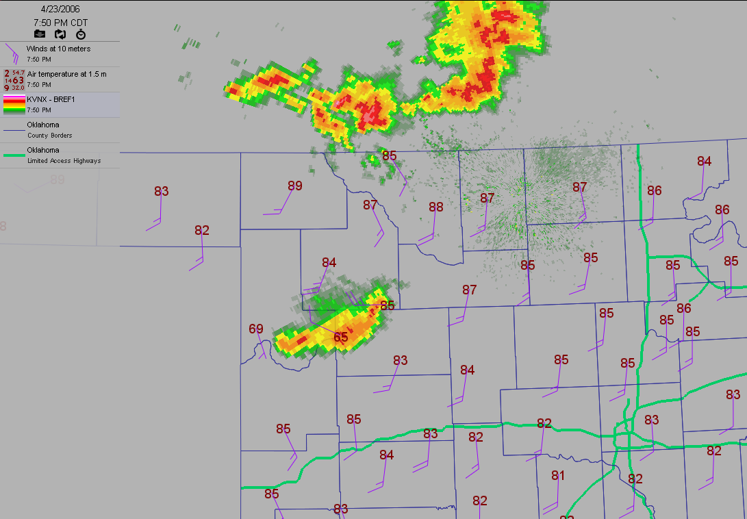
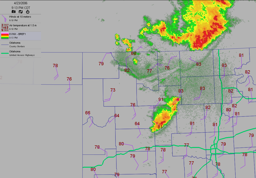
Right around sunset last night, there were storms north of the OK/KS
border, and a storm cluster in south of Woodward:
( OK cheat sheet:  )
)
Anyway, that storm was doing what April thunderstorms are supposed to
do: brief, very heavy rainfall, gusty winds (25+ mph at Woodward and
Seiling), lightning, thunder, you know all that good stuff. They also
really cooled things off (69 and 65 degrees at Cheyenne and Camargo,
respectively).
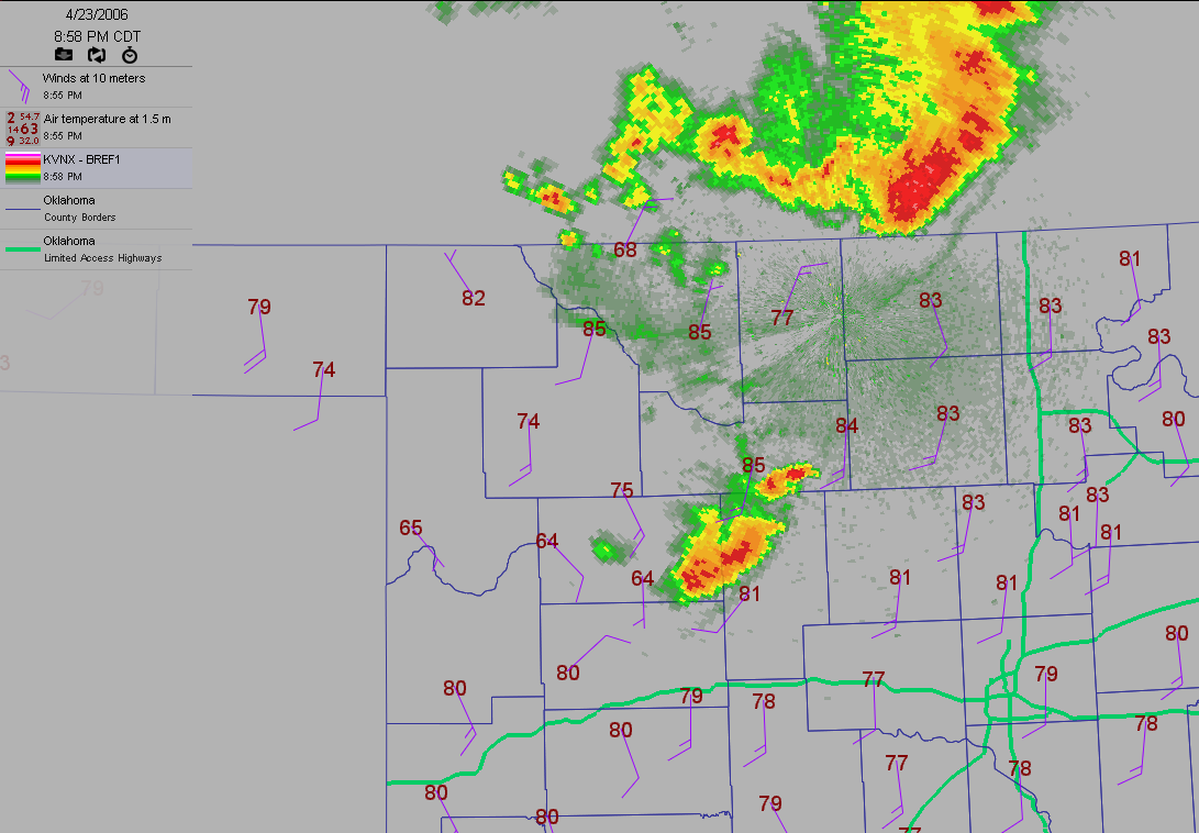
About an hour later, the storm had evolved somewhat, and blown through
most of Dewey County, chilling Putnam to a delightful 64 degrees:
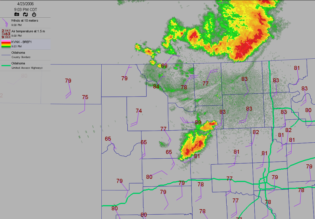
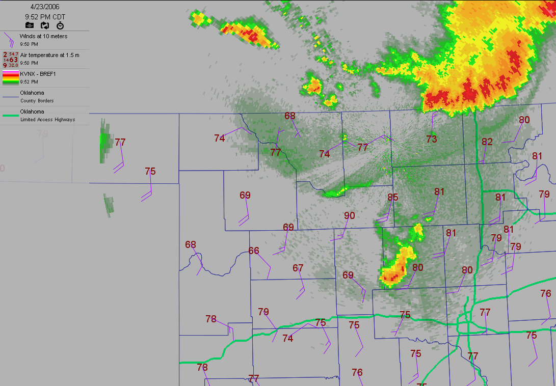
A few minutes later, things would start to get screwy. As a dying
element passed over Fairview, the temperature there jumped to 89F, with
strong westerly winds. Within five minutes, the temperature had risen
above 90!
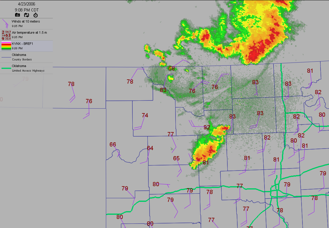
Forty minutes later, the same scenario played itself out at the Lahoma
station:
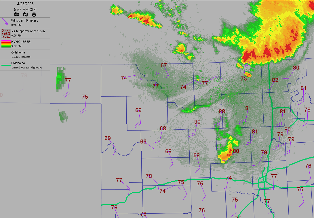
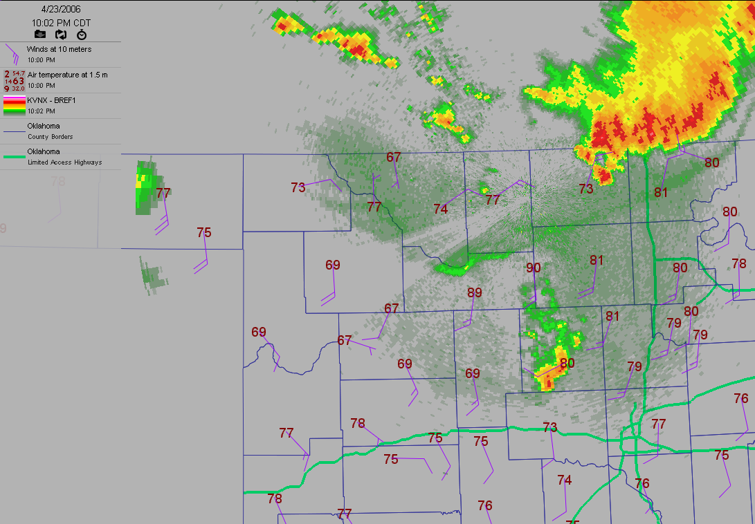
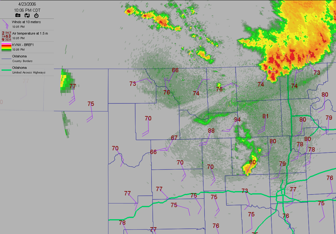
The temperature at Lahoma got up to 94! As you might have guessed, the
Lahoma and Fairview Mesonet stations recorded a heatburst. These things
are a special form of the downburst, which often occur when updrafts
die a rapid death, and all of the suspended precipitation crashes down
violently. When conditions are right, a the atmosphere produces a
delicate sequence of evaporational cooling, momentum and compressional
warming. The first adds to the second which enhances the third in a
bizarre physics game of cooling-leads-to-warming. For people at the
business end of a heatburst, the net result is a strong burst of hot
air, and that's what we saw in parts of north-central Oklahoma last
night (most dramatically at Lahoma and Fairview).
By the way, dwell upon that last image for a minute. It's okay, we'll
wait for you.
Notice that, as the Fairview/Lahoma heatburst matured, outflow from
storms in Kansas was relatively cool (temps in the 60s and 70s near
the border versus near 80 in the pre-storm environment along I-35).
You can also see a distinct outflow boundary separating the cool
outflow from the muggy southerly winds. And, by the way, Camargo and
Seiling were still frolicking in a delightful reservoir of cool
outflow. In fact, there's a 30-degree spread over just 70 miles ...
and it's all caused by cold-then-hot outflow from the same convection!
Like we said, conditions have to be just right!
April 24 in Mesonet History
| Record | Value | Station | Year |
|---|---|---|---|
| Maximum Temperature | 97°F | BEAV | 2012 |
| Minimum Temperature | 15°F | BOIS | 2013 |
| Maximum Rainfall | 6.77 inches | HASK | 2011 |
Mesonet records begin in 1994.
Search by Date
If you're a bit off, don't worry, because just like horseshoes, “almost” counts on the Ticker website!