Ticker for May 23, 2005
MESONET TICKER ... MESONET TICKER ... MESONET TICKER ... MESONET TICKER ...
May 23, 2005       May 23, 2005       May 23, 2005       May 23, 2005


This Week: 50th Anniversary of Blackwell Tornado

Wednesday will mark 50 years since a violent tornado destroyed much
of the eastern half of Blackwell, taking at least 20 lives and many
buildings. As horrible as the day was for Blackwell, it was worse in
Udall, Kansas, where 80 people were killed a few hours after the
chaos in Blackwell.

The terrible events near Blackwell and Udall are well documented,
but few people know that this storm was a tri-state killer.  It is
also attributed with the deaths of fifteen USAF crew members. Their
plane was downed by the (not yet tornadic) storm near Sterling, Texas.


Sunset Streaker Caught on Camera!

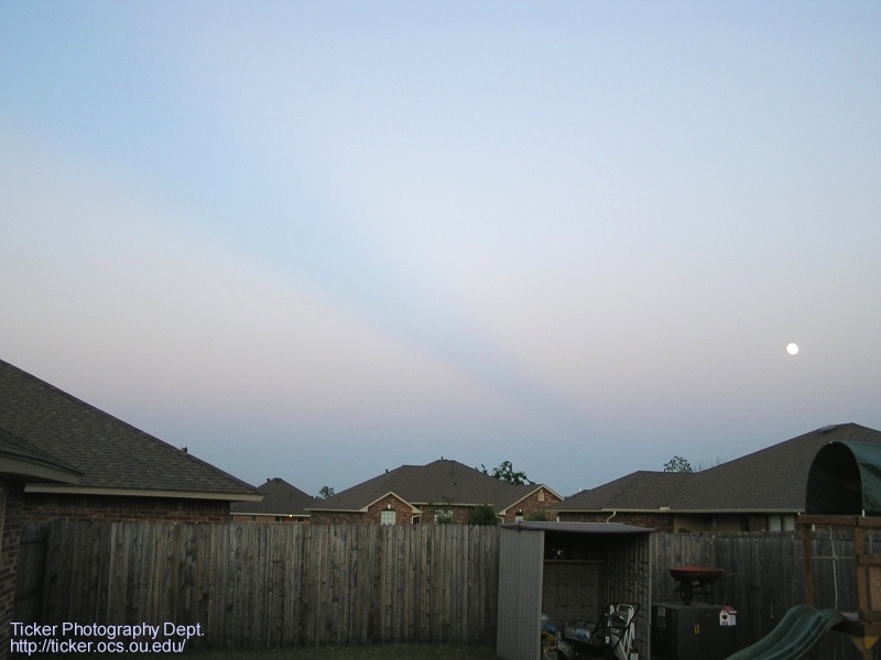
Last night's sunset came with a not-too-common, but certainly not rare,
feature. In this photo, taken from the backyard of an undisclosed
climatologist, notice the darker streak running diagonally from the
upper-left hand corner into the horizon at the photo's center:


(We cannot explain, nor will we attempt to explain, the wheelbarrow on
the transformer unit. Folks, climatologists are weird.)

This photo was taken looking due east. So, the streak is running from
the west-northwest into the horizon. What's causing it? Well, to answer
that, consider what's causing the pinkish areas around it. They are
caused by particles in the atmosphere are scattering the light of the
setting sun back into the eye of the observer. So, the pink-challenged
streak in the middle is either caused by lack of said particles or lack
of said sunlight. Because it seems unlikely that Mother Nature would
remove all scattering particles from one slice of the atmosphere, we'll
pursue the latter scenario.

First, to find out what is depriving this slice of sky from it's share
of sunlight, we should determine the sun's position when the pic was
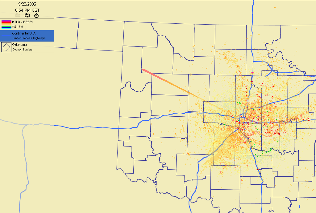
snapped. Here's a look at the 8:31 pm radar image from Oklahoma City:


It shows a conspicuous spike extending from the west-northwest. This
spike is caused by the setting sun, whose radiation overwhelms the
radar. The sun doesn't just get into outfielders' eyes - it messes
with radar too! So, this radar image places the sun west-northwest
of the observer, which is the direction whence the dark streak
emanates.

(by the way: we could've just looked at the full moon in the first
photo and determined that the setting sun was opposite the full
moon, i.e., to the west-northwest, but that would've deprived us
of the chance to pontificate upon radar data.)

So, the pieces are coming together: dark streak indicates lack of
sunlight; dark streak's origins are WNW of observer; setting sun is
WNW of observer; so ... something is blocking the sun to the WNW!

The naked eye is encumbered by the dastardly laws of optics and the
curvature of the earth, so no obstructions were visible at the time
of the photo. Thankfully, radar and satellite imagery found the
culprit.

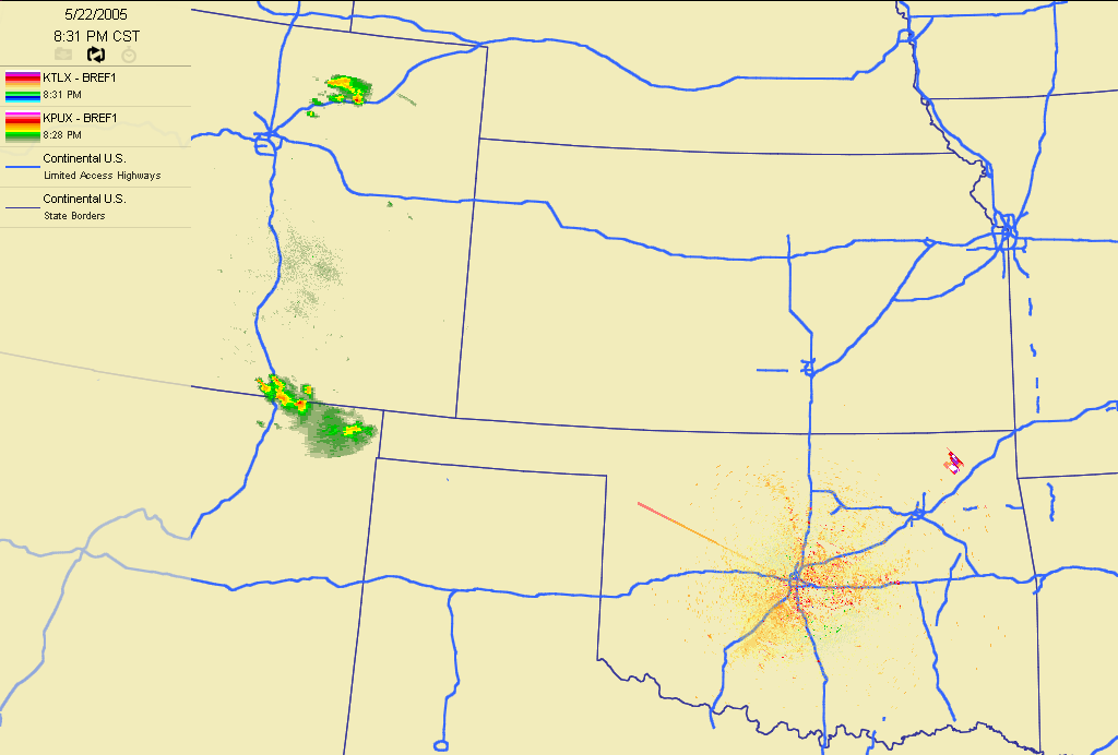
Here's a radar image from the same time as above, but it includes data
from the Pueblo, Colorado radar:


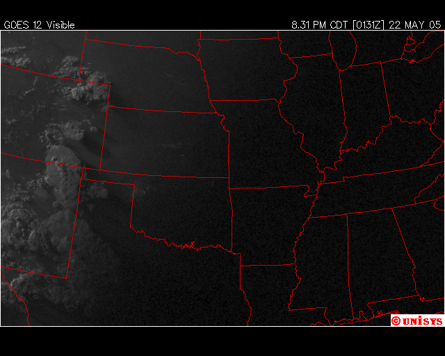
See those storms on the Colorado-New Mexico border? They also show up
on the concurrent visible satellite image:


Even though the tops of those storms were not seen by a ground-based
observer, they obstructed light from the setting sun, such that a
long shadow was cast into the skies above the Norman-based observer!
That shadow showed up as the darker, non-pink streak in the first
photo.
May 23 in Mesonet History
| Record | Value | Station | Year |
|---|---|---|---|
| Maximum Temperature | 112°F | ALTU | 2000 |
| Minimum Temperature | 40°F | EVAX | 2017 |
| Maximum Rainfall | 9.67″ | VINI | 2011 |
Mesonet records begin in 1994.
Search by Date
If you're a bit off, don't worry, because just like horseshoes, “almost” counts on the Ticker website!