Ticker for May 10, 2005
MESONET TICKER ... MESONET TICKER ... MESONET TICKER ... MESONET TICKER ...
May 10, 2005       May 10, 2005       May 10, 2005       May 10, 2005


Fear No More The Furious Winter's Rages

As May's days crawl into the double-digits, the climatological chance
of a freeze shrinks to near zero for most of the state. Even in the
panhandle, the historically-based probability of a freeze is now
below ten percent. In other words, the worldly task of the Ticker
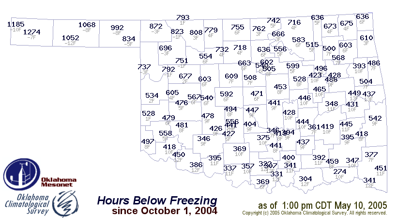
freeze-duration map is done. With a tyrant's stroke, we have consigned
it to dust, but not before archiving its seasonal totals:


2004-05 Extremes: Boise City spent upwards of 1200 hours below
freezing, while Hugo claimed a paltry 274 chilling hours.


Fear, However, the Heat O' the Sun

Our attention now turns to the persistent dryness plaguing much of the
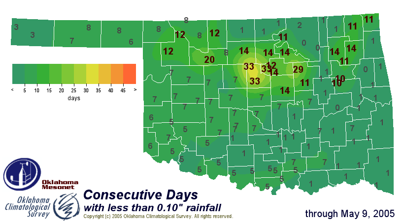
state. For the foreseeable future, the Ticker will feature maps like
the following:


The first shows, on a station-by-station basis, the consecutive days
with less than a tenth-inch of rainfall. For example, parts of Logan
and Payne Counties have gone more than a month without such a day.
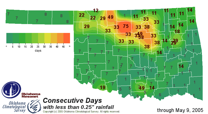
The second map sets the bar at a quarter-inch, and paints a bleaker
picture yet. The last time the Breckinridge Mesonet station notched
a quarter-inch of rain on a calendar day was way back on Feb. 23rd,
when 0.46" fell.
May 10 in Mesonet History
| Record | Value | Station | Year |
|---|---|---|---|
| Maximum Temperature | 102°F | ERIC | 2022 |
| Minimum Temperature | 31°F | EVAX | 2019 |
| Maximum Rainfall | 5.62″ | IDAB | 2009 |
Mesonet records begin in 1994.
Search by Date
If you're a bit off, don't worry, because just like horseshoes, “almost” counts on the Ticker website!