Ticker for April 20, 2005
MESONET TICKER ... MESONET TICKER ... MESONET TICKER ... MESONET TICKER ...
April 20, 2005 April 20, 2005 April 20, 2005 April 20, 2005
Heat Burst Phenomenon Abounds in SW Oklahoma
Several southwest Oklahoma Mesonet stations recorded mighty strong
wind gusts last night:
Station Gust Date Time
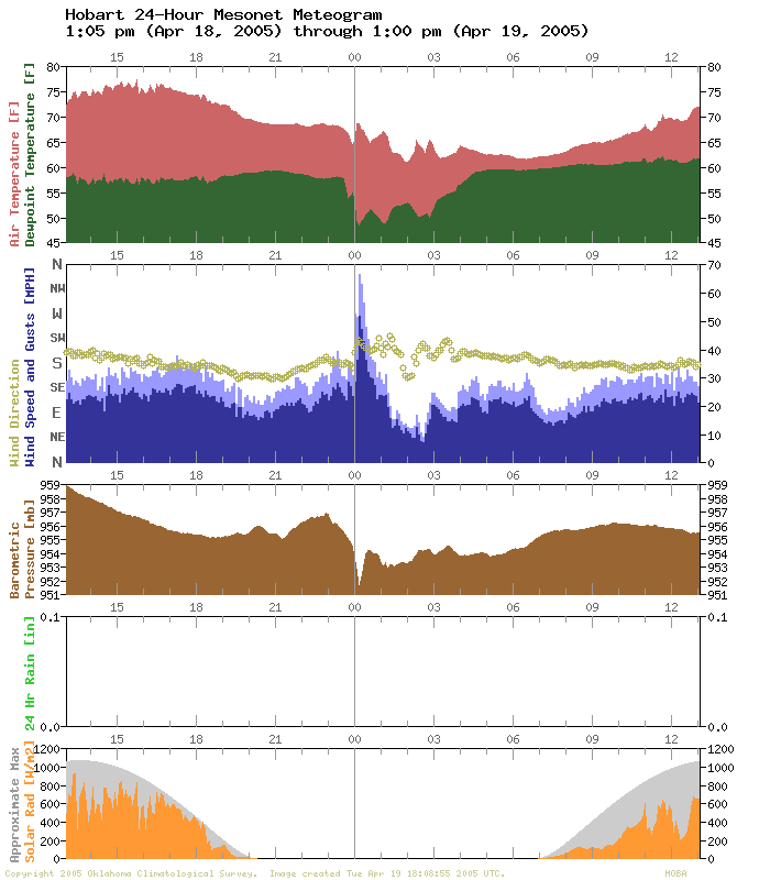
Hobart 67 mph Apr 19 12:10 am
Hobart 63 mph Apr 19 12:15 am
Erick 60 mph Apr 19 2:20 am
Hobart 56 mph Apr 19 12:20 am
Erick 55 mph Apr 19 2:15 am
Erick 52 mph Apr 19 2:10 am
Hobart 52 mph Apr 19 12:00 am
Hobart 51 mph Apr 19 12:05 am
Erick 49 mph Apr 18 11:10 pm
Erick 48 mph Apr 19 2:00 am
Hobart 48 mph Apr 19 12:25 am
Erick 48 mph Apr 18 11:15 pm
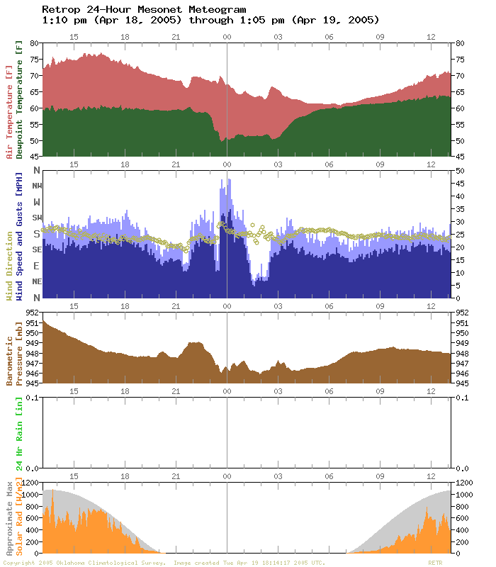
Retrop 47 mph Apr 19 12:05 am
Erick 47 mph Apr 18 11:30 pm
But that's not all they recorded. Closer inspection shows that heat
bursts associated with collapsing thunderstorm were the culprit. Take
a look at the following slides from various times through the night.
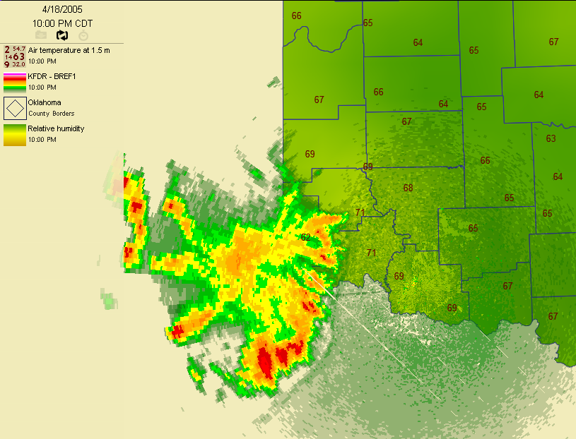
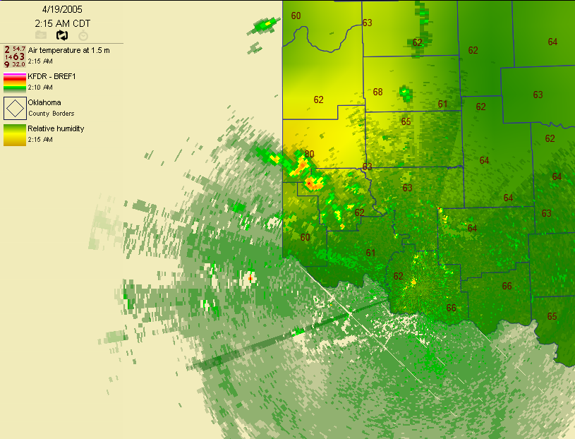
The radar imagery comes from the NWS location near Fredrick. The color
background represents the reltive humidity (brown=low, green=high), and
the numbers are Mesonet temperature observations.
Around 10:00 pm, and impressive cluster of thunderstorms tracked into
southwestern Oklahoma:
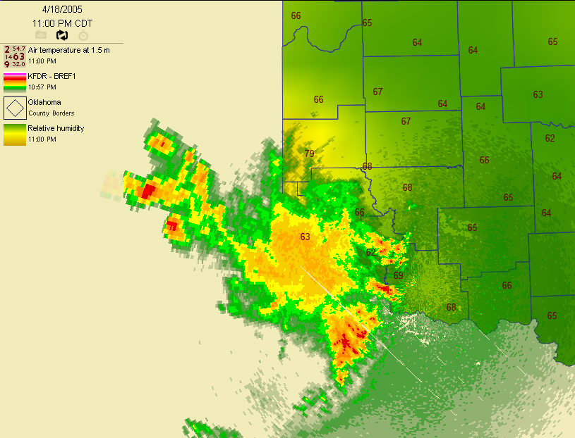
An hour later, some elements approached west-central Oklahoma, where
they essentially collapsed. Air involved with the resulting downdraft
heated compressionally, and resulted in the 78F 11pm temperature at
Erick. Notice also the lower relative humidities in the region.
By 12:30 am, much of the original line had dissipated, but left an
interesting radar pattern in its wake:
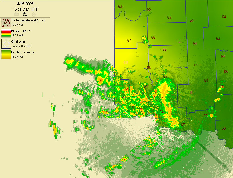
Those returns to the west and west-northwest of the radar site might
look like scary storms, but they are actually what radar meteorologists
call "anomalous propagation" or "AP". These two overly-fancy words mean
the atmosphere is bending radar beams in an unexpected way, and that way
is into the ground. Some of the radar beam is reflected by the ground
and makes its way back to the radar, which interprets the echoes as
something meteorological. It's a cousin to what happens to light waves
when we see a mirage, or what radio operators sometimes call "ducting".
In this case, the "AP" reveals itself in the very straight boundary
extending westward (and another southwestward) from the radar. Mother
Nature does not often align her particles in such an artificially
straight line.
Anyway, by 1:00 am, most of the AP is gone, but the radar reveals
another line of elements approaching west-central Oklahoma:
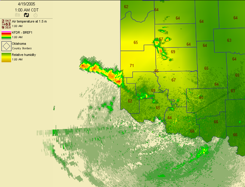
As these elements weakened, they spawned a prolonged heat-burst-like
signature at Erick, notably an 80F temperature at 2:15 in the morning!
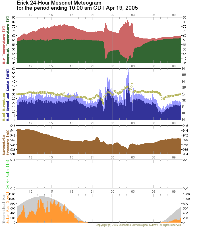
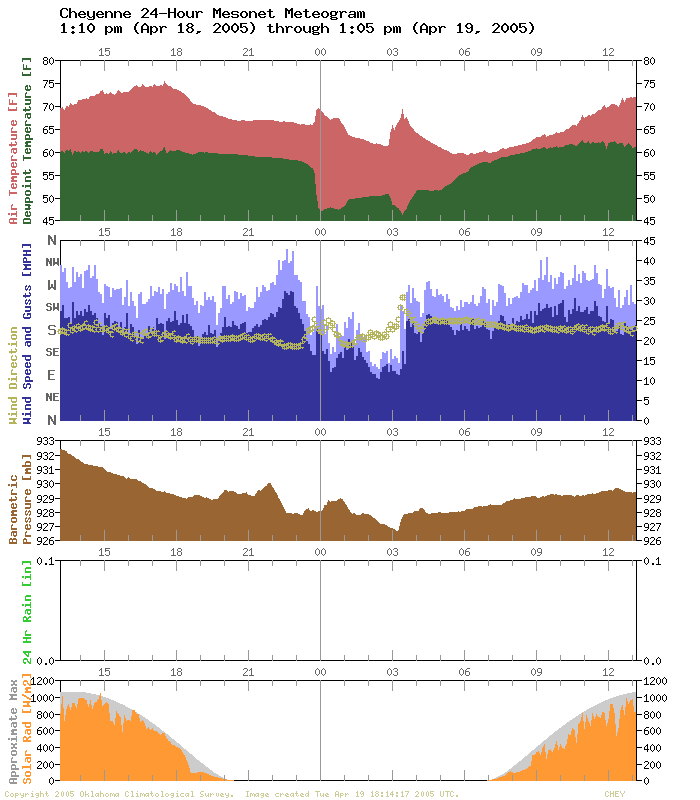
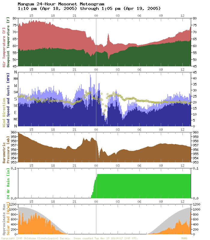
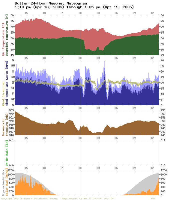
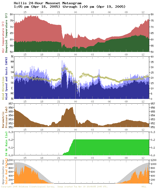
Finally, if you're a fan of meteograms, you'll see several heat burst
signatures at Oklahoma Mesonet stations in the region:
The most dramatic occurred at Erick, at 11:00 pm and shortly after
midnight:
Cheyenne had a nice signal:
Mangum actually got some rain, followed by a heat burst:
Hobart had a wind gust near 70 mph, and no rain:
Butler, Hollis, and Retrop:
April 20 in Mesonet History
| Record | Value | Station | Year |
|---|---|---|---|
| Maximum Temperature | 98°F | GRA2 | 2022 |
| Minimum Temperature | 24°F | BOIS | 2021 |
| Maximum Rainfall | 2.74″ | VINI | 2025 |
Mesonet records begin in 1994.
Search by Date
If you're a bit off, don't worry, because just like horseshoes, “almost” counts on the Ticker website!