Ticker for April 13, 2005
MESONET TICKER ... MESONET TICKER ... MESONET TICKER ... MESONET TICKER ...
April 13, 2005 April 13, 2005 April 13, 2005 April 13, 2005
Tales of an Indecisive Dryline
A quick look at the surface map from Sunday afternoon reveals
fairly common springtime scenario in the Sooner State:
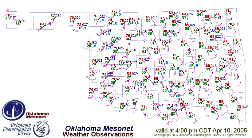
A well-defined dryline draped north-south across western Oklahoma
(around US Hwy 281, for those of you following along on your roadmaps),
with some invading cold air suggested in the panhandle.
This system went on to spawn some thunderstorms and severe weather.
But the dryline, as sharp as it was, really couldn't make up its mind.
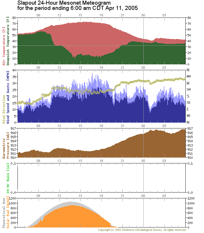
Now, drylines can barrel through a place, as this one did through
Slapout around 11 am that day (notice the abundant sunshine, crashing
dewpoint and rapid shift to westerly winds):
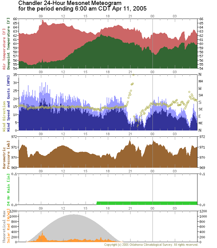
Or, drylines can leave a place unscathed, such as this one left Chandler
(notice the lack of the aforementioned features):
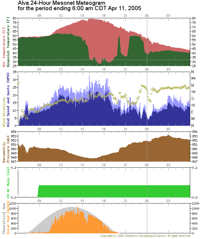
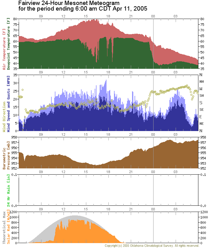
However, what made this dryline fun was its vacillation in the US 281
corridor. This dryline wobbled around, as seen in the following two
meteograms from Alva (which spent much of its day in the dry air) and
Fairview (which spent much of its day in the moist air):
Special thanks to Mesonet operator Cindy Morgan, who has pretty much
assured her spot in the Ticker Contributor Hall of Fame.
April 13 in Mesonet History
| Record | Value | Station | Year |
|---|---|---|---|
| Maximum Temperature | 99°F | MAYR | 2006 |
| Minimum Temperature | 19°F | BOIS | 2004 |
| Maximum Rainfall | 4.11″ | CHER | 1999 |
Mesonet records begin in 1994.
Search by Date
If you're a bit off, don't worry, because just like horseshoes, “almost” counts on the Ticker website!