Ticker for October 19, 2004
MESONET TICKER ... MESONET TICKER ... MESONET TICKER ... MESONET TICKER ...
October 19, 2004 October 19, 2004 October 19, 2004 October 19, 2004
Smiling Satellite Image Plays With Afternoon Temps
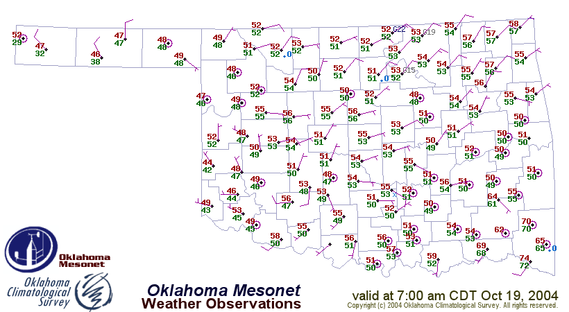
A stationary front draped across Oklahoma has played a role in keeping
temperatures down over much of the state. However, a visible satellite
image fromthis afternoon reveals an additional culprit:

The "smile" drooping from the eastern panhandle to Oklahoma City and
back up to the Missouri border is composed of persistent low clouds
and fog associated with the front. These clouds block the Sun's rays
(profound, huh?), and, therefore, the ability of the Sun to heat the
surface. Of course, south of this cloud deck, the Sun has been free
to do its diabatic chores, providing all the October energy it can
muster. As a result, the temperature gradient has strengthened
considerably from the morning into the afternoon hours:
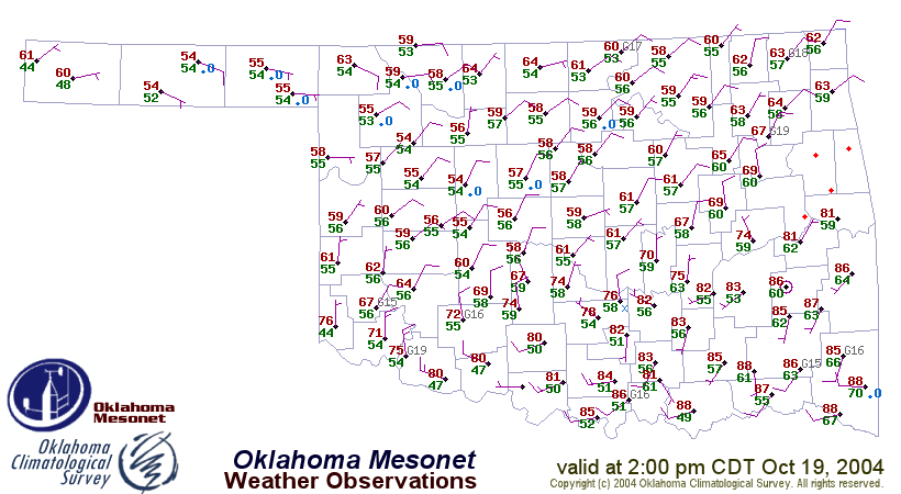
But Wait, There's More
It's one thing to strengthen an existing gradient. What would really
be impressive is the creation of an entirely new one! Well, today's
smiley face has done just that. Notice the local temperature maximum
in the clear skies near the Kansas border west of I-35 at 2:30 pm:
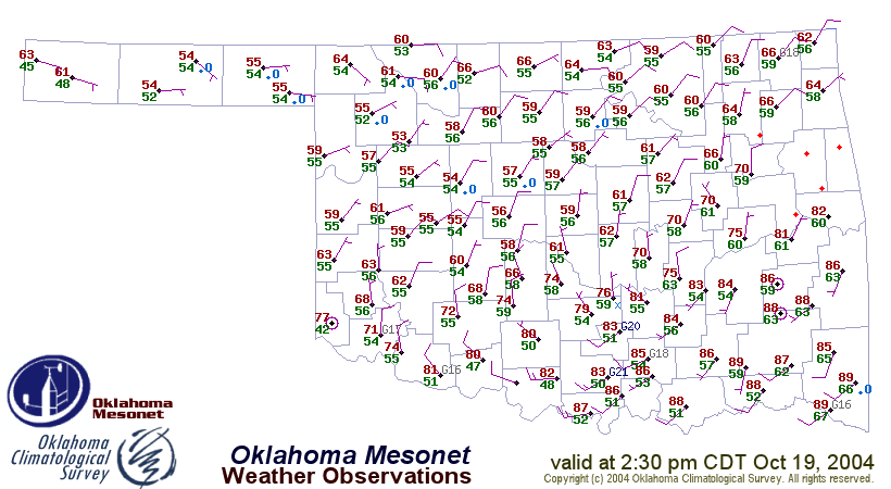
The temps at Medford and Cherokee had climbed to 66, while stations
just to the south (the south!) were mired in the mid-to-upper 50s.
So, even in the "cold" sector a couple hundred miles removed from
the front, temperature gradients have emerged, fueled by differences
in diabatic heating (solar energy, in this case).
Folks, That's Not All
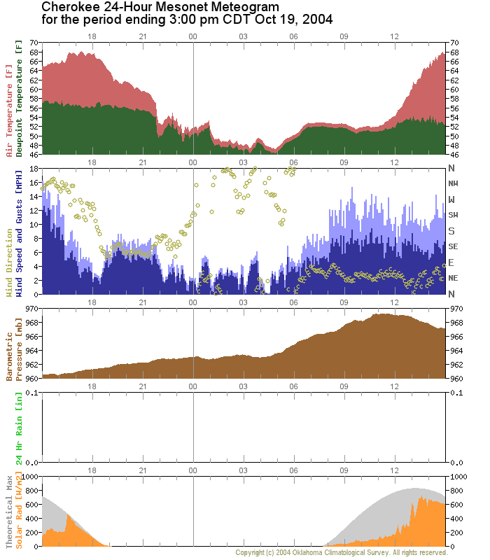
We couldn't let this afternoon pass without the inclusion of a few
meteograms. The Ticker drew a north-south line transecting the state
(and the front) from Cherokee to Walters. We then grabbed a few
meteograms from near its path.
The first station along the transect is Cherokee. The bottom (solar)
panel of its meteogram indicates that its skies soared into sunniness
around noon today. At nearly the same time, its temperature trace shot
upward from its dewpoint-hugging low-50s value to near 70:
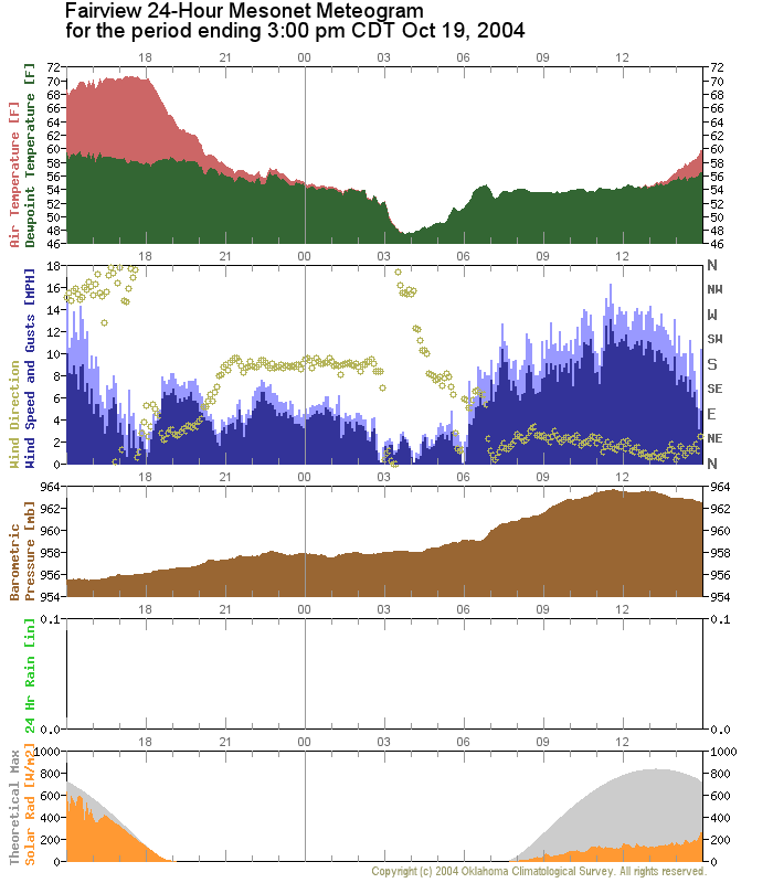
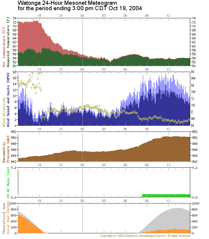
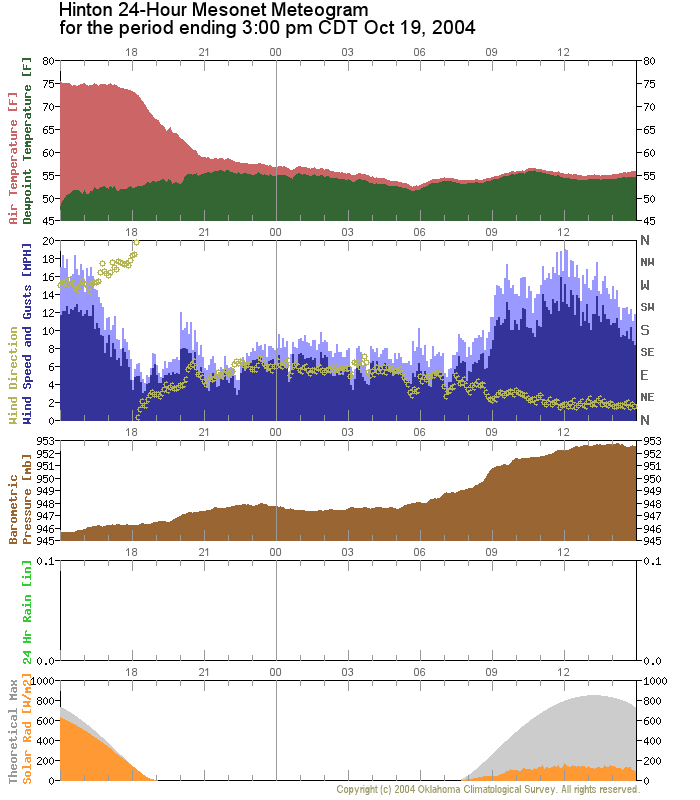
The three stations south of Cherokee (Fairview, Watonga and Hinton)
clung to the clutches of cloudiness well into the afternoon.
As a result, their temperatures remained reined, and 50s reigned:
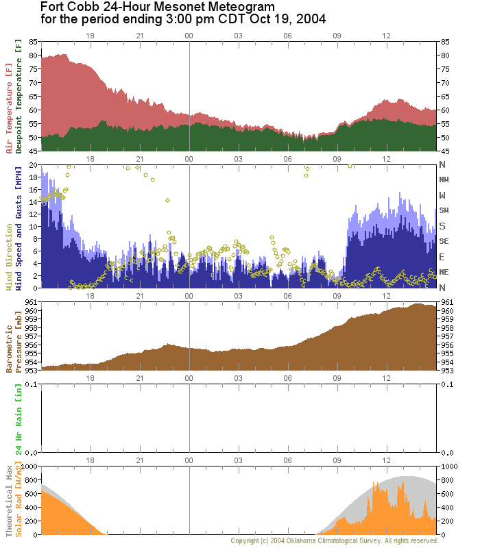
The edge of the cloud deck flirted with Fort Cobb much of the day, and
temperatures there found the mid-60s early on. Then the clouds returned,
and teamed with the persistent northeasterly flow to return temps to
near 60:
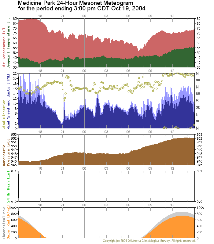
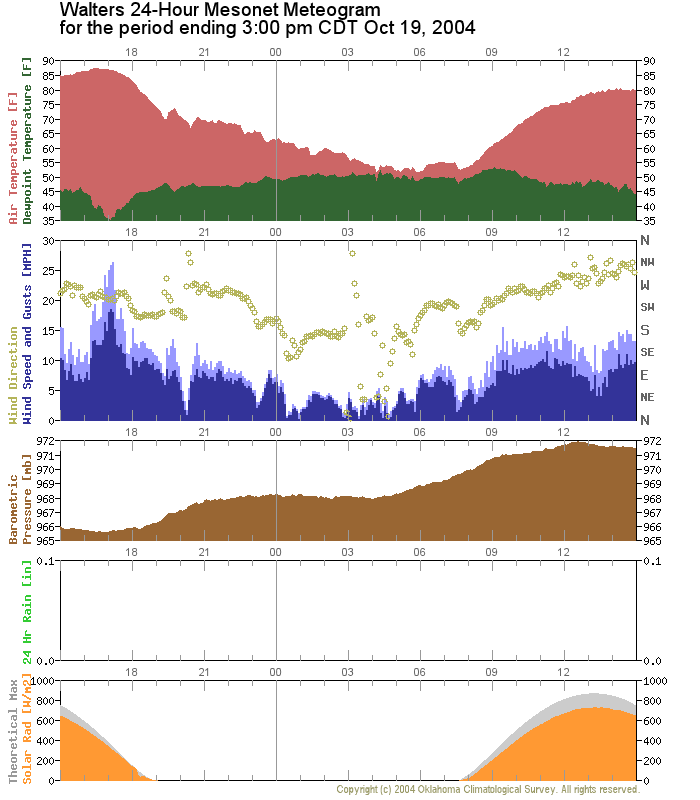
Finally, Medicine Park and Walters brewed under clear skies the entire
day. Despite the best efforts of the northerly winds, temperatures at
Medicine Park quickly found the 70s:
Meanwhile, the combination of clear skies and more westerly winds in
the frontal zone rocketed temps at Walters into the 80s!
All in all, it was a great afternoon to watch conditions unfold on
the Mesonet!
October 19 in Mesonet History
| Record | Value | Station | Year |
|---|---|---|---|
| Maximum Temperature | 94°F | BEAV | 2003 |
| Minimum Temperature | 17°F | NOWA | 2022 |
| Maximum Rainfall | 2.73 inches | WAUR | 2016 |
Mesonet records begin in 1994.
Search by Date
If you're a bit off, don't worry, because just like horseshoes, “almost” counts on the Ticker website!