Ticker for August 30, 2004
MESONET TICKER ... MESONET TICKER ... MESONET TICKER ... MESONET TICKER ...
August 30, 2004 August 30, 2004 August 30, 2004 August 30, 2004
A Very Cool (?) Heat Burst at El Reno
Last week, while the Entire Ticker Staff was running here and there,
Mesonet Data Manager and Lead Operator David Demko captured a very
impressive snapshot of a heat burst at El Reno:
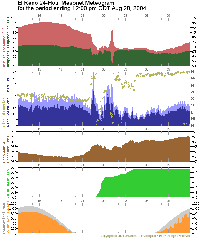
The air temperature spiked nearly twenty degrees (from 69F to 87F)
in about 30 minutes! Notice the impressive drop in dewpoint
temperature as well.
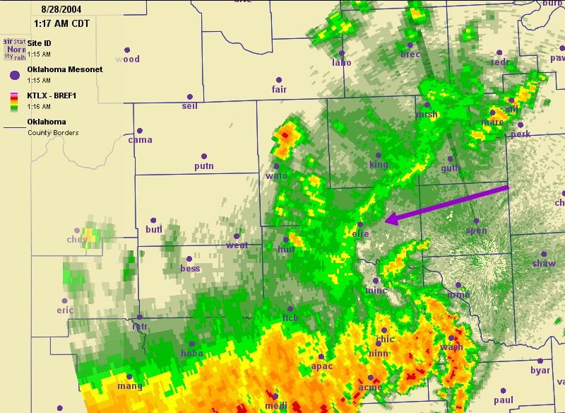
Also, three distinct bursts of winds are apparent. The first, at
around 10:30 pm, was associated with a multi-cell thunderstorm that
dropped temperatures, as well as nearly hanf an inch of rain.
The last two came in advance of, then concomitant with, the temperature
spike. The wind directions assoicated with these two spikes are quite
different - from the south in advance of the heat burst, then from
the north or northeast as another storm disintegrated nearly overhead:
August 30 in Mesonet History
| Record | Value | Station | Year |
|---|---|---|---|
| Maximum Temperature | 112°F | ALTU | 2011 |
| Minimum Temperature | 49°F | KENT | 2017 |
| Maximum Rainfall | 7.93 inches | MEDF | 2003 |
Mesonet records begin in 1994.
Search by Date
If you're a bit off, don't worry, because just like horseshoes, “almost” counts on the Ticker website!