Ticker for March 15, 2004
MESONET TICKER ... MESONET TICKER ... MESONET TICKER ... MESONET TICKER ...
March 15, 2004 March 15, 2004 March 15, 2004 March 15, 2004
"Cold" Front Swipes Sooner State
A huge number of Ticker readers (okay, three) have noted the higher
temps behind today's ostensibly-cold front:
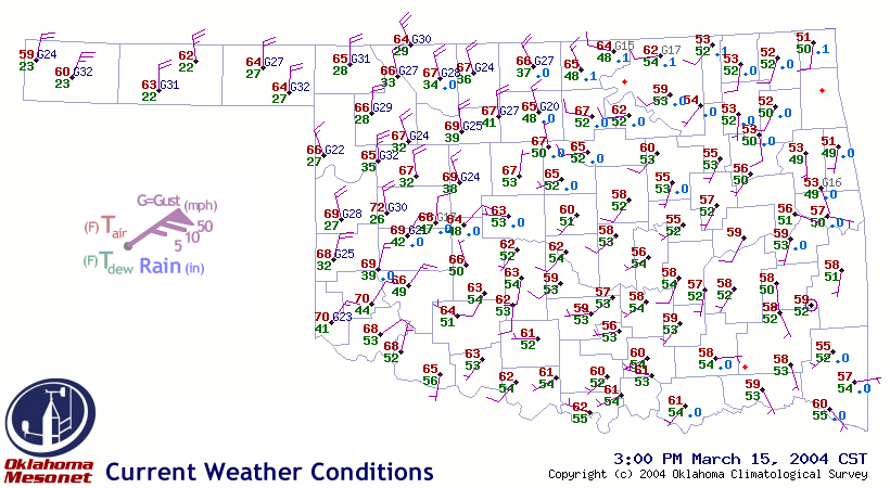
Why so? Well, fronts don't live eternally. They often morph into
an alternate surface feature, or just melt into oblivion. In warmer
climes and times, cold fronts often meet their demise at the hand of
modification ... and today brings us a great example of this dreaded
process.
Today, the air behind today's advancing cold front (which wasn't a real
barnburner to begin with) lies in direct sunshine, while the region
to its south is bedecked in cloud:

By mid-March, the heating power of the Sun is much more formidable
than it was a couple of months ago. So today's sunshine helped heat
the less-than-impressively-cooler "cold" sector to temperatures that
exceeded the overcast "warm" sector.
March 15 in Mesonet History
| Record | Value | Station | Year |
|---|---|---|---|
| Maximum Temperature | 88°F | ALV2 | 2013 |
| Minimum Temperature | 14°F | SLAP | 1997 |
| Maximum Rainfall | 3.96 inches | WILB | 2014 |
Mesonet records begin in 1994.
Search by Date
If you're a bit off, don't worry, because just like horseshoes, “almost” counts on the Ticker website!