Ticker for March 5, 2004
MESONET TICKER ... MESONET TICKER ... MESONET TICKER ... MESONET TICKER ...
March 5, 2004 March 5, 2004 March 5, 2004 March 5, 2004
Severe Winds Wrap-Up
Several Mesonet stations observed severe wind gusts during
yesterday's events. Here are some selected values:
Medicine Park 86 mph 2:05p Byars 54 mph 4:05p
Ringling 70 mph 3:15p Newkirk 54 mph 11:35a
Newport 67 mph 3:40p Newport 54 mph 3:45p
Waurika 64 mph 2:55p Vanoss 54 mph 4:15p
Sulphur 62 mph 4:00p Ringling 53 mph 3:25p
Ringling 61 mph 3:20p Acme 52 mph 3:30p
Grandfield 60 mph 2:35p Ardmore 52 mph 3:50p
Ketchum Ranch 58 mph 3:20p Walters 52 mph 2:50p
Walters 57 mph 2:55p Waurika 52 mph 3:00p
Apache 56 mph 3:20p Medicine Park 51 mph 3:00p
Ketchum Ranch 55 mph 3:25p Hugo 50 mph 5:45p
Sallisaw 54 mph 6:20p Burneyville 50 mph 3:45p
Stigler 54 mph 5:55p
Severe thunderstorm winds are defined as 50 knots (about 58 mph)
or greater.
Oklahoman Atlantis Resurfaces
Before the heavy rains of this week, the Entire Ticker Staff traveled
to Kiowa County to visit what used to be Lugert, Oklahoma. Lugert's
story is captivating, and worthy of a chapter or book. Unofrtunately,
the Ticker Staff lacks the talent, space or time to do it justice.
The one sentence version: After 20 colorful years in the United States,
Eastern European immigrant Frank Lugert participates in the 1901
opening of the Kiowa-Comanche-Apache reservation, opens general store,
plats town, issues his own currency, town destroyed by tornado,
partially rebuilt, dwindles due to Dust Bowl, improved transportation
and the consolidation of farms/ranches, town condemned and eventually
flooded by the expanded Lugert-Altus Lake.
Anyway, the town was submerged in the early 1940's, shortly after the
building of the Reservoir. Since then, Lugert has spent most of the
last 60 years under water, emerging from time to time during dry
spells. The recent dry years in southwest Oklahoma, combined with
the lake's normal annual drawdown for irrigation, have again left much
of the townsite exposed.
Here are a few pics from the Ticker staff. Oklahoma's red clays have
reclaimed most of the color from the townsite.
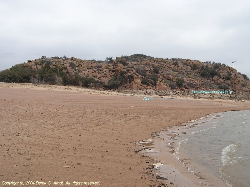
A snapshot of the boat ramp and dock on the lake's west side, with
the conservation capacity level noted:
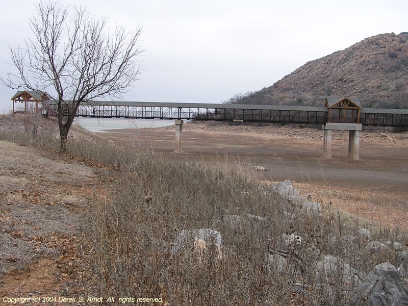
This walkway connects two wings of the impressive Quartz Mountain Lodge:
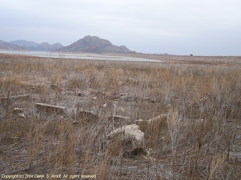
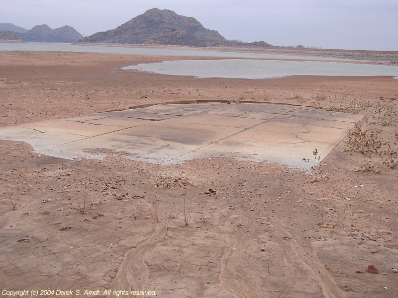
Here's a foundation a half-mile or so southeast of the main townsite.
This is in the lake bed, about 100 yards from the lake's eastern dike.
The dike comes into view about halfway up the right side of this photo.
Note the establishment of many grasses. This area has been exposed
for quite a while.
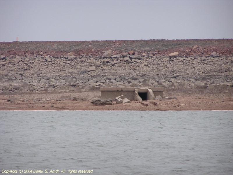
Moving a little farther out into the lake, here's what remains of one
Lugert building. This photo was taken about 1/3 mile from the dike:
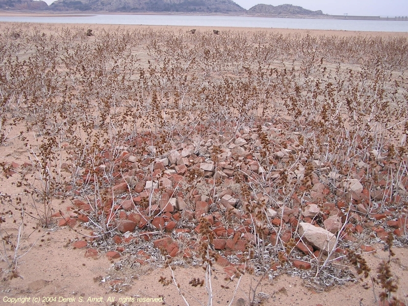
Piles of brick were commonplace all around the townsite. Lugert's
buildings were of much better construction than most early-century
agricultural/mining towns in southwest Oklahoma. A tornado destroyed
every building in town in 1912 (except for Frank Lugert's general
store), and those who chose to rebuild used sturdier materials than
frame housing.
Also notice that cockleburrs have invaded, but no grasses yet.
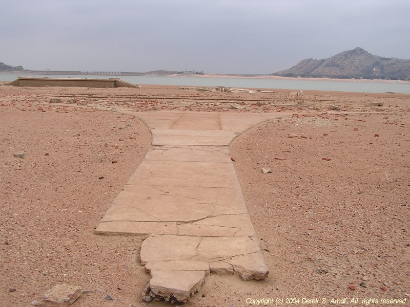
Moving farther out inot the lake, here's a slab that has been
recently revealed. This photo shows the lake's most recent decline:
The remains of the Lugert School:
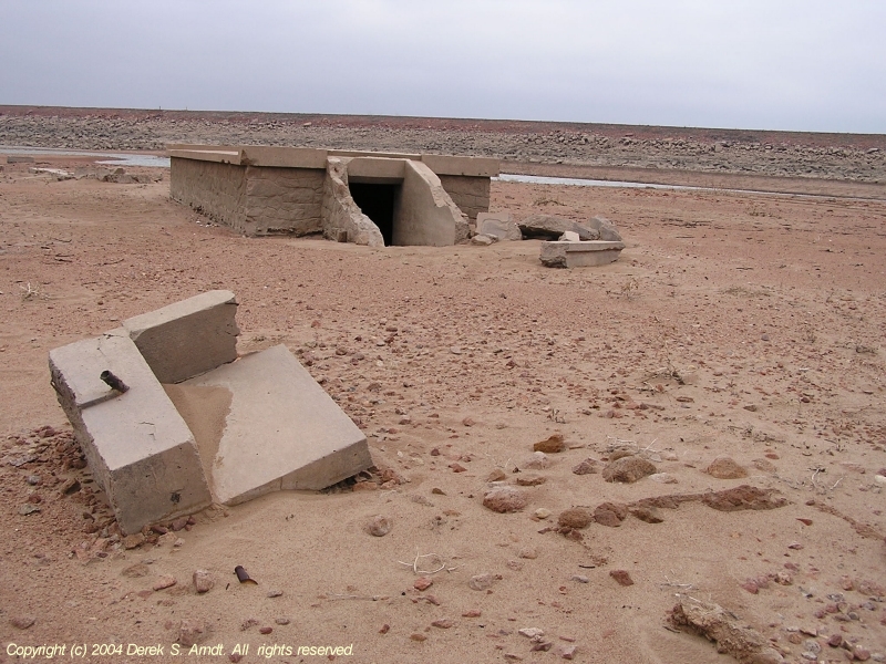
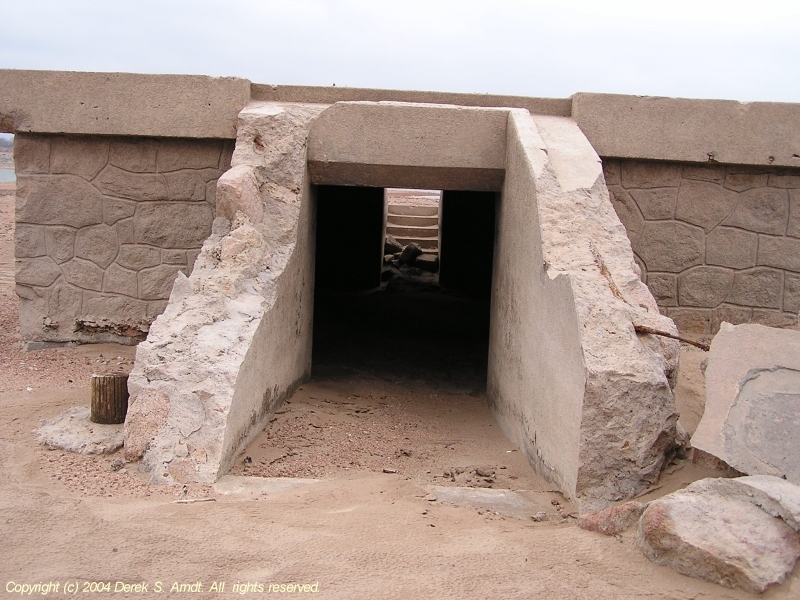
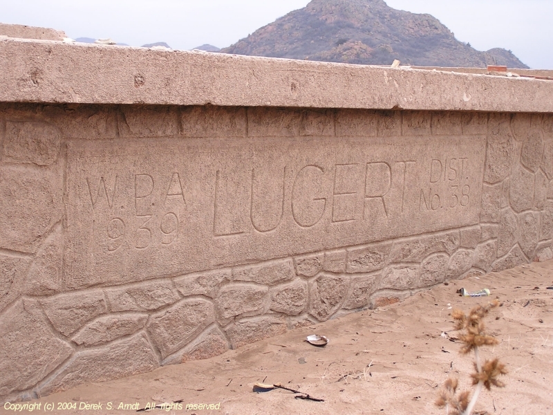
Two stories of school space sat atop this cellar, which was built
by the WPA in 1938. This foundation held Lugert's future on its
shoulders for just a few years before disapearring under the waters.
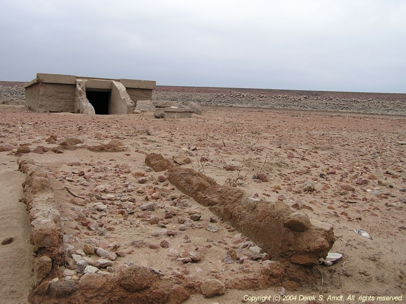
Panning back shows the magnitude of the lake's decline. Here's the
same school structure shown against the dike:
Finally, here are the remnants of a large building near the center
of the townsite. The school cellar lies immediately to the rear
of this foundation, and the dam can be seen just above the school.
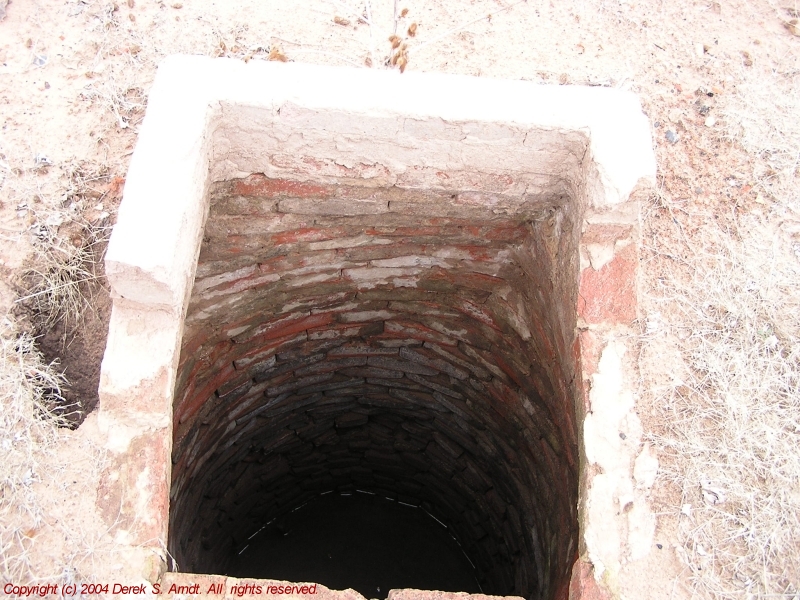
Oh, one last thing should be noted. This is a very dangerous walk,
which was previously unbeknownst to the Ticker Staff. The lake bed
is dotted with exposed wells and vaults, among the townsite's remains,
and near the remains of homes from the surrounding countryside.
There are several wells that will kill a person who falls in:
March 5 in Mesonet History
| Record | Value | Station | Year |
|---|---|---|---|
| Maximum Temperature | 92°F | ALTU | 2009 |
| Minimum Temperature | -2°F | KENT | 2019 |
| Maximum Rainfall | 0.80 inches | REDR | 2021 |
Mesonet records begin in 1994.
Search by Date
If you're a bit off, don't worry, because just like horseshoes, “almost” counts on the Ticker website!