Ticker for December 18, 2003
MESONET TICKER ... MESONET TICKER ... MESONET TICKER ... MESONET TICKER ...
December 18, 2003 December 18, 2003 December 18, 2003 December 18, 2003
Was That a Cold Front?
Mesonet Operator Cindy Standing points out a peculiar feature in
today's 24-hour Mesonet meteogram for Breckinridge:
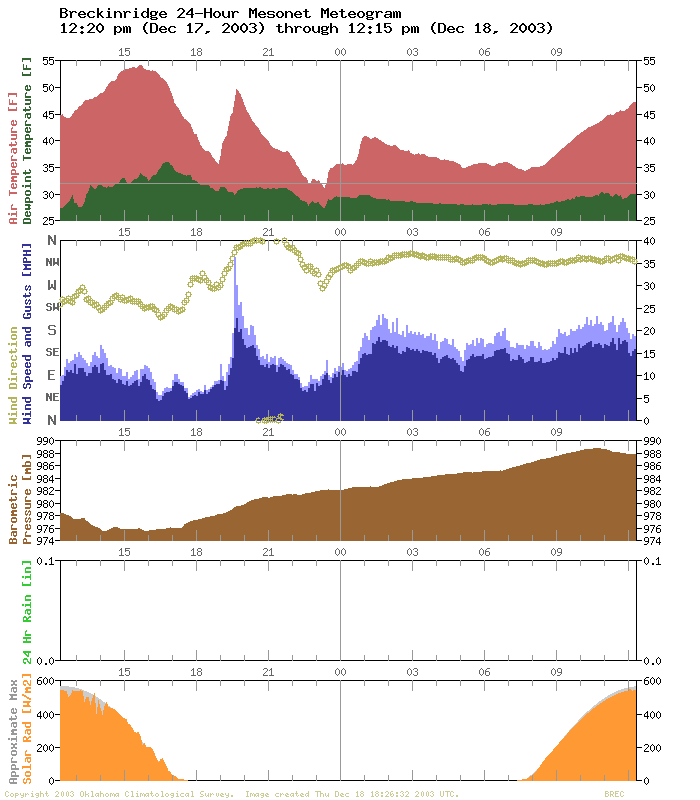
Last night, shortly after 7:00 pm, a cold front passed, winds swung
around from southwesterly to north-northwesterly and temperatures ...
uh, rose sharply? Yep, that's right! Over the next half-hour, the
temperature at Breckinridge skyrocketed 15 degrees from the mid-30s
to near 50.
Strangely enough, if you look at enough meteograms, you'll see this
phenomenon quite often. They are usually associated with:
1. Shallow or slow-moving fronts (these often go hand-in-hand)
2. Very turbulent frontal zones, and
3. Non-daylight hours.
In the "warm" regime that's about to be replaced, stratification begins
around sunset. In other words, the surface cools rapidly in comparison
to the air just a few dozen feet above the surface. This is a reliable
process that happens almost every night. The result is a slowly-growing
layer of cooler air at the surface, where we live and take temperature
measurements. Above this layer are the "remains of the day": warmer air
that has not yet cooled off.
Now, introduce a cold front to this process.
The turbulence in the vicinity of the advancing front is an
equal-opportunity mixer. When the layer of cold air is shallow, like
when the front is just arriving, the turbulence can entrain large doses
of the warmer "remains of the day". The net result is a well-mixed
blend of one part cold air, and many parts warmer air. What does that
mean for the observer sitting in Breckinridge? A rapid warm-up!
But the warming is short-lived. As the cold front advances, this
mixing process involves a deeper and deeper layer of cold air.
Eventually, the mixing involves nearly 100% cold air, and temperatures
fully reflect those of the cold air regime.
Here's a graphic reproduced from the February 16, 2000 edition of the
Ticker:

It shows this process occur over time. Imagine the
Breckinridge Mesonet station at Point 1 in relation to the front, then
at Point 2, and eventually progressing to Point 3.
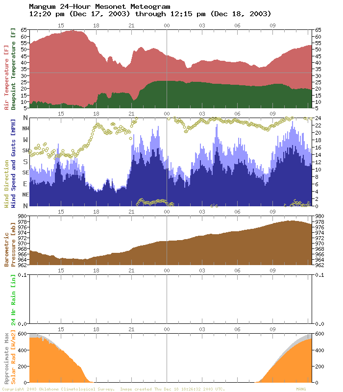
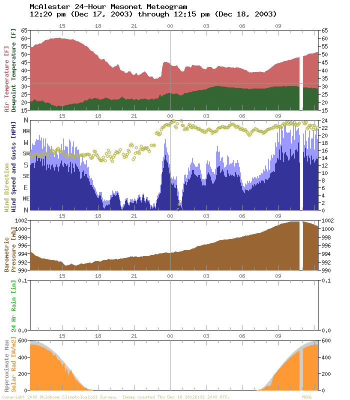
By the way, this process showed up in many Mesonet metograms last night,
though few were as dramatic as Breckinridge. We've included the Mangum
and McAlester meteograms below.
December 18 in Mesonet History
| Record | Value | Station | Year |
|---|---|---|---|
| Maximum Temperature | 76°F | HUGO | 2006 |
| Minimum Temperature | -18°F | EVAX | 2016 |
| Maximum Rainfall | 1.43 inches | WEST | 1995 |
Mesonet records begin in 1994.
Search by Date
If you're a bit off, don't worry, because just like horseshoes, “almost” counts on the Ticker website!