Ticker for February 27, 2003
MESONET TICKER ... MESONET TICKER ... MESONET TICKER ... MESONET TICKER ...
February 27, 2003  February 27, 2003  February 27, 2003  February 27, 2003


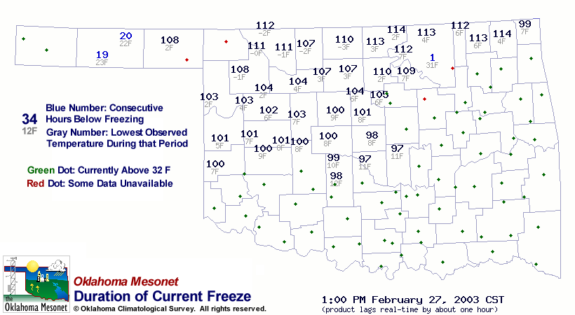
100+ Hours of Freezing Temps

The following map shows the number of consecutive hours below
freezing (and lowest temperature of that period) for Mesonet stations,
as of 1:00 pm today:


One of the state's longest extended freezes in some time is coming
to an end, at least around the edges (about 30 stations that "thawed"
for the first time today had already dropped off the above map).
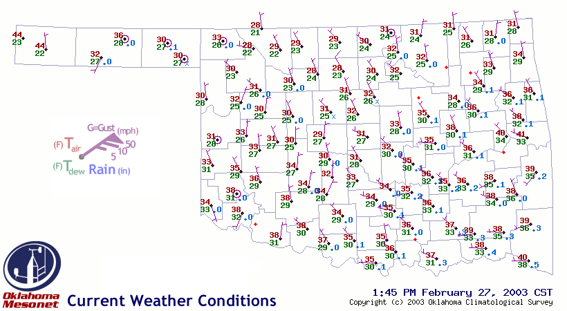
Most temperatures at the still-freezing stations are hovering around
30 degrees, as the deep snow cover helps resist further temperature
rises:


Get Ready for Phantom Rainfall

As the freeze/melt line creeps ever-northward, some snow-packed
areas of Oklahoma will begin to melt.  Some of this melt may appear
in Mesonet observations as rainfall.

Here's where scaling becomes an issue.  A person studying day-to-day
events might throw out the data.  On the other hand, this data is
extremely valuable to a person interested in long-term events, such
as drought.
February 27 in Mesonet History
| Record | Value | Station | Year |
|---|---|---|---|
| Maximum Temperature | 90°F | WALT | 2011 |
| Minimum Temperature | 4°F | BEAV | 2002 |
| Maximum Rainfall | 1.82″ | CLOU | 2018 |
Mesonet records begin in 1994.
Search by Date
If you're a bit off, don't worry, because just like horseshoes, “almost” counts on the Ticker website!