Ticker for February 18, 2003
MESONET TICKER ... MESONET TICKER ... MESONET TICKER ... MESONET TICKER ...
February 18, 2003  February 18, 2003  February 18, 2003  February 18, 2003


A Little Oklahoma History: Climatologist Perspective

As with any science, it's important for a climatolgologist to know the
ins, outs, goods, bads and uglies of his or her data set.  So, folks at
OCS have recently put the evolution of the state's cooperative observer
network under the microscope.

Oklahoma being a very young state, its formative years coincided with
the dawn of the "modern era" of the coop network.  There's still work
to be done from a science point-of-view, but some interesting maps
reveal a little about the state's history.

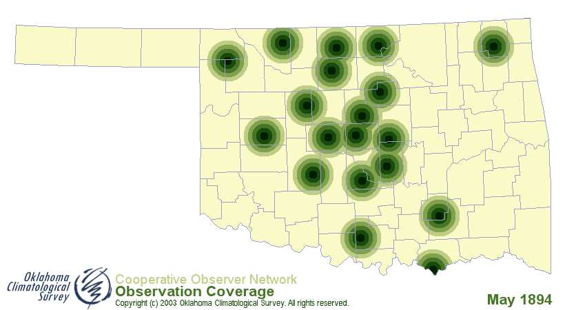
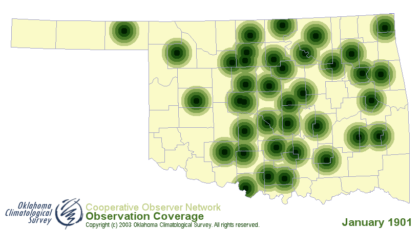
The following maps resulted from a look at the coverage offered by the
coop network on a month-by-month basis.  The green dots and rings were
used to compute station density statistics, but the important thing
to remember is that each green dot represents a station.

The first, valid for May 1894, shows clusters of development of
the coop network in the Cherokee Strip of what is now north-central
Oklahoma (opened by land run in September 1893), and the Unnasigned
Lands of what is now central Oklahoma (opened April 1889):


The second map, valid January 1901 (still almost seven years before
statehood), demonstrates the significance of settlement along the old
Chisholm Trail, which ran north-south across Oklahoma, just west of
center:


The Chisholm Trail's heyday had since passed, but the settlement
along it testifies to its impact (and the importance of weather data!).
February 18 in Mesonet History
| Record | Value | Station | Year |
|---|---|---|---|
| Maximum Temperature | 91°F | BUFF | 2016 |
| Minimum Temperature | -8°F | TIPT | 2021 |
| Maximum Rainfall | 0.78″ | TIPT | 1998 |
Mesonet records begin in 1994.
Search by Date
If you're a bit off, don't worry, because just like horseshoes, “almost” counts on the Ticker website!