Ticker for February 5, 2002
MESONET TICKER ... MESONET TICKER ... MESONET TICKER ... MESONET TICKER ...
February 5, 2002   February 5, 2002   February 5, 2002   February 5, 2002


Why so Cold in the Southeast?

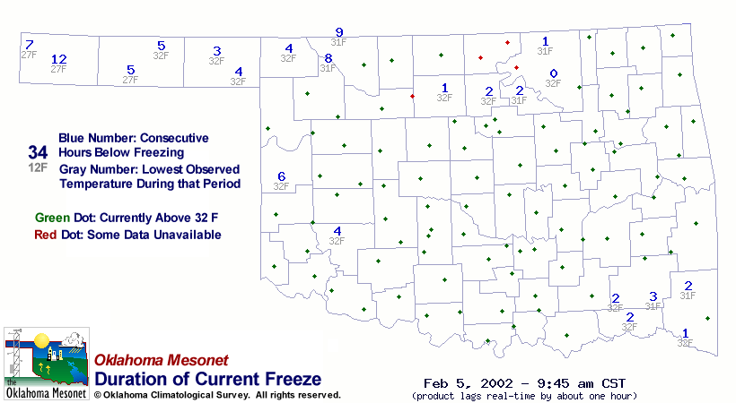
A morning glance at the Mesonet Freeze Duration map revealed that
portions of far southeast Oklahoma had been below freezing for a
few hours, while much of the rest of the state hovered above freezing:


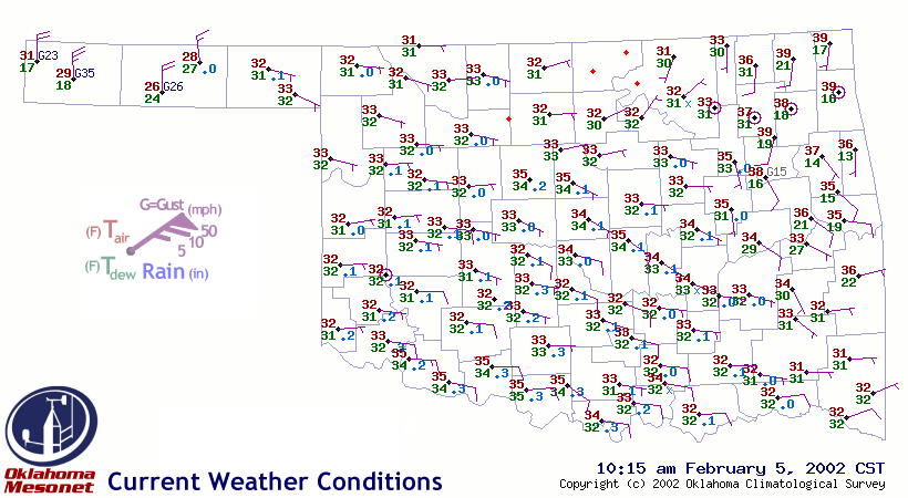
A follow-up glance at the Mesonet weather map revealed that the freeze
map wasn't lying: temps in the southeast were indeed among the coldest
in the state (by a very slight margin):


This isn't very common.  So, why did it happen?  Largely because the
state's driest air was in the southeast (which is also not common).

Today's surface temps were heavily influenced by a phenomenon commonly
known as "wet-bulbing".  When precipitation falls through unsaturated
air, some of it evaporates/sublimates.  The investment of energy into
that process lowers air temperatures, and the resulting freed water
molecules raise the dew point.  This process can continue (assuming the
precipitation continues) until the air becomes saturated at, you guessed
it, the air's wet bulb temperature, somewhere in the middle ground
between the original air temperature and original dewpoint temperature.

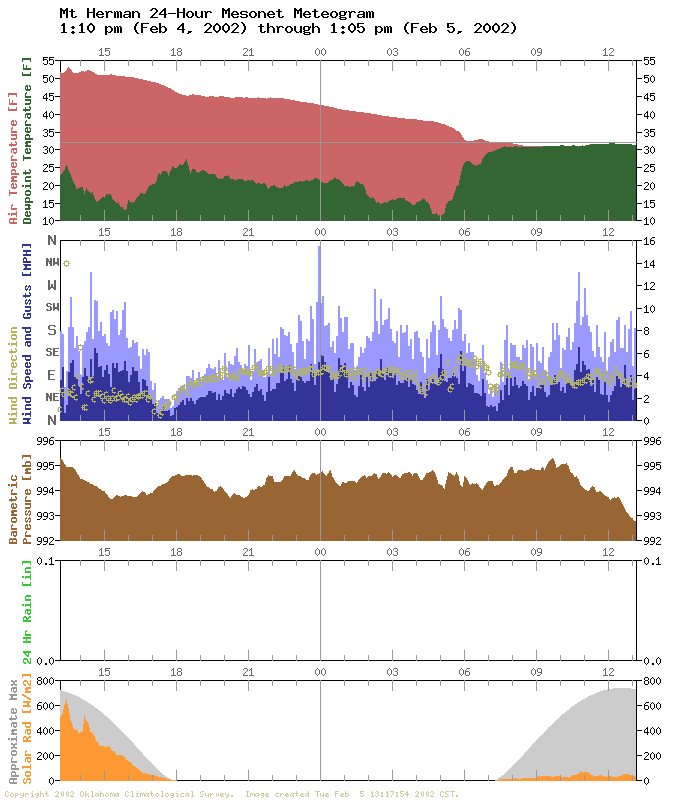
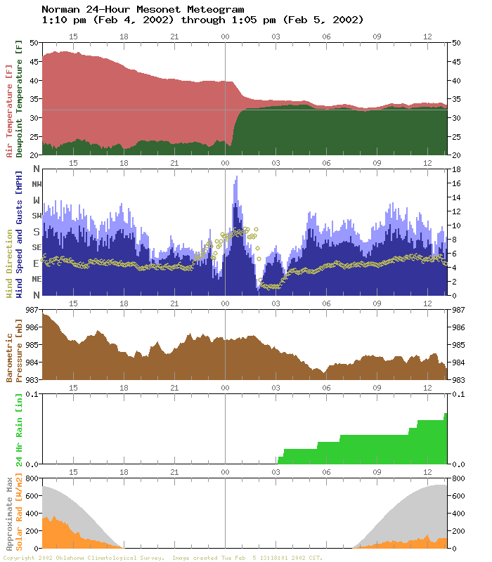
Take a look at the meteograms from Mt. Herman in southeast Oklahoma
and Norman in central Oklahoma:


Both had air temperatures near 40F when precipitation started falling
(but not necessarily accumulating).  But, because Mt. Herman was in
slightly drier air (dew points in the teens vs. the 20s), more
evaporation (and associated cooling) was required to bring the air
to saturation.  This small difference in moisture content was enough
to drop southeastern Oklahoma (and southwestern Arkansas, by the way)
below freezing: a subtle difference that could come into play on days
similar to today.

The Ticker staff is always surprised at how little precipitation it
takes to appreciably alter air temperatures.  If you want to give it
a try, go outside on a day with intermittent snow flurries: you'll
be amazed (and cold).
February 5 in Mesonet History
| Record | Value | Station | Year |
|---|---|---|---|
| Maximum Temperature | 84°F | GOOD | 2025 |
| Minimum Temperature | -2°F | BEAV | 2014 |
| Maximum Rainfall | 1.40 inches | MTHE | 2008 |
Mesonet records begin in 1994.
Search by Date
If you're a bit off, don't worry, because just like horseshoes, “almost” counts on the Ticker website!