Ticker for September 20, 2001
MESONET TICKER ... MESONET TICKER ... MESONET TICKER ... MESONET TICKER ...
September 20, 2001 September 20, 2001 September 20, 2001 September 20, 2001
Storm-scale Processes Help Woodward Set State's High Temp
One number stands out above the others on today's Mesonet high/low
temperature map:
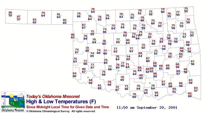
The Woodward station's maximum temperature of 87 F (as of noon) seems
a bit warm, when compared to its neighbors. That's because of a heat
burst this morning, which shows up clearly on the Woodward meteogram:
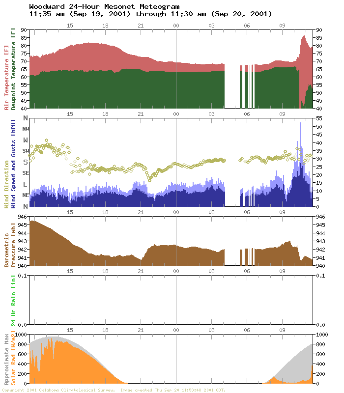
Notice the peak wind and warming associated with rapidly descending
air at about 10:30 am.
By design, the Mesonet is equipped to capture mesoscale processes.
However, one favorable side effect of this design is that it's a bit
more sensitive to even smaller scales (like those involving heat
bursts). We've seen an explosion in heat burst observations since
the installation and commission of the Oklahoma Mesonet. In fact,
so many heat bursts were observed in the first six years of the
Mesonet's operation, an OU School of Meteorology graduate student
constructed a composite event based on Mesonet surface data!
September 20 in Mesonet History
| Record | Value | Station | Year |
|---|---|---|---|
| Maximum Temperature | 107°F | FREE | 2024 |
| Minimum Temperature | 41°F | NOWA | 2003 |
| Maximum Rainfall | 5.83 inches | MTHE | 2019 |
Mesonet records begin in 1994.
Search by Date
If you're a bit off, don't worry, because just like horseshoes, “almost” counts on the Ticker website!