Ticker for March 1, 2001
MESONET TICKER ... MESONET TICKER ... MESONET TICKER ... MESONET TICKER ...
March 1, 2001 March 1, 2001 March 1, 2001 March 1, 2001
Freezing Rain Affects 20-30 Stations
Freezing rain in the last 24 hours accumulated on the wind monitors
of many Mesonet stations, which temporarily rendered wind speed
measurements as unrealistic for about one-fifth of the network.
Sensors were affected along a corridor stretching roughly from Love
and Jefferson counties in south-central Oklahoma to the Tulsa metro
area.
Temps are back above freezing this afternoon and the wind monitors
are freed from their icy restraints.
Great Meteograms
The meteogram taken this morning from Eufaula shows several
interesting features:
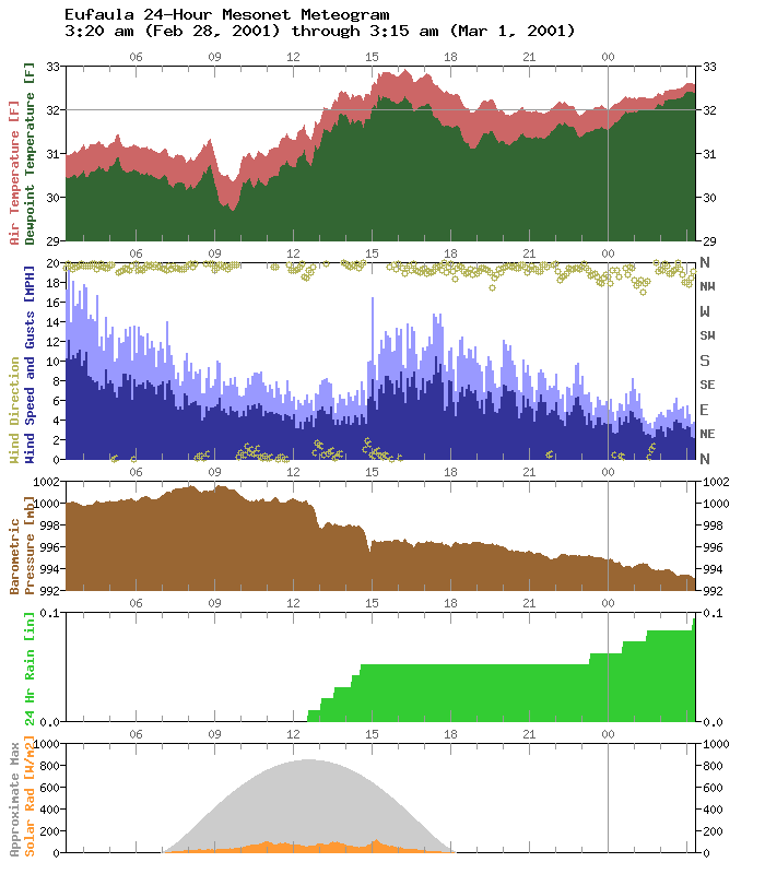
First, it's uncommon to see temperature *and* dewpoint confined to
a 4 F range over 24 hours. That's why the traces look so scraggly.
Very small changes in temperature show up well because the
meteogram is focused on such a small range.
Second, you can see the gradual degradation of the wind speed as
freezing precip accumulated on the sensor during the late morning
and early afternoon hours. Then, about 3 p.m. (in the middle of
the meteogram, the temperature climbed above freezing enough to
melt some of the accumulated ice. This is evidenced by the response
in the wind field.
Also, the Hooker meteogram is interesting as well:
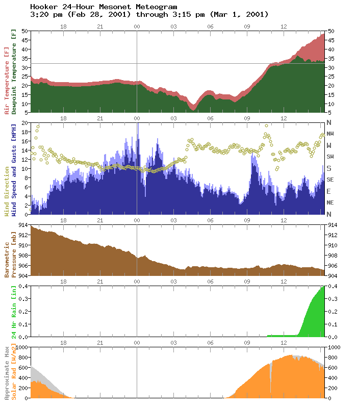
In the early afternoon temperatures recovered enough to melt the
frozen precip in the rain gauges. This resulted in some clear-sky
"precipitation" observations.
Cool stuff!
March 1 in Mesonet History
| Record | Value | Station | Year |
|---|---|---|---|
| Maximum Temperature | 95°F | NEWP | 2006 |
| Minimum Temperature | 7°F | GOOD | 2001 |
| Maximum Rainfall | 1.86 inches | HUGO | 1997 |
Mesonet records begin in 1994.
Search by Date
If you're a bit off, don't worry, because just like horseshoes, “almost” counts on the Ticker website!