Ticker for August 22, 2000
MESONET TICKER ... MESONET TICKER ... MESONET TICKER ... MESONET TICKER ...
August 22, 2000 August 22, 2000 August 22, 2000 August 22, 2000
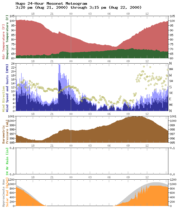
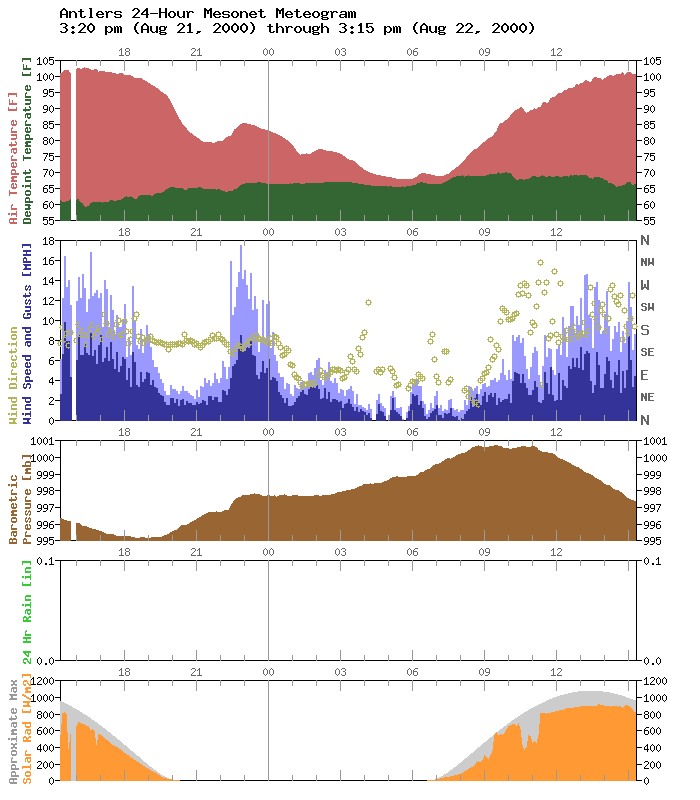
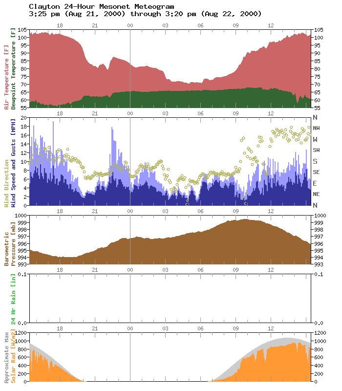
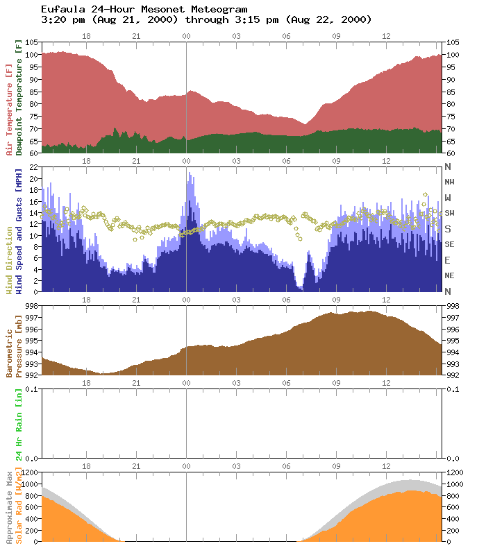
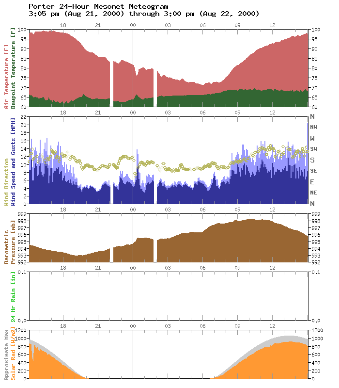
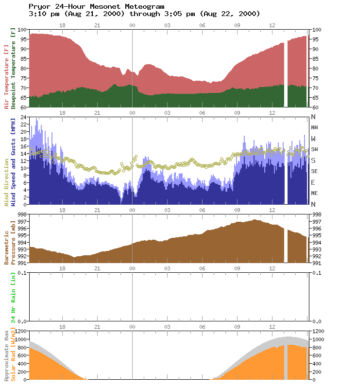
What Was That?
For the second night in the last week, folks around the Mesonet have
noticed a wave travel from south to north across eastern Oklahoma.
The feature occurred at Hugo and nearby Antlers around 10:00 pm and
propagated northward over the following hours. At each station, the
wind speeds increased dramatically as the feature passed, along with
a noticeable increase in air temperature (with the exception of Porter,
where the temperature actually decreased!).
Take a look at the feature in the following meteograms, oriented roughly
from south to north, along the "timeline":
Even stations out west got into the act, such as Durant and Ringling:
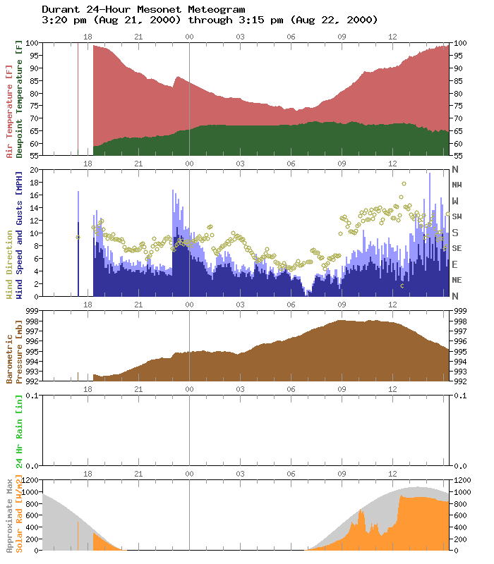

It's another example of the interesting stuff hidden in Mesonet
meteograms.
Streaks Continue
The following 100+ degree streaks are current and include today's highs:
Grandfield: 21 days (streak began Aug 2)
Walters: 21 days (streak began Aug 2)
Waurika: 21 days (streak began Aug 2)
Clayton: 20 days (streak began Aug 3)
Ringling: 13 days (streak began Aug 10)
Antlers: 8 days (streak began Aug 15)
Burneyville: 8 days (streak began Aug 15)
Cloudy: 8 days (streak began Aug 15)
Madill: 8 days (streak began Aug 15)
Broken Bow: 7 days (streak began Aug 16)
Durant: 7 days (streak began Aug 16)
Hugo: 7 days (streak began Aug 16)
Idabel: 7 days (streak began Aug 16)
Lane: 7 days (streak began Aug 16)
August 22 in Mesonet History
| Record | Value | Station | Year |
|---|---|---|---|
| Maximum Temperature | 108°F | GRA2 | 2023 |
| Minimum Temperature | 48°F | BRIS | 2016 |
| Maximum Rainfall | 4.25 inches | MRSH | 2005 |
Mesonet records begin in 1994.
Search by Date
If you're a bit off, don't worry, because just like horseshoes, “almost” counts on the Ticker website!