Ticker for December 22, 2015
MESONET TICKER ... MESONET TICKER ... MESONET TICKER ... MESONET TICKER ...
December 22, 2015 December 22, 2015 December 22, 2015 December 22, 2015
Big storm, big wet, big uncertainty!
You think I'm being glib, flippant, and many other words I had to look up to
understand what they mean? Well if you had to sort through all the forecast
discussions, data and graphics this morning, you'd be a bit punch too. And no,
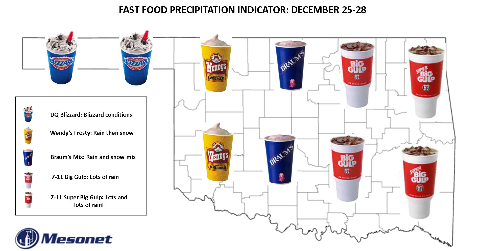
not ready for a BRAUM'S DEF-CON METER yet, still too much uncertainty. We went
with the map above, however, trying to determine the main precip type in a very
uncertain situation. We got your DQ Blizzard (Oreo!), your Wendy's Frosty, your
Braum's Mix (keep sending those checks, Braum's!), your 7-11 Big Gulp and your
Super Big Gulp. No McFlurry. Sorry McDonald's, too much moisture with this storm.
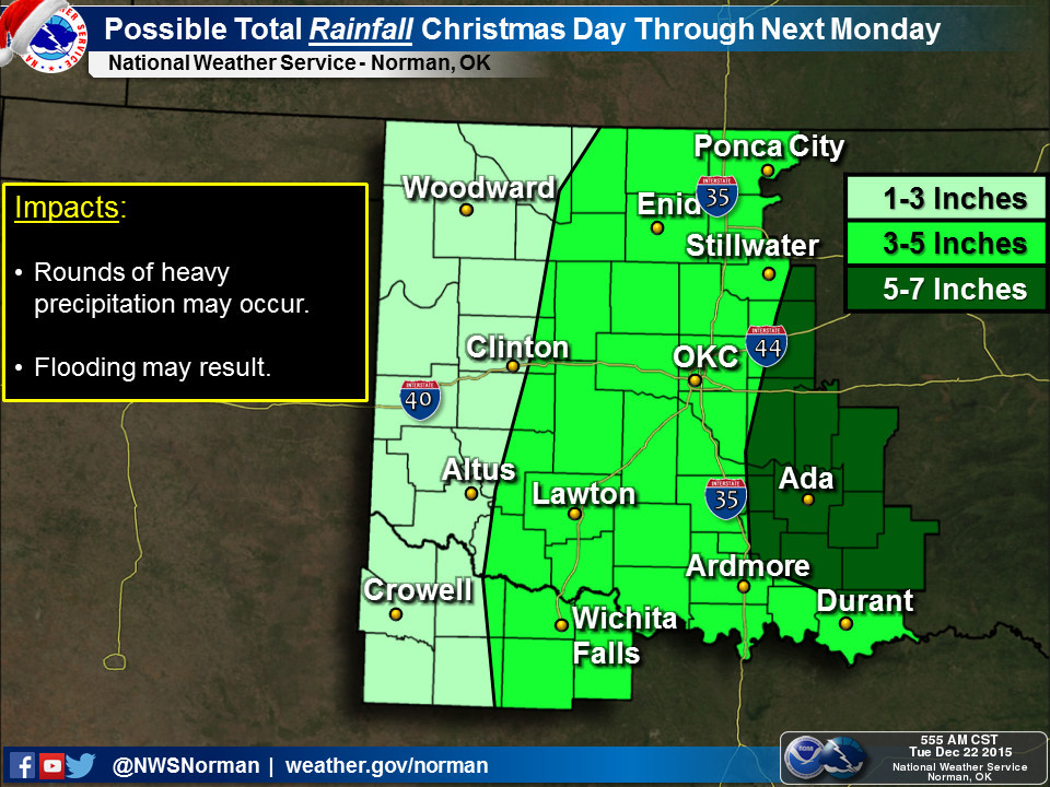
Uhhhh, 5-7 inches of rain? In December? GULP! I mean "Super Big Gulp!"
The storm's moisture is fairly locked in, from what I can tell. The totals will
waver and quiver around the map as the models get a lock on this large closed
upper low pressure system that's forecast to move over the Southern Plains this
weekend. But remember, the term "closed low, weatherman's woe" exists for a
reason. Now I could go post all the same types of certain uncertainty from the
various NWS office forecast discussions, just like yesterday, but I'd just be
repeating myself.
The main thing to remember here is to prepare for a very big, wet storm system
that will have a varying amount of cold air to work with (more in the NW, less
in the SE...I know, shocker). Precipitation types and amounts for individual
locations are still up in the air, pardon the pun, so keep your eyes and ears
trained to your favorite NWS or media (or both) weather source to stay weather
aware this weekend. Especially if you have to travel.
Oh, not you Santa. You've seen worse.
Hmmmm, I wonder if they serve McFlurry's this early...
Gary McManus
State Climatologist
Oklahoma Mesonet
Oklahoma Climatological Survey
(405) 325-2253
gmcmanus@mesonet.org
December 22 in Mesonet History
| Record | Value | Station | Year |
|---|---|---|---|
| Maximum Temperature | 76°F | WAUR | 2015 |
| Minimum Temperature | -9°F | VINI | 2000 |
| Maximum Rainfall | 2.34″ | BROK | 2017 |
Mesonet records begin in 1994.
Search by Date
If you're a bit off, don't worry, because just like horseshoes, “almost” counts on the Ticker website!