Ticker for December 15, 2016
MESONET TICKER ... MESONET TICKER ... MESONET TICKER ... MESONET TICKER ...
December 15, 2016 December 15, 2016 December 15, 2016 December 15, 2016
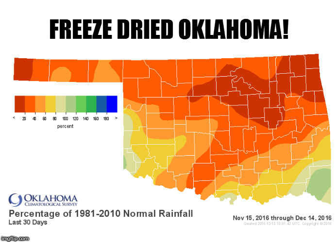
Freeze dried Oklahoma
Lost in all this talk about winter and cold and freezing and frigid and frostbite
and when-will-it-end is another hazard that gets far less notoriety, but is much
more damaging...drought. And this week, we did what's called a "reassessment" of
the drought situation across Oklahoma. We do these from time to time when we feel
like the proper drought depiction has sort of "gotten away" from us. That can mean
the data we're seeing isn't matching what's actually happening on the ground, and
that was the case over the past month or so. After some very detailed
descriptions from county level down to the individual ag producer level
communications, it was time for that reassessment. Hence, we have seen a huge jump
in the drought conditions this week since last week based on a new understanding
of the actual impacts (i.e., ground truthing).
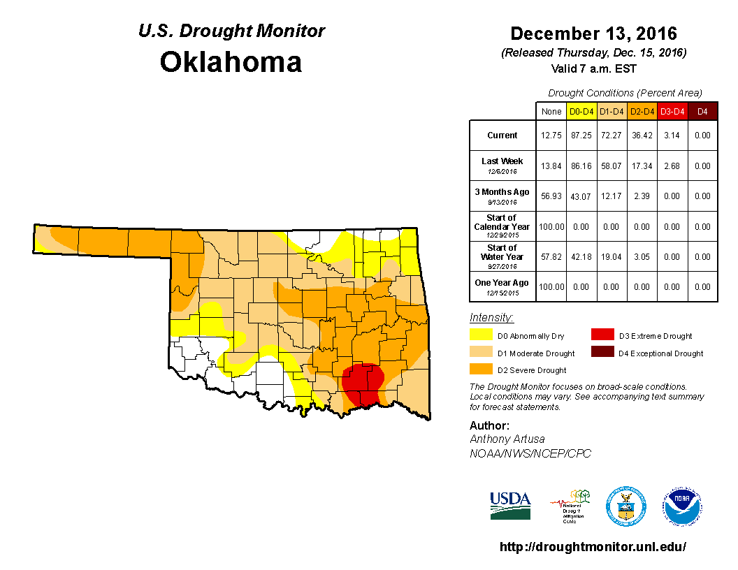
As you can see from the data table, we had a jump in the percent of OK in at
least moderate drought from 58% to 72%, and an increase in moderate/severe
drought from 17% to 36%. We were lucky to have extreme drought stay at 3%.
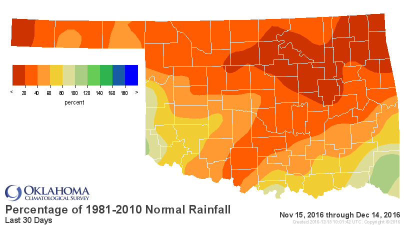
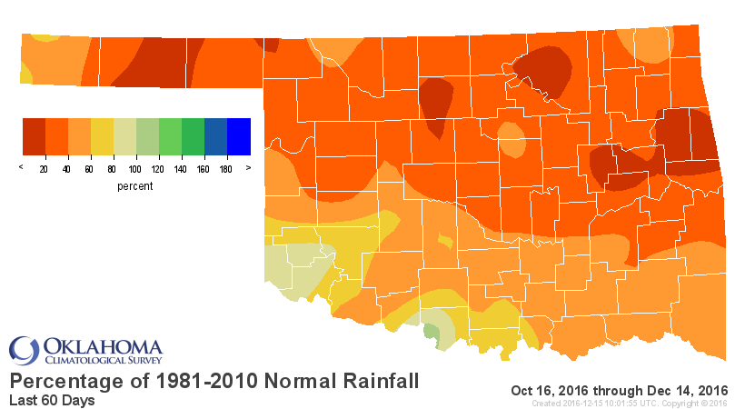
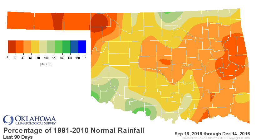
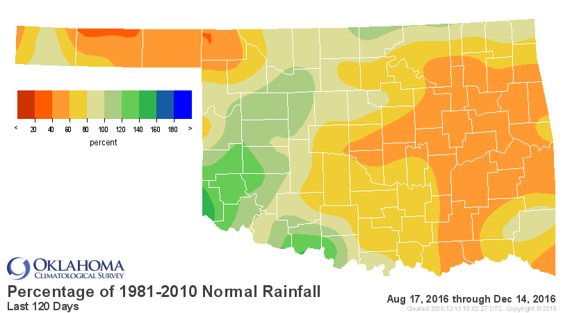
What led to this? Well, the statistics tell some of the story. Let's just look
at the 30-120 day pct of normal maps from the Mesonet.
Now you may be wondering why the big jump after it's gotten so cold, a time when
drought usually doesn't increase. No plants yearning for water, evaporation is
low, no swimming pools being filled or lawns being watered (well, most lawns
not being watered...still see folks out watering dormant bermuda grass for
some reason). Remember, before this 2-week cold snap we had just come off our
2nd warmest fall on record, in the midst of our 3rd warmest year. Many, many
reports of dry or drying-up farm ponds, failed wheat, dead pasture grass and
flagging OK reservoirs prompted the reassessment. Even some of our major
reservoirs are showing the impacts, and this is mostly water loss during the
fall.
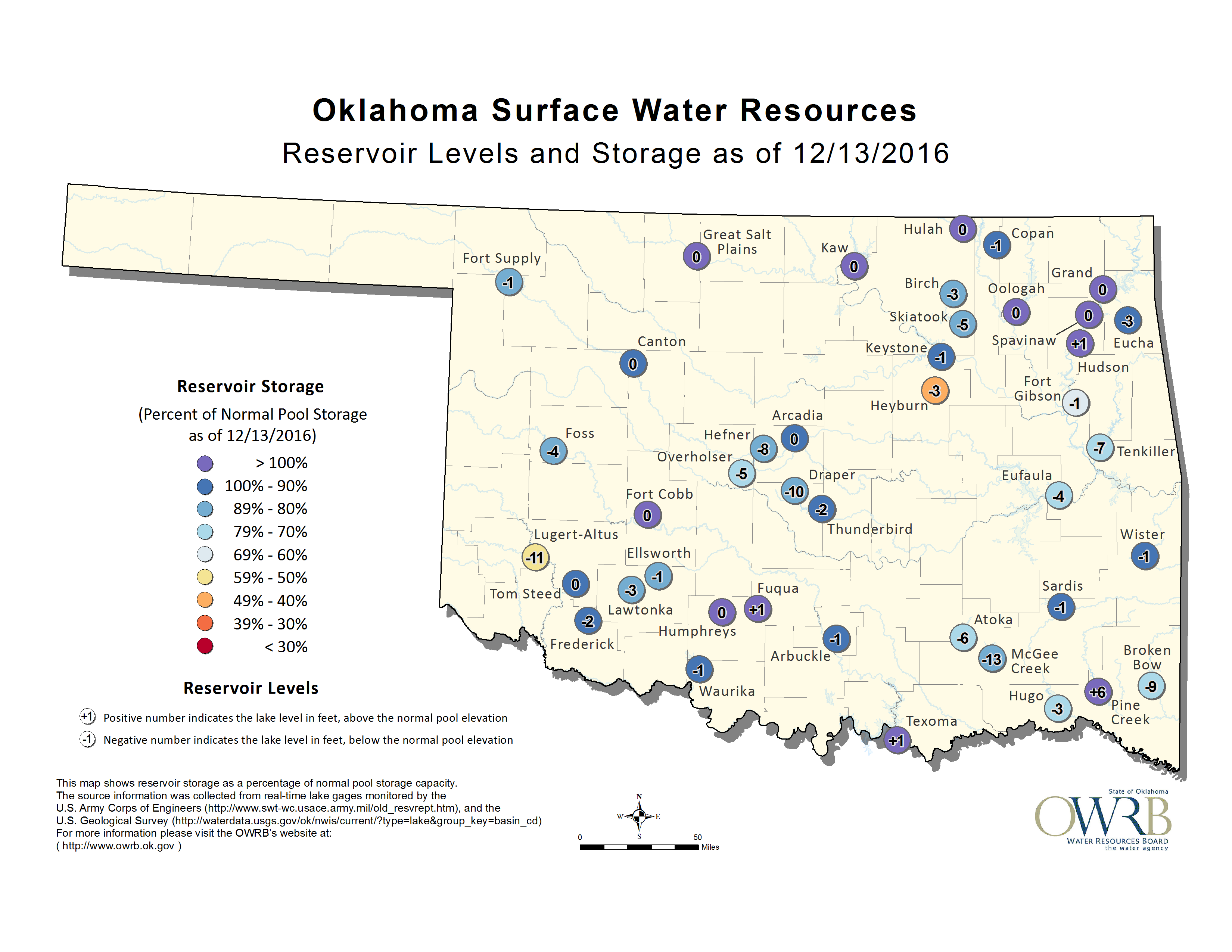
Lots of negative numbers on that image from OWRB from all over the state.
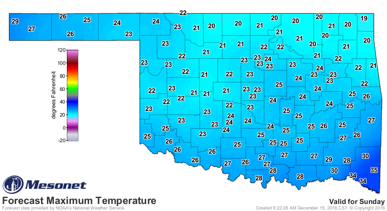
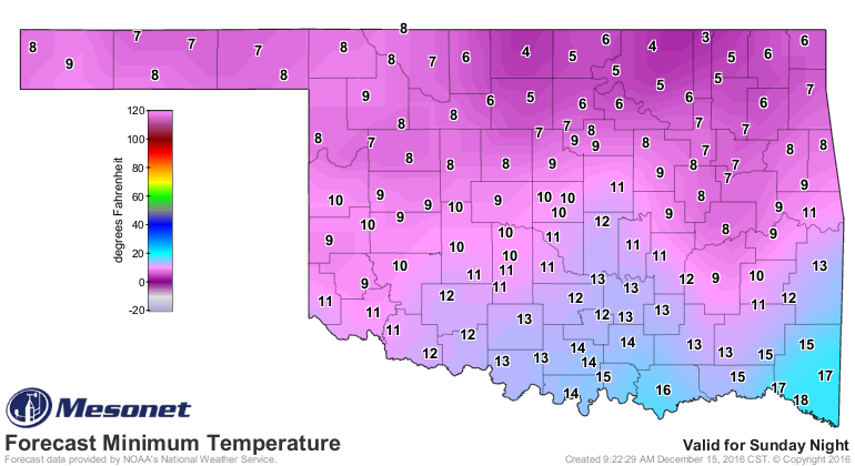
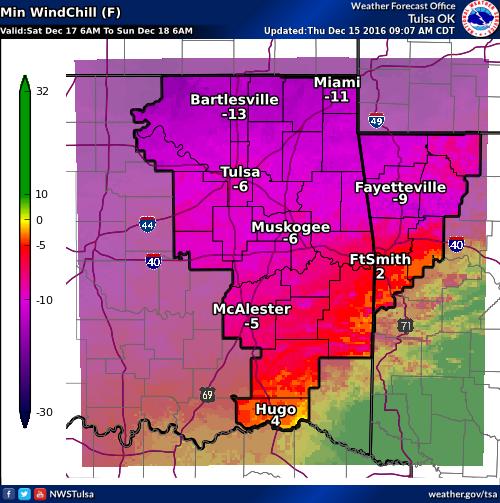
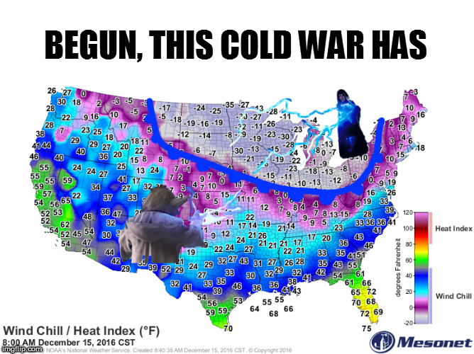
Now about that cold weather...if you hate it now, you'll loathe it this weekend.
Sometime late Friday into early Saturday, the coldest air the state has seen
since January 2015 will come barrelling through with temps struggling out of the
teens and 20s with windchills dropping below zero at times.
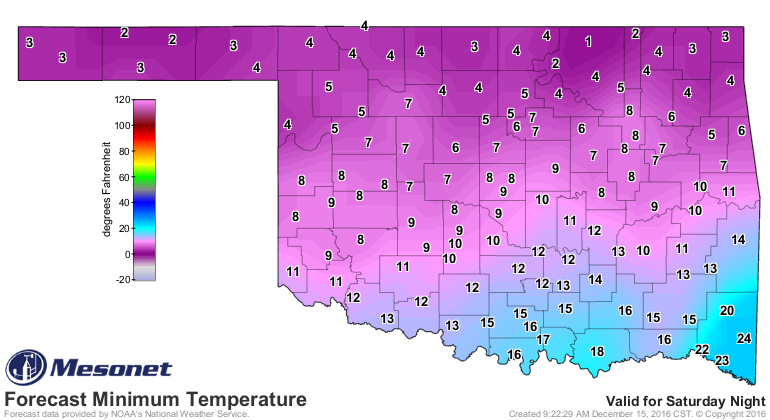
This is a DANGEROUS cold weather outbreak. This is the time to check on those
folks like the elderly, the sick and the young to make sure they have adequate
shelter, food and heat. And if you have to be outdoors, take your cold weather
safety precautions seriously because as noted, those windchills are going to
be downright nasty.
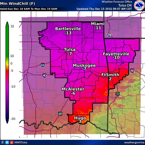
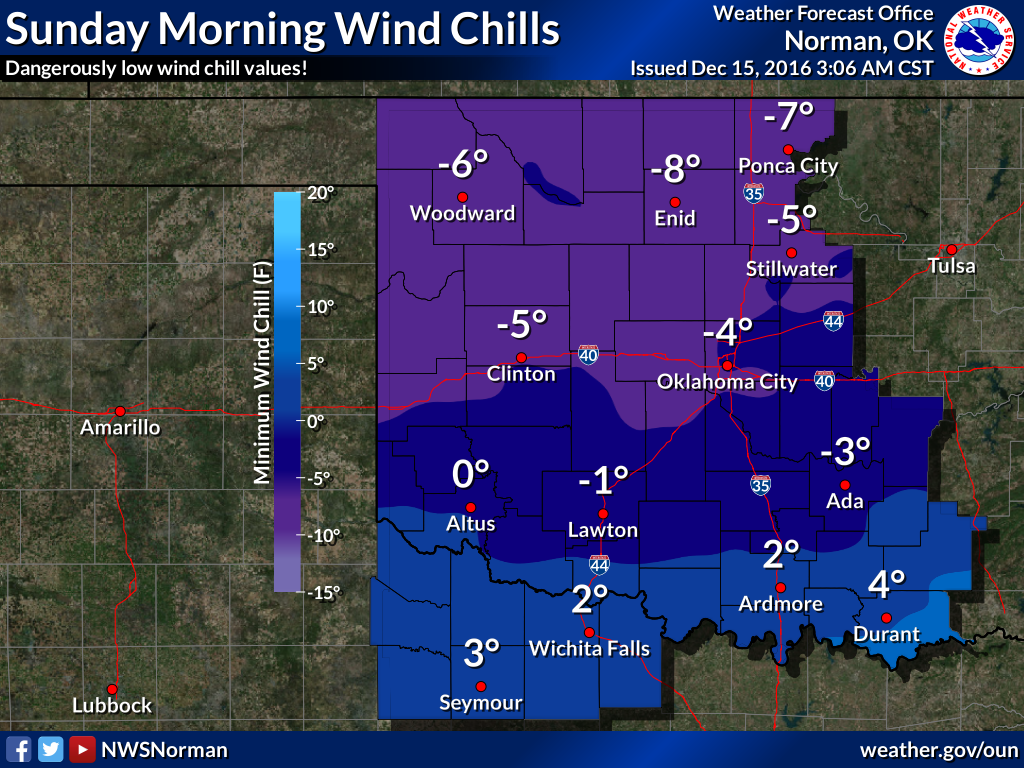
As I said, the maps from this weekend are going to look at lot like those
from Jan. 7-8, 2015, if not worse.
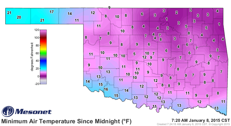
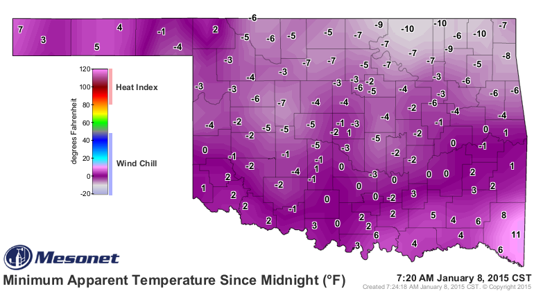
So some of the coldest air we've seen in almost 2 years, much like after what
we saw this fall with the previous arctic air outbreaks, will be a shock to the
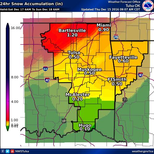
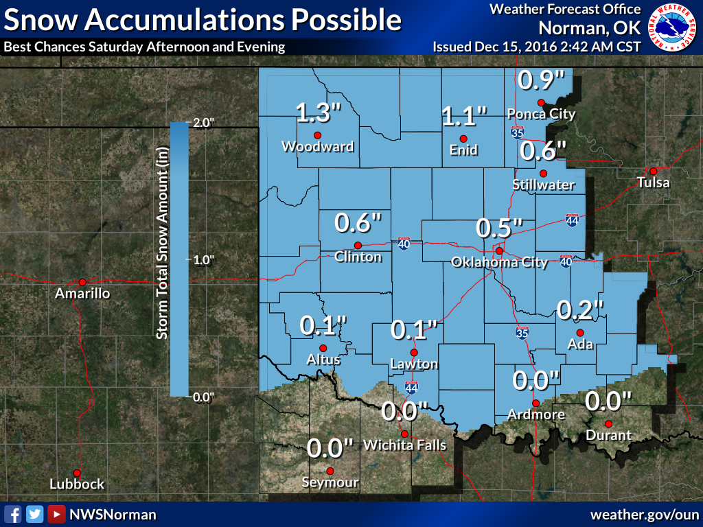
system. And we're even going to see snow, which some of you yearn for. Well,
consider yourself yearned!! Did I say that right? Well, here are the snowfall
forecasts anyway!
I'll continue to yearn for Friday. This Friday, then Friday, June 9. Surely
it will be warm that day.
Begun, this cold war has.
Gary McManus
State Climatologist
Oklahoma Mesonet
Oklahoma Climatological Survey
(405) 325-2253
gmcmanus@mesonet.org
December 15 in Mesonet History
| Record | Value | Station | Year |
|---|---|---|---|
| Maximum Temperature | 83°F | SEIL | 2021 |
| Minimum Temperature | 2°F | KENT | 2008 |
| Maximum Rainfall | 1.99″ | BBOW | 2001 |
Mesonet records begin in 1994.
Search by Date
If you're a bit off, don't worry, because just like horseshoes, “almost” counts on the Ticker website!