Ticker for December 14, 2017
MESONET TICKER ... MESONET TICKER ... MESONET TICKER ... MESONET TICKER ...
December 14, 2017 December 14, 2017 December 14, 2017 December 14, 2017
Drought Wars: The Last Rain
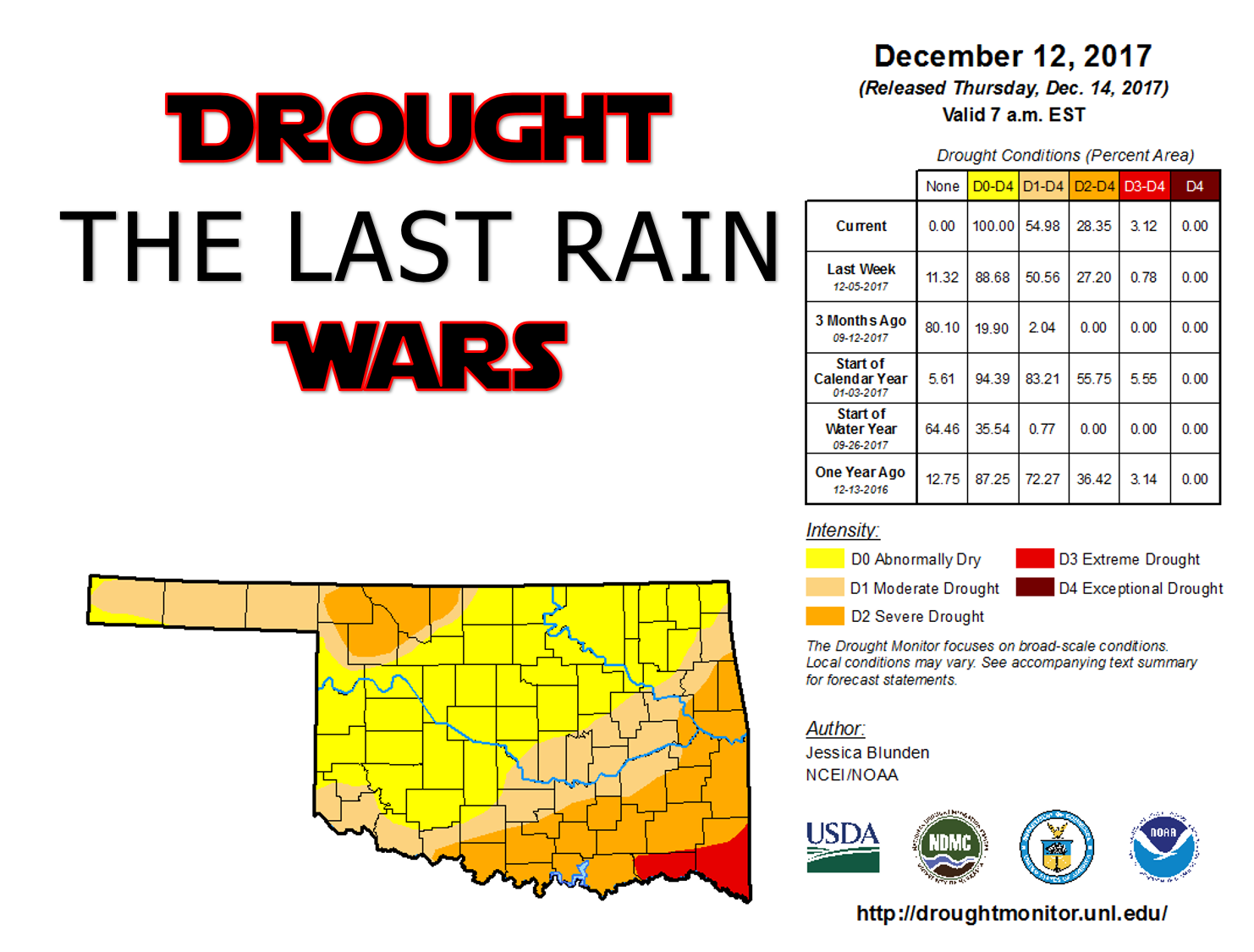
Yes, we've pegged the meter on the nerd scale, but when Mother Nature gives you a
completely colored in drought map, you make Corellian Ale...errr, I mean lemonade.
And for those purists, here's the nasty looking map sans nerdiness, this time
with the drought categories broken down into categories.
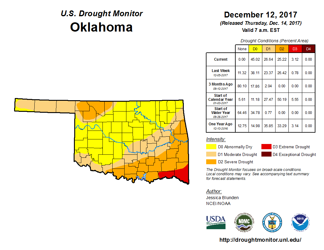
Well one thing that jumps out at ya right away is that there is no more D-NADA
(or in Drought Monitor terms, no area less than D0). So the entire state is at
LEAST in Abnormally Dry (D0) conditions. The D0 designation is used to either
indicate areas going into or coming out of drought. In this case, obviously areas
going INTO drought. Then we have 27% in moderate, 25% in severe, and now 3%
in extreme drought.
The good news? No Exceptional drought (D4)!
The bad news? 55% of the state is in drought.
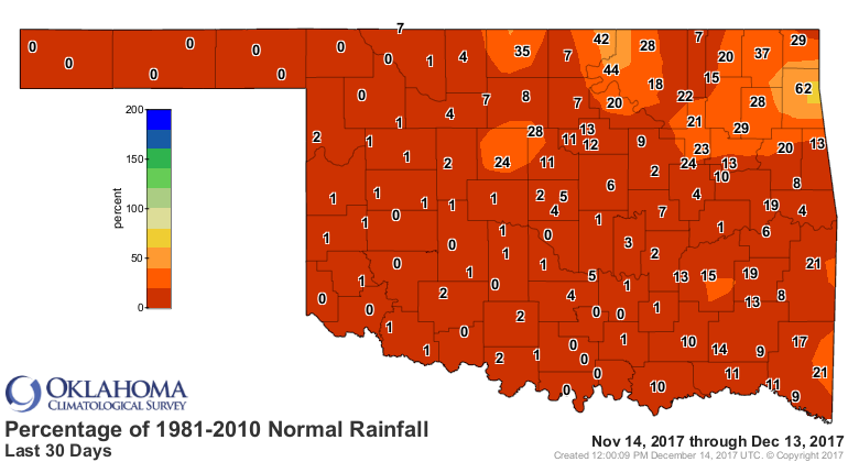
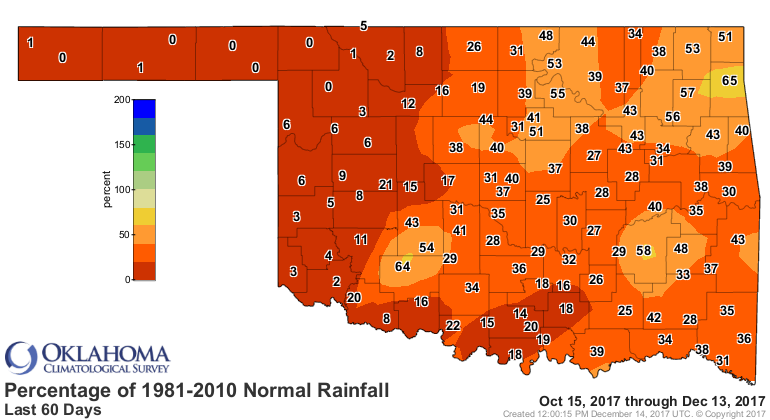
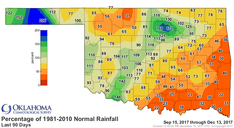
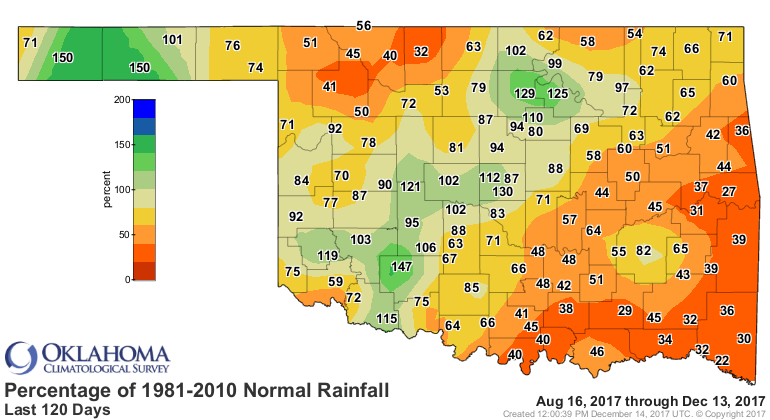
We've shown these maps to death, but we'll just show you the percent of normal
maps from 30-120 days out to show you how the drought has progressed.
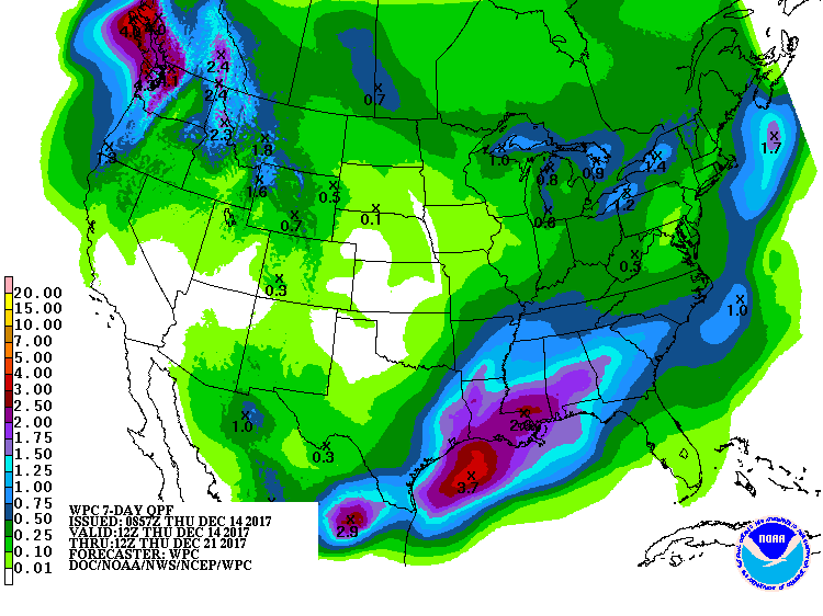
How about some relief coming up? Well, not much, at least not in the next
7 days.
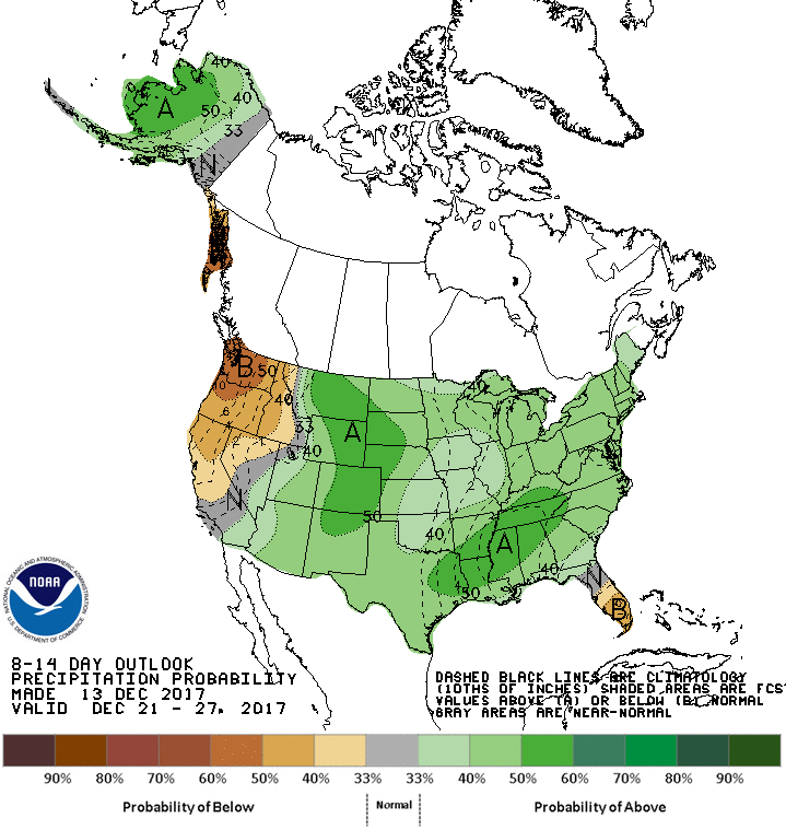
There are still some indications we might see a pattern change as we approach
Christmas, with some true arctic air and a breakdown in the ridge to our west
that keeps blocking all those storm systems from bringing us some decent
precip. It's finally showing up on the CPC temp and precip outlooks for late
next week through the Christmas Holiday.

Again though, I'd have to urge caution on this outcome for now as we're still
quite a ways out, and the storm we're talking about is still out in the pacific.
As per usual, wait until it approaches the continental U.S. and gets sampled
by our NWS data gathering instruments so the forecast models can get a better
handle on it. It takes lots of precise timing to get a good storm system to
produce (especially if you're looking forward to the white stuff), and that
timing is iffy this far out.
In reality, what we need is a large low pressure system to slowly approach us
from the west, allow those southerly winds to transport a lot of moisture up
our way from the Gulf of Mexico, then have that storm system have its way
with the moisture. You want frozen stuff? Well, add some cold air.
When we get in a persistent drought pattern, I like to say "I'll believe it when
I see it." Rain, that is. For instance, the Canadian forecast model doesn't
exactly lend a lot of confidence to this scenario yet, with only a 30-40%
chance of seeing at least an inch of liquid precip accumulate between now and
Dec. 29.
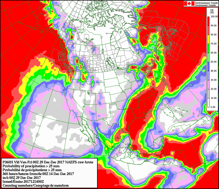
But hey, what do the Canadians know? They're a bunch of Bantha herders!
May the Rain be with you, always.
Gary McManus
State Climatologist
Oklahoma Mesonet
Oklahoma Climatological Survey
(405) 325-2253
gmcmanus@mesonet.org
December 14 in Mesonet History
| Record | Value | Station | Year |
|---|---|---|---|
| Maximum Temperature | 83°F | ARNE | 2021 |
| Minimum Temperature | -3°F | MEDF | 2000 |
| Maximum Rainfall | 2.69″ | SLAP | 2023 |
Mesonet records begin in 1994.
Search by Date
If you're a bit off, don't worry, because just like horseshoes, “almost” counts on the Ticker website!