Ticker for December 1, 2011
MESONET TICKER ... MESONET TICKER ... MESONET TICKER ... MESONET TICKER ...
December 1, 2011 December 1, 2011 December 1, 2011 December 1, 2011
November Rains Have Drought on the Run in Oklahoma
November Rains Have Drought on the Run in Oklahoma
With Oklahoma experiencing one of its most severe droughts on record, an extended
period of above normal rainfall was desperately needed. Fortunately, that is
exactly what occurred as Oklahoma enjoyed its 12th wettest November since records
began in 1895. According to preliminary data from the Oklahoma Mesonet, the month
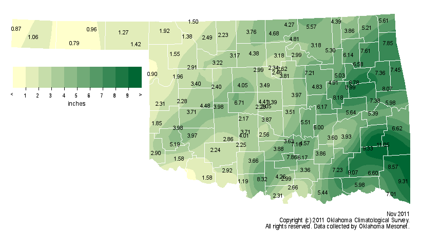
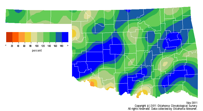
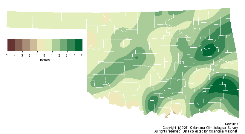
finished more than an inch above normal with a statewide average of 4.22 inches.
Combined with September and October, the climatological fall season still came up
a bit short with an average of 8.61 inches across the state, 1.4 inches below
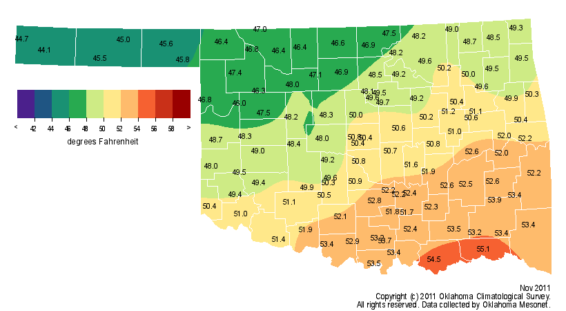
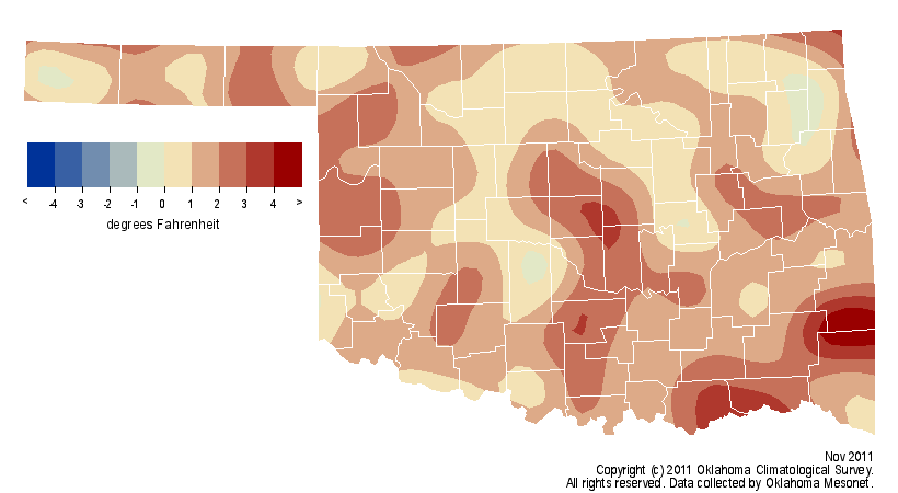
normal. The month was also a bit on the mild side at 1.2 degrees above normal,
the state?s 52nd warmest November on record. Oklahoma?s summer, officially the
hottest since 1895 for any state, propelled the January-November period to the
fifth warmest on record at 2.3 degrees above normal.
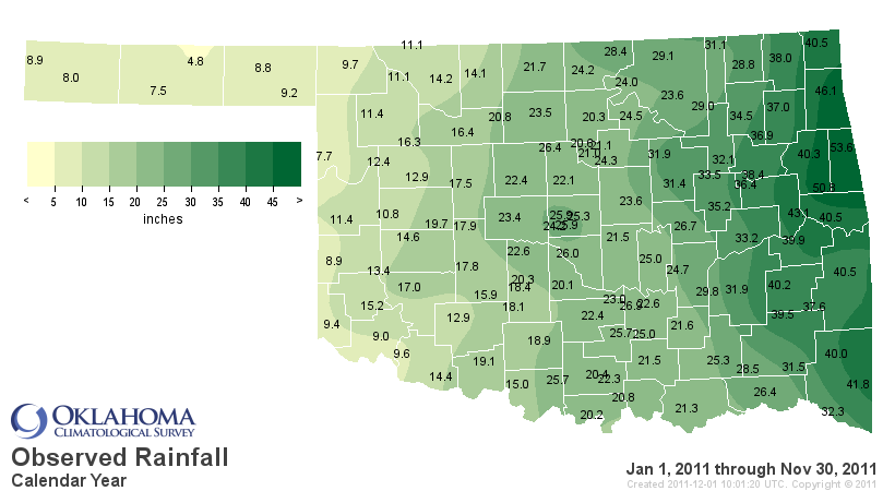
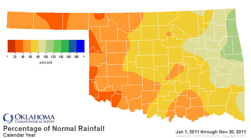
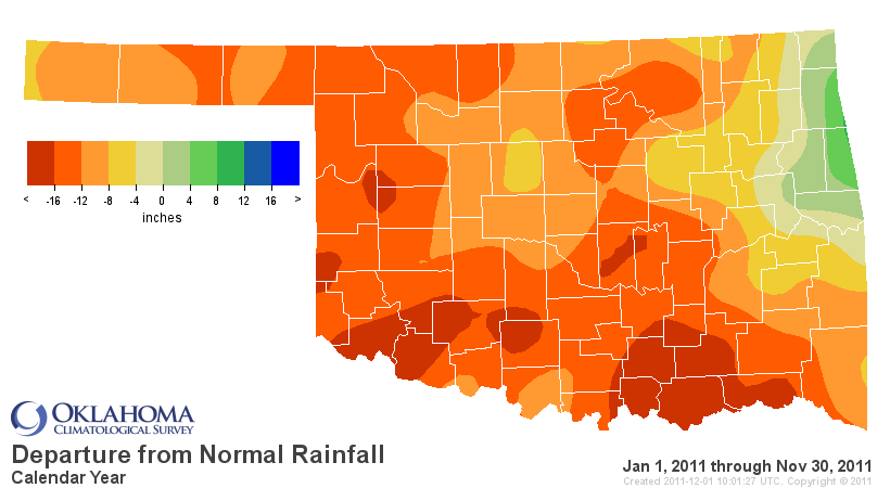
Nov. rainfall maps:
Nov. temperature maps:
Significant long-term precipitation shortfalls remain across much of Oklahoma.
The January-November statewide average finished at 22.67 inches, 12 inches
below normal, to rank as the ninth driest such period on record. The western
half of the state remained the hardest hit during that period with average
deficits ranging from 10 inches in the Panhandle and the northwest to 15 inches
in the southwest. South central Oklahoma?s deficit was still a whopping 18
inches even after the recent rains. For western and south central areas of the
state, the January-November period was one of the top-three driest since 1895.
The Oklahoma Mesonet site at Hooker has recorded less than 5 inches of rain for
the year thus far. The lowest annual total for any location in Oklahoma dating
back to the late 1800s is Regnier?s 6.53 inches from 1956. Twelve Mesonet sites
in far western Oklahoma have recorded less than 10 inches of rainfall for the
year, with another 13 reporting 15 inches or less.
January-November precipitation maps:
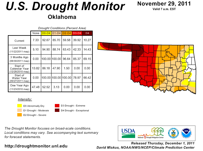
The latest Drought Monitor released on Thursday, Dec. 1, now has only 10
percent of the state in the exceptional drought category. The exceptional
category is the worst possible designation under the Drought Monitor intensity
scale. That figure was 69 percent at the end of August. Approximately 40
percent of the state remains in the extreme-exceptional category, the worst two
designations. All of that hardest hit area lies in the western half of the
state. In Contrast, over 85 percent of the state was covered in extreme-
exceptional drought three months ago. The Drought Monitor now has 85 percent of
the state under some drought designation, from moderate to exceptional on the
intensity scale. Only three percent of the state was considered to be in
drought at this time a year ago.
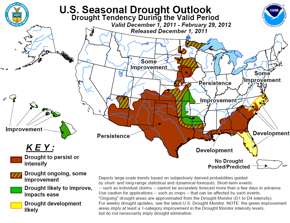
The latest Seasonal Drought Outlook from the National Weather Service?s Climate
Prediction Center expects the eastern half of Oklahoma to see drought
conditions improve over the next three months. The outlook is effective for
December-February. The western half of the state is expected to see drought
persist or intensify over that period. Additional moisture expected during the
first two weeks of December is the basis for the possible improvements in
eastern Oklahoma.
Winter is an important moisture recharge period for Oklahoma?s soils and
reservoirs. December-February is a climatological dry period, but it is also a
time of low water demand. Dormant vegetation, less sunlight and cooler
temperatures result in much less moisture loss due to plants and evaporation.
That recharge of moisture can be vital should dry conditions persist in early
spring when moisture demands begin to increase once again.
Gary McManus
Associate State Climatologist
Oklahoma Climatological Survey
(405) 325-2253
gmcmanus@mesonet.org
December 1 in Mesonet History
| Record | Value | Station | Year |
|---|---|---|---|
| Maximum Temperature | 86°F | HOLL | 2012 |
| Minimum Temperature | 0°F | SEIL | 2006 |
| Maximum Rainfall | 0.75″ | WATO | 2015 |
Mesonet records begin in 1994.
Search by Date
If you're a bit off, don't worry, because just like horseshoes, “almost” counts on the Ticker website!