Ticker for October 27, 2022
MESONET TICKER ... MESONET TICKER ... MESONET TICKER ... MESONET TICKER ...
October 27, 2022 October 27, 2022 October 27, 2022 October 27, 2022
BOO!
Yeah, you SHOULD be frightened. It has now rained twice across the SE three-quarters
of the state or so, and the forecasts were actually right on the money!
It's true.
So we're good on the rain now, right? This coming rain is just gravy (man, imagine how
glorious THAT would be!), right?
WRONG!
NW OK folks would kill for some gravy AND rainfall.
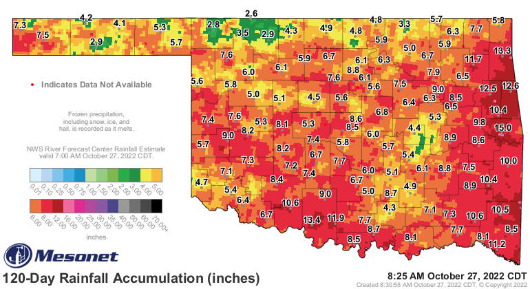
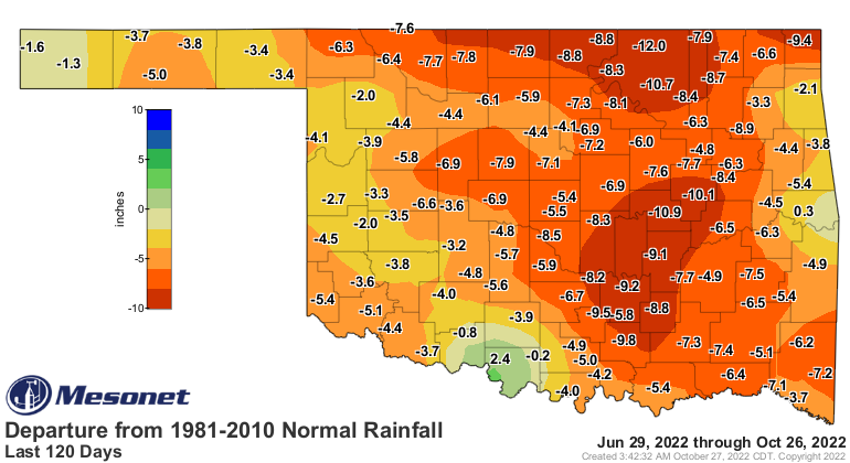
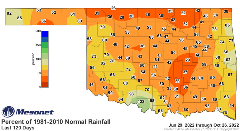
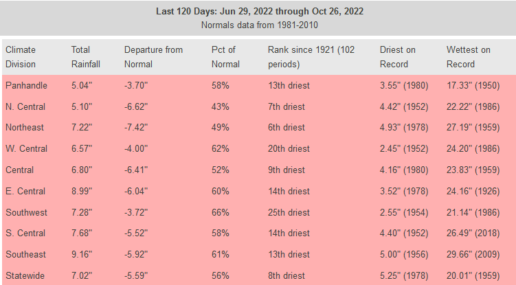
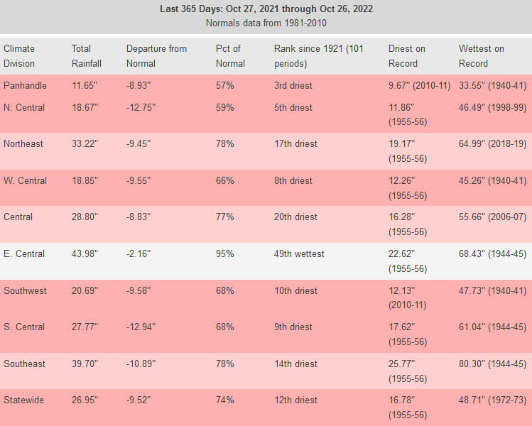
But the last 120 days doesn't cover the drought. The shorter-term drought actually
goes back to June 11, so missing about 3 weeks on those maps. AND the longer-term
drought actually goes back to August 2021, which is why the tiny surpluses you see
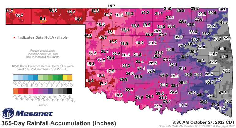
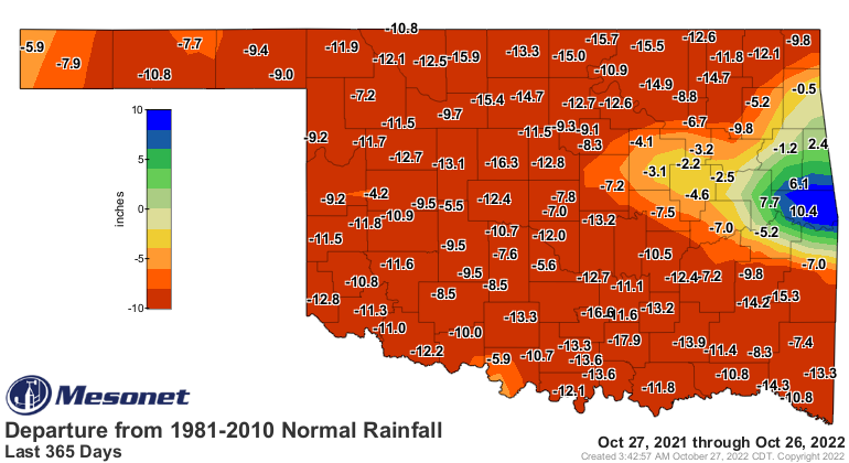
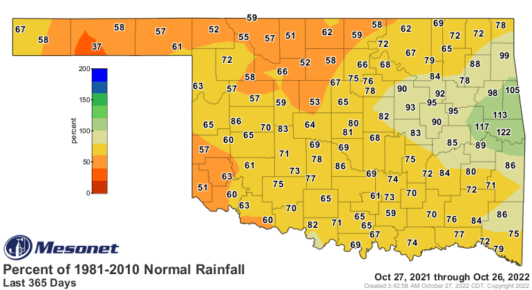
on the 120-day map don't result in drought removal. Check out the 365-day rain maps,
for example.
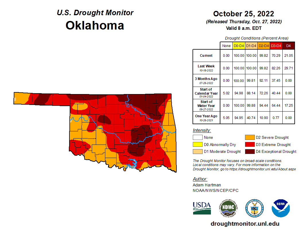
AHA! Another bit of surplus over in far eastern OK. But the 120-day maps showed a
deficit over there, so with drought and rain, it's all in the timing, the amounts,
the intensity, and the impacts.
At any rate, we are left with this drought picture for the state:
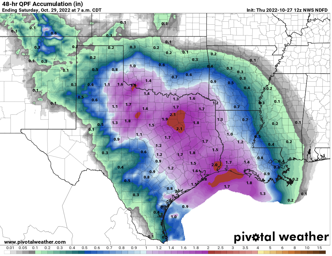
Now we are once again seeing rain chances beginning later today into tonight and
tomorrow morning, even lingering a bit into Saturday. Rainfall amounts will be
significant enough across southern OK to produce more drought relief, but it does
appear northern OK is going to be left out on the heavier totals.
However, don't despair, NW OK...okay, despair just a little bit, but it does appear
another big storm system will move in from the west next week.
October 27 in Mesonet History
| Record | Value | Station | Year |
|---|---|---|---|
| Maximum Temperature | 91°F | MANG | 2014 |
| Minimum Temperature | 15°F | BOIS | 2020 |
| Maximum Rainfall | 4.03″ | EUFA | 2004 |
Mesonet records begin in 1994.
Search by Date
If you're a bit off, don't worry, because just like horseshoes, “almost” counts on the Ticker website!