Ticker for August 22, 2022
MESONET TICKER ... MESONET TICKER ... MESONET TICKER ... MESONET TICKER ...
August 22, 2022 August 22, 2022 August 22, 2022 August 22, 2022
BRO!
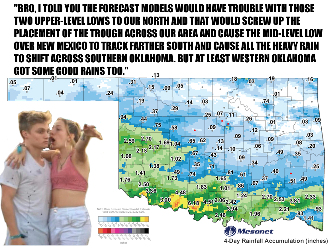
Well, at least that's what a Norman NWS forecaster surmised about our wayward
axis of heavy rain shifting 200 miles south in the forecast models over the span
of about 48 hours. I guess we just have to be thankful that at least part of the
state saw significant drought-quenching rains over the last three days. Here are
some of the more generous totals over the period. And keep in mind it's still
raining down south as I type.
-***-
Aug. 19-22 Rain Totals
-----------------------
Waurika 6.13"
Ringling 4.51"
Walters 4.49"
Madill 3.85"
Cloudy 3.81"
Tipton 3.37"
Grandfield 2.97"
Butler 2.70"
Cheyenne 2.59"
Ardmore 2.52"
Altus 2.50"
Burneyville 2.50"
-****-
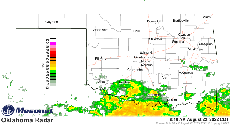
The radar estimated rainfall shows a large area of 4-6 inches of rain down
across southern Oklahoma, with some totals in very localized areas probably
approaching 8+ inches. So a ginormous amount of rain over a short time frame
that obviously led to some pretty serious flooding concerns.
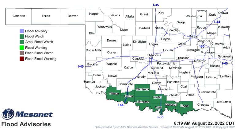
And we also managed to reset these maps that were getting pretty ugly (and I
know ugly, Bro!).
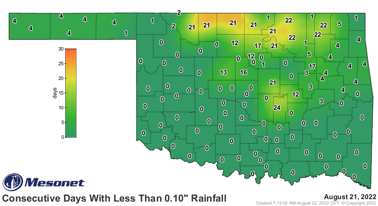
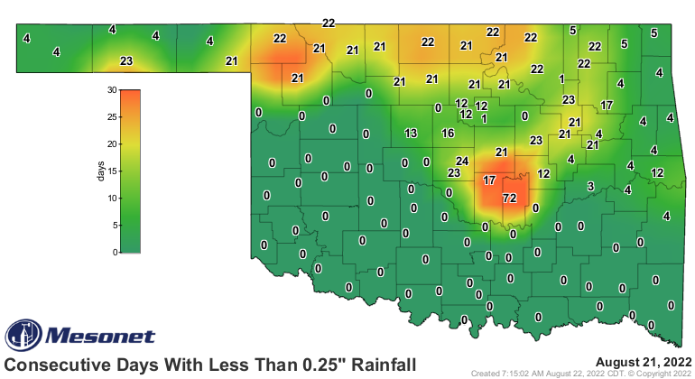
Heck, the 6.18 inches (and counting) of rain at Waurika is more than they had
seen in the previous 87 days combined, dating back to May 25!
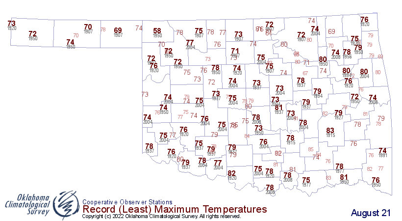
Another benefit of all the clouds and rainfall is the much milder (if not
much more humid) weather. We even saw some record low maximum temperatures
yesterday across western Oklahoma where some sites failed to eclipse the 60s

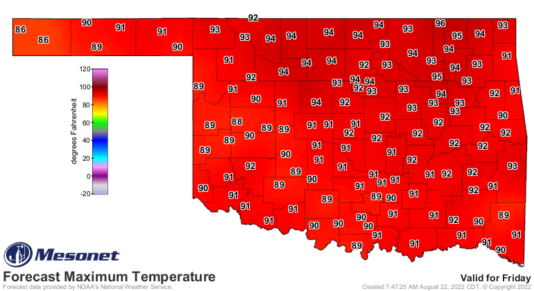
And while we will bust up into the 90s a couple of times this week across
parts of Oklahoma, it does appear that we have transitioned from "hot most of
the time but broken up by a day here or there with some cooler weather" to
just the opposite. At least for the time being. Now we should see an extended
period of seasonable-to-cooler than normal weather, with maybe a few hot days
intermixed, at least for another week or two. The heat will be concentrated up
in northern Oklahoma where the rain missed, but don't count out some high heat
index values to the south. Friday is a good example of what to expect.
I'll believe we've switched for September when you pry the hot weather from
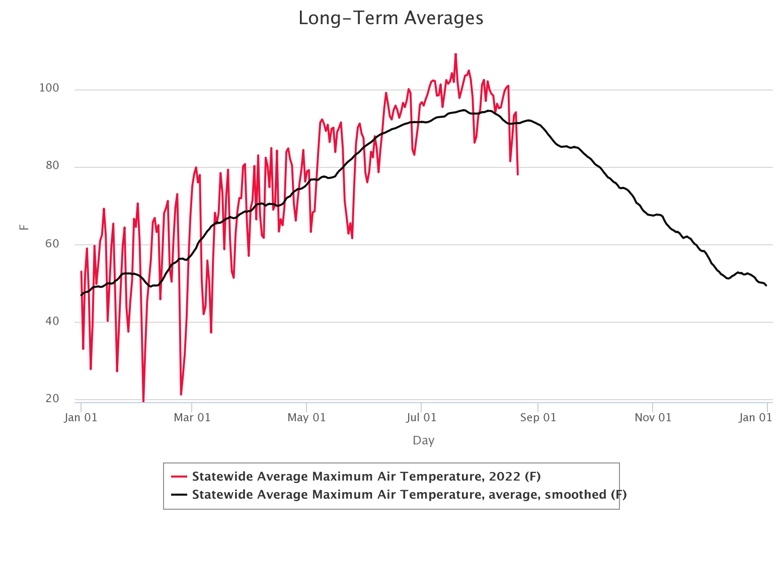
my cold dead hands, however. But, that long-term average high temperature graph
starts a pretty sharp downward trend as we get into September. And notice the
mostly steady above normal weather we've seen with that persistent heat dome
over the area since June 11.
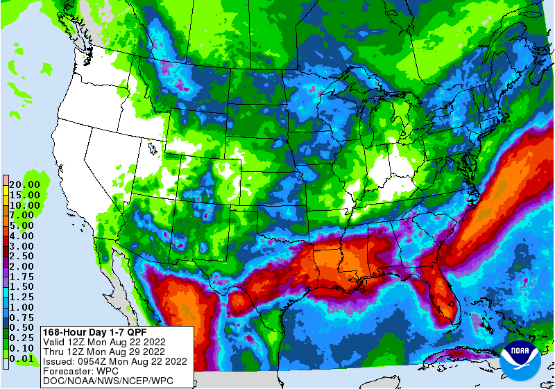
Dare I show you the latest 7-day rainfall forecast? It does show our next big
rain chances coming next weekend (the rain currently falling notwithstanding).
All in all, the weather looks rather BLAH to me, I guess after all the
excitement in the run up to the heavy rains. But it does look like we are going
to bookend our hot climatological summer with mild rainy periods both at the
start of June and then to finish out this month.
Beware those mid-level lows though, Bro!
Gary McManus
State Climatologist
Oklahoma Mesonet
Oklahoma Climatological Survey
gmcmanus@mesonet.org
August 23 in Mesonet History
| Record | Value | Station | Year |
|---|---|---|---|
| Maximum Temperature | 113°F | ALTU | 2024 |
| Minimum Temperature | 52°F | NOWA | 2009 |
| Maximum Rainfall | 5.40″ | BEAV | 2019 |
Mesonet records begin in 1994.
Search by Date
If you're a bit off, don't worry, because just like horseshoes, “almost” counts on the Ticker website!